Showing posts with label Parks. Show all posts

Tuesday, September 16, 2014

Scotland: Beinn Eunaich, Beinn a'Chochuill, Stob Dearg, Stob na Broige, Binnein Mor, na Gruacaichean, Ben Lui, and Beinn a'Chleibh (Munros 6-13)

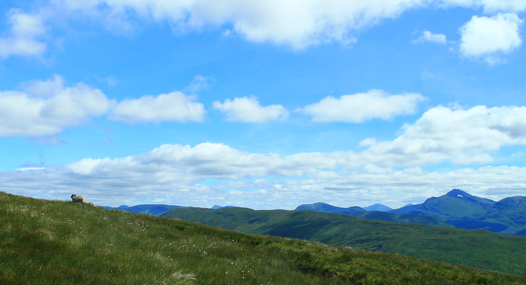
In Scotland, during the summer, you want to spend as much time outside as possible (and as little time updating your blog) because the nice summer weather doesn't last forever! While there were a lot of exciting things going on around Glasgow this summer like the Commonwealth Games and visiting friends from the US, my friend Hazel and I spent a decent amount of time out in the Highlands bagging more Munros - which has now become an obsession of ours.

Beinn Eunaich & Beinn a'Chochuill
20 June 2014

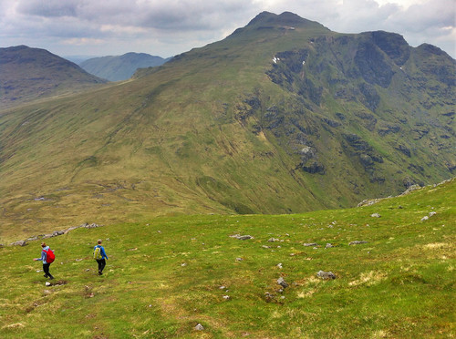
This was was actually one I did myself. Hazel left for Greenland for a few weeks, so I was on my own and really itching to get out into the hills. The problem without a car is that you're reliant on the bus and train. Luckily for me, the train from Glasgow to Oban stops at the beautiful Loch Awe at the foot of four massive munros. I wanted to do all four, but having only gone hillwalking once on my own, I thought I'd at least get two in, so I started off down the road to the footpath up to Beinn Eunaich, which looked easy since it's a farm road heading into a water reservoir stored within the mountains, but it was steep and I was not prepared! I was doing the loop backward and started up the side of Beinn Eunaich which is this relentless grassy hill that ever so slowly arches its way to the summit - you know the kind where you think you're almost there, but then you see the summit still looming in front of you? But the climb was a breath-taking one with incredible views down over Loch Awe and the picturesque Kilchurn Castle on its shores. Well, eventually I made it to the top of this slightly cobbly top (989 m/3,245 ft) and was met with even more views down the other side (which to the north was a vertical dropoff!) over the waters of Loch Etive.
20JUN2014 04
Great day for a hillwalk above Loch Awe. Looking north on the way
up Beinn Eunaich
The wind had started to pick up and bringing clouds in from the ocean. Nothing that really threatened rain, but low enough that the summits of all the mountains around me were shrouded in mist. I carried on down to the saddle between Beinn Eunaich and Beinn a'Chochuill, back into the world of visible distances, but then it was up, up, up to the next Munro. One the way, I passed an elderly man who'd walked in from the nearest town - a much farther distance than I walked from the train station - and was impressed he was still trekking on. I mean, he was old! Back in the clouds, I relied on the path being clear enough for me to see my way to the top of Beinn a'Chochuill (980 m/3,215 ft). It was dry and I had my lunch here, and the summit was high enough that the clouds going over the summit were thin, but it forced the rest of the clouds to flow between it and its neighbouring munros. Not being able to even see the rest of the 4-munro circuit, I decided it was best to head back to the Loch. After all, I had time to check out Kilchurn Castle and have a pint from the hotel at the train station! Overall, it was a nice day out in the crisp air, clouds, and two munros (nearly) all to myself!

(More to read below the slideshow!)


Stob Dearg & Stob na Broige
25 August 2014

Hazel finally returned from Greenland which made getting out to further-flung munros much easier with her car, and though the Matiz is a wee one, it got us where we needed to go. The weather was perfect for late August and we couldn't believe our luck and decided to head up north to the famous Glen Coe - probably Scotland's most recognisable valley (and home to James Bond's Skyfall, in the movie at least). I'd still never been and was pumped to go!

It took a few hours to get there, and another while carefully off-roading Hazel's car into the packed parking lot (did I mention Glen Coe is popular?). We started off to the trail heading up the ridge at the eastern end of Glen Coe - Buachaille Etive Mor. The walk up was brilliant! Right through a very rocky but gently sloping Coire na Tulaich. Having not been hillwalking for a few months, we were a bit nervous about whether we'd be in shape to do it, but the walk to the ridgeline was over before we knew it! We still had another few hundred meters to get to the summit, but we were there, enjoying the absolutely perfect views of the mountains of Glen Coe and over to Ben Nevis, Britain's highest elevation, looming a few ranges away.
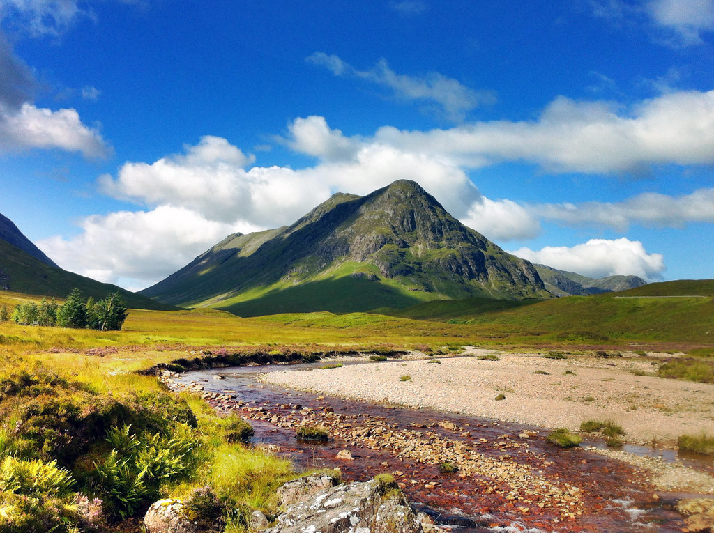
25AUG2014 09
Beautiful peaks of Buachaille Etive Mor, guarding the
entrance to Glen Coe. Who says that middle peak isn't a munro?
C'mon!
It wasn't much more effort to reach the summit of Stob Dearg (1,021 m/3,350 ft), and we were rewarded with one of the most breathtaking views I've ever seen. The summit is perched right at the end of the ridge and it quickly drops off on three sides leaving you with unimpeded views down into Glen Coe to the west and the immensely expansive Rannoch Moor to the east. There was not even a stitch of wind all day and the waters of Rannoch Moor lay perfectly still.

Back down the ridge we went, off to find the next munro, but there was a massive mountain between us and where the map said the next munro was. We were very disheartened to learn that not all mountains in Scotland over 3,000 ft are classified as munros as we trudged up the trail to the summit of Stob na Doire (1,011 m/3,317 ft) - which is boringly classified as a "munro top." Apparently, there is no exact definition of a munro other than that it must be over 3,000 ft (which Stob na Doire clearly meets), but a munro must also be its own mountain, standing prominently from any neighboring ridge or mountain. Stob na Doire was massive, but clearly not "a mountain in its own right" to be classified as a munro. We took a photo at the top anyway, in case the rules change in the near future and it earns classification as a Munro.

After Stob na Doire, it was almost a joke to reach the "summit" of Stob na Broige (956 m/3,136 ft) - almost 200 feet below the summit of Stob na Doire! But it still felt good to reach its top and look out over the road to Loch Etive. The weather couldn't have been better and after a quick bite to eat we started off down the mountains back to the car through a green valley lit up by the golden setting sun. It was a bit tricky getting the car out of the dirt parking lot as the ground was eroded where the pavement from the road ended, but we got her out and started the long drive back to Glasgow.

(More to read below this slideshow, too!)


Binnein Mor & na Gruagaichean
27 August 2014


We just couldn't get enough of the good weather and thought that while it lasted we should get out once more. The weather report called for clear skies, light wind, and no rain, so once again Hazel and I hopped in her "gran-mobile" and drove back up to Glen Coe. We wanted to do the Aonach Eagach ridge on the north side of Glen Coe, but after looking reports of its treachery, we decided against it until we had someone with us who could urge us along Britain's sharpest ridge walk. We decided to try some other ridge walks first before tackling that monster! So we drove through Glen Coe and then tucked east to Kinlochleven where we parked the car and headed off up to the Mamores peaks.

I'm not sure we realised just how long of a walk this was going to be. The first few miles are just a constant slight increase up a long valley (though with nice views over Loch Leven and the town below), until the path dumps you out into a beautiful valley perched up between Binnein Mor (our first destination) and the neighbouring munro Sgurr Eilde Mor. While the day was just as sunny as the previous walk, the air was not nearly as still and we were being buffeted by very stiff and strong gusts of wind! We worked our way up to the ridge overlooking Coire an Lochain where we had spectacular views of Ben Nevis across the valley, and even though our legs were about to give out, we still weren't at the top! Out of 282 munros, Binein Mor is the 28th highest and we still had to get there. We met some nice Dutch tourists and caught up with a single hillwalker who was bagging his 200-and-something munro. He reassured us that Aonach Eagach's bark was worse than its bite, but that with the stiff winds, it was better we weren't on that ridge. We made it to the summit of Binnein Mor (1,130 m/3,707 ft) which is perched on a little point in the sky with very steep and long drop-offs on either side! Vertigo definitely set in a few times, especially with the wind, but once we sat for some water, we got over it pretty quickly.
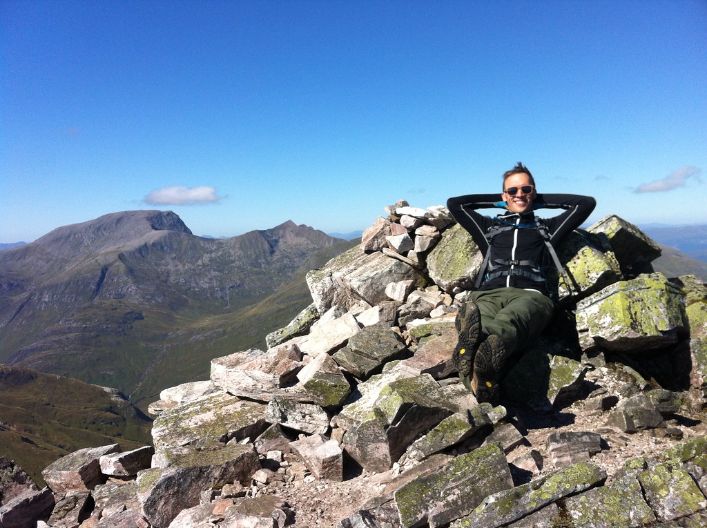
27AUG2014 36
Chilling out on top of Binnein Mor. Munro #10!
We didn't linger at the summit long due to the wind. It was incredibly brisk and chilled us even with all the layers we were wearing! But we did have a little celebration as this was my 10th munro! We found a little spot tucked away from the wind for lunch, but since the walk was so long, we pressed onward along a nice ridge to na Gruagaichean and enjoyed a good scramble up to the summit (1,056 m/3,465 ft) where we celebrated once more as this was Hazel's 10th munro! Ben Nevis just stared us down while we had the rest of our lunch. Time was getting on, and the sun was already setting and we still had to get back to the car and drive back to Glasgow! The walk down the ridge was nice and grassy with stunning views of Loch Leven and we could even see the jagged ridge of Aonach Eagach in the distance. But the nice grassy ridge soon gave way to a massive, steep, pathless, grassy hillside that we essentially bushwacked our way through before reaching the trail that would return us to the car. It was definitely one of the longest walks I've done so far (almost 9 miles), but it was definitely worth it!

(There's one more section to read below this slideshow!)


Ben Lui & Beinn a'Chleibh
14 September 2014


The weather's been changing a lot around Scotland as Fall starts to set in but the weather report suggested we'd have clear skies and cloud-free munros over the weekend, so my intrepid munro-bagging-partner, Hazel, and I went for it. We drove west to Ben Lui, which was described as one of the finest munros in scotland with amazing views, but we had the feeling, as we parked the car, that those views would not be for us today. Clouds were low and the peaks of all the munros were shrouded in mist. But we were here so might as well go for it anyway!
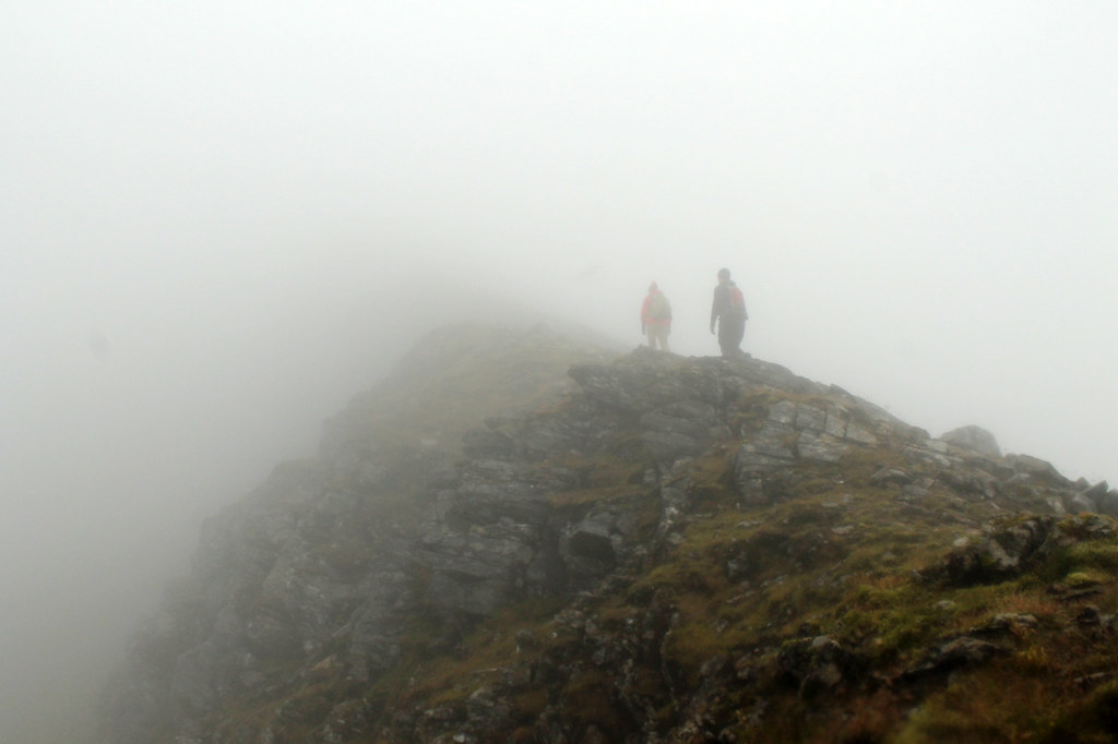
14SEP2014 18
Carefully keeping to the path in the fog along the ridge to Ben Lui
We forded the River Lochy and trudged our way up through the muddy pine timber forest which was nice as there were a few waterfalls and the leaves were already changing colour. But soon we found ourselves in the massive bowl-shaped valley between Ben Lui and Beinn a'Chleibh, both covered in clouds and a brisk wind blowing through the gap between them. We headed up east along a long, steep, grassy slope that just kept going, and going...and going, until we were in the clouds. But the grass stopped and was replaced by broken boulders and alpine-climate plants. We'd reached the ridge that would take us to the summit, being careful not to lose our footing lest we trip and fall down the cliff into the valley on the other side, which incidentally is where a 4-person aircraft tragically crashed a few decades ago. We wanted to see if we could find the wreckage, but the clouds were too thick and we didn't want to go wandering off trail.

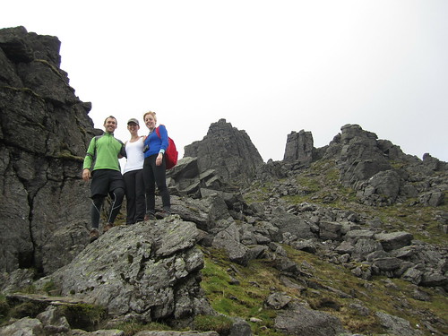
After a few fun scrambles and photoshoots, we made it to an open plateau with a cairn that we thought was the summit, only to realise we had a little further to go before reaching Ben Lui's true summit (1,130 m/3,707 - the same height as Binnein Mor, but ranked 29th). It was too cold and damp to linger there much longer so we headed down to the bealach and it was pretty much a hop, skip, and a jump up to the summit of the neighbouring munro, Beinn a'Chleibh (916 m/3,005 ft) which was cloud-free for a while. But there was no reason for it not to be cloud free - after all, Beinn a'Chleibh is the 281st highest munro out of 282! So, not spectacular, but fun to check it off the list nonetheless. Clouds eventually did roll in and we never really got a good clear view of Ben Lui all day. We ran into many people who were doing one or two more munros after Ben Lui and Beinn a'Chleibh, but I'd injured my knee running the day before so we decided to head back to the car, which didn't take long, and it was nice not having a three-hour drive back home. Not sure how many more nice days we'll have, but so far, nothing can stop us!


Saturday, June 7, 2014

Scotland: Beinn Narnain, Beinn Ime, and Ben Vorlich (Munros 3-5)

Beinn Narnain and Beinn Ime

Date: 27 May 2014

I've said it before, but it's worth saying again: when the weather is nice in Scotland, you've got to go take advantage of it! Luckily, as a student, as long as my work gets done on time, it (kind of) doesn't matter when I do it. So when the sun comes out, it's time to go! A few weeks ago, my classmates Hazel and Ruth and I headed off to Arrochar, west of Glasgow near Loch Lomond to hike a few of the Munros in the Arrochar Alps. It was supposed to rain a little bit in the afternoon, but it was clear now and we decided to take the steeper route to the summit of Beinn Narnain and get that over and done with first, figuring if it was rainy later, the steep slope would be too slippery to come down.

It was the right decision. The path up from the Argyle Forest Park parking lot to the summit is a long and tiresome, seemingly never-ending steep trail from sea level right up to 600 meters before it finally levels out for a little while. Once you're up and out of the forest, the views are magnificent and when you get to the part that levels out, stunning views of the craggy peaks of The Cobber loom into view.

The Spearhead
Final ascent up Beinn Narnain through The Spearhead
But of course with all hillwalking, there are about three or four "false peaks" that make it seem like you're almost there, but then...nope! One of these false peaks was the Cruach nam Miseag and we really thought we might be to the summit. Instead it was just a vantage point where we could see the trail go down in elevation before winding its way up between huge rock outcrops called The Spearhead! A few hikers were threading their way through The Spearhead and we could hear their voices echoing while we sat and had a wee break. The rest of the trail wasn't terrible, however. It turns out that getting up through The Spearhead didn't take long at all and as a geologist, the blocky and square outcrops that towered overhead were just fascinating!

After one last rocky gully we clambered up through, we found ourselves on the top of the mountain - not the summit yet, mind you, but it was a flat walk from here. We stopped for a few photos looking over Loch Lomond from the top of The Spearhead and eventually made it to the cairn and trig point at Beinn Narnain's summit of 926 metres (3,038 ft). We stayed up there a little while to catch our breath and had a good look around us. It was quite cloudy, but the sun poked through every now and again, and the cloud base was higher than the mountains, so we had good views of all of the other Arrochars and even Ben Lomond across the lake.

Beinn Ime
Over and down from Beinn Narnain to Beinn Ime. Looking
back at it, the trail up Beinn Ime just looks squidgy!
We could see the next mountain over, Beinn Ime, from the top of Beinn Narnain and decided that it didn't look too awfully far off. Besides, the walk down to the "bealach" (which I think is the name for the saddle between two peaks) and up to the top of Beinn Ime was smooth, looked fairly shallow, and quite grassy, so it couldn't have been that bad, right?

While getting down to the bealach from Beinn Narnain wasn't bad, the bealach and the majority of the slope up to Beinn Ime was totally waterlogged from rain we'd had the previous few days. It wasn't all that warm, and soon conditions became worse as our feet sank into soggy, squidgy, grass, and our socks became soaked with cold water. As Hazel put it, it was a long plod. We didn't talk much and instead just kept one foot in front of the other until the path hardened underfoot and became more clear up at the higher elevations. A walker coming down the mountain told us we weren't too far off, and sure enough, the trail quickly leveled off and we walked along the ridge to the cairn at the summit of Beinn Ime, the highest of the Arrochar Alps at 1,011 metres (3,317 ft). Being so high, it was really windy, but luckily previous hikers had created a sort of a fortress around the cairn that blocked some of the wind, so we sat there having our lunch with the best view around!

It was windy and chilly enough, and our feet were still wet, that we didn't stay for too long and started the long plod down the mountain. Fortunately, the trail back to the car looped down the valley between Beinn Narnain and The Cobbler, so we didn't have any more walking upslope. We stopped for some snacks at some large boulders at the foot of The Cobbler but didn't stay too long. The rain came in just as we were getting back to the car, so while we weren't too wet, it did get us in the end. Good thing we hadn't gone down the real steep slope we started on!

(there's more below the slideshow)


Ben Vorlich

06 June 2014


I decided to trade my Friday for my Saturday and since it was sunny on Friday, head off to the one last remaining Munro in the Arrochar Alps I'd yet to tackle - Ben Vorlich. I'd seen Ben Vorlich from my hikes up Ben Vane and the Beinns Narnain and Ime, and the reviews from Walk Highlands said to expect a steep and unrelenting climb to the summit ridge. The reviews were not joking! Luckily, I was hiking on my own yesterday, so I could take my own pace. Once I found the trailhead, as the reviews said, it just goes up. And up. And up. Though the trail is well-defined, it is not just steep, but wet, and mucky. So much so that one misstep could mean face-planting it into the hillslope which would not be good because there were a lot of rocks, too!

Ben Vorlich Summit
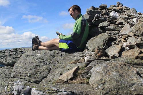
Ben Vorlich - a good place to have a read!
The walk up the slope gets you about 400 metres in elevation over the valley below, and even though the trail started to cut over along the side of the mountain, it sure didn't feel any less steep. The views started to get amazing though as the low clouds all around me started to clear. And near the top of the slope, massive rock outcrops and cliff-forming bedrock created an awesome geologic playground to be walking through! Even the mucky trail was shining with the weathered mica minerals that reflect sunlight so well.

Well, eventually the trail flattens out, kind of, but there is still a ways to go to get to the summit. And even when you get to the trig point, you're still not there because the actual summit is another short walk beyond! But once you're there, you know you're there - 943 metres (3,094 ft) is hard to miss! Not too many people were up at the summit, so it was nice and quiet. And though it was a bit windy, I was able to find a little crevice between some rocks, out of the wind where I could have my lunch and finish reading a book I've been trying to get through. It was so much nicer having time to enjoy the peace and quiet of the summit, rather than being rushed to get to the next one or forced off by inclement weather.

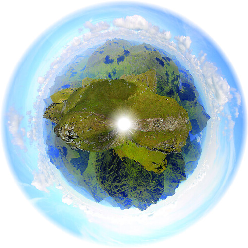
Trig Point Panorama
The panoramic planet I stitched together from the trig point
on Ben Vorlich
But soon enough, I felt it was time to start heading back down to the car park at Inveruglas where I'd been dropped off by the CityLink bus and was getting picked up from them, too. By the time I started walking down the weather was pretty much sunny and warm and I took my time with photography experiments and some of the best Loch Lomond scenery I've seen yet! The trail down the slippery slope I started on wasn't too bad going down, though I did slip a number of times, but before I knew it I was back down heading to the car park with plenty of time to spare. When I got there, the sun was warm on the rocks at the lake's edge, so I found a good comfortable spot, took off my boots and finished my book. Great day away, but tomorrow will have to be a work day. I just hope it actually rains so I don't feel guilty for taking a Friday off!

Sunday, September 29, 2013

Australia: Alice Springs

Travel Date: 17 August 2013

Note: I am well beyond an outsider in Australia and there is a lot to learn about the Aboriginal cultures and ways of life. It is and can be a very sensitive topic in many Australian communities and if my wording or interpretation of what I learned is incorrect or offensive, please let me know. I am trying to be as truthful and as historically and culturally accurate as possible. Thanks!

Over the last few months, I've been watching the airline sales in Australia like a hawk. I was about halfway through my time in Australia for my PhD and was feeling a bit of a mid-Aussie-crisis and realised I might not get to see everything I wanted to if I didn't hurry. I'd planned to visit Australia's Red Centre in the southern Northern Territories in January when I have a bit more time, but then it dawned on me that the weather in the outback in January can be brutally hot! Then, a sale came in from Tiger Airways, from Sydney to Alice Springs and I just decided to book it. Now that I'm sitting in the airport waiting to head back home to Sydney, it was well worth the time off.

DAY 1 (3)
Alice Springs from ANZAC Hill and the western MacDonnell Ranges
Alice Springs is not a large town by Australian standards, though it is no tiny burb either. Because of its relative proximity to some of the outback's most famous sites, notably Uluru (the largest rock in the world), Kata Tjuta (aka The Olgas), and Kings Canyon, Alice receives a lot of tourism traffic by air as Aussies and backpackers alike flock here from all over the coastal towns and cities. Alice Springs has a more important place in modern Australian history, however, as being a telegraph relay station between Darwin on the northern coast of the Northern Territories and Adelaide on the southern shores of South Australia. The town even gets is Aussie name from a small pool of water seen near the Telegraph Station a few kilometres north of the present city, a rarity in the dry centre. In fact the pool of water was a temporary puddle, really - a result of previous rains which flooded the Todd River (which is otherwise a dry riverbed). For a short period of time in Australian history, there was a 9th territory - Central Australia - of which Alice Springs was its capital city. Eventually Central Australia merged with the Northern Territories and ceased to exist, but that didn't stop Alice Springs from remaining an important town in the otherwise desolate Ausralian Outback.

To the local Arrernte communities the land around Alice Springs was created by ancestral beings that created the landscape. Specifically, the MacDonnell Ranges were formed by three caterpillars moving across the country, digging their way through the land as they passed Alice Springs. Red river gums, found growing in the dry Todd River bed are sacred and believed to be ancient ancestor caterpillars as well. Another story involves a fight between an ancestral dingo and an anonymous adversary who both fought over a woman and in the midst of their fights created parts of the surrounding mountains including Mt. Gillen, a prominent point on the nearest mountain. The Aboriginal Australians have a deep connection with their surroundings because these ancestral beings formed every part of the landscape as they moved around and so these creation stories, or Dreamtime stories, form the foundation for all rules of social, political, and religious life in Aboriginal communities.

When I arrived in Alice Springs Saturday mid-day, I wasn't expecting much to be going on and thought I'd spend some time at the Natural History Museum, a few kilometres west of the town centre. After chatting to the receptionist at the YHA Hostel (a very nice hostel and in a great location) suggested a few other ideas and I settled on walking out of the city to the north where the original Telegraph Station was located. It was a beautiful walk through rocky sandstone and granite outcrops, red river gums, desert oaks, and beautiful wildflowers along the dry and dusty riverbed of the Todd River. The sun was roasting at midday but I finally reached the Telegraph Station after about an hour of walking only to find that there was a $9 fee to get in to the historic site. The very friendly lady (please note copious amounts of sarcasm here) working the small shop scoffed when I asked if there were student discounts and when I asked if there was anything to see without paying, she just pointed to the exit. So I walked around the fence enclosing the historic compound and then up a hill on which one of the Australian trig points, used as reference points for geographic mapping, was located and snapped a few photos of the MacDonnell Ranges to the west.

DAY 1 (34)
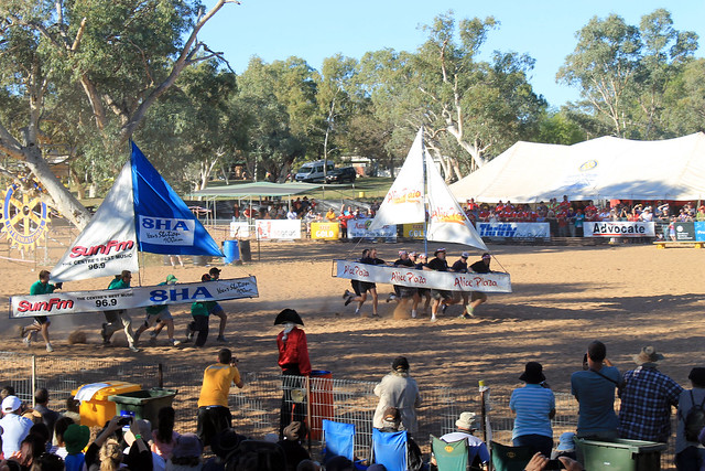
The US military personnel from nearby Pine Gap racing the ANZAC
servicemen in the hotly contested annual competition. The US
regained the winning title after last year's loss

Heading back into town along the River Walk I was in for a surprise. Contrary to my Lonely Planet Australia Guide (whose Alice Springs information urgently needs to be completely revamped!), one of the small city's most well-known and exciting events was happening on my arrival day: the Henley-on-Todd Regatta. Even though there is rarely any water flowing along the Todd River through Alice Springs, it is the site of one of Australia's most famous sailing races. Instead of actually sailing on water, the boats used in this regatta are just metal framed, canvas-wrapped "boats" that are picked up by the sailors and run along the race course on the dry river bed and back to the starting point. Hosted by the Mayor of Alice Springs and a number of other emcees, the boats are sponsored by local businesses and anyone in town, or from anywhere in Australia (or the world), can compete in various events including kayak, mini-yacht, and big-yacht races, hampster wheel relays, and tug-o-war for various age groups.

One of the main highlights of the event is a big-yacht race between the Australians and the Americans (military personnel from a nearby station). Apparently last year the Australians were the victors, but the Americans, racing in the USS Mayflower, prevailed this year and were quickly riddled by tongue-in-cheeck humour from the emcees but to great applause from the crowd who are just there for a good time. (The Americans also won the tug-o-war competition, as well, I might add!)
DAY 1 (40)
The Navy (left), The Vikings (centre), and The Pirates (right)
But the day's events culminate in the largest gunship battle to occur on Australian soil every year. Right at 4:30 three "ships" built onto the back of large trucks representing the Vikings, the Navy, and the Pirates enter the arena and drive around battling each other. The ships launch water balloons, fire coloured saw-dust canons, and hose each other down with high-pressure water guns all while trying to evade attacks from the other ships as the crowd cheers them on. Even though the Vikings were the first to run out of water and most-bullied by the Navy and Pirates, they seemed to be a long-time crowd favourite though it was the Pirates who came away victorious this year. The poor Navy lost despite their high-energy attacks and subsequently endured a host of adult-humoured, Village People, seamen-themed jokes from the announcers.

Interestingly enough, the Henley-on-Todd is probably the only regatta in the world to be cancelled due to wet weather as the usually dry riverbed surges with flash-flood waters flowing through the city (and this has happened at least once!).

After the Henley-on-Todd finished, I made my way up Alice Springs ANZAC hill where their memorial honouring fallen, former, and current armed service men and women dominates the town's skyline for a beautiful sunset over the western MacDonnell Ranges. It was my first taste for an outback sundown and what a sunset it was! The ever-present dust in the air in central Australia makes for beautiful red and blue sunsets and the silhouettes of the denuded mountains to the west made for a spectacular end to a great day.

Once the sun went down I found some quick take-away and went to bed since I was getting picked up the next morning for my 3-day outback tour.

Friday, July 5, 2013

Australia: Tasmania - Freycinet National Park

Trip Date: 26 April 2013

After a quick night in Hobart, my friend, Danielle, and I piled our things into her car and started our drive up the east coast of Tasmania. Our destination was Wineglass Bay in Freycinet National Park. When I first moved into my current apartment, my flatmate strongly suggested (no, he told me it was a must) that I go to Freycinet National Park because Wineglass Bay was so stunning it was just not to be missed!

Bicheno Waterfront
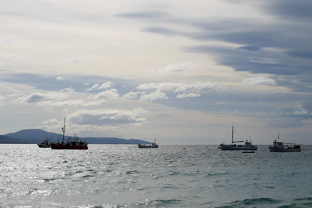
Fishing boats in Bicheno Harbour, Tasmania
Well, it took us a few hours to even get close, but we stopped a few times on the west side of Great Oyster Bay (west of the Freycinet Peninsula) for some photo ops and then drove past the Freycinet turn-off, continuing on up to the small seaside town of Bicheno. Not much ever seemed to be going on in Bicheno, but it sure looked like the perfect place for a vacation home. It still boasts a small fishing industry and some of the fishing boats were anchored offshore.

We stretched our legs along the waterfront for a few minutes and I was fascinated by the granite rock exposures along the beach - mostly because they had HUGE orthoclase feldspar mineral crystals - some as big as my finger! The tidal pools between the rocks were filled with little red sea anemones that twisted in the water as the waves came in and out. Bright orange lichens grew on the rocks, though we'd see more impressive lichens later on. We had a bit of fun posing in the dinghies pulled up on the harbour docks but soon headed back to the town and enjoyed a really good little lunch at a pizza cafe called, Pasini's.

Back in the car we drove south and headed down the access road to the small town of Coles Bay and the entry to Freycinet National Park. While many of Australia's national parks are essentially small tracts of land set aside solely for recreation without many stunning or staggering landscapes or ecosystems, Freycinet is different. Like the Blue Mountains, Royal, Uluru, Daintree, and Kakadu National Parks, Freycinet offers a spectacular mountain landscape with a few tall granite peaks with sparse vegetation growing up the slopes. As we turned the corner and the first view of Mt. Amos and Mayson loomed into view, my jaw hit the floor! I could already tell why my flatmate told me this was a park not to be missed!

Freycinet Panorama
Freycinet National Park seen from Coles Bay, Tasmania
We checked in to our hostel (the YHA in Coles Bay - which has impressively thin walls with two very loud groups of backpackers partying late through the night - avoid at all costs) and drove to the car park at the base of the trail to Wineglass Bay. It was late in the afternoon and we had limited time before the sun set, so we had to hurry a bit!

Wineglass Bay Lookout
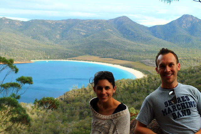
My friend Danielle and me at the Wineglass Bay Lookout in
Freycinet National Park, Tasmania
The trail is well-traveled up to the Wineglass Bay lookout and winds its way through large granite boulders and banksia and gum bush. We stopped at the lookout and had amazing views of Wineglass Bay which is an inlet coming in off of the Southern Ocean ending in an impressively wide beach and some of the bluest of blue waters I've ever seen!

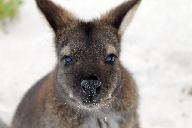
Not wanting to miss out on anything Danielle and I continued down the trail to the beach and were greeted by a solitary Bennett's wallaby who was saying hello to any of the beach's visitors, probably looking for food. He was definitely not skittish around people and while wallabies may be antisocial toward other wallabies, this little guy was certainly friendly toward me! I was able to get close enough that we had a little chat and I even took a selfie with my iPhone camera, much to Danielle's entertainment. Soon, the wallaby realised that my camera was not food and immediately became disinterested and hopped off to other hikers.

Wallaby Portrait
Portrait of a Bennett's Wallaby on the beach at Wineglass Bay in
Freycinet National Park, Tasmania
Danielle sat on the beach while I explored the coarse-sandy shores. A fishing boat was anchored not far offshore but was soon greeted by what we think was a police boat, likely wondering what a fishing boat was doing in protected National Park waters.

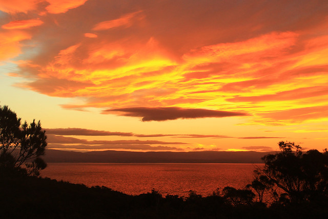
The rocks along the bay here were covered with the brilliantly-orange lichens we saw in Bicheno, and maybe it was the setting sun, but they seemed to be much more vivid in colour here! The sun was going down and we started back toward the car before it got too dark, and with perfect timing too, because as we neared the lookout the setting sun illuminated the clouds and rocks, almost setting them on fire! It was one of the most amazing sunsets I've ever seen, even by Australian standards! I can't tell if I've just become really good at taking photos of sunsets, or if Australia's sunsets are just always stunning, but it was just beautiful and I think my photos turned out quite nicely.

Sky on Fire
Sunset over Great Oyster Bay from Freycinet National Park (Yep, was really this red!)
Before heading back into Coles Bay we took a little drive up to Cape Tourville Lighthouse. It was now almost pitch black out and the moon was beginning to rise. The lighthouse is positioned on top of large bluffs overlooking the Southern Ocean and the winds started to pick up, making our walk around the lighthouse pretty chilly! I set up my camera a few times to try and get good nighttime photos of the lighthouse and coast, but without a tripod it was hard to keep the camera still while the shutter remained open long enough to get a decent exposure. The photos turned out pretty clear considering Danielle and I couldn't see each other even though we were only a few metres apart!

It was a perfect way to end a perfect day along Tasmania's east coast and we headed back into town for a dinner and drink at the pub before barely getting any sleep at the hostel. Yeah, while I recommend staying in Coles Bay, you're better off camping than trying to get any sleep at the hostel. But having such an amazing experience with the sunset and the wallaby easily made up for it!

Saturday, May 25, 2013

Australia: Tasmania's Lyell Highway from Hobart to Strahan

Travel Date: 24 April 2013

Back in early April, while everyone in Australia was taking their Easter Friday and Monday off of work, I was grading assignments and in my lab working, being the diligent PhD student I am! But I needed a getaway, and part of my excuse for working over Easter was that I'd previously purchased a round-trip flight down to Tasmania for five days in late April.

I needed a break. After four solid months of slogging through lab work, research, writing, reading, and teaching, I needed to step off the Sydney merry-go-round or go insane. Having moved to Glasgow in winter of 2012, then to Sydney in August, I pretty much had a year of winter immediately followed by the Australian summer with no change of seasons to speak of and definitely no Fall, which is my favourite. Sure I got a little taste of Michigan Football last September-November, but no pumpkin spiced lattes, no leaves changing colour, nothing. But the nice thing about Tasmania is that it is as far south  from the Equator as Michigan and Vermont are north of it, and April in Tassie would be the same as October in the northern hemisphere. In other words, it was Fall!

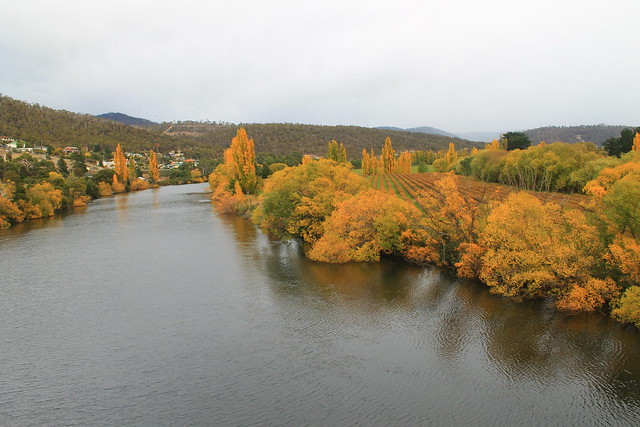
Fall Colours on the River Derwent
Fall colours along the River Derwent in New Norfolk
I arrived in Hobart, Tasmania's capital, at 8am, picked up my rental car - a wee Suzuki Swift which I really ended up liking! - and started off down the Lyell Highway. My goal was to get to the small town of Strahan on the western coast of Tasmania, but I also wanted to see as much as possible. My initial plan was to drive north toward Launceston and then west to Cradle Mountain before arriving late in Strahan, but took the advice of locals on the r/tasmania subreddit who thought I might be better off taking the shorter route and actually experience it. They were right.

My first stop wasn't planned until Lake St. Clair in the Tasmanian central highlands, but after picking up coffee in New Norfolk - a town originally set up as a new homebase for Australian convicts stationed out at the soon to be abandoned Norfolk Island camp in the Tasman Sea - I crossed the River Derwent and had to stop because the trees along the riverbanks were on fire with autumnal colours! It was beautiful! From what I'd heard about Tasmania and the Tasmanian culture of environmental awareness and power of purchasing locally, I imagined it to be much like Vermont in the US. The similarities, I would find out, were uncanny, and the trees along the river were just the beginning. I do have to say, though, that this is the only time I've been happy seeing invasive species; you see, no native Australian trees change colour with the seasons, only the imported species from Europe and North America!

Continuing along through pastoral farming/grazing communities, the Lyell Hwy suddenly started its ascent into mountains and the roads became narrow, steep, and windy (and windy)! I passed some of Tasmania's many hydroelectric facilities in Terraleah and the road then spit me out onto the highland plateaus just east of the central Highlands.

Tasmania's central highlands and the entire southwest quadrant of the island are all preserved as National Parks, most of which make up the Tasmanian Wilderness World Heritage Area, and while you can access many places in those parks, the majority of it is left as a natural wilderness for your experienced outdoor exploration! The famed Overland Track is one of the World's best wilderness walks right through Cradle Mountain-Lake St. Clair National Park,and something I hope to do before leaving Australia.

My first planned stop, though, was at an artistic site just east of Lake St. Clair called The Wall in the Wilderness. I'd heard about this artist who is carving out scenes from Tasmania's varied industrial, cultural, and environmental histories in huge panels of wood. In my mind I imagined it to be like a huge detailed collage of various moments that I could learn a lot from. Surely I wouldn't be disappointed. But when I walked up to the door there was a big sign saying something along the lines of:
No cameras allowed! Personal photographs do not capture the essence of my artistic vision when taken in the wrong light. When I have people throwing punches at me for not allowing them to take photos it gives me the right ban all cameras. My art is self-funded and I will decide what I will and will not allow.
Well, that kind of made me stop in my tracks and think, "Wow, what an ass." But not knowing what this guy has gone through, I returned my camera to my car. I thought the $10 admission fee was a bit steep, especially with no student discounts, but I gave them the benefit of the doubt. The building was cold and dimly-lit and in the central hall was the Wall. It was impressive to look at. Dozens of wooden panels of Huon Pine were hanging from a central wall, the majority of which had images of Tassie history hand-carved into the wood: hydro power, convict history, the extinct Tasmanian tiger, and natural scenery - and those that weren't yet carved had the pencil marks on them showing what they would eventually be. It was neat, and the artist is obviously a talented wood-carver, but was it comparable to Michelangelo's painting of the Sistene Chapel (as the Wall's website claims)? No, not in the least bit! Maybe it was the sour taste left in my mouth from not being able to take my camera in, or the tone with which that message was conveyed, but I thought the wall was impressive in size only. There were no information placards describing what I was looking at, but I could buy a book for another $20 to learn about each panel. Essentially, I thought this piece of art was a waste of time and money and I do not encourage anyone to visit. You'll just be nickel-and-dimed out of $10 and with nothing given in return. It's not educational and not all that spectacular when all is said and done. And even though I paid to see the Wall - thus paying for the future work on the wall - I didn't even get to take a photo of it. Crap. Don't go.

Lake St. Clair
Sitting on the ferry pier at Lake St. Clair
It was still cloudy out from morning rain showers, but I drove on to the entrance of  Cradle Mountain-Lake St. Clair National Park at the southern end of Lake St. Clair, which fills a glacially carved basin and is Australia's deepest lake. I went to buy a pass from the Visitor Centre, hoping I could use it at all National Parks in Tasmania I'd go to over the next few days, but it turns out that the passes can't be transferred between cars and if you go to Cradle Mountain, you have to pay a separate, exorbitant, entrance fee - so I settled on the day-pass and went to inquire about the Lake's ferry service. Being on the south side of the park, This is the ending point for anyone doing the Overland Track and a ferry service operates between both ends of the lake taking OT walkers and day-hikers to various piers. Not having enough time to do a four-hour walk, I was just hoping to get into the wilderness via the ferry, but after inquiring about it, I found out I was 10 minutes late and that no more ferries were scheduled for the day (damn Wall in the Wilderness!). So I walked down to the lake's edge for a bit taking in the staggering mountain scenery that was constantly peeking in and out of low-hanging grey clouds. Even on a bleak afternoon it was beautiful.

Back in the car the clouds started clearing, changing to big puffy white clouds, and the sun came out! Not much further down the Lyell Hwy I started seeing huge mountain after huge mountain loom into view from road as it twisted between them and the geologist inside me took over and every time I saw something new I'd let out an, "Oh my Gaaaawwwwddd!!!!! Woooowwwwww!!!!" The National Parks of Tasmania really earn their status as being stunning and beautiful! With stops at the Great Divide and Happy Valley overlook, I parked down at the Franklin River Nature Walk.

The Franklin River rose to international recognition in the 1980s when environmentalists started protesting plans to dam the Franklin River downstream from here. It is one of Tasmania's last wilderness rivers and the environmentalists were fighting to keep it that way. The hydro company eventually lost the battle and a new era of environmentally-conscious Australians rose to national political prominence. Furthermore, a new importance was placed on wild areas of Tasmania with an effort to keep them wild and untouched as much as possible. The walk was short but goes right along the banks of the Franklin and Surprise Rivers and weaves between massive pine and gum trees - some of which are the tallest species of trees in the world!

I'm not sure what the Highway is like during peak holiday season, but the Lyell was essentially empty for my entire drive. The afternoon was getting on and I'd decided that I needed to get to Strahan before sunset so I could watch the sun go down over the Southern Ocean - which you can't really do from too many places in the world! In my rush, I almost missed one of the best views of Tasmania: Donaghy Wilderness Overlook. I actually drove past the parking lot, but turned around. Two backpackers from the UK were just finishing and when I asked if the 30-minute walk was worth it, they said, "We've been traveling around Australia for two months and this is by far the best overlook we've seen!" I was sold, parked my car, and started walking.

I was not disappointed. If you take it quickly, it only takes about 20 minutes and the walk takes you to a little knob from which you get a 360-degree view of the surrounding mountains, valleys, rivers, and the ever-impressive Frenchmans Cap - a unmistakably unique mountain crag off in the distance which can be seen from miles and miles around! There was no one else out on the overlook and I had the place to myself under warm blue skies and a sun just beginning to dip below the mountains to the west. I grabbed a bunch of photos and sped back to my car. I only had about 2 hours left before sundown and it was more than 2 hours to get to Strahan.

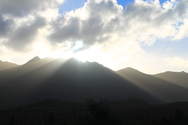
Tassie Sunset
Sunset in western Tasmania taken from the shores of Lake Burbury
I sped down the road, probably faster than I should have been going, trying to make it to Ocean Beach in Strahan before the sun hit the horizon, but I kept coming across beautiful scenery! I next had to take a quick minute at Lake Burbury because the sun's rays were shining from behind the tips of the nearby mountain peaks, casting glorious rays over the land, and I am certain I got some of the best sunset photos I will ever take in my life! And then the drive into Queenstown - famous for its regional mining operations which have all but stripped the hillsides of any and all vegetation and sediment cover. The road coming down out of the mountains to Queenstown was also beautiful, but in an industrial and destructive way. At least Mt. Owen seemed to still be forested and one massive waterfall was cascading down the hillsides.

I got to Strahan with about 15 minutes to spare, drove around the town and out to Ocean Beach where I missed the sun actually setting, though the sky was still beautifully lit up with pinks, oranges, reds, and the blues of the night. I stepped out and down to the beach where I took my shoes and socks off, rolled up my jeans and walked down to the water's edge, finally allowing myself to breathe and take in the dusky views up and down the beach - Tasmania's longest. I picked up a few pebbles as keepsakes as the ocean waters washed over my feet because after all, it's not all that often you can say you've stuck your toes in the Southern Ocean. Tasmania and the southern tips of South Africa, Argentina, Chile, and New Zealand are really the only places you can do this (and Antarctica, too), and it's quite a surreal experience when you consider its vastness.

Happy with everything I was able to accomplish along the Lyell Highway, I drove back to Strahan in the dark, found my hostel - the Strahan Backpackers YHA - and got great advice from the owner for delicious fish 'n' chips, Schwoch's, in the town's centre. A delicious ending to a busy, productive, and beautiful day!

Wednesday, March 13, 2013

New Zealand: Te Paki Dunes, Whangaroa Lookout, Kiwis at Aroha Island

Date Traveled: 03 January 2013

After a hellishly adventurous morning of hiking, soaking wet, in the rain out to New Zealand's westernmost point, I wasn't sure how much more adventure I'd be up for for the rest of the day. But then, as I was driving from Cape Reinga to Paihia, where I had accommodation booked that night, I passed the sign for Te Paki Sand Dunes and thought to myself, "I might not ever get the chance to come back this way in my life, so I might as well stop and see it now."

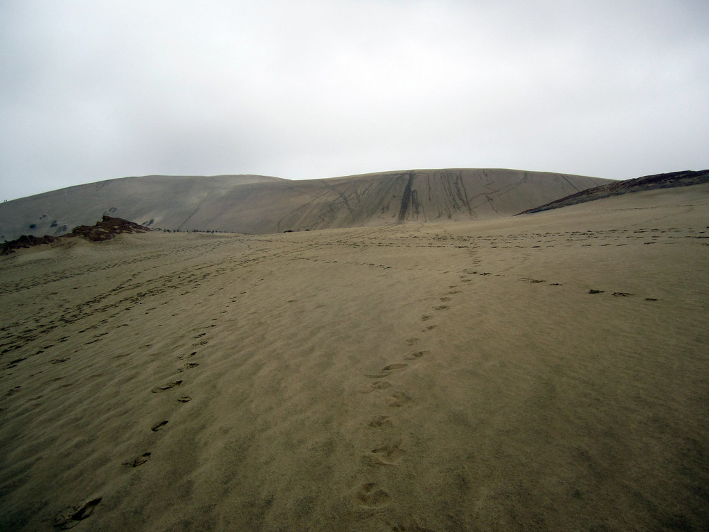
03JAN2013 (149)
Coming over the first rise at Te Paki Sand Dunes
Good thing I did! Te Paki sand dunes are the highest dunes in New Zealand, and they are massive (though not as big as Sleeping Bear Dunes or Pictured Rocks). I parked my car and pulled out my rain gear, because it was still raining and I had had enough of being soaked to the bone, and crossed a shallow little stream to get to the base of the dunes. The blisters on my feet weren't enjoying being cramped up in shoes or sandals, even, so I went barefoot climbing the first steep ascent which opens up on top to a vast, wide, plateau of sand with a few rocky outcrops sticking out. On the other side of the plateau was another climb to what looked like the highest dune peak around and when I got to the top of that, I realised just how expansive the dune fields here are! According to Lonely Planet's New Zealand Guide, there are 7 square kilometres of dunes here offering all sorts of recreation activities like sand tobogganing (which you can rent from the little van in the parking lot) and the start (or end) of the famous 4WD off-roading expedition up/down 90 Mile Beach is also here.

Well, I knew I wasn't going to spend a huge amount of time here, so when I got to the top, I had a nice look around, took some photos of the area, and then starting heading down. But this wasn't just any saunter down the sandy slopes. Oh, no! Growing up going to the beaches, one of my favourite things to do was go dune jumping. Usually this involves finding a nice sturdy tussock of grass near the top of the dune, getting a running start, and then throwing yourself off that tussock into the air and landing on the downslope surface of the dune. If you land on your feet without breaking your legs, it's possible to then use that momentum and run all the way down the rest of the hill. There was no dune grass here, but the sand slope was steep and a good running start was all I needed and with arms windmilling through the air, I ran down in big, leaping steps to the sandy plateau.

Here on the plateau, one of the rock outcrops caught my interest. It was circular from above and looked almost dome-like except that while the middle of the dome and its edges were still in tact, the rest had eroded out by some means of chemical or physical weathering. Up on the dune slope I'd just run down, there were a few other people using their footsteps to make large pictures in the sand. I think the one group of kids must have been from Switzerland since they made a big square with the cross in the middle.

I crossed the sandy plateau and dune-jumped my way back down to the creek and crossed over to my car, brushed off and got back on the road. Not much further down the cape, there was a sign pointing toward "New Zealand's Northernmost Pub" and I thought I should stop in for a bite to eat and charge my phone at the same time. I figured it would be some British-esque pub with a warm fire, carved wood booths, and a generally cozy atmosphere. Boy was I wrong. This place I don't think ever was cozy or welcoming, and while the staff was friendly and accommodating, I didn't want to stay there a moment longer than I needed to and I don't suggest anyone stop here. You will be sorely disappointed!

03JAN2013 (167)
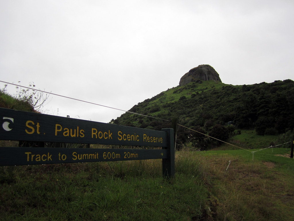
The Whangaroa lookout
Finally, I was on the road again and kept driving for a few hours, listening to local Maori radio which had some good music on there, including a lot of Christian songs I remember singing in elementary school, but sung in Maori with a South Pacific twist. I'd read about another spot that I thought might be worth looking into. The hills in and around the town of Whangaroa (remember, in New Zealand, Wh- is pronounced F-) are generally forested except for their tops which are exposed, bare, rocky knobs made of conglomerates and granite - if I remember right! The hilltop in Whangaroa offers an awesome 360° vista of the entire area and the Whangaroa Bay right next to it. I found the parking area at the Saint Paul's Rock Scenic Reserve and started up the trail which was really slippery thanks to the mixture of mud and rain. To get to the top of the rock, though, the trail climbs up through the exposure and you need to hold on to chains fastened into the rock to pull yourself up to the top! It was a nice view indeed. Even in the gray late-afternoon you could see all the way out to the ocean, see all of Whangaroa Bay, and even an expansive oyster farm.

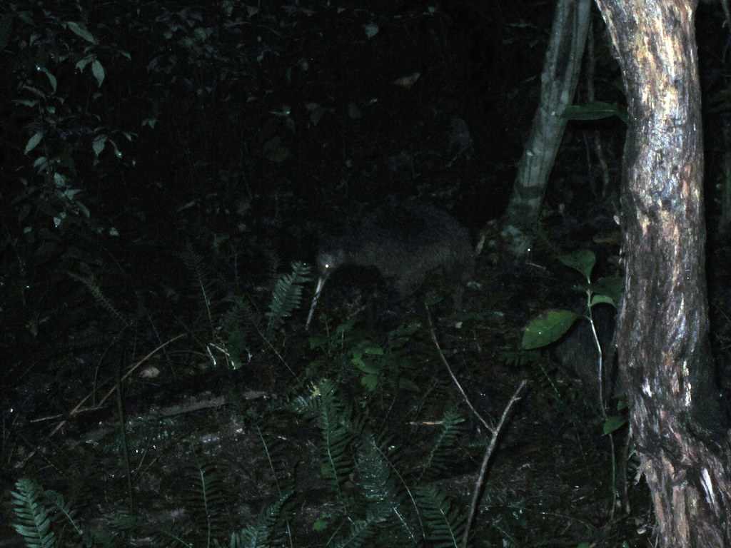
I didn't stay long, though, just long enough to get a 360° panoramic shot but then I got back in the car and kept driving. My destination for the night was the Aroha Island Ecological Centre, just east of Kerikeri. I'd read about Aroha Island in the Lonely Planet guide and after reading that they have a few northern brown kiwi birds living on the island, I didn't think I had a choice but to book a camping spot here! Kiwis are exceptionally rare in the wild in New Zealand. In fact, many New Zealanders haven't seen a kiwi in the wild! Since I've been on my "must see all Australian wildlife in the wild" kick, I figured I may as well add kiwis to the list and do my best to see them in their native habitat, too! And Aroha Island was the perfect place for that; they offered nightly tours of the island for an additional charge saying that most tours see a kiwi. But when I checked in, the lovely woman at the Welcome Centre said they weren't doing any tours...but that I could use one of their flashlights and have a map of the island and see if I could see them for myself!

I set up my tent in the last remaining hours of daylight and backed up all of my photos from my hiking adventures at Cape Reinga to my iPad, waiting for darkness to settle in. The woman told me that the kiwis are seen all hours of the night and that they start roaming around 10:30pm. I was told to not make much noise because while kiwis have bad eyesight, they hear very well; I was also told to use the flashlight given to me which had a red filter on it because the kiwis couldn't see that red light, and that any regular flashlight would scare them off for sure. It started raining again, though not too hard, and I figured I'd have to put my rain gear back on if I didn't want to get wet, but that meant I'd be making a lot of noise while walking along the path. The island isn't large and only take about 30 minutes to walk the perimeter, so I set off with the red light and the map.

The woman also mentioned that I would know the kiwis were there long before seeing them because they make a very distinct snuffling noise. Kiwis are different from most birds in that their nostrils are located at the end of their beaks and since they use their beaks to sift through the soil while looking for food, they constantly have to clear their airways and in doing so make a very dry wheezing sound. Well, even with that information, I couldn't hear much more than the rain dripping through the leaves and my rain pants brushing up against each other. I moved so slowly along the path, thinking every noise was a kiwi, that it took me about half an hour just to walk half the island. I started along the other half thinking I was on a wild goose - errr kiwi - chase when I heard it!

03JAN2013 (193)
One of the two wild northern brown kiwis I saw on Aroha Island
Above the pitter-patter of the rain I thought I heard people talking and I thought it must be some other kiwi-scouts, but looking ahead, I didn't see any lights but kept hearing a dry, scraping, snuffle sound. I rounded the corner in the path, and sure enough, right in front of me, no more than 2 metres away were two adult kiwis! They were big! I mean big compared to what I imagined them. I always thought they were maybe the size of a grapefruit, but these were each the size of a rugby ball, stuck up on what looked like three spindly legs, but then I realised the third leg was just their beak! I didn't want to make too much noise but I wanted to get closer to see if I could get some photos of them with my phone. I'm not sure if it was the rain or if their hearing isn't as great as the woman told me, but I was able to sneak within a metre of them both without them realising, or caring, that I was there! I just stood there for about 20 minutes watching these amazing birds do their thing, rooting through the soil along the path looking for food, and they eventually moved off and started heading down the hill toward the water. I decided that if they were going to leave, I'd try getting a few photos of them with my flash on, and while they moved away after the first flash, they didn't seem to be terrified by it and stayed relatively close, so I took a few more before leaving them to eat in peace! I think my heart was pumping just as much as it had been that morning when I was trying not to be swept out to sea by incoming waves! Here, on tiny Aroha Island, was some young Yank who just wanted to see kiwis in the wild, and with very minimal effort was able to do what so few people have ever had the opportunity to do!


Needless to say, at the end of the day, hiking 15 kilometres, climbing a large sand dune, hiking to the top of a rocky lookout, and successfully sighting some wild kiwis, I was exhausted and slept very very well! The next morning, as I was packing up my tent, some very friendly ducks came by to wish me safe travels and to thank me for staying at Aroha Island, insisting that I recommend it to anyone who wants to have wild kiwi adventures while traveling through New Zealand. I told them I surely would!

Saturday, February 9, 2013

Australia: Boxing Day in Sydney

26 December 2013

Well, my first Christmas away from home and family was more than dull. Let's be frank. It was terrible. Sydney was rainy, gloomy, and gray. I would much rather have been at home in Michigan in the cold and snow, driving 10 miles under the speed limit because of icy roads, shoveling the driveway, and spending an extra five minutes just putting boots and winter gear on every time I left the house. Oh, I wouldn't have minded the extra ten minutes it takes to get the car running, brush off the snow, and scrape off the ice from the windshield. Had I had a nice sunny day down at the beach in 30-40°C (90-110°F) weather, maybe my tone would be different, but nah.

Christmas Eve wasn't bad, though. A friend of mine had some friends over at his apartment for a nice cookout on his new grill (or in Aussie terms, to have a barbecue on his new barbecue), which was fun, but I left around 10:30 because I wanted to maintain some semblance of Christmas tradition so I headed down to really the only church I know of, St. Mary's Cathedral, for part of their Christmas Eve services. Really, I just wanted to hear and sing some traditional Christmas Carols like our church back at home does for the midnight service, but I arrived at the Cathedral an hour late for that. It was packed, though, and every single seat in the nave was full with spare pews lining the outer aisles, but few spare seats; people were standing and sitting wherever there was an open spot on the floor. I did, however, find a seat next to a very nice Asian woman who reminded me a lot of my grandmothers. She was there for the services, too, unlike many of the tourists poking their heads in, but between songs and scripture, she was all ears and wanted to know what an American like me was doing in Sydney, why I wasn't at home with family, and why I would come to St. Mary's if I was not Catholic. I smile thinking about her because even though I'd never met her before and never will see her again, I sensed that she wasn't spending her holiday with many family members either, and so in some way we were supposed to sit next to each other and be a surrogate family for the next two hours.

The service was very nice and included your traditional scripture readings (albeit all sung on the same note like in all Catholic churches which I do not understand - kind of like the sing-speaking in "Les Misérables"), the classic carols (which when over 500 people join in with the organ in a massive Cathedral is amazing!), and all of those little other Catholic rites or call-and-response songs that seemingly everyone knows but follows no real melody and for an outsider like me is just complete confusion! But I did my best and I wasn't there to nit-pick the service. It was very well done and quite inspiring to share that experience with so many people! It's a good feeling to know that churches still do fill up these days, even if it is just for Christmas.

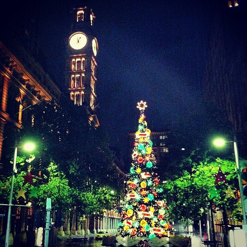
Midnight passed and the service finally came around to partaking in communion, which I know that since I'm not Catholic, I do not take at a Catholic church. I also know, from my Aunt's church back at home, that serving communion to a few hundred people can take over an hour, so with a Cathedral full of people, I figured it would take until next Christmas! I said, "Merry Christmas," to my surrogate-grandmother and ducked out of the Cathedral. Sydney was empty, and since I wasn't tired yet, I walked down to Martin Place (the Wall Street of Sydney) to see the Christmas Tree they had set up, and then walked up George Street to the Town Hall station where I caught the last train home.

Merry Christmas, everyone!
Martin Place Christmas Tree, Christmas Day 2012
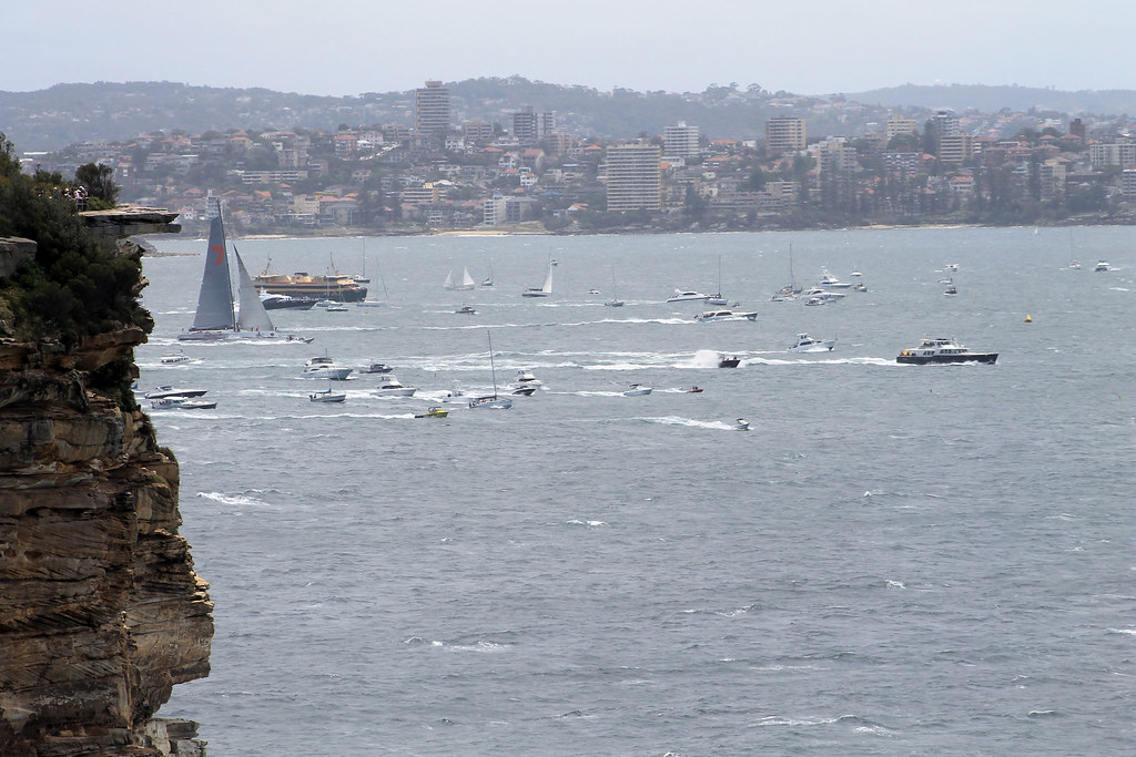
Since I've already mentioned how not-great Christmas was, I'll move on to Boxing Day! Boxing Day is a holiday celebrated in most other current or former British Empire countries and commonwealths. It is the day that workers would receive gifts from their employers upon returning to work after Christmas. Nowadays, most everyone has Boxing Day off and there are lots of festivities around the city, the most exciting of which is the Sydney to Hobart (capital of Tasmania) Yacht Race which begins at the Harbour Bridge. All of the boats, ships, and yachts then race out to the Harbour Heads, out into the Pacific Ocean and then follow the coast all the way down to Tasmania. It is a massive event and I was told to make sure to get a good view somewhere near the Harbour Heads, which I was going to do but not after treating myself to a breakfast fit for a king: scrambled eggs, french toast, real bacon, and pineapple - delicious! The time it took me to make and eat breakfast set me back, though, so I caught a bus out to Watsons Bay, the suburb right on the South Head, distraught that I was sure I'd miss the good spots because the traffic was heavy and people were everywhere! But as it turns out, I found a great little spot on the edge of the cliffs at the Gap Park where my view was looking directly north to the North Head, perfect for watching the Yachts come through the Harbour Mouth and turn to head south.

Wild Oats XI Rounds the Bend

For a while there was no excitement other than watching the 14 helicopters flying around overhead like a swarm of flies. But then a series of motor boats rounded the South Head and soon enough Wild Oats XI came streaming through the mouth of the Harbour, sails full, and you quickly realise just how big some of this boats are! I was a good distance away and above the yacht, but comparing the size of the yacht to the size of the cliffs behind her at North Head, you came to the conclusion that there wasn't much difference! (Wild Oats XI, by the way, eventually won the race.) Soon to follow were a few more large yachts and a dozens more smaller yachts, each being accompanied by a speedboat and being followed by locals in their own speedboats, tourists on the Manly Ferry, and patrons out on the tall-ship, the James Craig. Once the yachts made their way past North and South Heads, they were in the open ocean, turned south, and started following the coast toward Hobart, their final destination, almost 1,200 kilometres away!


It was fantastic to watch and be part of such a large crowd, but soon the crowd thinned and I headed over to the Laings Point Reserve, spread out my blanet, took out a few papers and a beer and read in the shade of a tree, with beautiful views of the city all around! Overall, not an entirely bad Boxing Day...though I forget what I did with the rest of the day...

Relaxing Boxing Day
Creative Commons License
This work by Eric W. Portenga is licensed under a Creative Commons Attribution-NonCommercial-NoDerivs 3.0 Unported License.