Sunday, September 29, 2013

Australia: Alice Springs

Travel Date: 17 August 2013

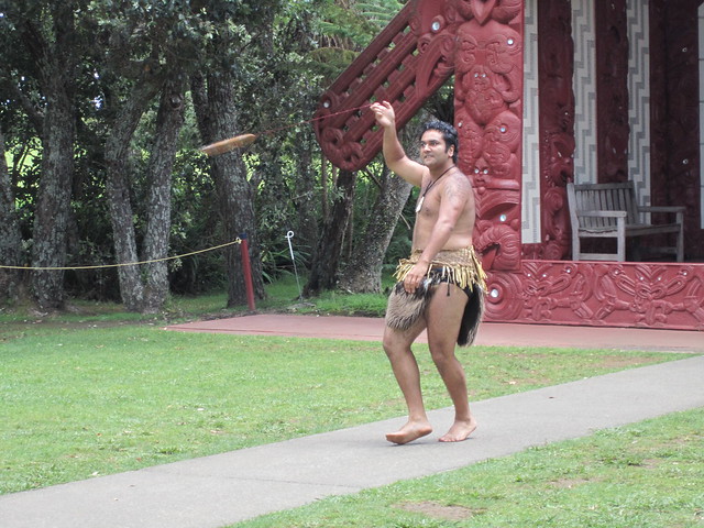
Note: I am well beyond an outsider in Australia and there is a lot to learn about the Aboriginal cultures and ways of life. It is and can be a very sensitive topic in many Australian communities and if my wording or interpretation of what I learned is incorrect or offensive, please let me know. I am trying to be as truthful and as historically and culturally accurate as possible. Thanks!

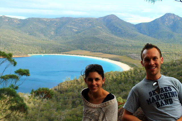
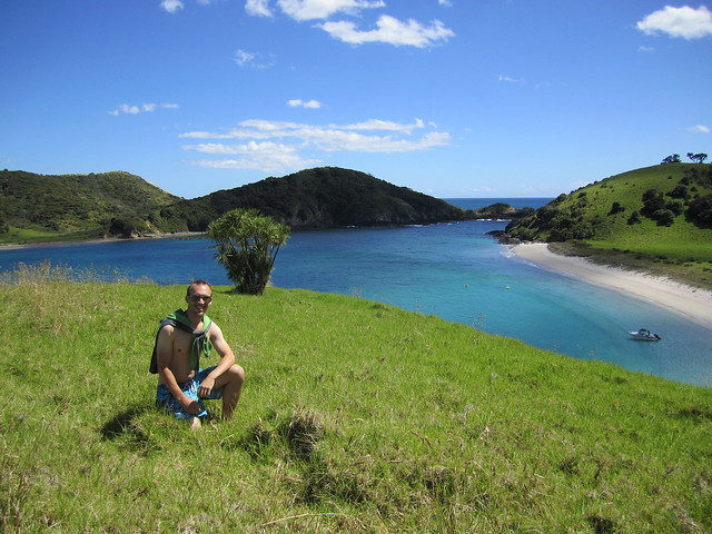
Over the last few months, I've been watching the airline sales in Australia like a hawk. I was about halfway through my time in Australia for my PhD and was feeling a bit of a mid-Aussie-crisis and realised I might not get to see everything I wanted to if I didn't hurry. I'd planned to visit Australia's Red Centre in the southern Northern Territories in January when I have a bit more time, but then it dawned on me that the weather in the outback in January can be brutally hot! Then, a sale came in from Tiger Airways, from Sydney to Alice Springs and I just decided to book it. Now that I'm sitting in the airport waiting to head back home to Sydney, it was well worth the time off.

DAY 1 (3)
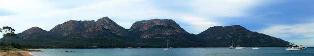
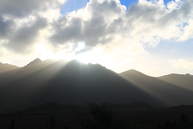
Alice Springs from ANZAC Hill and the western MacDonnell Ranges
Alice Springs is not a large town by Australian standards, though it is no tiny burb either. Because of its relative proximity to some of the outback's most famous sites, notably Uluru (the largest rock in the world), Kata Tjuta (aka The Olgas), and Kings Canyon, Alice receives a lot of tourism traffic by air as Aussies and backpackers alike flock here from all over the coastal towns and cities. Alice Springs has a more important place in modern Australian history, however, as being a telegraph relay station between Darwin on the northern coast of the Northern Territories and Adelaide on the southern shores of South Australia. The town even gets is Aussie name from a small pool of water seen near the Telegraph Station a few kilometres north of the present city, a rarity in the dry centre. In fact the pool of water was a temporary puddle, really - a result of previous rains which flooded the Todd River (which is otherwise a dry riverbed). For a short period of time in Australian history, there was a 9th territory - Central Australia - of which Alice Springs was its capital city. Eventually Central Australia merged with the Northern Territories and ceased to exist, but that didn't stop Alice Springs from remaining an important town in the otherwise desolate Ausralian Outback.

To the local Arrernte communities the land around Alice Springs was created by ancestral beings that created the landscape. Specifically, the MacDonnell Ranges were formed by three caterpillars moving across the country, digging their way through the land as they passed Alice Springs. Red river gums, found growing in the dry Todd River bed are sacred and believed to be ancient ancestor caterpillars as well. Another story involves a fight between an ancestral dingo and an anonymous adversary who both fought over a woman and in the midst of their fights created parts of the surrounding mountains including Mt. Gillen, a prominent point on the nearest mountain. The Aboriginal Australians have a deep connection with their surroundings because these ancestral beings formed every part of the landscape as they moved around and so these creation stories, or Dreamtime stories, form the foundation for all rules of social, political, and religious life in Aboriginal communities.

When I arrived in Alice Springs Saturday mid-day, I wasn't expecting much to be going on and thought I'd spend some time at the Natural History Museum, a few kilometres west of the town centre. After chatting to the receptionist at the YHA Hostel (a very nice hostel and in a great location) suggested a few other ideas and I settled on walking out of the city to the north where the original Telegraph Station was located. It was a beautiful walk through rocky sandstone and granite outcrops, red river gums, desert oaks, and beautiful wildflowers along the dry and dusty riverbed of the Todd River. The sun was roasting at midday but I finally reached the Telegraph Station after about an hour of walking only to find that there was a $9 fee to get in to the historic site. The very friendly lady (please note copious amounts of sarcasm here) working the small shop scoffed when I asked if there were student discounts and when I asked if there was anything to see without paying, she just pointed to the exit. So I walked around the fence enclosing the historic compound and then up a hill on which one of the Australian trig points, used as reference points for geographic mapping, was located and snapped a few photos of the MacDonnell Ranges to the west.

DAY 1 (34)
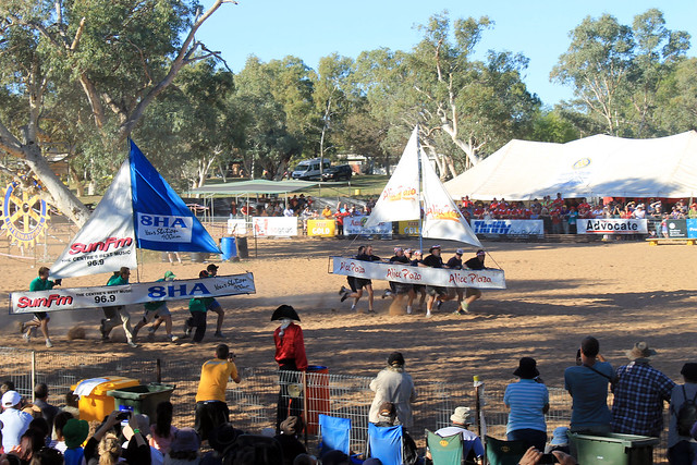
The US military personnel from nearby Pine Gap racing the ANZAC
servicemen in the hotly contested annual competition. The US
regained the winning title after last year's loss

Heading back into town along the River Walk I was in for a surprise. Contrary to my Lonely Planet Australia Guide (whose Alice Springs information urgently needs to be completely revamped!), one of the small city's most well-known and exciting events was happening on my arrival day: the Henley-on-Todd Regatta. Even though there is rarely any water flowing along the Todd River through Alice Springs, it is the site of one of Australia's most famous sailing races. Instead of actually sailing on water, the boats used in this regatta are just metal framed, canvas-wrapped "boats" that are picked up by the sailors and run along the race course on the dry river bed and back to the starting point. Hosted by the Mayor of Alice Springs and a number of other emcees, the boats are sponsored by local businesses and anyone in town, or from anywhere in Australia (or the world), can compete in various events including kayak, mini-yacht, and big-yacht races, hampster wheel relays, and tug-o-war for various age groups.

One of the main highlights of the event is a big-yacht race between the Australians and the Americans (military personnel from a nearby station). Apparently last year the Australians were the victors, but the Americans, racing in the USS Mayflower, prevailed this year and were quickly riddled by tongue-in-cheeck humour from the emcees but to great applause from the crowd who are just there for a good time. (The Americans also won the tug-o-war competition, as well, I might add!)
DAY 1 (40)
The Navy (left), The Vikings (centre), and The Pirates (right)
But the day's events culminate in the largest gunship battle to occur on Australian soil every year. Right at 4:30 three "ships" built onto the back of large trucks representing the Vikings, the Navy, and the Pirates enter the arena and drive around battling each other. The ships launch water balloons, fire coloured saw-dust canons, and hose each other down with high-pressure water guns all while trying to evade attacks from the other ships as the crowd cheers them on. Even though the Vikings were the first to run out of water and most-bullied by the Navy and Pirates, they seemed to be a long-time crowd favourite though it was the Pirates who came away victorious this year. The poor Navy lost despite their high-energy attacks and subsequently endured a host of adult-humoured, Village People, seamen-themed jokes from the announcers.

Interestingly enough, the Henley-on-Todd is probably the only regatta in the world to be cancelled due to wet weather as the usually dry riverbed surges with flash-flood waters flowing through the city (and this has happened at least once!).

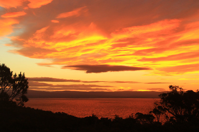
After the Henley-on-Todd finished, I made my way up Alice Springs ANZAC hill where their memorial honouring fallen, former, and current armed service men and women dominates the town's skyline for a beautiful sunset over the western MacDonnell Ranges. It was my first taste for an outback sundown and what a sunset it was! The ever-present dust in the air in central Australia makes for beautiful red and blue sunsets and the silhouettes of the denuded mountains to the west made for a spectacular end to a great day.

Once the sun went down I found some quick take-away and went to bed since I was getting picked up the next morning for my 3-day outback tour.

Friday, July 5, 2013

Australia: Tasmania - Hobart

Trip Date: 28 April 2013

On my last day in Tasmania, Danielle had to do some work and dropped me off at the harbour in downtown Hobart. I bought a ticket for a ferry and admission to one of Australia's - if not the world's - premiere museums: the Museuem of Old and New Art (MONA). Before the ferry left, I spent about two hours walking around town and visiting the Tasmanian Museum where I learned more about the Tasmanian Tiger.

28APR2013 (6)
Hobart Post Office, Tasmania
The Tasmanian Tiger was the island's main predator before the arrival of Europeans. Once Europeans began grazing sheep in Tasmania the Tasmanian tigers were considered a nuisance because of their taste for sheep. The government put a bounty on every Tassie tiger that was killed and before long the only tigers left in existence were caged in zoos. But even that didn't last long and in the early 1900s the last Tassie tiger at the Hobart Zoo died. The tigers have not been seen since and the species is considered all but extinct. I say all but extinct because there is a very very VERY slight possibility that a population of tigers may have survived in the vast wilderness that covers Tasmania's southeast. Expeditions and surveys to find any remaining tigers have returned inconclusive. In the 1930s, after the last zoo tiger died, a biologist went looking for wild tigers and found footprints, but never found any tigers. Some people believe they still exist and sightings are reported but unconfirmed. I'd like to believe that life found a way and that some do exist, eluding humans for nearly a century. I like to believe this because the same story exists with mountain lions of Vermont - the catamount. While reports of them surface every now and then, there is no biological evidence that they still exist. But a few years ago, my Masters supervisor and I were driving to New York and on the rural highways of Vermont a large cat ran across the road in front of us. The cat we saw was definitely a cat, and much larger than a bobcat (which is larger than a housecat - or even a feral cat). To this day, I swear we saw a catamount and because of that I hold high hopes that the Tassie Tiger has cleverly maintained low populations in Tasmania's vast wildernesses.

28APR2013 (14)
Mt. Wellington looming above Hobart Harbour
Soon enough, I boarded the ferry from the city centre out along Port Arthur to the museum which is some distance up the River Derwent. The Lonely Planet guide for Australia says that this museum is one that is NOT TO BE MISSED and that it is "a veritable Disneyland for adults." Built right into the sandstone along the waterfront, the huge underground museum is home to a myriad of old and new art pieces including sarcophaguses, Aboriginal Australian art, modern sculpture art, interactive art, and modern paintings. Some of the exhibits I found utterly fascinating like "Kryptos" a dimly lit maze leading to an inner room; along the walls of "Kryptos" are words from the Epic of Gilgamesh in binary code and you get the sense you are entombing yourself as you walk toward the centre. Other pieces I liked included a huge wall of small Aboriginal paintings that fit together to form a much larger mural. There was also a room with a series of lightbulbs overhead. Visitors could take turns holding a handle of sorts which would record the pulse of their heartbeat and the lightbulb directly overhead would begin flashing in sync with your heartbeat. As each new visitor lit their lightbulb, the previous visitor's bulb would move down the line through a room that must have had hundreds of randomly flashing heart beats. But then there was the weird art, like a machine that was designed to replicated exactly the human digestive system. Every day the machine is fed food from the cafeteria and at 2pm the machine poops. Yes. This machine literally poops. It was disgusting and I don't really understand how it is considered art. Nevertheless, the day at MONA was absolutely a day worth the price of admission and I suggest anyone going to Hobart visit the museum because there is something for everyone there!

28APR2013 (37)
"Kryptos" at MONA
I took the ferry back into the city and Danielle met me down at the wharf and we walked over to Salamanca Markets, some of the oldest preserved buildings near Hobart's waterfront that now boast the city's best restaurants and shopping venues. We had delicious pizza from Cargo Bar and then stopped a few doors down at Jack Greene for a drink before heading back to her apartment for the night.

The night wasn't quite over yet as a huge full moon rose in the east and I couldn't help but run outside with my camera and try to capture this beautiful setting. We'll call it a mild success as I need a tripod!

The next morning, Danielle drove me out to the airport and I all too quickly found myself on my way back to Sydney. The five days in Tasmania were absolutely stunning with their jaw-dropping scenery, amazing food, wonderful people, cultural experiences, and wildlife encounters. It made working all through my Easter holiday weekend worth it. But, of course, like all of my trips, there is still so much I need to see in Tasmania and I am already planning my next trip back where I'll tackle Launceston, Cradle Mountain, and maybe even hike the Overland Trek! But that has to wait until another time.

Tasmania: Australia's Island State. Go there. You'll love it!

Australia: Tasmania - Tasmanian Devils

Trip Date: 27 April 2013

The morning after our night of no-sleep at the Coles Bay YHA, we woke up with some fresh coffee and breakfast at a wonderful new cafe in "downtown" Coles Bay with great panoramic views of the main mountain range of the Freycinet Peninsula. After we refueled our stomachs and the gas tank, we headed back toward Hobart, but turned off toward the town of Port Arthur out on the Tasman Peninsula.

Salt Pans
Tessellated Pavement on the Tasman Peninsula coast, Tasmania
Danielle got less sleep than I did the night before and when we reached the area around Eaglehawk Neck - a 100 metre wide isthmus - which has a number of geological sites of interest, she stayed in the car while I walked down to a unique site called the Tessellated Pavement. This rock shelf is exposed along the coast, not much higher than the water level. Hundreds of millions of years ago this location was under a lot of water and only the tiniest of sediments were transported out into the deep ocean. Tasmania was also glaciated at the time and larger rocks and pebbles stuck in iceberg ice floated out to the open ocean and as the ice melted, these larger sediments were dropped down onto the ocean floor. Over time these sediments became rock and various tectonic forces deformed the rock ever so slightly, but enough to crack the rocks, forming joints in three different directions. Today, the rock is exposed to salt weathering and wave action. The rock that is higher than the high-tide level allows salt crystals to grow large enough on the rock surface such that it wears that surface down more quickly than it wears down the joints. This process forms salt pans. Alternatively, the rocks exposed down by the water's edge and below the water's surface is inundated by water so frequently that salt crystals can't grow. Rather, the strong wave action picks up sand and abrades the rock and is funneled along the joints in the rock causing the joints to be more eroded than the rock surface and this creates these loaf-like structures. Both the loaves and the pans are exposed along the Tessellated Pavement and even though it is really a simple geologic site, it was beautifully fascinating.

Tasman Arch
The Tasman Arch on the Tasman Peninsula
Back in the car we drove across Eaglehawk Neck to the Tasman Arch - a large rock arch formed by wave action forming a cave along the coastal cliffs. Over time the inside of the cave erodes to the point where it is no longer able to support its roof and the ceiling caves in leaving behind the arch over the cave's entrance.

The day was getting on by this point and we were both getting tired. There was no way we were going to make it to Port Arthur, but we were close enough to another awesome destination: The Tasmanian Devil Conservation Park.

While in Australia, I started undertaking a challenge I hadn't expected to take: seeing all of the native Australian wildlife IN THE WILD. I've seen a lot on the mainland including platypus, emu, kangaroos, birds of all kinds, wombats, and echidnas (and I saw kiwis in New Zealand). So while in Tasmania I really wanted to see Tasmanian Devils in the wild. Unfortunately, the Tasmanian devil's populations has drastically dwindled after a contagious facial cancer decimated much of the healthy wild devils. Tasmania is now undertaking drastic measures to preserve healthy Tasmanian devils and save the species from meeting the same fate as the other Tasmanian predator - the Tasmanian tiger which was driven to extinction by European settlers after their arrival. The Tasmanian Devil Conservation Park is playing an active role in preserving the genetic diversity of the healthy Tassie devil population and I figured that spending $35 to see them in the conservation park rather than trying to find one in the wild would be money well-spent. We were not disappointed.

Handfed With Love
Danielle feeding a kangaroo at the Tasmanian Devil Conservation Park
near Port Arthur, Tasmania
We arrived at the Tassie Devil Conservation Park shortly before a scheduled feeding time and after paying our fees started walking through the park which also has a small family of kangaroos, a few wallabies, quolls, various birds, and four separate Tassie Devil enclosures. We helped the owner of the park feed the kangaroos for a good ten minutes which was SO fun! The kangaroos just hopped over to your hands, holding your hands with theirs, and nibbling the feed out of your hands. Little joeys hopped around excitedly and nuzzled right up to us!

Tassie Devils!
Tassie devil waking up for feeding time at the Tasmanian Devil
Conservation Park
But then it was time for the Tassie devil feeding and the devils knew it! In the one enclosure, right at feeding time, the two brother devils who were at first sleeping in their dens, became quite active and started chasing each other around the pen, snarling, and play-biting each other's snouts. They were quite vicious, but they were so much fun to watch. But then the devils stopped at the same time and looked at us - the owner had opened the cooler and the devils could smell the fresh wombat meat, which he tossed into the pen and the two brothers started a tag as they wrestled the meat away from one another. We must have spent at least 20 minutes watching the devils put on one of the best little shows for us, continuing the trend, as my friend, Danielle said, of, "Tasmania putting on a show just for me!" Once the devils were fed, they retreated to their dens and fell asleep, so Danielle and I walked around the park once more, saying goodbye to all the other residents before leaving.


On the way back to Hobart, we stopped once more at Eaglehawk Neck. The town of Port Arthur on the Tasman Peninsula was once home to one of the worst convict colonies in Tasmania and the British used the natural defenses of this peninsula - most notably this 100 metre stretch of land - to keep the convicts from escaping. Strung across Eaglehawk Neck was a string of vicious dogs chained up and trained to attack any convicts trying to escape the peninsula by land. The modern Tasmanians are using these natural defenses once again, but instead of using them to keep convicts from getting OFF the peninsula, they will be used to create and protect a healthy area of land, totally cleaned of infected Tasmanian devils. Devils are being completely removed from the peninsula and the healthy ones put in quarantine for two years to ensure they do not have the facial tumors. Once it is certain the Tasman Peninsula is cleared of infected devils, a series of triple-barrier fences and canals will be built and dug to keep infected devils from the newly-disease-free peninsula. With the fences and canals in place, quarantined Tassie devils will be reintroduced to the peninsula and if the Tasmanian efforts are successful, it is quite possible that the Tasmanian devils will be saved from extinction!

We were happy to have experienced the Tasmanian Devil Conservation Park, and now having crossed the devils off my must-see list, we began the drive back to Hobart where we readily crashed upon arrival at Danielle's apartment, exhausted from our two-day excursion up Tasmania's east coast.

Australia: Tasmania - Freycinet National Park

Trip Date: 26 April 2013

After a quick night in Hobart, my friend, Danielle, and I piled our things into her car and started our drive up the east coast of Tasmania. Our destination was Wineglass Bay in Freycinet National Park. When I first moved into my current apartment, my flatmate strongly suggested (no, he told me it was a must) that I go to Freycinet National Park because Wineglass Bay was so stunning it was just not to be missed!

Bicheno Waterfront
Fishing boats in Bicheno Harbour, Tasmania
Well, it took us a few hours to even get close, but we stopped a few times on the west side of Great Oyster Bay (west of the Freycinet Peninsula) for some photo ops and then drove past the Freycinet turn-off, continuing on up to the small seaside town of Bicheno. Not much ever seemed to be going on in Bicheno, but it sure looked like the perfect place for a vacation home. It still boasts a small fishing industry and some of the fishing boats were anchored offshore.

We stretched our legs along the waterfront for a few minutes and I was fascinated by the granite rock exposures along the beach - mostly because they had HUGE orthoclase feldspar mineral crystals - some as big as my finger! The tidal pools between the rocks were filled with little red sea anemones that twisted in the water as the waves came in and out. Bright orange lichens grew on the rocks, though we'd see more impressive lichens later on. We had a bit of fun posing in the dinghies pulled up on the harbour docks but soon headed back to the town and enjoyed a really good little lunch at a pizza cafe called, Pasini's.

Back in the car we drove south and headed down the access road to the small town of Coles Bay and the entry to Freycinet National Park. While many of Australia's national parks are essentially small tracts of land set aside solely for recreation without many stunning or staggering landscapes or ecosystems, Freycinet is different. Like the Blue Mountains, Royal, Uluru, Daintree, and Kakadu National Parks, Freycinet offers a spectacular mountain landscape with a few tall granite peaks with sparse vegetation growing up the slopes. As we turned the corner and the first view of Mt. Amos and Mayson loomed into view, my jaw hit the floor! I could already tell why my flatmate told me this was a park not to be missed!

Freycinet Panorama
Freycinet National Park seen from Coles Bay, Tasmania
We checked in to our hostel (the YHA in Coles Bay - which has impressively thin walls with two very loud groups of backpackers partying late through the night - avoid at all costs) and drove to the car park at the base of the trail to Wineglass Bay. It was late in the afternoon and we had limited time before the sun set, so we had to hurry a bit!

Wineglass Bay Lookout
My friend Danielle and me at the Wineglass Bay Lookout in
Freycinet National Park, Tasmania
The trail is well-traveled up to the Wineglass Bay lookout and winds its way through large granite boulders and banksia and gum bush. We stopped at the lookout and had amazing views of Wineglass Bay which is an inlet coming in off of the Southern Ocean ending in an impressively wide beach and some of the bluest of blue waters I've ever seen!

Not wanting to miss out on anything Danielle and I continued down the trail to the beach and were greeted by a solitary Bennett's wallaby who was saying hello to any of the beach's visitors, probably looking for food. He was definitely not skittish around people and while wallabies may be antisocial toward other wallabies, this little guy was certainly friendly toward me! I was able to get close enough that we had a little chat and I even took a selfie with my iPhone camera, much to Danielle's entertainment. Soon, the wallaby realised that my camera was not food and immediately became disinterested and hopped off to other hikers.

Wallaby Portrait
Portrait of a Bennett's Wallaby on the beach at Wineglass Bay in
Freycinet National Park, Tasmania
Danielle sat on the beach while I explored the coarse-sandy shores. A fishing boat was anchored not far offshore but was soon greeted by what we think was a police boat, likely wondering what a fishing boat was doing in protected National Park waters.

The rocks along the bay here were covered with the brilliantly-orange lichens we saw in Bicheno, and maybe it was the setting sun, but they seemed to be much more vivid in colour here! The sun was going down and we started back toward the car before it got too dark, and with perfect timing too, because as we neared the lookout the setting sun illuminated the clouds and rocks, almost setting them on fire! It was one of the most amazing sunsets I've ever seen, even by Australian standards! I can't tell if I've just become really good at taking photos of sunsets, or if Australia's sunsets are just always stunning, but it was just beautiful and I think my photos turned out quite nicely.

Sky on Fire
Sunset over Great Oyster Bay from Freycinet National Park (Yep, was really this red!)
Before heading back into Coles Bay we took a little drive up to Cape Tourville Lighthouse. It was now almost pitch black out and the moon was beginning to rise. The lighthouse is positioned on top of large bluffs overlooking the Southern Ocean and the winds started to pick up, making our walk around the lighthouse pretty chilly! I set up my camera a few times to try and get good nighttime photos of the lighthouse and coast, but without a tripod it was hard to keep the camera still while the shutter remained open long enough to get a decent exposure. The photos turned out pretty clear considering Danielle and I couldn't see each other even though we were only a few metres apart!

It was a perfect way to end a perfect day along Tasmania's east coast and we headed back into town for a dinner and drink at the pub before barely getting any sleep at the hostel. Yeah, while I recommend staying in Coles Bay, you're better off camping than trying to get any sleep at the hostel. But having such an amazing experience with the sunset and the wallaby easily made up for it!

Australia: Gordon River Cruise

Travel Date: 25 April 2013

25APR2013 (1)
ANZAC Park along the waterfront in Strahan
I woke up early in the morning at the YHA in Strahan, packed up my things, and loaded my bags into my rental car, and drove down to the Esplanade in the town centre for my first (and only) ANZAC Day Dawn Service. The Australia and New Zealand Army Corps (ANZAC) was the first organised armed services of both countries and were first deployed in World War I at the Battle of Gallipoli which was an effort by the Allies to capture Constantinople and thus monitor/block all sea trade to Russia (thanks, Wikipedia). What I did not have to look up, though, was that the battle was not successful for the Allied Forces and many Australians and New Zealanders lost their lives. ANZAC Day memorialises this Battle as well as all other military excursions that the two countries have been involved in since. It's essentially the Australian and New Zealand version of Memorial Day. Traditional services are held at dawn throughout Australia, and Strahan was no exception. I stopped in at the coffee shop among the 60 or so townspeople who were up early for the service. Soon, the townspeople formed a procession 3-across and walked over to an obelisk in ANZAC Park across the street (while I, and any other tourists, just wandered en masse). There was a nice little service with some prayers being read, a poem by a local high schooler, and some words from the town's mayor - all of which was constantly interrupted by a hoarde of geese, ducks, and seagulls in the park behind us, so it was kind of hard to hear. Then the mayor tried playing a recording of tradtional ANZAC music on a portable CD player, but couldn't get it to play. After about five minutes, the young high schooler who read the poem stepped up to help the elderly mayor. Thinking a young person would have the CD player going in no time, it surprised me when after another five minutes passed and the music hadn't started. It was then I realised how unique my age is: the mayor was maybe too old to be familiar with CD players and the high schooler was so used to iPods and mp3 players that she also didn't know how to work it! They eventually realised that if they put the CD player on solid ground, it would play just fine. The service soon ended and most everyone headed into the local hotel (pub) for breky and a coffee and rum mixture. I settled for coffee (plain) and a sandwich from the cafe next door.

It was a very bleak, grey, and drizzly morning, but I'd booked a ticket on the Gordon River Cruise (highly recommended by tour guides). Strahan is nestled in a little cove off of Macquarie Harbour, Australia's second largest harbour next to Melbourne's Port Phillip Bay, and fed by the Gordon River, which extends up into the vast wilderness of southwest Tasmania. I booked the trip for three reasons. Firstly, not having much time to hike into many of the wilderness areas of Tasmania, I thought this would be a fantastic way to "get into" the wild (yes, even if it is aboard a luxury catamaran). Secondly, it also stopped at the famous Sarah Island - one of Tasmania's most feared convict colonies out on a tiny island in the middle of the harbour - and I wasn't sure if I'd get to learn anything about Tasmania's harsh convict history during the rest of my trip. Thirdly, it included lunch!

The cruise left the docks in Strahan and immediately headed out toward the entrance to the harbour where we passed a few different lighthouses while passing through Hell's Gate. The convicts called the entrance to Macquarie Harbour Hell's Gate because of its isolation and hardships they knew they'd endure on Sarah Island as well as the fact that even though the surrounding area is beautiful, attempted escape almost certainly would lead to death either by British soldiers or the treacherous nature of the environment. Hell's Gate is only  a few tens of metres wide and is very shallow, so not too many large vessels can enter the harbour. Also because of the shallow and narrow entrance, it takes ebb tides more time to push their way into the harbour. In fact, the upper few metres of the harbour's water is freshwater supplied from the surrounding rivers and stained brown with tannin because the narrow entrance to the harbour makes it more difficult for the tides to flush out the harbour!

25APR2013 (30)
Lighthouse at Hell's Gate, the entrance to Macquarie Harbour, Tasmania
This has an added benefit to the local fishermen. Salmon and trout were introduced to Australia from Great Britain and because they require a certain balance of fresh and salt water, Macquarie Harbour is the perfect place for fish farms, of which there are many.

The boat turned around outside Hell's Gates, not wanting to get battered by the huge ocean waves, wind, and rain and went back into the harbour toward the opposite end where the Gordon River flows into it. As soon as we neared the entrance to the river, the water became much calmer and though it was still rainy and gray the trip became a bit more relaxed. We traveled up the river a few kilometres and learned about the native Huon Pines which grow in the area. Convicts at Sarah Island predominantly built ships out of the Huon Pine because the pine's pitch contained an oil which prevented worms from boring into the wood. Logging of the Huon Pines was so intense that all operations have since been halted and the species protected. Now, only National Park officials can remove Huon pine wood from the forests, and even then, it can only be wood from fallen trees. No Huon pines can be cut down.

25APR2013 (74)
Mouth of the Gordon River, flowing into Macquarie Harbour, Tasmania
We got off the boat and had a little walk on a boardwalk through the rainforest, which was very very rainy and allowed us to get up close with the Huon pines and a number of little mud chimneys built by crabs excavating down into it. Back on the boat, though, a buffet lunch was served with some of the freshest salmon you could hope for and local Tassie apples. Delicious!

The rain had stopped momentarily as we approached Sarah Island, home to one of the worst convict settlements in Tasmania, reserved only for those who repeated offense after arriving to Australia. The island is fraught with stories of cruelty, backstabbing, coercion, treachery, and violence I cannot even begin to recount the tales we heard. But the end of Sarah Island came with the installation of a commandant who had previously been a ship builder with no experience of managing convicts. But as soon as he started his post at the island, the violence decreased, the escape attempts stopped, and productivity increased immensely. It turns out that when you give convicts special things they want like alcohol and dignified sleeping quarters, you could get in return a very productive work force. But after news of fair treatment toward the convicts at Sarah Island reached the higher-ups in the British military, the settlement was shut down.

25APR2013 (122)
Convict settlement ruins on Sarah Island in Macquarie Harbour, Tasmania
Having spent enough time outside on the boat, I stayed inside the rest of the way back to the wharf. Arriving shortly after 2pm in Strahan, I rushed to get to my car because I knew I had very limited hours of daylight remaining and a very long way to go to get back to Hobart for the night! But as luck would have it, the rain started back up as soon as I got back in my car. Not just a drizzle, but one of the most blinding, white-out deluges I've ever driven through. I put my trust in the little car and its tires and just started heading down the road trying not to slow down through the very rough driving conditions where rain was flowing down the road and around corners. My wipers, though on at the highest setting, couldn't keep up with the rain. I bought petrol in Queenstown and then started my ascent into the mountains.

The change from the day before in the mining area, where all the hills had been stripped of vegetation and soil was unbelievable. Every single crevasse or nook between hills was GUSHING with unbelievably voluminous waterfalls! With nowhere for the rain to seep into, it just collected and rushed downhill!! The rain continued as I got up into the mountains, and though I was making good time, I was surely driving a little too dangerously for the conditions. But finally, a few hours later, as I came closer to Lake St. Clair, the rain let up as the weather was held back on the western side of Tasmania by the highly elevated mountains. While still wet, the rest of the drive was fairly smooth and pleasant and I made it back to the Hobart airport to drop of my rental car only about an hour after the sun went down.

Saturday, May 25, 2013

Australia: Tasmania's Lyell Highway from Hobart to Strahan

Travel Date: 24 April 2013

Back in early April, while everyone in Australia was taking their Easter Friday and Monday off of work, I was grading assignments and in my lab working, being the diligent PhD student I am! But I needed a getaway, and part of my excuse for working over Easter was that I'd previously purchased a round-trip flight down to Tasmania for five days in late April.

I needed a break. After four solid months of slogging through lab work, research, writing, reading, and teaching, I needed to step off the Sydney merry-go-round or go insane. Having moved to Glasgow in winter of 2012, then to Sydney in August, I pretty much had a year of winter immediately followed by the Australian summer with no change of seasons to speak of and definitely no Fall, which is my favourite. Sure I got a little taste of Michigan Football last September-November, but no pumpkin spiced lattes, no leaves changing colour, nothing. But the nice thing about Tasmania is that it is as far south  from the Equator as Michigan and Vermont are north of it, and April in Tassie would be the same as October in the northern hemisphere. In other words, it was Fall!

Fall Colours on the River Derwent
Fall colours along the River Derwent in New Norfolk
I arrived in Hobart, Tasmania's capital, at 8am, picked up my rental car - a wee Suzuki Swift which I really ended up liking! - and started off down the Lyell Highway. My goal was to get to the small town of Strahan on the western coast of Tasmania, but I also wanted to see as much as possible. My initial plan was to drive north toward Launceston and then west to Cradle Mountain before arriving late in Strahan, but took the advice of locals on the r/tasmania subreddit who thought I might be better off taking the shorter route and actually experience it. They were right.

My first stop wasn't planned until Lake St. Clair in the Tasmanian central highlands, but after picking up coffee in New Norfolk - a town originally set up as a new homebase for Australian convicts stationed out at the soon to be abandoned Norfolk Island camp in the Tasman Sea - I crossed the River Derwent and had to stop because the trees along the riverbanks were on fire with autumnal colours! It was beautiful! From what I'd heard about Tasmania and the Tasmanian culture of environmental awareness and power of purchasing locally, I imagined it to be much like Vermont in the US. The similarities, I would find out, were uncanny, and the trees along the river were just the beginning. I do have to say, though, that this is the only time I've been happy seeing invasive species; you see, no native Australian trees change colour with the seasons, only the imported species from Europe and North America!

Continuing along through pastoral farming/grazing communities, the Lyell Hwy suddenly started its ascent into mountains and the roads became narrow, steep, and windy (and windy)! I passed some of Tasmania's many hydroelectric facilities in Terraleah and the road then spit me out onto the highland plateaus just east of the central Highlands.

Tasmania's central highlands and the entire southwest quadrant of the island are all preserved as National Parks, most of which make up the Tasmanian Wilderness World Heritage Area, and while you can access many places in those parks, the majority of it is left as a natural wilderness for your experienced outdoor exploration! The famed Overland Track is one of the World's best wilderness walks right through Cradle Mountain-Lake St. Clair National Park,and something I hope to do before leaving Australia.

My first planned stop, though, was at an artistic site just east of Lake St. Clair called The Wall in the Wilderness. I'd heard about this artist who is carving out scenes from Tasmania's varied industrial, cultural, and environmental histories in huge panels of wood. In my mind I imagined it to be like a huge detailed collage of various moments that I could learn a lot from. Surely I wouldn't be disappointed. But when I walked up to the door there was a big sign saying something along the lines of:
No cameras allowed! Personal photographs do not capture the essence of my artistic vision when taken in the wrong light. When I have people throwing punches at me for not allowing them to take photos it gives me the right ban all cameras. My art is self-funded and I will decide what I will and will not allow.
Well, that kind of made me stop in my tracks and think, "Wow, what an ass." But not knowing what this guy has gone through, I returned my camera to my car. I thought the $10 admission fee was a bit steep, especially with no student discounts, but I gave them the benefit of the doubt. The building was cold and dimly-lit and in the central hall was the Wall. It was impressive to look at. Dozens of wooden panels of Huon Pine were hanging from a central wall, the majority of which had images of Tassie history hand-carved into the wood: hydro power, convict history, the extinct Tasmanian tiger, and natural scenery - and those that weren't yet carved had the pencil marks on them showing what they would eventually be. It was neat, and the artist is obviously a talented wood-carver, but was it comparable to Michelangelo's painting of the Sistene Chapel (as the Wall's website claims)? No, not in the least bit! Maybe it was the sour taste left in my mouth from not being able to take my camera in, or the tone with which that message was conveyed, but I thought the wall was impressive in size only. There were no information placards describing what I was looking at, but I could buy a book for another $20 to learn about each panel. Essentially, I thought this piece of art was a waste of time and money and I do not encourage anyone to visit. You'll just be nickel-and-dimed out of $10 and with nothing given in return. It's not educational and not all that spectacular when all is said and done. And even though I paid to see the Wall - thus paying for the future work on the wall - I didn't even get to take a photo of it. Crap. Don't go.

Lake St. Clair
Sitting on the ferry pier at Lake St. Clair
It was still cloudy out from morning rain showers, but I drove on to the entrance of  Cradle Mountain-Lake St. Clair National Park at the southern end of Lake St. Clair, which fills a glacially carved basin and is Australia's deepest lake. I went to buy a pass from the Visitor Centre, hoping I could use it at all National Parks in Tasmania I'd go to over the next few days, but it turns out that the passes can't be transferred between cars and if you go to Cradle Mountain, you have to pay a separate, exorbitant, entrance fee - so I settled on the day-pass and went to inquire about the Lake's ferry service. Being on the south side of the park, This is the ending point for anyone doing the Overland Track and a ferry service operates between both ends of the lake taking OT walkers and day-hikers to various piers. Not having enough time to do a four-hour walk, I was just hoping to get into the wilderness via the ferry, but after inquiring about it, I found out I was 10 minutes late and that no more ferries were scheduled for the day (damn Wall in the Wilderness!). So I walked down to the lake's edge for a bit taking in the staggering mountain scenery that was constantly peeking in and out of low-hanging grey clouds. Even on a bleak afternoon it was beautiful.

Back in the car the clouds started clearing, changing to big puffy white clouds, and the sun came out! Not much further down the Lyell Hwy I started seeing huge mountain after huge mountain loom into view from road as it twisted between them and the geologist inside me took over and every time I saw something new I'd let out an, "Oh my Gaaaawwwwddd!!!!! Woooowwwwww!!!!" The National Parks of Tasmania really earn their status as being stunning and beautiful! With stops at the Great Divide and Happy Valley overlook, I parked down at the Franklin River Nature Walk.

The Franklin River rose to international recognition in the 1980s when environmentalists started protesting plans to dam the Franklin River downstream from here. It is one of Tasmania's last wilderness rivers and the environmentalists were fighting to keep it that way. The hydro company eventually lost the battle and a new era of environmentally-conscious Australians rose to national political prominence. Furthermore, a new importance was placed on wild areas of Tasmania with an effort to keep them wild and untouched as much as possible. The walk was short but goes right along the banks of the Franklin and Surprise Rivers and weaves between massive pine and gum trees - some of which are the tallest species of trees in the world!

I'm not sure what the Highway is like during peak holiday season, but the Lyell was essentially empty for my entire drive. The afternoon was getting on and I'd decided that I needed to get to Strahan before sunset so I could watch the sun go down over the Southern Ocean - which you can't really do from too many places in the world! In my rush, I almost missed one of the best views of Tasmania: Donaghy Wilderness Overlook. I actually drove past the parking lot, but turned around. Two backpackers from the UK were just finishing and when I asked if the 30-minute walk was worth it, they said, "We've been traveling around Australia for two months and this is by far the best overlook we've seen!" I was sold, parked my car, and started walking.

I was not disappointed. If you take it quickly, it only takes about 20 minutes and the walk takes you to a little knob from which you get a 360-degree view of the surrounding mountains, valleys, rivers, and the ever-impressive Frenchmans Cap - a unmistakably unique mountain crag off in the distance which can be seen from miles and miles around! There was no one else out on the overlook and I had the place to myself under warm blue skies and a sun just beginning to dip below the mountains to the west. I grabbed a bunch of photos and sped back to my car. I only had about 2 hours left before sundown and it was more than 2 hours to get to Strahan.

Tassie Sunset
Sunset in western Tasmania taken from the shores of Lake Burbury
I sped down the road, probably faster than I should have been going, trying to make it to Ocean Beach in Strahan before the sun hit the horizon, but I kept coming across beautiful scenery! I next had to take a quick minute at Lake Burbury because the sun's rays were shining from behind the tips of the nearby mountain peaks, casting glorious rays over the land, and I am certain I got some of the best sunset photos I will ever take in my life! And then the drive into Queenstown - famous for its regional mining operations which have all but stripped the hillsides of any and all vegetation and sediment cover. The road coming down out of the mountains to Queenstown was also beautiful, but in an industrial and destructive way. At least Mt. Owen seemed to still be forested and one massive waterfall was cascading down the hillsides.

I got to Strahan with about 15 minutes to spare, drove around the town and out to Ocean Beach where I missed the sun actually setting, though the sky was still beautifully lit up with pinks, oranges, reds, and the blues of the night. I stepped out and down to the beach where I took my shoes and socks off, rolled up my jeans and walked down to the water's edge, finally allowing myself to breathe and take in the dusky views up and down the beach - Tasmania's longest. I picked up a few pebbles as keepsakes as the ocean waters washed over my feet because after all, it's not all that often you can say you've stuck your toes in the Southern Ocean. Tasmania and the southern tips of South Africa, Argentina, Chile, and New Zealand are really the only places you can do this (and Antarctica, too), and it's quite a surreal experience when you consider its vastness.

Happy with everything I was able to accomplish along the Lyell Highway, I drove back to Strahan in the dark, found my hostel - the Strahan Backpackers YHA - and got great advice from the owner for delicious fish 'n' chips, Schwoch's, in the town's centre. A delicious ending to a busy, productive, and beautiful day!

Tuesday, May 21, 2013

Australia: Waterfalls and Lighthouses - A Day Trip South of Sydney

Trip Date:

Back in January a group of friends and I took a day-trip south of Sydney to Wollongong, Morton National Park, and Kiama. I think we all just needed a day to get out of the city and wanted to see some cool sites along the way. Well, it was successful, I'd say. We left early in the day and drove the hour it took to get to Wollongong where we stopped along the coast to check out the lighthouse and the sea rocks before grabbing an early lunch at Le Vendi along the harbour which boasts Wollongong's best fish 'n' chips, which were good, but I'm beginning to think that a chippy is going to have to really step it up in order to get that title in my books. The rock platforms beneath the lighthouse were pretty impressive! Deep salt weathering pits, widened by wave action, were filled with water and all sorts of seaweeds, crabs, and little fish. Some were big enough to fit a few people into, like a wee jacuzzi! The waves were big too, and I soon learned I should have brought an extra pair of socks... Wollongong is a University town but also has quite a lot of industrial activity along the coast. Not sure if it's a place I'd prefer to live.

Belmore Falls
The double-cascades of Belmore Falls. Only a
trickle now, it's easy to imagine them in full force!
After lunch, we drove the Illawarra Highway west through Macquarie Pass National Park - which is one of the coolest windiest roads I've ever been on, rivaling those I took through Mangamuka Gorge on New Zealand's North Island - to the small town of Robertson for a photo-op with the Big Potato, and finally to our first waterfall destination: Belmore Falls. Belmore falls, and all the other nearby waterfalls, cascades from the highlands to the deep valleys below over spectacular sandstone cliffs of the Hawkesbury Sandstone. We stopped at a view point looking down to the Kangaroo River Valley before heading over to the waterfall where we hopped a few large pools of water to get as close as we could to the waterfall's edge, which was only possible because the waterfall was nothing more than a little trickle at this time of the year. As anyone would, we tried our luck throwing some small boulders into the pool at the base of the waterfall to see how big of a splash or sound we could get. Lucky for us, the splash was big, but the sound - a big CRACKING noise - was loud and echoed off the walls. Awesome!

Continuing on we stopped at Fitzroy Falls for a little nature walk and waterfall viewing and also at Carrington Falls in Budderoo National Park. Carrington Falls spilled down into a tall, vertical chute and my friend Paul and I thought it would be a hoot to throw a few rocks down into the chute, which was difficult because the closest viewing platform was still so far away that we only managed to get little rocks into the falls, but they still made a satisfying sound!

Blue Blowhole Water
The bright blue ocean swells entering
Kiama's famous Blowhole
Back in the cars, we drove to Kiama and it's famous Blowhole! A blowhole starts out its life as a sea-cave, eroded into the rocks by wave action. Eventually, this cave tunnels its way into the rocks and the roof of the cave collapses so that now, when large ocean waves and swells are forced into the sea-tunnel, they speed up and slam into the back of the cave, erupting the water upwards. The Blowhole was really active when we were there and the water erupted a good 10 metres up into the air! We ventured down to the edge of the sea cliffs, and then I alone crept my way down to the rock platform near the mouth of the blowhole where I watched the huge ocean swells flow in and out of the Blowhole entrance. It was hypnotic and the bright turquoise blue water was just mesmerising! As the sun set, we headed up the street to a pork-roast dinner at the RSL (a kind of club for members of Australia's armed services and their families).

It was just a day trip, but we sure covered a lot of ground and I always think it's nice to get off the merry-go-round that can be city life!

Sunday, May 5, 2013

New Zealand: Bay of Islands

Travel Date: 04-05 January 2013

My last post from my trip to New Zealand over New Year's this year picks back up on the same day I visited the Waitangi Treaty Grounds near Paihia. Back in Paihia, however, I was about to embark on one of the coolest experiences of my travels. Traveling alone is not always the most fun, I don't think. As much fun as it is to meet new people and fellow travelers, it often feels like a broken record because you're always telling people the same things: where you're from, what you do, where you've traveled, what you've done on those travels - and then it starts all over. I'd much rather have someone to travel with, either friends or family, to be able to have an ever-continuing travel narrative that carries through the rest of the journeys. With that in mind, I booked myself a room in a YHA. But this was no ordinary YHA because Paihia is the gateway to the Bay of Islands which is no ordinary travel destination!

The Bay of Islands is a fantastic region on North Island, New Zealand and as its name suggests it is a bay - a picturesque beautiful bay - with islands in it - hundred of islands!! I'd been seeing travel posters for New Zealand advertising the Bay of Islands (BoI from now on) and the posters of course make the green islands stand out starkly from the crystal clear turquoise waters of the bay and the cobalt blue skies and little white yachts and tiny yellow kayaks appear to be floating on air. Obviously this photo was used to make it seem like the idyllic place to holiday, but could the BoI really be this perfect? I found out that the answer was and emphatic, "YES!"

The Rock
The Rock houseboat/hostel I stayed on while touring the Bay of Islands
on New Zealand's North Island
I said the YHA I booked was no ordinary hostel and that is because this YHA is in fact a car-ferry turned houseboat capable of hosting 36 passenters. Rock, The Boat was an ideal way to spend 24 hours on the water - and as the New Zealand Lonely Planet guide says, you can't truly see the BoI unless you're on the bay! The way I justified was this: if I'd booked a hostel, eaten out or even cooked my own food, rented a kayak for a few hours, chartered a fishing guide, and booked a snorkeling outing, I would have spent well over NZ$300! By booking a room on The Rock I could get all of this for a measly NZ$188! Sometimes I think touristy packages like this are overhyped, but I decided to go for it and I was not disappointed in the least bit!

I parked my car at the Paihia YHA (for the land-lubber backpackers) - for free, which they let me do since I'd be spending my money with YHA anyway - and headed down to the dock where I waited in line with a hoard of girls speaking German, a couple of couples, and one chatty South Korean girl from Auckland who was taking the weekend off. No one was really interacting with anyone outside their group, which didn't really bother me; I figured if people weren't social on the boat at least I'd get some relaxation. We were shortly greeted by two guys in their mid-20s who introduced themselves as part of the crew. They put our bags in a boat, gave us some life-jackets and brought us out to a two-level brown houseboat in the harbour. Being an old car-ferry, the boat's back was the former ramp and was kept in the down position as a kind of landing-deck. There was a rack of kayaks on the back and a spiral stairway up to the back deck on the second floor with a New Zealand flag attached. The inside of the boat was amazingly cozy! On the back was a small ring of benches surrounding a wood-burning stove. A large bar occupied the middle of the boat and was where drinks were served and the crew cooked the meals. Bathrooms were small and off to the side and the rest of the main floor was lined by various seats and tables. There was a piano, a foosball table, racks of magazines, and the open rafters were decorated with various antique nautical instruments, tackles, lures, fish, bottles, and so on! The upstairs was where all the rooms were. The four crew members had their rooms up near the front of the boat and the guest rooms took up the rest of the space and were either double rooms, or bunk rooms with six-beds each. The boat could host 36 passengers at once, but luckily there were only 13 of us so it was much more relaxed and much less crowded!

As our captain started bringing us out to the centre of the bay, the crew started the daunting task of making sure everyone knew everyone else and felt part of the family! To get things started they had a wooden duck on a small raft tied to the houseboat with a piece of string. Each of us were then to take turns, introduce ourself, say one unique thing about us, and then take a turn shooting at the duck with a paintball gun! Whichever guy and girl shot the duck first received a free drink from the bar. So it was pretty quickly that we all met each other, started sharing stories, and realised how bad of shots we were with a paintball gun! The crew was amazing at their jobs. I can't imagine the cruise being as fun as it was if the crew had just let us do our own things, but they encouraged us to socialise and though we didn't really get to know each other that much better by the end than we were at the beginning, that first activity broke down those initial barriers and at least got us talking to each other and having a laugh.

Bay of Islands
The Purerua Peninsula making the northern boundary of the Bay of Islands
The weather was perfect and the water nearly perfectly flat on the bay, just like in the photos! The distant hills were beautifully green and the water sparkling blue. We all socialised a bit on the boat watching other watercraft lazily wander around the bay until we got to our resting spot for the night, a small bay off of one of the mainland peninsulas which twist their way into the BoI. We dropped anchor and were told we would be fishing for our dinner. One of the crew cut up a fish for bait and gave each of us some fishing rods and we all stood off the back, or on the adjoining small boat and tried our luck. I wasn't lucky at all, but one of the guys caught two or three red snappers which we were able to keep and another crew member started to prepare it for dinner. After a few drinks and more chatting while waiting for the rest of dinner to be prepared we had one of the best meals I've had on a boat: steaks, fish, salads, potatoes, and beer. Delicious!

It started to rain a little bit, but the few clouds quickly passed and then the stars came out. There was no moon, so it was especially dark, and I couldn't believe the number of stars I could see! With the sun down and the stars out, our next activity began. We split into two groups and were going to do some nighttime kayaking around the bay which was special because at night, especially on clear nights, you could see bioluminescent algae phosphoresce and light up as you disturbed them by paddling through the water. In the eddies of water spinning around the kayak paddles little specks of light would twinkle and flash and then die out as water returned to a calm normal. If your eyes were keen, you could also see fish swimming around beneath your kayak by the traces of light left behind in its wake as it swam through and stirred up the algae. I was a little nervous I'd see a big fish (or shark) swim under me, but it seemed to mostly be smaller fish. We paddled around a bit and could even just lay back on the flat water looking up at the stars! Off in the distance the lights on the boat were all turned off and a warm glow was coming from the wood burner and a number of candles and Christmas lights. It was a beautiful scene that you can only take my word for because I didn't feel the need to potentially drop my camera or phone in the ocean.

Back on the boat some folks went to bed, but I stayed up and chatted with the Germans and a few others for a while over a few beers, but mostly tea. They were all such a friendly bunch, and I have to give it to the groups of friends and couples on the boat, they all did a great job of branching out and chatting with those of us traveling alone. I can only imagine how awkward it could have been if no one was as friendly or social as they (we) were. But soon we were all off to bed.

Bay of Islands Sunrise
Morning sunrise over Electric Bay
It's amazing how well you can find sleep on a boat gently rocking under the influence of little waves. Morning came early though and I was one of maybe five people up before sunrise, which is very unusual for me, but I am so glad I did. The sunrise was just as beautiful as the sunset and the morning air was so calm and quiet it was nice to peacefully be able to take it all in. A few of the other guests who were up early then decided it was time for a morning swim and jumped in and swam around the boat. Now, I should probably explain here that I have an almost crippling fear of being in the ocean. I don't know what it is, really, but I just am afraid to swim in it. I tell people that my brother made me watch Jaws at a very impressionable age and it just stuck with me that if I went in the ocean I would be eaten by a shark. Being on a boat is fine, as is wading or paddling near the shore, but fully submerging myself in the water not near any shore is beyond my limits. Part of being on this trip, though, was going to be testing those limits and I have to admit that the morning swim looked like an ideal way to do it. So before long, and without thinking, I jumped in. The water was cold and it took my breath away, along with the crippling anxiety that came along with the fact that I was in the ocean, not knowing what sort of sea-monsters were swimming beneath my feet! But I was in and did a nice lap around the boat before calling it good and pulling myself out, wrapping myself in a towel, and having my morning coffee. It was exhilirating (yes, even that simple morning swim) and I was ready to take on the rest of the water tasks that lay ahead of us in the day. 

After breakfast, the captain started the boat, brought us past Motukaori and Motuarohia Islands and dropped anchor in Mangahawea Bay off Moturua Island. It was time for the next water-based adventure: snorkeling. The crew pointed to where we'd be going and I saw nothing but two large rocks sticking out of the water (Rangiatea and Motuoi Islands) and some shoals of smaller rocks between them. It did not look safe to me and my anxiety crept back in, starkly contrasting with the excitement of everyone around me. Even the Korean girl, who didn't know how to swim, was excited, tightly strapped in to her personal flotation device! It's amazing what a little bit of peer pressure can do, because not wanting to be the only person to no go snorkeling and not wanting to show how scared I was (which was dumb because I told them all how terrified I was!), I didn't have a choice but to grab some flippers, a snorkel, and mask and jump in with the rest. Again the cold water got me, but my adrenaline helped push me through as we all flipped our way over to the rocks. We had two goals here. Firstly, we were there to explore the rocks and snorkel around. But secondly, we were also there to catch kina (sea urchins) for a snack later on. I now fully admit that I had an amazing time snorkeling! It was so cool to just dive around watching all the fish swim around, some in large schools like the blue maomao and some solitary ones like the sandager's wrasse (easily as big as two feet in length!) or the small demoiselle. The blue maomao were really extraordinary because you could just swim into their small schools as they congregated by the rocks. The other swimmers were either exploring or trying their hand at diving down to the rocks and picking up the kina, putting them in a small net the snorkeling crewmember had with us. I had a great time and was determined not to be in the first group of people to head back to the boat, though I also have to admit I never quite got the hang of breathing normally through a snorkel. It's such a weird feeling to breathe through a tube and I kept taking short quick gasps of air which didn't do me much good when I wanted to dive down. But soon the chilly water got to me and hoisted myself onto the small zodiac that took me back to the houseboat.

Sunny Waewaetorea
On top of Waewaetorea Island
With snorkeling done for the day we all dried off and had our packed lunches in the sun as the boat went around some more islands and anchored in the little harbour between Okahu and Waewaetorea Islands. We all hopped back into the kayaks and paddled toward the shore of Waewaetorea Island where some of us took a little walk to the top of the tall grassy hill to get a better view of the BoI, and really, we could not have asked for more perfect weather! It was warm, sunny, and only a few whisps of clouds in the sky! Back down at the beach we played some beach games with a cricket set and rugby ball - cricket I was surprisingly good at, but not the game we played with the rugby ball. But then we were told the afternoon was getting on and we needed to start heading back to Paihia Harbour so they could take the next group of passengers out. So we kayaked back to the houseboat, and before we pulled up anchor for the last time I took one more dive and swim off the back as a personal way of saying to myself, "See? You can do this!"

The cruise back to Paihia was very relaxed. Everyone just chilled out on the sofas and seats throughout the boat chatting and having a beer or two. I joined in as well, but kept being distracted by the beautiful surroundings and landscapes. There was even a large regatta in the Bay that day and a whole string of yachts were sailing around, reminding me of the Boxing Day race that started in Sydney just a few weeks earlier. We even were treated to some of the kina we caught, which were cracked open by one of the crew members. We learned that kina reproduce asexually so have both the eggs and sperm inside their bodies and that the eggs (or was it the sperm?) was considered a delicacy in many restaurants and that you could pay upwards of $50 for a small appetiser of the stuff! I don't think any of us were too keen on trying it, but the Korean girl, who turned out to be quite adventurous, volunteered to go first and we watched as the kina eggs was dabbled on her hand in a sticky yellow goo, and then she quickly stuck out her tongue and licked it clean! It was gross, but sure enough, all of us were trying it before long. Definitely not something I'd pay $50 for by any stretch of the imagination, but it wasn't all bad - kind of a salty, buttery, goo... 

Bay of Islands Regatta
Bay of Islands regatta in front of the Purerua Peninsula
But soon enough, we were anchored back in Paihia Harbour and with an unceremonious farewell to the fellow passengers, we were transported back to the docks and then each of us were on our own ways. It was fitting because the reality was that most of us probably wouldn't see each other again, but since there were no false pretenses (for example everyone saying, "let's keep in touch!") there were no hard feelings. We'd all gotten exactly what we expected: a fun night out on the Bay of Islands with friendly people making personal memories of fun mini-adventures!

Lonely Planet's New Zealand guide says that the Bay of Islands is overhyped, which compared to the rest of New Zealand might be the case (sure, it's no huge volcano, powerful earthquake, or glacial landscape), but if you want water-based activities, it's the bee's knees and I recommend to anyone who wants to get the most for their money, go on The Rock!! If you have the right social disposition, you will not regret it!

Monday, April 29, 2013

New Zealand: Waitangi Treaty Grounds

Trip Date: 04 January 2013

Hi everyone. It's become the time in my PhD where I really cannot afford to provide you with the long posts of the past. I noticed there was a lot of repetition between the blog text and the photo captions and so I am going to try and minimise redundancy by giving a brief overview of where I went, what I did, and how I got there with more detail of what I saw and learned in the Flikr photo captions. I don't really know how many people read this thing through and through, so I hope you can appreciate my changes.

So, back to my trip to New Zealand waaayy back in January...

...I left off at the end of a harrowing day of near-death experiences and kiwi encounters and by the next morning, I felt I was due some rest and relaxation. I drove in to the town of Keri Keri for some breakfast at the little Cafe Zest which had some of the best blueberry muffins I've had in a very long time and then on to Paihia, the entrance to New Zealand's famed Bay of Islands. The Bay of Islands was my main destination, ever since seeing ads for it in my local rail station in Sydney. I'd read that it is useless to visit the Bay of Islands if you don't actually go on the water, so I found myself a YHA hostel on a houseboat called, Rock the Boat, but more on that in the next post. Rock didn't leave until 5pm later that day so I had all morning and afternoon to myself.

Waitangi Flagpole
Waitangi Flagpole at the site where the Treaty of
Waitangi was signed between the British and
the Maori peoples in 1840.
The town over from Paihia is Waitangi and is famous for being the site where the British colonists and many Maori tribes came together to sign a treaty, giving the Maori recognition of their right to the land, provided the Maori with the status of British citizens, but gave the British Crown control and governance of New Zealand. Not everything was really fully agreed upon and many Maori chiefs refused to sign. Nevertheless, the treaty became a symbol for New Zealand independence, much like the Declaration of Independence in the US. The grounds include the site where the treaty was signed, where the first Governor of New Zealand had his house (a very modest one), a traditional Maori meeting house, and one of the largest canoes (waka in Maori) in the world.

When I drove up I was greeted at the entrance by some young men and women dressed in traditional Maori clothes inviting me in. It made me very skeptical at how kitchy this site was going to be - I though cheesy reenactments and a badly presented tour were in store, especially at the price of $45 to gain entrance to the Treaty Grounds, a tour, and a ticket to a cultural performance. I thought to myself, I'm only here once so I'd better see what it's about, and in the end I could not have been proven more wrong or found a better way to spend $45 in a day!

I had about half an hour to explore the Treaty Grounds on my own but then I made my way over to the Meeting House where we were greeted by the young woman who was out front. She had a very cheery demeanor as she explained the significance of the cultural performance we were about to witness. We were told that we, as visitors, were a tribe and she selected a tribal leader for us. We were then going to be tested as a tribe by the hosting tribe (the performers) to determine whether we came in peace or in war. And then the show started with the hosting tribal leader stepping out in front of us swinging a piece of wood on a string around him, making whooshing noises in the air, snarling with his tongue stuck out and his eyes bulged so you could see as much white of them as was possible. He was shortly joined by two other men in their intimidation dance and a small group of women came out on the veranda and started to chant. Finally, the host tribal chief laid down a leaf (or feather or flower?) on the ground and our chief picked it up. We were seen as friends and welcomed into the Meeting House.

Maori Cultural Performance
The Maori tribal chief beginning the welcoming ceremony to Whare
Runanga, the Meeting House. Through intimidating dance, snarls,
facial expressions, and weaponry, his goal is to see if we came in peace.
While we were instructed to treat the outside ceremony very seriously, the attitude of the show changed immediately once we were inside. We were introduced through song and dance to traditional Maori customs, stories, weapons, and history for the next 45 minutes. The music was enchanting, the performers amazingly talented, and I was in awe for the entire show, sitting there with a big smile on my face, thinking how much the rest of my family would enjoy this! The Meeting House itself was just as incredible as the performance with wooden tikis carved into panels and geometric murals painted on the walls.

After the show, the performers greeted us outside in the courtyard and those of us who have no shame were allowed to hold some of the Maori weapons for a photo op, giving our try at intimidation... Let's just say I didn't quite play the part as well as the performers!

I then joined up with a tour group and we walked the grounds, led by a colourful storyteller of a tour guide to the different sites, including the large, 117-foot long waka (canoe), traditionally carved in one piece from the felled trunk of a totara tree in a sacred ceremony in celebration of the 100th anniversary of the signing of the Treaty of Waitangi in 1940. The 3-meter wide stump of the tree used for its construction is housed at the end of the waka's canopy and is just massive! The waka itself was built as a war canoe that could carry 135 people! It actually floats and is taken out onto the bay from time to time for special celebrations.

If you ever find yourself in the Bay of Islands area, do not miss this site!!!! It is well worth the $45 and well worth an afternoon of your time!

Creative Commons License
This work by Eric W. Portenga is licensed under a Creative Commons Attribution-NonCommercial-NoDerivs 3.0 Unported License.