Wednesday, July 27, 2011

Sleeping Bear Dunes National Lakeshore

Trip taken: August 12, 2010

If you're from Michigan, you know about Sleeping Bear Dunes and also probably heard the Ojibwe story for how they came into being (beautifully told by Kathy-Jo Wargin in The Legend of Sleeping Bear). Legend has it that a mother bear and her two cubs were fleeing from Wisconsin and swam across Lake Michigan. The mother bear arrived first, only to realize her cubs were not with her any longer. She climbed the dunes and used them as a look out for her cubs. But her cubs never made it across the lake, but rather, they became the North and South Manitou Islands.

The landscape tells a different story, one that begins during the last ice age as a sheet of ice, miles thick, began retreating from its cover of Michigan. Millions of tons of sand and gravel and rocks were carried away by rivers from the ice margin and make up much of the visible landscape. Furthermore, large glacial deposits, or moraines, were left behind, providing the structure for the very steep bluffs along the lakeshore. In the thousands of years since the ice retreated, these bluffs were battered by waves and wind and sand and gravel became exposed only to be blown up and around by the wind, where they created a large dune field up on top of the bluffs, in what are known as "perched dunes." It is one of these perched dunes that became the mother bear of Ojibwe legend. But honestly, I don't think most people know the geologic background of the park, which is okay, as long as they are able to appreciate that it took a long time for it to come into being.
The darkly shaded bump on top of the dunes is the Sleeping Bear of legend
 Last summer, my friend Stephanie (lovingly called Smac by those who know her), and I made a point to visit The Dunes on our quest to acquire cancellation stamps at each National Park. We stayed at my family's cottage in northern Michigan where, over healthy snacks of blueberries and peppers, I learned how to play Canasta - a game I quickly forgot how to play but want to pick up again!
Smac, healthy snacks, and canasta
But early the next morning we packed up our lunches and took off on the road out to The Dunes! It takes a little while to get there from anywhere, but the closest city is Traverse City, which has its own airport and tons of neat shops downtown. Then you drive through the farmland west of town where you'll see anything from corn and potatoes to grapes and hops being grown.

The easiest thing for a family to do at the Dunes, if they want to get in the sand quickly, is to go to the Dune Climb, just north of Empire (turn right just after the Visitor Center). The Dune Climb let you get out of your car and into the sand, about 10 feet away. Here, you can climb about 100 feet up a sand dune. You can stop there if you want, but the real treat is about an hour's hike past the Dune Climb. In the summer, you want to make the hike along the Cottonwood Trail in the morning before the sand gets to be too hot - or make sure you have good foot protection - because you're in a land of no shade and a lot of ups and downs over little dunes, passing between cottonwood trees and through fields of aromatic dune grass.
Looking back toward the parking lot from the start of the Cottonwood Trail. Right where the trees are seen above the sand line is the edge of the Dune Climb. Glen Lake is in the background.
Trail blazes for the Cottonwood Trail.
Cottonwood Trail.
On the return journey from the beach. Regardless, it's a lot of hot sand to walk through!
South Manitou Island in the distance seen from the Cottonwood Trail.
Once you reach the end of your journey on the Cottonwood Trail, you are rewarded with a thin stretch of a cobble-strewn, sandy beach. Michigan's beaches are one of the world's best known secrets and no one I know who has visited them has ever found nicer beaches anywhere in the world. The sand is frequently referred to as singing sand for the noise it makes as you shuffle through it. And in most places there is nothing but sand at the beaches. For the most part, the sand is not sharp, or littered with shells or trash or large stones. For the most part!

At Sleeping Bear, though, there are plenty of cobbles to be found along the beach, which can make wading in the water a little bumpy, but it is well worth it. If you didn't know any better, you might think you were in the crystal clear waters of the Caribbean and if I remember right, the water temperature that day was at least 80°F!!
Beach at the end of the Cottonwood Trail.
Crystal clear, warm waters of Lake Michigan!
The sandy part of the beach

Smac and I stayed down at the beach for a good hour before making the return journey to the car parked at the Dune Climb. The day was getting on, and we had a few other things we wanted to do so we headed back toward Empire. BUT, if you were to keep going north in the park you would eventually come to a turn off where you can visit a Coast Guard station and maritime museum as well as take a ferry out to both North and South Manitou Islands where you can go back country camping, snorkeling among shipwrecks, and hike along steep island bluffs!

We made a quick stop at the Visitor Center in Empire to collect our official Sleeping Bear Dunes National Lakeshore park brochure as well as get our Sleeping Bear Dunes cancellation stamps. The center is a useful stop, especially if you have kids, to get a general overview of the geology, biology, and history of the park. It was a nice day, though, and we had other things we wanted to do.
 
We then went south of Empire to a little hike at Empire Bluffs. From this short, easily hikable trail, you get beautiful and classic views of Sleeping Bear Dunes. Along the way, though, we found rusted out old farm equipment and a section of the trail where various trees are marked with different colored ribbons to show which trees are infected with destructive and invasive parasites, fungi, insects, and other maledictions.
Farm equipment on the Empire Bluffs trail
Colored ribbons showing infected trees.
Sleeping Bear Dunes.
Smac and Me at the Empire Bluffs overlook.
After Empire Bluffs, Smac and I drove up to the Big Daddy (or Momma?) of them all: The Sleeping Bear Dunes! These dunes are MASSIVE! While dunes at Pictured Rocks National Lakeshore rise over 300 feet, Sleeping Bear Dunes rise over 400 feet! This causes the dune slopes to frequently oversteepen and a large sand slide will occur, sending massive amounts of sand down into the lake. Therefore, maintaining dune vegetation is crucial in the park's management plan. However, one of the park's main attractions gives you the opportunity to hike down the 400-foot dune, as long as you realize you will have to climb back up (a good reason to try the smaller Dune Climb first!).
Getting ready to head down the dune!
An overlook allows those unable to go down the dune a breathtaking view of Lake Michigan.
Looking up from the bottom of the dune. It's deceiving because at the top of the sand line in the photo (where the sky starts), the dune continues but at a shallower angle, so you just can't see it from here!
Smac coming down the dune.
On the way back up, I stopped to take a picture showing the steep incline of the dune. It's pretty much a 100% grade!
Smac and me back at the top of the dune!
There are frequently a lot of people at this dune climb, especially as the sun starts to set because you really don't have a better vantage point anywhere else in Michigan than here! Unfortunately, it also means there are many people who don't understand their surroundings. For example, as I was climbing back up the dune I stopped to wait for Smac to catch up and a very large man was sitting on the slope, exhausted, sunburned, and clearly in over his head. His intentions were good in that his son wanted to go down to the bottom so he went with. But he was out of shape and had no water. That's not to say he wasn't refreshing himself; in fact, while I was talking to him, he reached into his pocket and pulled out a Budweiser (king of beers?) and started guzzling it. I appreciate the fact that he was out there enjoying a day with his family, but when you're in a National Park, in nature, I surely hope you know what you're getting yourself into and know how to respect it. This man eventually made it back to the top (he was nearly there already!) but it took him another half-hour and ten stops along the way to catch his breath.

Smac and I stuck around a little while longer to make a perfect end to our National Park day by watching the sun set over Lake Michigan. It truly was beautiful and made me realize how much I missed living so close to this awesome place!
Sunset over Lake Michigan

So with three of three of the four National Lakeshores in the National Park System checked off (
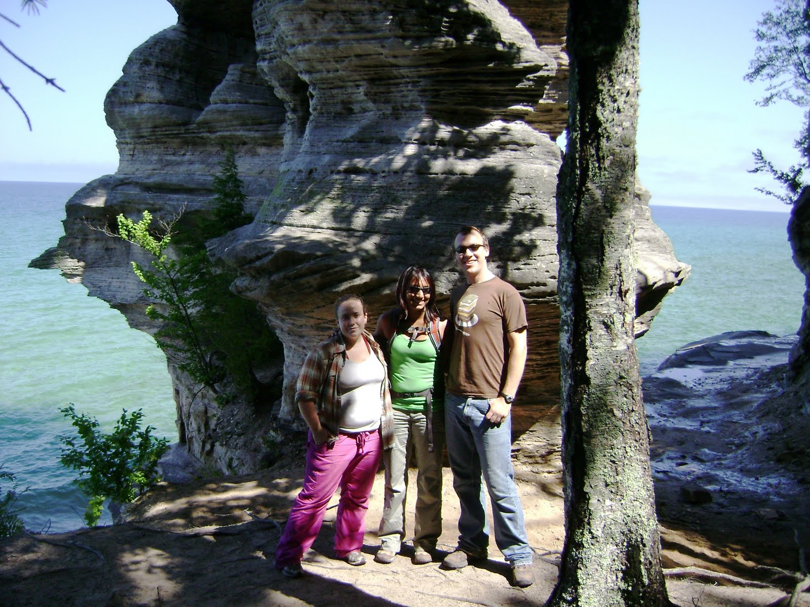
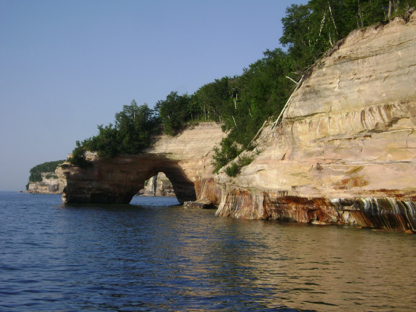
Pictured Rocks, Indiana Dunes, and Sleeping Bear Dunes), I hope that by the end of the summer I can check off the fourth: Apostle Islands in Wisconsin. Cross your fingers and let's hope!

Tuesday, July 19, 2011

Pictured Rocks National Lakeshore

Trip taken: August 1-3, 2008

Most people, when you ask them to think about Michigan, will probably say something about the auto-industry or the apparent demise of Detroit. Oddly enough, no one from Michigan says anything about it being the Great Lakes State, which is surprising because it is the state with the second longest shoreline (Alaska being first) and it has more lighthouses than any other state! Though many of Michigan's State Parks can be found along Lakes Superior, Michigan, Huron, and Erie, two of its gems are the National Lakeshores: Pictured Rocks in the Upper Peninsula and Sleeping Bear Dunes in the Lower Peninsula.

After graduating from the University of Michigan in 2008, I tried to get my friends from U of M's geology field camp, Camp Davis, together for a mini reunion. While most people could not make it, my friends Ruth and Mary and I got together for an extended weekend and we left on a Friday morning for the small town of Grand Marais on the northern side of the Upper Peninsula, along Lake Superior. It was an eight hour drive from Ann Arbor, but the weekend that followed was well worth it!

We arrived in Munising sometime later in the afternoon and decided it would be best to secure a campsite for the next two nights. We were lucky enough that one of the "Lakeside" campsites at Hurricane River was still available and it wasn't even 100 yards to Lake Superior. We quickly set up our tents and decided we would take a quick walk down the beach to the Au Sable Light Station, a little over a mile away. We got there just before the staff was about to close the tower, but we got up there and I don't think there is any better place to see the more than 400-foot Grand Sable Dunes or to watch a thunderstorm roll in across the lake from Ontario!

Au Sable Light Station
Ruth (in red), Mary (in blue), and Me up in the Au Sable Light Station and the Grand Sable Dunes in the background.
Grand Sable Dunes in the evening
The entire way back to our campsite we could see the edge of a storm coming in and we felt the drizzle as we walked the beach, which is sandy with tons and tons of cobbles and boulders left behind by the retreating Laurentide Ice Sheet. The Great Lakes are known as the Inland Seas to some, and no sea is without its shipwrecks. Along the beach between the Hurricane River campsite and the Au Sable Light Station are the remains of a few of these ship wrecks - though, if my memory serves me right, are not on any maps as the Park Service wants these wrecks to be left alone. (But we found one!)
Washed ashore with one of the ships
Ship wreck in the evening sun
Mary and Ruth are ready to rock out at the Lakeshore!!
By the time we got back to our campsite we had to take shelter as the storm hit shore. Luckily, it wasn't long lasting and we were soon getting our campfire started. Well, Mary was soon getting our campfire started using her karate skills and Ruth got out her guitar and gave Mary some music to chop wood by.
Sleep was important because the next day was a big one. We were going to hike more than 10 miles starting at the Chapel Falls parking lot. It's about three miles from the trailhead to Chapel Rock, a lonely sandstone pulpit-of-sorts at the beach through a peaceful aspen forest and past the 60-foot tall Chapel Falls.
Alongside Chapel Falls
Trail going out to Chapel Rock and Chapel Beach
Chapel Rock! The lone white pine on top has two major roots that drape over the empty space to the right where there used to be a natural rock bridge that has since collapsed!
Hiking to Chapel Rock
Mary, Ruth, and me at Chapel Rock. Lake Superior in the back.
We had a little lunch at Chapel Rock before continuing west along a trail that goes over top 200-foot sandstone cliffs which give the park its name. The water was so sparkling blue and clear! And it was interesting to see in places a very sudden drop off into much deeper water. We couldn't have asked for better weather this day. Even though it was the first weekend of August, we were comfortable in long pants and short sleeves and that the mosquitoes and black flies were not in full force. And there were dozens of people who were kayaking the still lake waters near the base of the cliffs, exploring little wave-cut caverns and arches. That is something I will have to do next time I am here!

The trail we took, as I said, led us over these monstrous cliffs, but the most notable site is called the Grand Portal where you look straight down 200 feet into the crystal clear water and you are directly over a very large (and actively caving in) rock arch! In fact, just a few years ago a very large rock fell from the underside of the arch down into the water! We continued until we came to Mosquito Beach, which, luckily, had not mosquitoes there and then headed back inland past Mosquito Falls and to the trailhead.
A rocky point sticking out into and above Lake Superior
Looking down into Lake Superior
Grand Portal Point
Ruth, Mary, and me near Grand Portal Point
Group photo on top of Grand Portal Point
A very geologist-y photo!
Lake Superior from Grand Portal Point
Mosquito Falls
Exhausted, we arrived back at the car and threw our bags in the back. Though we got an early start to the day, it was still only mid-afternoon so we decided to head into the town of Munising, stopping for lunch at a very lodgey restaurant where we ate our fill of lord-knows-what. All I remember from this place is that we overheard someone say that, "It's always Father's Day in Shingleton," which is the name of the little town we were in!

In Munising we decided to check the cost of tickets for the tour boats that take passengers along the lakeshore. We saw many of them earlier in the day and thought it would be enjoyable to see the cliffs from below instead of walking up above them. It was fantastic and only like $30! The three of us joined a crew of many and got great narrations of the different rock formations we saw by the boat's captain:
Lighthouse on Grand Island just out from Munising
Miner's Castle
Looking back on Miner's Castle, the rocks look like a Giant stepping up out of the water
Bridalveil Falls. When the water is flowing after the snow melt season, it gushes with a stream of white water
Pictured Rocks shoreline
The rocks are "pictured" because of the staining caused by dissolved metals being seeped out with groundwater flowing through the rocks. Different metals oxidize a different color like iron turns red and copper turns blueish-green
Lovers' Leap rock formation. Native American legend has it that two lovers who could not be with each other jumped off of this arch into the lake and died, to be together forever.
This is the Battleship Row because the rocks look like a line of battleships ready to head out of port.
I thought this looked like a goblet!
If conditions are right, the tour boat will even slowly take you into one of the coves between the rocks where there is literally feet on either side of the boat and you think you're going to crash into the rocks. But you don't and one lucky person is selected to touch the rocks from the front of the ship and push us back out into the lake!
Spray Falls: These are just east of Chapel Rock and normally the boats don't go this far, but it was our Captain's last voyage so we got lucky!


More cliffs as we head back into port
 
Caves carved out by wave action
Going by the Grand Portal. You can see the little rock where Ruth, Mary, and I got our group photo taken earlier in the day! The large pile of rocks under the arch is what is left after a recent major rock fall!
The sun setting over Grand Island
Photo of me back looking at Chapel Rock from the lake
 With a long day of hiking behind us and a breathtaking evening cruise, we got in the trusty car for one more night of camping. I don't think we said much when we got back to the campsite because we were all just dog-tired! But the next morning came and we had breakfast and packed our gear back into the car and made one more stop before getting back on the road. We had seen the Grand Sable Dunes from the Au Sable Light Station, but before leaving we wanted to get a closer look and did so from the Log Slide Overlook, just west of Grand Marais. As we headed back to the car, I saw a sign that read:
Ten Mintues to go down. One hour to come up.
The sign was posted at the top of a 300 foot sand dune and I took it as a challenge. With a good running start and a jump off a perched tuft of dune grass, away I went, arms flailing as I ran down the dune! I nearly fell a couple of times because it is not just sand all the way down; there are some layers of really course pebbles and larger cobbles that hurt like hell when you step on them! But once at the bottom, I took a quick dip in the lake and started back up the dune. All in all, I think Ruth and Mary said it took me ten minutes and the score became Sign: 0, Eric: 1.
300-foot drop from the top of the dunes to the bottom!
Mary and Ruth at the Log Slide overlook
Our fun little weekend group!
And with one final stop on the way out of the park on Sunday, we accomplished a little bit of everything Pictured Rocks National Lakeshore has to offer: hiking, boating, waterfalls, dunes, lighthouses, you name it! Though it's a smaller, lesser-known unit of the National Park System, its remote location has kept the ecosystems here fairly well in-tact and you can enjoy a weekend away for next to nothing! The National Lakeshores are little gems scattered across the Great Lakes and though I've been to three of the four, I can wait to go back to all of them!!
Good Weekend!
Creative Commons License
This work by Eric W. Portenga is licensed under a Creative Commons Attribution-NonCommercial-NoDerivs 3.0 Unported License.