Date: 27 May 2014
I've said it before, but it's worth saying again: when the weather is nice in Scotland, you've got to go take advantage of it! Luckily, as a student, as long as my work gets done on time, it (kind of) doesn't matter when I do it. So when the sun comes out, it's time to go! A few weeks ago, my classmates Hazel and Ruth and I headed off to Arrochar, west of Glasgow near Loch Lomond to hike a few of the Munros in the Arrochar Alps. It was supposed to rain a little bit in the afternoon, but it was clear now and we decided to take the steeper route to the summit of Beinn Narnain and get that over and done with first, figuring if it was rainy later, the steep slope would be too slippery to come down.
It was the right decision. The path up from the Argyle Forest Park parking lot to the summit is a long and tiresome, seemingly never-ending steep trail from sea level right up to 600 meters before it finally levels out for a little while. Once you're up and out of the forest, the views are magnificent and when you get to the part that levels out, stunning views of the craggy peaks of The Cobber loom into view.
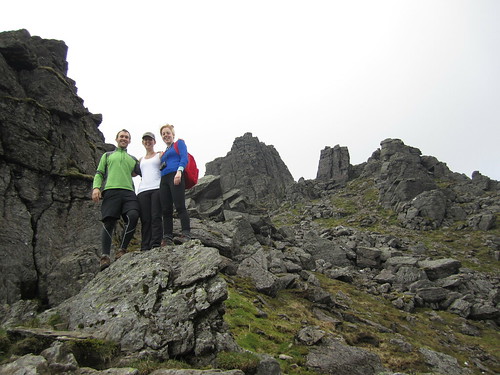 |
| Final ascent up Beinn Narnain through The Spearhead |
After one last rocky gully we clambered up through, we found ourselves on the top of the mountain - not the summit yet, mind you, but it was a flat walk from here. We stopped for a few photos looking over Loch Lomond from the top of The Spearhead and eventually made it to the cairn and trig point at Beinn Narnain's summit of 926 metres (3,038 ft). We stayed up there a little while to catch our breath and had a good look around us. It was quite cloudy, but the sun poked through every now and again, and the cloud base was higher than the mountains, so we had good views of all of the other Arrochars and even Ben Lomond across the lake.
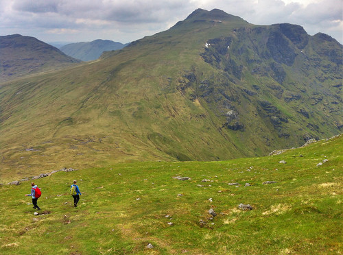 |
| Over and down from Beinn Narnain to Beinn Ime. Looking back at it, the trail up Beinn Ime just looks squidgy! |
While getting down to the bealach from Beinn Narnain wasn't bad, the bealach and the majority of the slope up to Beinn Ime was totally waterlogged from rain we'd had the previous few days. It wasn't all that warm, and soon conditions became worse as our feet sank into soggy, squidgy, grass, and our socks became soaked with cold water. As Hazel put it, it was a long plod. We didn't talk much and instead just kept one foot in front of the other until the path hardened underfoot and became more clear up at the higher elevations. A walker coming down the mountain told us we weren't too far off, and sure enough, the trail quickly leveled off and we walked along the ridge to the cairn at the summit of Beinn Ime, the highest of the Arrochar Alps at 1,011 metres (3,317 ft). Being so high, it was really windy, but luckily previous hikers had created a sort of a fortress around the cairn that blocked some of the wind, so we sat there having our lunch with the best view around!
It was windy and chilly enough, and our feet were still wet, that we didn't stay for too long and started the long plod down the mountain. Fortunately, the trail back to the car looped down the valley between Beinn Narnain and The Cobbler, so we didn't have any more walking upslope. We stopped for some snacks at some large boulders at the foot of The Cobbler but didn't stay too long. The rain came in just as we were getting back to the car, so while we weren't too wet, it did get us in the end. Good thing we hadn't gone down the real steep slope we started on!
(there's more below the slideshow)
Ben Vorlich
06 June 2014
I decided to trade my Friday for my Saturday and since it was sunny on Friday, head off to the one last remaining Munro in the Arrochar Alps I'd yet to tackle - Ben Vorlich. I'd seen Ben Vorlich from my hikes up Ben Vane and the Beinns Narnain and Ime, and the reviews from Walk Highlands said to expect a steep and unrelenting climb to the summit ridge. The reviews were not joking! Luckily, I was hiking on my own yesterday, so I could take my own pace. Once I found the trailhead, as the reviews said, it just goes up. And up. And up. Though the trail is well-defined, it is not just steep, but wet, and mucky. So much so that one misstep could mean face-planting it into the hillslope which would not be good because there were a lot of rocks, too!
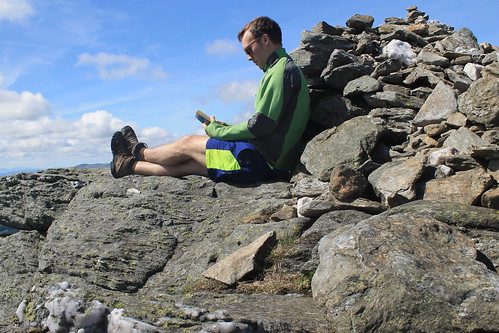 |
| Ben Vorlich - a good place to have a read! |
Well, eventually the trail flattens out, kind of, but there is still a ways to go to get to the summit. And even when you get to the trig point, you're still not there because the actual summit is another short walk beyond! But once you're there, you know you're there - 943 metres (3,094 ft) is hard to miss! Not too many people were up at the summit, so it was nice and quiet. And though it was a bit windy, I was able to find a little crevice between some rocks, out of the wind where I could have my lunch and finish reading a book I've been trying to get through. It was so much nicer having time to enjoy the peace and quiet of the summit, rather than being rushed to get to the next one or forced off by inclement weather.
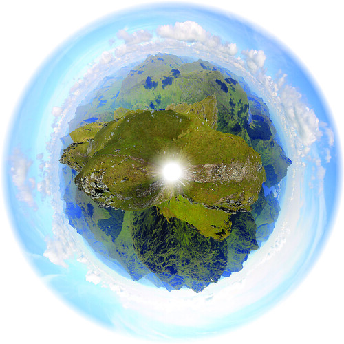 |
| The panoramic planet I stitched together from the trig point on Ben Vorlich |

Looks like you guys are having great time. It must be amazing being there.
ReplyDeletecompare airport parking prices
compare parking rates