I've said it before, but it's worth saying again: when the weather is nice in Scotland, you've got to go take advantage of it! Luckily, as a student, as long as my work gets done on time, it (kind of) doesn't matter when I do it. So when the sun comes out, it's time to go! A few weeks ago, my classmates Hazel and Ruth and I headed off to Arrochar, west of Glasgow near Loch Lomond to hike a few of the Munros in the Arrochar Alps. It was supposed to rain a little bit in the afternoon, but it was clear now and we decided to take the steeper route to the summit of Beinn Narnain and get that over and done with first, figuring if it was rainy later, the steep slope would be too slippery to come down.
It was the right decision. The path up from the Argyle Forest Park parking lot to the summit is a long and tiresome, seemingly never-ending steep trail from sea level right up to 600 meters before it finally levels out for a little while. Once you're up and out of the forest, the views are magnificent and when you get to the part that levels out, stunning views of the craggy peaks of The Cobber loom into view.
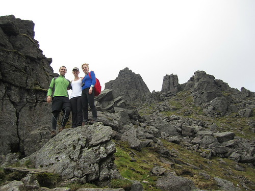
Final ascent up Beinn Narnain through The Spearhead
But of course with all hillwalking, there are about three or four "false peaks" that make it seem like you're almost there, but then...nope! One of these false peaks was the Cruach nam Miseag and we really thought we might be to the summit. Instead it was just a vantage point where we could see the trail go down in elevation before winding its way up between huge rock outcrops called The Spearhead! A few hikers were threading their way through The Spearhead and we could hear their voices echoing while we sat and had a wee break. The rest of the trail wasn't terrible, however. It turns out that getting up through The Spearhead didn't take long at all and as a geologist, the blocky and square outcrops that towered overhead were just fascinating!
After one last rocky gully we clambered up through, we found ourselves on the top of the mountain - not the summit yet, mind you, but it was a flat walk from here. We stopped for a few photos looking over Loch Lomond from the top of The Spearhead and eventually made it to the cairn and trig point at Beinn Narnain's summit of 926 metres (3,038 ft). We stayed up there a little while to catch our breath and had a good look around us. It was quite cloudy, but the sun poked through every now and again, and the cloud base was higher than the mountains, so we had good views of all of the other Arrochars and even Ben Lomond across the lake.
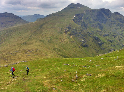
Over and down from Beinn Narnain to Beinn Ime. Looking
back at it, the trail up Beinn Ime just looks squidgy!
We could see the next mountain over, Beinn Ime, from the top of Beinn Narnain and decided that it didn't look too awfully far off. Besides, the walk down to the "bealach" (which I think is the name for the saddle between two peaks) and up to the top of Beinn Ime was smooth, looked fairly shallow, and quite grassy, so it couldn't have been that bad, right?
While getting down to the bealach from Beinn Narnain wasn't bad, the bealach and the majority of the slope up to Beinn Ime was totally waterlogged from rain we'd had the previous few days. It wasn't all that warm, and soon conditions became worse as our feet sank into soggy, squidgy, grass, and our socks became soaked with cold water. As Hazel put it, it was a long plod. We didn't talk much and instead just kept one foot in front of the other until the path hardened underfoot and became more clear up at the higher elevations. A walker coming down the mountain told us we weren't too far off, and sure enough, the trail quickly leveled off and we walked along the ridge to the cairn at the summit of Beinn Ime, the highest of the Arrochar Alps at 1,011 metres (3,317 ft). Being so high, it was really windy, but luckily previous hikers had created a sort of a fortress around the cairn that blocked some of the wind, so we sat there having our lunch with the best view around!
It was windy and chilly enough, and our feet were still wet, that we didn't stay for too long and started the long plod down the mountain. Fortunately, the trail back to the car looped down the valley between Beinn Narnain and The Cobbler, so we didn't have any more walking upslope. We stopped for some snacks at some large boulders at the foot of The Cobbler but didn't stay too long. The rain came in just as we were getting back to the car, so while we weren't too wet, it did get us in the end. Good thing we hadn't gone down the real steep slope we started on!
(there's more below the slideshow)
Ben Vorlich
06 June 2014
I decided to trade my Friday for my Saturday and since it was sunny on Friday, head off to the one last remaining Munro in the Arrochar Alps I'd yet to tackle - Ben Vorlich. I'd seen Ben Vorlich from my hikes up Ben Vane and the Beinns Narnain and Ime, and the reviews from Walk Highlands said to expect a steep and unrelenting climb to the summit ridge. The reviews were not joking! Luckily, I was hiking on my own yesterday, so I could take my own pace. Once I found the trailhead, as the reviews said, it just goes up. And up. And up. Though the trail is well-defined, it is not just steep, but wet, and mucky. So much so that one misstep could mean face-planting it into the hillslope which would not be good because there were a lot of rocks, too!
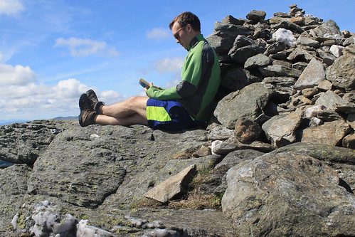
Ben Vorlich - a good place to have a read!
The walk up the slope gets you about 400 metres in elevation over the valley below, and even though the trail started to cut over along the side of the mountain, it sure didn't feel any less steep. The views started to get amazing though as the low clouds all around me started to clear. And near the top of the slope, massive rock outcrops and cliff-forming bedrock created an awesome geologic playground to be walking through! Even the mucky trail was shining with the weathered mica minerals that reflect sunlight so well.
Well, eventually the trail flattens out, kind of, but there is still a ways to go to get to the summit. And even when you get to the trig point, you're still not there because the actual summit is another short walk beyond! But once you're there, you know you're there - 943 metres (3,094 ft) is hard to miss! Not too many people were up at the summit, so it was nice and quiet. And though it was a bit windy, I was able to find a little crevice between some rocks, out of the wind where I could have my lunch and finish reading a book I've been trying to get through. It was so much nicer having time to enjoy the peace and quiet of the summit, rather than being rushed to get to the next one or forced off by inclement weather.
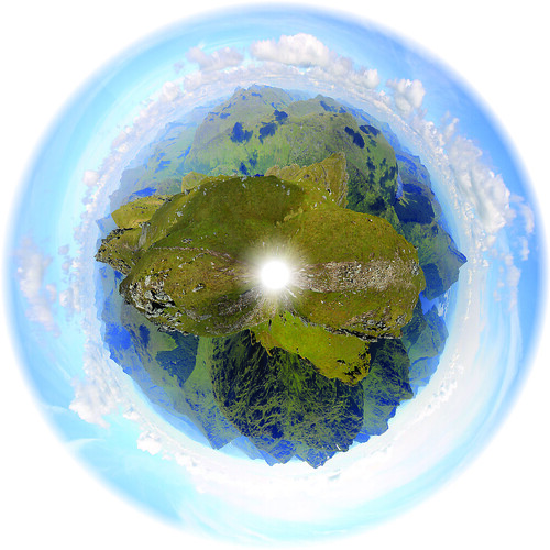
The panoramic planet I stitched together from the trig point
on Ben Vorlich
But soon enough, I felt it was time to start heading back down to the car park at Inveruglas where I'd been dropped off by the CityLink bus and was getting picked up from them, too. By the time I started walking down the weather was pretty much sunny and warm and I took my time with photography experiments and some of the best Loch Lomond scenery I've seen yet! The trail down the slippery slope I started on wasn't too bad going down, though I did slip a number of times, but before I knew it I was back down heading to the car park with plenty of time to spare. When I got there, the sun was warm on the rocks at the lake's edge, so I found a good comfortable spot, took off my boots and finished my book. Great day away, but tomorrow will have to be a work day. I just hope it actually rains so I don't feel guilty for taking a Friday off!
After a quick night in Hobart, my friend, Danielle, and I piled our things into her car and started our drive up the east coast of Tasmania. Our destination was Wineglass Bay in Freycinet National Park. When I first moved into my current apartment, my flatmate strongly suggested (no, he told me it was a must) that I go to Freycinet National Park because Wineglass Bay was so stunning it was just not to be missed!
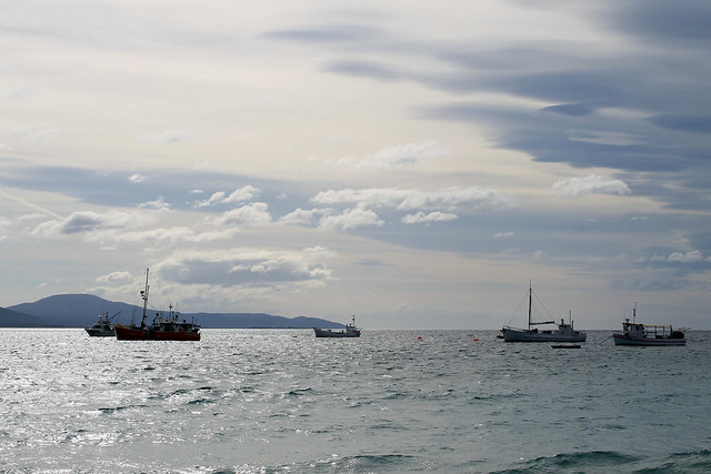
Fishing boats in Bicheno Harbour, Tasmania
Well, it took us a few hours to even get close, but we stopped a few times on the west side of Great Oyster Bay (west of the Freycinet Peninsula) for some photo ops and then drove past the Freycinet turn-off, continuing on up to the small seaside town of Bicheno. Not much ever seemed to be going on in Bicheno, but it sure looked like the perfect place for a vacation home. It still boasts a small fishing industry and some of the fishing boats were anchored offshore.
We stretched our legs along the waterfront for a few minutes and I was fascinated by the granite rock exposures along the beach - mostly because they had HUGE orthoclase feldspar mineral crystals - some as big as my finger! The tidal pools between the rocks were filled with little red sea anemones that twisted in the water as the waves came in and out. Bright orange lichens grew on the rocks, though we'd see more impressive lichens later on. We had a bit of fun posing in the dinghies pulled up on the harbour docks but soon headed back to the town and enjoyed a really good little lunch at a pizza cafe called, Pasini's.
Back in the car we drove south and headed down the access road to the small town of Coles Bay and the entry to Freycinet National Park. While many of Australia's national parks are essentially small tracts of land set aside solely for recreation without many stunning or staggering landscapes or ecosystems, Freycinet is different. Like the Blue Mountains, Royal, Uluru, Daintree, and Kakadu National Parks, Freycinet offers a spectacular mountain landscape with a few tall granite peaks with sparse vegetation growing up the slopes. As we turned the corner and the first view of Mt. Amos and Mayson loomed into view, my jaw hit the floor! I could already tell why my flatmate told me this was a park not to be missed!
Freycinet National Park seen from Coles Bay, Tasmania
We checked in to our hostel (the YHA in Coles Bay - which has impressively thin walls with two very loud groups of backpackers partying late through the night - avoid at all costs) and drove to the car park at the base of the trail to Wineglass Bay. It was late in the afternoon and we had limited time before the sun set, so we had to hurry a bit!
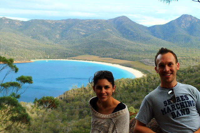
My friend Danielle and me at the Wineglass Bay Lookout in
Freycinet National Park, Tasmania
The trail is well-traveled up to the Wineglass Bay lookout and winds its way through large granite boulders and banksia and gum bush. We stopped at the lookout and had amazing views of Wineglass Bay which is an inlet coming in off of the Southern Ocean ending in an impressively wide beach and some of the bluest of blue waters I've ever seen!
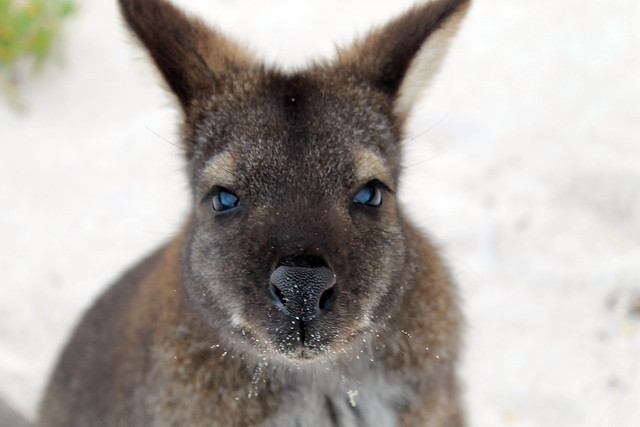
Not wanting to miss out on anything Danielle and I continued down the trail to the beach and were greeted by a solitary Bennett's wallaby who was saying hello to any of the beach's visitors, probably looking for food. He was definitely not skittish around people and while wallabies may be antisocial toward other wallabies, this little guy was certainly friendly toward me! I was able to get close enough that we had a little chat and I even took a selfie with my iPhone camera, much to Danielle's entertainment. Soon, the wallaby realised that my camera was not food and immediately became disinterested and hopped off to other hikers.
Portrait of a Bennett's Wallaby on the beach at Wineglass Bay in
Freycinet National Park, Tasmania
Danielle sat on the beach while I explored the coarse-sandy shores. A fishing boat was anchored not far offshore but was soon greeted by what we think was a police boat, likely wondering what a fishing boat was doing in protected National Park waters.
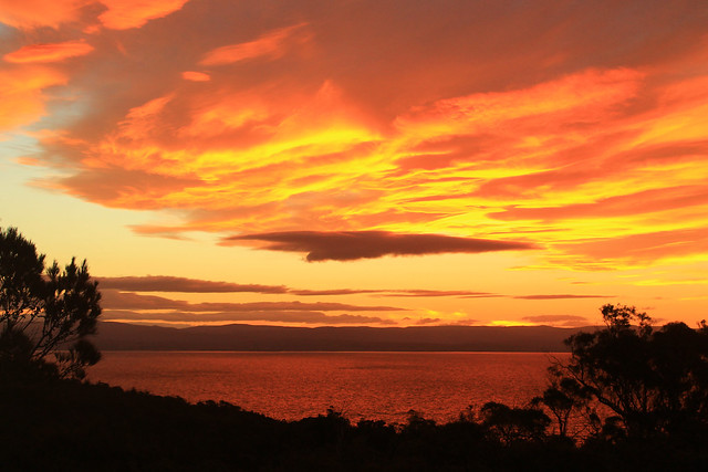
The rocks along the bay here were covered with the brilliantly-orange lichens we saw in Bicheno, and maybe it was the setting sun, but they seemed to be much more vivid in colour here! The sun was going down and we started back toward the car before it got too dark, and with perfect timing too, because as we neared the lookout the setting sun illuminated the clouds and rocks, almost setting them on fire! It was one of the most amazing sunsets I've ever seen, even by Australian standards! I can't tell if I've just become really good at taking photos of sunsets, or if Australia's sunsets are just always stunning, but it was just beautiful and I think my photos turned out quite nicely.
Sunset over Great Oyster Bay from Freycinet National Park (Yep, was really this red!)
Before heading back into Coles Bay we took a little drive up to Cape Tourville Lighthouse. It was now almost pitch black out and the moon was beginning to rise. The lighthouse is positioned on top of large bluffs overlooking the Southern Ocean and the winds started to pick up, making our walk around the lighthouse pretty chilly! I set up my camera a few times to try and get good nighttime photos of the lighthouse and coast, but without a tripod it was hard to keep the camera still while the shutter remained open long enough to get a decent exposure. The photos turned out pretty clear considering Danielle and I couldn't see each other even though we were only a few metres apart!
It was a perfect way to end a perfect day along Tasmania's east coast and we headed back into town for a dinner and drink at the pub before barely getting any sleep at the hostel. Yeah, while I recommend staying in Coles Bay, you're better off camping than trying to get any sleep at the hostel. But having such an amazing experience with the sunset and the wallaby easily made up for it!
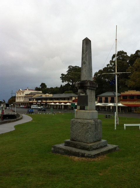
I woke up early in the morning at the YHA in Strahan, packed up my things, and loaded my bags into my rental car, and drove down to the Esplanade in the town centre for my first (and only) ANZAC Day Dawn Service. The Australia and New Zealand Army Corps (ANZAC) was the first organised armed services of both countries and were first deployed in World War I at the Battle of Gallipoli which was an effort by the Allies to capture Constantinople and thus monitor/block all sea trade to Russia (thanks, Wikipedia). What I did not have to look up, though, was that the battle was not successful for the Allied Forces and many Australians and New Zealanders lost their lives. ANZAC Day memorialises this Battle as well as all other military excursions that the two countries have been involved in since. It's essentially the Australian and New Zealand version of Memorial Day. Traditional services are held at dawn throughout Australia, and Strahan was no exception. I stopped in at the coffee shop among the 60 or so townspeople who were up early for the service. Soon, the townspeople formed a procession 3-across and walked over to an obelisk in ANZAC Park across the street (while I, and any other tourists, just wandered en masse). There was a nice little service with some prayers being read, a poem by a local high schooler, and some words from the town's mayor - all of which was constantly interrupted by a hoarde of geese, ducks, and seagulls in the park behind us, so it was kind of hard to hear. Then the mayor tried playing a recording of tradtional ANZAC music on a portable CD player, but couldn't get it to play. After about five minutes, the young high schooler who read the poem stepped up to help the elderly mayor. Thinking a young person would have the CD player going in no time, it surprised me when after another five minutes passed and the music hadn't started. It was then I realised how unique my age is: the mayor was maybe too old to be familiar with CD players and the high schooler was so used to iPods and mp3 players that she also didn't know how to work it! They eventually realised that if they put the CD player on solid ground, it would play just fine. The service soon ended and most everyone headed into the local hotel (pub) for breky and a coffee and rum mixture. I settled for coffee (plain) and a sandwich from the cafe next door.
It was a very bleak, grey, and drizzly morning, but I'd booked a ticket on the Gordon River Cruise (highly recommended by tour guides). Strahan is nestled in a little cove off of Macquarie Harbour, Australia's second largest harbour next to Melbourne's Port Phillip Bay, and fed by the Gordon River, which extends up into the vast wilderness of southwest Tasmania. I booked the trip for three reasons. Firstly, not having much time to hike into many of the wilderness areas of Tasmania, I thought this would be a fantastic way to "get into" the wild (yes, even if it is aboard a luxury catamaran). Secondly, it also stopped at the famous Sarah Island - one of Tasmania's most feared convict colonies out on a tiny island in the middle of the harbour - and I wasn't sure if I'd get to learn anything about Tasmania's harsh convict history during the rest of my trip. Thirdly, it included lunch!
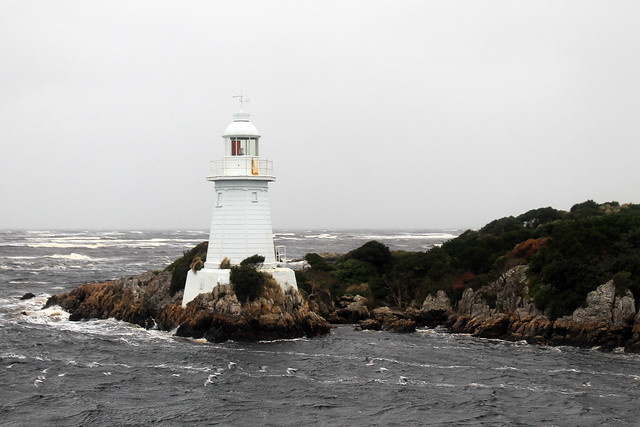
The cruise left the docks in Strahan and immediately headed out toward the entrance to the harbour where we passed a few different lighthouses while passing through Hell's Gate. The convicts called the entrance to Macquarie Harbour Hell's Gate because of its isolation and hardships they knew they'd endure on Sarah Island as well as the fact that even though the surrounding area is beautiful, attempted escape almost certainly would lead to death either by British soldiers or the treacherous nature of the environment. Hell's Gate is only a few tens of metres wide and is very shallow, so not too many large vessels can enter the harbour. Also because of the shallow and narrow entrance, it takes ebb tides more time to push their way into the harbour. In fact, the upper few metres of the harbour's water is freshwater supplied from the surrounding rivers and stained brown with tannin because the narrow entrance to the harbour makes it more difficult for the tides to flush out the harbour!
Lighthouse at Hell's Gate, the entrance to Macquarie Harbour, Tasmania
This has an added benefit to the local fishermen. Salmon and trout were introduced to Australia from Great Britain and because they require a certain balance of fresh and salt water, Macquarie Harbour is the perfect place for fish farms, of which there are many.
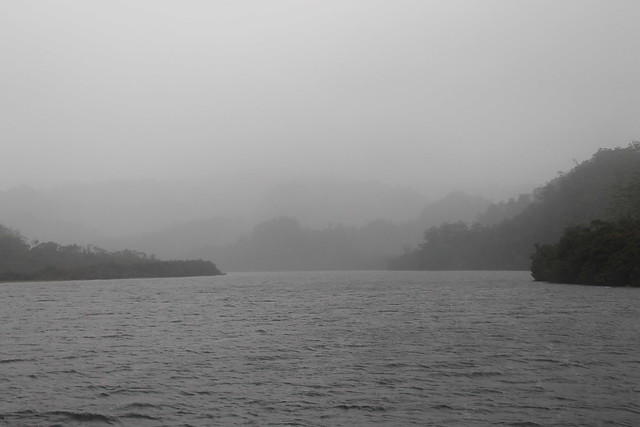
The boat turned around outside Hell's Gates, not wanting to get battered by the huge ocean waves, wind, and rain and went back into the harbour toward the opposite end where the Gordon River flows into it. As soon as we neared the entrance to the river, the water became much calmer and though it was still rainy and gray the trip became a bit more relaxed. We traveled up the river a few kilometres and learned about the native Huon Pines which grow in the area. Convicts at Sarah Island predominantly built ships out of the Huon Pine because the pine's pitch contained an oil which prevented worms from boring into the wood. Logging of the Huon Pines was so intense that all operations have since been halted and the species protected. Now, only National Park officials can remove Huon pine wood from the forests, and even then, it can only be wood from fallen trees. No Huon pines can be cut down.
Mouth of the Gordon River, flowing into Macquarie Harbour, Tasmania
We got off the boat and had a little walk on a boardwalk through the rainforest, which was very very rainy and allowed us to get up close with the Huon pines and a number of little mud chimneys built by crabs excavating down into it. Back on the boat, though, a buffet lunch was served with some of the freshest salmon you could hope for and local Tassie apples. Delicious!
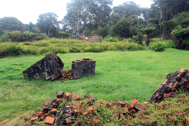
The rain had stopped momentarily as we approached Sarah Island, home to one of the worst convict settlements in Tasmania, reserved only for those who repeated offense after arriving to Australia. The island is fraught with stories of cruelty, backstabbing, coercion, treachery, and violence I cannot even begin to recount the tales we heard. But the end of Sarah Island came with the installation of a commandant who had previously been a ship builder with no experience of managing convicts. But as soon as he started his post at the island, the violence decreased, the escape attempts stopped, and productivity increased immensely. It turns out that when you give convicts special things they want like alcohol and dignified sleeping quarters, you could get in return a very productive work force. But after news of fair treatment toward the convicts at Sarah Island reached the higher-ups in the British military, the settlement was shut down.
Convict settlement ruins on Sarah Island in Macquarie Harbour, Tasmania
Having spent enough time outside on the boat, I stayed inside the rest of the way back to the wharf. Arriving shortly after 2pm in Strahan, I rushed to get to my car because I knew I had very limited hours of daylight remaining and a very long way to go to get back to Hobart for the night! But as luck would have it, the rain started back up as soon as I got back in my car. Not just a drizzle, but one of the most blinding, white-out deluges I've ever driven through. I put my trust in the little car and its tires and just started heading down the road trying not to slow down through the very rough driving conditions where rain was flowing down the road and around corners. My wipers, though on at the highest setting, couldn't keep up with the rain. I bought petrol in Queenstown and then started my ascent into the mountains.
The change from the day before in the mining area, where all the hills had been stripped of vegetation and soil was unbelievable. Every single crevasse or nook between hills was GUSHING with unbelievably voluminous waterfalls! With nowhere for the rain to seep into, it just collected and rushed downhill!! The rain continued as I got up into the mountains, and though I was making good time, I was surely driving a little too dangerously for the conditions. But finally, a few hours later, as I came closer to Lake St. Clair, the rain let up as the weather was held back on the western side of Tasmania by the highly elevated mountains. While still wet, the rest of the drive was fairly smooth and pleasant and I made it back to the Hobart airport to drop of my rental car only about an hour after the sun went down.
Back in early April, while everyone in Australia was taking their Easter Friday and Monday off of work, I was grading assignments and in my lab working, being the diligent PhD student I am! But I needed a getaway, and part of my excuse for working over Easter was that I'd previously purchased a round-trip flight down to Tasmania for five days in late April.
I needed a break. After four solid months of slogging through lab work, research, writing, reading, and teaching, I needed to step off the Sydney merry-go-round or go insane. Having moved to Glasgow in winter of 2012, then to Sydney in August, I pretty much had a year of winter immediately followed by the Australian summer with no change of seasons to speak of and definitely no Fall, which is my favourite. Sure I got a little taste of Michigan Football last September-November, but no pumpkin spiced lattes, no leaves changing colour, nothing. But the nice thing about Tasmania is that it is as far south from the Equator as Michigan and Vermont are north of it, and April in Tassie would be the same as October in the northern hemisphere. In other words, it was Fall!
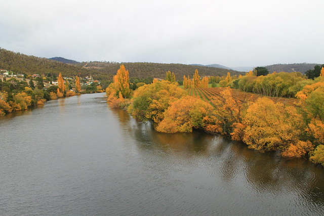
Fall colours along the River Derwent in New Norfolk
I arrived in Hobart, Tasmania's capital, at 8am, picked up my rental car - a wee Suzuki Swift which I really ended up liking! - and started off down the Lyell Highway. My goal was to get to the small town of Strahan on the western coast of Tasmania, but I also wanted to see as much as possible. My initial plan was to drive north toward Launceston and then west to Cradle Mountain before arriving late in Strahan, but took the advice of locals on the r/tasmania subreddit who thought I might be better off taking the shorter route and actually experience it. They were right.
My first stop wasn't planned until Lake St. Clair in the Tasmanian central highlands, but after picking up coffee in New Norfolk - a town originally set up as a new homebase for Australian convicts stationed out at the soon to be abandoned Norfolk Island camp in the Tasman Sea - I crossed the River Derwent and had to stop because the trees along the riverbanks were on fire with autumnal colours! It was beautiful! From what I'd heard about Tasmania and the Tasmanian culture of environmental awareness and power of purchasing locally, I imagined it to be much like Vermont in the US. The similarities, I would find out, were uncanny, and the trees along the river were just the beginning. I do have to say, though, that this is the only time I've been happy seeing invasive species; you see, no native Australian trees change colour with the seasons, only the imported species from Europe and North America!
Continuing along through pastoral farming/grazing communities, the Lyell Hwy suddenly started its ascent into mountains and the roads became narrow, steep, and windy (and windy)! I passed some of Tasmania's many hydroelectric facilities in Terraleah and the road then spit me out onto the highland plateaus just east of the central Highlands.
Tasmania's central highlands and the entire southwest quadrant of the island are all preserved as National Parks, most of which make up the Tasmanian Wilderness World Heritage Area, and while you can access many places in those parks, the majority of it is left as a natural wilderness for your experienced outdoor exploration! The famed Overland Track is one of the World's best wilderness walks right through Cradle Mountain-Lake St. Clair National Park,and something I hope to do before leaving Australia.
My first planned stop, though, was at an artistic site just east of Lake St. Clair called The Wall in the Wilderness. I'd heard about this artist who is carving out scenes from Tasmania's varied industrial, cultural, and environmental histories in huge panels of wood. In my mind I imagined it to be like a huge detailed collage of various moments that I could learn a lot from. Surely I wouldn't be disappointed. But when I walked up to the door there was a big sign saying something along the lines of:
No cameras allowed! Personal photographs do not capture the essence of my artistic vision when taken in the wrong light. When I have people throwing punches at me for not allowing them to take photos it gives me the right ban all cameras. My art is self-funded and I will decide what I will and will not allow.
Well, that kind of made me stop in my tracks and think, "Wow, what an ass." But not knowing what this guy has gone through, I returned my camera to my car. I thought the $10 admission fee was a bit steep, especially with no student discounts, but I gave them the benefit of the doubt. The building was cold and dimly-lit and in the central hall was the Wall. It was impressive to look at. Dozens of wooden panels of Huon Pine were hanging from a central wall, the majority of which had images of Tassie history hand-carved into the wood: hydro power, convict history, the extinct Tasmanian tiger, and natural scenery - and those that weren't yet carved had the pencil marks on them showing what they would eventually be. It was neat, and the artist is obviously a talented wood-carver, but was it comparable to Michelangelo's painting of the Sistene Chapel (as the Wall's website claims)? No, not in the least bit! Maybe it was the sour taste left in my mouth from not being able to take my camera in, or the tone with which that message was conveyed, but I thought the wall was impressive in size only. There were no information placards describing what I was looking at, but I could buy a book for another $20 to learn about each panel. Essentially, I thought this piece of art was a waste of time and money and I do not encourage anyone to visit. You'll just be nickel-and-dimed out of $10 and with nothing given in return. It's not educational and not all that spectacular when all is said and done. And even though I paid to see the Wall - thus paying for the future work on the wall - I didn't even get to take a photo of it. Crap. Don't go.
Sitting on the ferry pier at Lake St. Clair
It was still cloudy out from morning rain showers, but I drove on to the entrance of Cradle Mountain-Lake St. Clair National Park at the southern end of Lake St. Clair, which fills a glacially carved basin and is Australia's deepest lake. I went to buy a pass from the Visitor Centre, hoping I could use it at all National Parks in Tasmania I'd go to over the next few days, but it turns out that the passes can't be transferred between cars and if you go to Cradle Mountain, you have to pay a separate, exorbitant, entrance fee - so I settled on the day-pass and went to inquire about the Lake's ferry service. Being on the south side of the park, This is the ending point for anyone doing the Overland Track and a ferry service operates between both ends of the lake taking OT walkers and day-hikers to various piers. Not having enough time to do a four-hour walk, I was just hoping to get into the wilderness via the ferry, but after inquiring about it, I found out I was 10 minutes late and that no more ferries were scheduled for the day (damn Wall in the Wilderness!). So I walked down to the lake's edge for a bit taking in the staggering mountain scenery that was constantly peeking in and out of low-hanging grey clouds. Even on a bleak afternoon it was beautiful.
Back in the car the clouds started clearing, changing to big puffy white clouds, and the sun came out! Not much further down the Lyell Hwy I started seeing huge mountain after huge mountain loom into view from road as it twisted between them and the geologist inside me took over and every time I saw something new I'd let out an, "Oh my Gaaaawwwwddd!!!!! Woooowwwwww!!!!" The National Parks of Tasmania really earn their status as being stunning and beautiful! With stops at the Great Divide and Happy Valley overlook, I parked down at the Franklin River Nature Walk.
The Franklin River rose to international recognition in the 1980s when environmentalists started protesting plans to dam the Franklin River downstream from here. It is one of Tasmania's last wilderness rivers and the environmentalists were fighting to keep it that way. The hydro company eventually lost the battle and a new era of environmentally-conscious Australians rose to national political prominence. Furthermore, a new importance was placed on wild areas of Tasmania with an effort to keep them wild and untouched as much as possible. The walk was short but goes right along the banks of the Franklin and Surprise Rivers and weaves between massive pine and gum trees - some of which are the tallest species of trees in the world!
I'm not sure what the Highway is like during peak holiday season, but the Lyell was essentially empty for my entire drive. The afternoon was getting on and I'd decided that I needed to get to Strahan before sunset so I could watch the sun go down over the Southern Ocean - which you can't really do from too many places in the world! In my rush, I almost missed one of the best views of Tasmania: Donaghy Wilderness Overlook. I actually drove past the parking lot, but turned around. Two backpackers from the UK were just finishing and when I asked if the 30-minute walk was worth it, they said, "We've been traveling around Australia for two months and this is by far the best overlook we've seen!" I was sold, parked my car, and started walking.
I was not disappointed. If you take it quickly, it only takes about 20 minutes and the walk takes you to a little knob from which you get a 360-degree view of the surrounding mountains, valleys, rivers, and the ever-impressive Frenchmans Cap - a unmistakably unique mountain crag off in the distance which can be seen from miles and miles around! There was no one else out on the overlook and I had the place to myself under warm blue skies and a sun just beginning to dip below the mountains to the west. I grabbed a bunch of photos and sped back to my car. I only had about 2 hours left before sundown and it was more than 2 hours to get to Strahan.
Sunset in western Tasmania taken from the shores of Lake Burbury
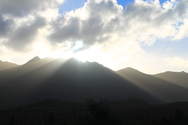
I sped down the road, probably faster than I should have been going, trying to make it to Ocean Beach in Strahan before the sun hit the horizon, but I kept coming across beautiful scenery! I next had to take a quick minute at Lake Burbury because the sun's rays were shining from behind the tips of the nearby mountain peaks, casting glorious rays over the land, and I am certain I got some of the best sunset photos I will ever take in my life! And then the drive into Queenstown - famous for its regional mining operations which have all but stripped the hillsides of any and all vegetation and sediment cover. The road coming down out of the mountains to Queenstown was also beautiful, but in an industrial and destructive way. At least Mt. Owen seemed to still be forested and one massive waterfall was cascading down the hillsides.
I got to Strahan with about 15 minutes to spare, drove around the town and out to Ocean Beach where I missed the sun actually setting, though the sky was still beautifully lit up with pinks, oranges, reds, and the blues of the night. I stepped out and down to the beach where I took my shoes and socks off, rolled up my jeans and walked down to the water's edge, finally allowing myself to breathe and take in the dusky views up and down the beach - Tasmania's longest. I picked up a few pebbles as keepsakes as the ocean waters washed over my feet because after all, it's not all that often you can say you've stuck your toes in the Southern Ocean. Tasmania and the southern tips of South Africa, Argentina, Chile, and New Zealand are really the only places you can do this (and Antarctica, too), and it's quite a surreal experience when you consider its vastness.
Happy with everything I was able to accomplish along the Lyell Highway, I drove back to Strahan in the dark, found my hostel - the Strahan Backpackers YHA - and got great advice from the owner for delicious fish 'n' chips, Schwoch's, in the town's centre. A delicious ending to a busy, productive, and beautiful day!
Back in January a group of friends and I took a day-trip south of Sydney to Wollongong, Morton National Park, and Kiama. I think we all just needed a day to get out of the city and wanted to see some cool sites along the way. Well, it was successful, I'd say. We left early in the day and drove the hour it took to get to Wollongong where we stopped along the coast to check out the lighthouse and the sea rocks before grabbing an early lunch at Le Vendi along the harbour which boasts Wollongong's best fish 'n' chips, which were good, but I'm beginning to think that a chippy is going to have to really step it up in order to get that title in my books. The rock platforms beneath the lighthouse were pretty impressive! Deep salt weathering pits, widened by wave action, were filled with water and all sorts of seaweeds, crabs, and little fish. Some were big enough to fit a few people into, like a wee jacuzzi! The waves were big too, and I soon learned I should have brought an extra pair of socks... Wollongong is a University town but also has quite a lot of industrial activity along the coast. Not sure if it's a place I'd prefer to live.
The double-cascades of Belmore Falls. Only a
trickle now, it's easy to imagine them in full force!
After lunch, we drove the Illawarra Highway west through Macquarie Pass National Park - which is one of the coolest windiest roads I've ever been on, rivaling those I took through Mangamuka Gorge on New Zealand's North Island - to the small town of Robertson for a photo-op with the Big Potato, and finally to our first waterfall destination: Belmore Falls. Belmore falls, and all the other nearby waterfalls, cascades from the highlands to the deep valleys below over spectacular sandstone cliffs of the Hawkesbury Sandstone. We stopped at a view point looking down to the Kangaroo River Valley before heading over to the waterfall where we hopped a few large pools of water to get as close as we could to the waterfall's edge, which was only possible because the waterfall was nothing more than a little trickle at this time of the year. As anyone would, we tried our luck throwing some small boulders into the pool at the base of the waterfall to see how big of a splash or sound we could get. Lucky for us, the splash was big, but the sound - a big CRACKING noise - was loud and echoed off the walls. Awesome!
Continuing on we stopped at Fitzroy Falls for a little nature walk and waterfall viewing and also at Carrington Falls in Budderoo National Park. Carrington Falls spilled down into a tall, vertical chute and my friend Paul and I thought it would be a hoot to throw a few rocks down into the chute, which was difficult because the closest viewing platform was still so far away that we only managed to get little rocks into the falls, but they still made a satisfying sound!
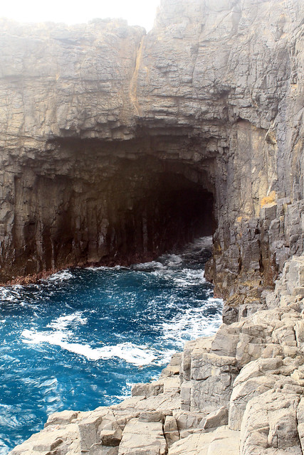
The bright blue ocean swells entering
Kiama's famous Blowhole
Back in the cars, we drove to Kiama and it's famous Blowhole! A blowhole starts out its life as a sea-cave, eroded into the rocks by wave action. Eventually, this cave tunnels its way into the rocks and the roof of the cave collapses so that now, when large ocean waves and swells are forced into the sea-tunnel, they speed up and slam into the back of the cave, erupting the water upwards. The Blowhole was really active when we were there and the water erupted a good 10 metres up into the air! We ventured down to the edge of the sea cliffs, and then I alone crept my way down to the rock platform near the mouth of the blowhole where I watched the huge ocean swells flow in and out of the Blowhole entrance. It was hypnotic and the bright turquoise blue water was just mesmerising! As the sun set, we headed up the street to a pork-roast dinner at the RSL (a kind of club for members of Australia's armed services and their families).
It was just a day trip, but we sure covered a lot of ground and I always think it's nice to get off the merry-go-round that can be city life!
The Great Ocean Road starts in Torquay, about an hour and a half south from Melbourne. Knowing that from this point on, there would be only a few towns with grocery stores, Caitlyn and I stocked up on food for the road. I'd driven to Torquay but Caitlyn hadn't driven in the two years she'd been in Australia, so I let her take the wheel from here on out, which was fine, because being a geologist I like to look at the rocks and coastlines and landscapes which is kind of a hazard while behind the wheel!
It didn't take long for us to get out of Torquay and through the small coastal town of Anglesea before we got a taste of what the next 200 kilometres would be like as the road stretched right along the tops of staggering cliffs, windswept beaches, and some of the most colourful water I've ever seen. Not only was it bluer than blue, but parts were emerald, turquoise, green, and gray and since the coast borders the Southern Ocean, where some of the world's largest waves are created, portions of the coastline were bleached white with seafoam and breaking waves.
Down the road from Anglesea is the town of Airey's Inlet with a magnificently white and red lighthouse you could see from a good distance away. It was late morning and we decided it would be a good place to stop for lunch. This part of the coast was inundated with lava and ash 29 million years ago from a volcano whose caldera was right at this point. Global sea-level rose around 24 million years ago and the basaltic rocks got covered with thick layers of sandy limestones. Now, at the base of the cliffs here the basalt rocks are more eroded from wave action than the limestone above it which forms the rocky cliffs and headlands along the Great Ocean Road.
We spent the next hour driving along these cliffs and beaches, but also into the backs of coves where small rivers flowed into the ocean and up the hills skirting the dense coastal forests. In the little town of Lorne - which seemed to be a sort of more posh holiday town - we turned inland up Erskine Falls Road, not necessarily to see the falls, but because of the wildlife. See, I did a little bit of research before hitting the road because one of the things I wanted to check of my list was seeing koalas out in the wild, and lucky for us, some of the best koala-spotting territory is in the coastal forests of the Great Ocean Road. One of the tips was to drive up Erskine Falls Road and we were sure to see the little furry critters in the trees. Well, we didn't see any koalas, nor did we really get a good feel for Erskine Falls because the path down to the falls was under construction... At least it was a pretty little detour.
Back on the road, we passed through the town of Wye River (another spot the guidebooks said we'd be sure to see koalas) and shortly thereafter, we did stop in Kennett River to find some toilets, which were in an RV/camping holiday park across the road from the ocean. I stopped in to the park's office to see if they could give us some tips on where and how to spot wild koalas. We were in luck! Just that morning the office clerk had seen a few in a tree in one of their camping lots and we were free to have a look around. So after emptying our bladders, we strolled through the caravan park with cameras in hand. We knew what koalas looked like from photos, but had no real idea what to be looking for or in what type of eucalyptus tree they'd be in. But then, just as plain as day, we looked up into a tree and saw three or four koalas lounging around in the higher branches of the tree!
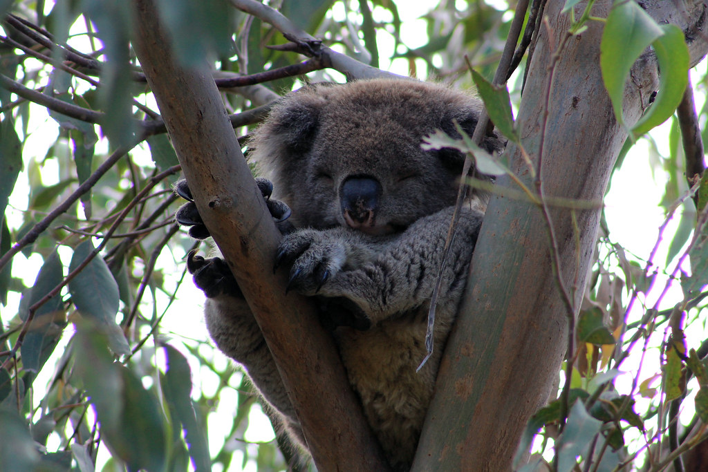
Koala snoozing in Kennett River
It was awesome! These little gray puffs of fur just lazily walk from one branch to the other, stretching their arms out to reach for a clump of leaves and then pull it toward them with surprising dexterity! And then they eat or sleep, or both at the same time it seemed! Koalas are pretty simple animals, but they were fascinating to watch and with our cameras, we circled the tree looking for the best angle to take a photo. It was odd because we'd been looking for these guys for a while not knowing what to look for, but once we found them it was if we couldn't stop finding them! On our way back to the car we saw some other road-trippers by a tree where another koala was perched right in the crook of some branches just out of arm's reach and this time there were no twigs blocking it from view and he just sat there looking from side to side, just begging to have his photo taken! I've never really had such an incredible wildlife experience before with such a rare animal that even many Australians have not seen in the wild. But it would only get better from here.
Back in the car, we drove a little ways up the Grey River Road right from Kennett River and stopped just a few hundred metres up the road because again there was a koala just chilling out on a eucalyptus branch right at eye-height, and this guy was hungry! Without really paying much attention to us, he kept eating and eating in perfect photographic poise! Caitlyn and I had him to ourselves for a good few minutes before a crowd of people walked up from down the road. Satisfied with our amazing encounter, we hopped back in the car and drove on.
The afternoon was drawing on and shortly we arrived in the small town of Apollo Bay where we stayed at the spacious, clean, and quiet Apollo Bay Eco YHA. YHAs are oftentimes notorious for having run-down accommodation for cheap (I'm looking at you YHA Auckland City Road...), but this was completely different. Everything about it was designed to be sustainable - from the no flush toilets (they flush if you really need them to), to big plate-glass windows that let in heaps of natural light, to the herb garden. And for $50/night for a room with two beds, it was perfect! We checked in but then got back in the car because we wanted to go check out the Cape Otway Light Station at the Australian mainland's second southern-most point.
The road to the lighthouse is a 20 minute turnoff from the Great Ocean Road and winds through Great Otway National Park without any other cars on the road. It was along this road that we came upon not just one or three koalas in a little tree, but an entire colony of koalas. It would be impossible to miss seeing them as there were dozens of them hanging out in a handful of trees with wide branches stretching across the road and back into the forests behind them. We stopped the car and stepped out taking quality photo after quality photo. And these ones weren't just eating (some were) but others were actively calling to each other in these terrible-sounding grunts, groans, and screams. It was soo bizarre! I tried catching some of it on film, but it didn't turn out great. Caitlyn and I sat there looking into the trees, bewildered, and amazed at what we were seeing! You couldn't ever see anything like this in a zoo, and the best part was it was totally free and we had these dozens of koalas totally to ourselves!
If it weren't for seeing these koalas here, our little afternoon detour would have been a bust because the lighthouse was closed for the day, anyway, so back to Apollo Bay it was. Caitlyn took a quick shower and I walked down to the harbour to take some photos at sunset and we met at a little Chinese restaurant where I was introduced to handcrafted beers from the local Prickly Moses microbrewery. The beer was delicious (I had the Summer Ale, Otway Ale, Red Ale, and Otway Stout throughout the course of the night) and I particularly liked, Moses, the echidna on the logo.
The next day was a big day. We had some impressive sights to see and yet we had to be back at the Melbourne Airport by 7pm to catch our flight home. That morning, we couldn't resist trying to blueberry pancakes at the Bay Leaf Cafe right on the main road in Apollo Bay, and we were not disappointed with the homemade stack of pancakes, bacon, and maple syrup. It was a brekkie to die for and I think I can say it was my only culinary winning-pick of our trip since Caitlyn was the one who found all of our delicious meals in Melbourne!
We got back on the road, stopping only a few times to check out a lookout over secluded beaches, but we had a new destination in mind that we wanted to be sure to save enough time for: The Twelve Apostles!
Possibly the crowning glory of the Great Ocean Road, The Twelve Apostles are a series of seastacks, or pillars of rock separated by the rest of the rocky coastline by erosion and wave action eating away at their bases. And the stretch of coast between Princetown and Port Campbell, is home to Port Campbell National Park and one of the most recognizable natural features of Australia. We parked the car at the Gippsland Steps and followed the path down to the beach where, save for a handful of other tourists taking photos, was relatively empty. Empty and beautiful! It was a sunny day with a bright blue sky and we meandered down the shoreline gawking up at the massive seastack in front of us! And surprise! It wasn't until we actually got closer to the seastack that we realised it was blocking another enormous pillar of rock behind it! As beautiful as this site was, we were in luck because these weren't even part of The Twelve Apostles!
Just down the road from the Gippsland Steps is the Twelve Apostles Visitor Center (which is nothing more than toilets and a cafe) but we walked along the path, under the road, out to lookout points right at the edge of the tops of the cliffs. It was from this point, looking north up the coast, that the classic photographs of the mammoth blocks of stone are taken. Originally, the area was known as the sow and piglets, but it was soon renamed The Twelve Apostles because locals figured that would entice more tourists - and they were right. But don't be fooled by the name: there are more (or less) than 12 seastacks depending on who you talk to or what you consider to be the difference between a seastack and an eroded pile of rock. Nevertheless, this is an awe-inspiring vista that is worth spending some time at! I was hoping we could find a way down to the beach, but there did not appear to be any paths or trails, so after an hour or so, we hopped in the car and continued on to Loch Ard Gorge.
The Loch Ard Gorge gets its name from one of the most storied shipwrecks along this reach of the coast - arguably one of the most dangerous waterways in the world. The Loch Ard was carrying 54 people on board at the end of a three-month voyage to Melbourne from England. On 31 May 1878 mists shrouded the coastline here and once they lifted the Loch Ard found itself in a precarious situation right next to the massive cliffs and while Captain Gibb tried steering the ship away from the cliffs, strong winds and currents carried the ship into a reef and oncoming waves slammed up against the sides of the ship and swells eventually caused the ship to sink. Only two of the 54 people on board survived, an Irish immigrant and the ship's apprentice, both of whom were carried into Loch Ard Gorge (a protected inlet from the treacherous coast). It was hard to imagine such trauma happening in such a beautiful place, but easy to see how an unforgiving ocean, strong winds, and rocky coastline create the perfect recipe for disaster! Caitlyn and I walked along the cliff tops and down into Loch Ard Gorge for a quick gander at the beach but were soon on our way.
The rest of the day involved driving the short distance to Port Campbell where we had a very average fish 'n' chips lunch and beer before heading inland toward Melbourne Airport to catch our flight back to Sydney that evening.
I am always amazed at how much you can pack into such a short vacation if you're willing to put the energy into doing it! I mean, over the course of four days we saw a historic jail, ate at tons of amazing restaurants, visited museums, drove 200 kilometres over some of the most rugged and beautiful coastal scenery in Australia, and saw wild koalas up-close. Four days! It's why I love traveling. There is so much to see in the world with so little time to see it all, but you sure can come close!
Sometimes it's nice just to get out of town for a few hours and have a change of scenery. That's exactly what I did this Saturday. My friends Quazi and Grant and I drove up, an hour north of Sydney to the little town of Woy Woy, on the other side of the bay from Killcare and Terrigal, which I visited a few weeks earlier. There isn't much to do there except have a coffee and move on, which is exactly what we did. A little bit to the south, you enter part of the Brisbane Water National Park - which is oddly enough about 700 kilometres from Brisbane. Brisbane Water NP ends where the Hawkesbury River flows into the ocean and there is a great scenic overlook at Warrah Lookout. We had to walk about 200 metres from the car to the overlook through a scabby forest with thin eucalypts and squiggly gums - which are gum trees that beetles have burrowed underneath the bark, forming these squiggly patterns.
The lookout is great! It's about 200 feet up from the water and you can get good vantage points from the fenced-in viewing area as well as non-fenced bedrock platforms. It was a bit of a gray day, and threatening rain the whole time, but you could still see up the Hawkesbury and out to Palm Beach and Barrenjoey Head on the other side of the river.
After the lookout, we drove down into the tiny town of Pearl Beach, which as a geologist, I loved because of all the different street names: Beryl Boulevard, Garnet Road, Onyx Road, Jade Place, Agate Avenue, Coral Crescent, Diamond Road, Emerald Avenue, Amethyst Avenue, Pearl Parade, Opal Court, Tourmaline Avenue, Crystal Avenue, Gem Road, Cornelian Road, and Silex Lane. Now most of these I understood because they are all names of minerals, gems, or rocks. But the last two, Cornelian and Silex, I had to look up. It turns out that cornelian is a reddish mineral in the chalcedony family which is a type of microcrystalline quartz - akin to jasper or flint. And Silex is any type of finely-ground stones with very high (or pure) silica contents. So they, too fit in with the rock/mineral/gem theme Pearl Beach has going on!
At the beach we walked out to the rocky headland of the Paul Landa Reserve and watched the tide come in a bit but then the waves started to crash a little too much, so we decided to head back before we got stranded. The sandstone bedrock out here was pretty cool too because it was chock-full of little weathering pits that created a honeycomb texture in the rocks. And between the rocks, near the water's surface, little rock crabs darted in and out of tiny fissures.
With a little lunch from the Pearl Beach Cafe in our bellies, we headed back to Sydney, refreshed!
A week after my hike through Royal National Park, I headed west with two friends from Uni, Louise and Ben, to the Blue Mountains National Park. A few days beforehand we were talking over lunch and decided to do a one-night camp out in the mountains - which I had been to before, but either just driving through or staying at a hostel in Katoomba. But I love camping and really hadn't ever gone backcountry camping - especially since I am terrible at starting fires or doing any sort of reasonable cooking over them - so I typically just camp out of my car...
We drove up into the mountains on a Saturday, stopped in Katoomba to pick up some last minute groceries, and then parked our car near the Golden Stairs and started hiking. The thing about the Blue Mountains is that to do any bushwalking through them, you have to descend from the rim of the valleys along very steep paths, often involving steps hewn into the strong sandstone or very steep metal steps. Going down wasn't too rough, really - at least for Ben and myself. Louise's knees started acting up, though, which plagued her the rest of the trip.
Once down in the bottom of the valley, the walk is long, but fairly flat. The path took us through gumtree forests with an undergrowth choked with ferns that blocked the sunlight giving us a fairly nice cool walk. There's the saying, though, that what goes up must eventually come down, and well, the converse is true: what goes down must eventually come up. Clearly, a place called Mount Solitary is not going to be at the bottom of a valley and soon, our flat, valley-bottom walk ended and we began to climb back up through a gumtree forest with a more open undergrowth and flowering waratah - the state emblem for New South Wales. Ben said he'd seen koalas here before, and you could definitely see evidence that they live here (aka poop on the trail), so for the next hour or so, I was straining my neck up into the trees to see if I could catch a glimpse of my first koala. We had no such luck, and with a strained neck, we reached our lunch spot at the bottom of the trail ascending Mount Solitary.
After lunch, our arduous climb up a fairly steep ridge, over boulders, between rocks, and alongside sheer drop-offs began. Louise's knees were not helping her out much, but we didn't really have a choice to turn back at this point. I grabbed her pack to ease her carrying load and slowly but surely, we reached the top, stopping at a few flat lookout points along the way. But the trek to the campsite wasn't over yet. We were at the top of Mount Solitary (a plateau, really) but the campsite was on the other end of it and a little ways down the other side! But at least the hiking here was flat.
Soon enough, though, and with only another hour or two of daylight, we reached the campsite and chose our spot underneath an overhanging rock ledge nestled down in a little valley. Even though it was kind of gray and threatening all evening, a lot of hikers run into trouble here because they don't bring enough water and expect to find some they can purify once they reach the campsite. Ben had hiked this area extensively and showed me a creek bed, that even during dry spells, usually has some water left in it, but this time around it was bone dry. Good thing we had plenty of our own water with us!
We dropped our belongings off at the campsite and walked a few hundred metres to a rocky lookout facing south toward Lake Burragorang. Like all areas in the Blue Mountains we were flanked by high and steep sandstone cliffs jutting up out of the eucalypt forest below. The sun was setting and you could really get a sense of why this area is called the Blue Mountains - oils in the eucalyptus leaves gives off a haze that appears blue in the right light. We sat there for a while, taking photos, watching birds fly around the trees and branches growing out of the cliff walls below us. Eventually we headed back to the campsite where Ben and Louise started a fire, but then Ben and I (Louise's knees wouldn't let her) walked to the opposite side of the plateau and looked north toward Katoomba and the Three Sisters - a very famous and sacred Aboriginal rock formation on the opposite side of the Jamison Valley. We found a few more rocks to climb for an even higher view of the cliffs and valleys shrouded in mist, but soon headed back to camp before it got too dark.
The next morning we woke up fairly early and I took the chance to catch the sun rise over the mountains. I was hoping the valleys would be filled with morning mist like the year before, but I was out of luck this morning. Nonetheless, there were some pretty spectacular views here. Back at camp, we packed things up, but took Louise over to the rock ledge facing the Three Sisters Ben and I were at the night before, and after a few more photo ops, went back to our bags and started the trek back out.
Once again, getting down the bouldery slopes off of Mount Solitary proved to be slow-going, but we safely made it down, all accounted for into the open eucalyptus forest. Louise insisted Ben and I go ahead of her since we also wanted to climb the shorter Ruined Castle - a big rock outcrop rising off the valley floor. The climb up to the Ruined Castle was rough. It was a lot steeper than it looked, but we eventually made it to the rocks at the top and followed a group of 20 senior citizens (at least in their mid-60s for sure!) up the side of the outcrop to the top where we all took turns climbing up to the highest point. Now, I don't know what is it, but I am terrified of heights like this. It's not that I'm unsure of my footing or looking down, but I am just afraid that I'll do something stupid and loose my balance and fall off the rocks. Getting up to the top of the outcrop was fine, but it was getting from my knees onto my feet that really did me in. But after seeing these old fogies climbing up there like it was nothing, I was determined to do it - no matter how ridiculous I looked in my photos! Well, I did it, and I did look ridiculous, but what can I do about that now?
Ben and I finished up at the Ruined Castle and we made it back to the valley floor just as Louise strolled up to us - good timing, eh! We stopped for a wee bit of lunch and had fun taking photos of a curious little bird who was scrounging around for snacks. Louise lured the bird pretty close to her hands with some broken crackers, and the bird was calm enough to give it a go...once, but he he was too suspicious otherwise and nothing more than a blur in most of my photos.
Soon enough we were back at the base of the Golden Stairs and the long climb back up to the car. Again, Louise insisted we go ahead of her so we each took our own pace getting up to the top. Ben is an avid hiker and reached the car well before me and we waited a little while longer for Louise, but we all made it in one piece and all very eager to take off our hiking boots. Overall, it was a great weekend with awesome people in a beautiful national park. Can't go wrong with that!
After living in Sydney for three months, and still not really knowing many people, I decided it was time to take the initiative and go do something. A while back, I'd come across a Facebook group called, Gay Camping New South Wales. It had over 1,000 members, so I figured it must be a legitimate organization but hadn't been able to attend any of their events. Finally, an event was posted advertising a 28 kilometer (17 mile) hike through Royal National Park, just south of Sydney. It was free, all access was by public transportation, and it was just one day, so without further delay, I signed myself up.
Royal National Park is the world's second oldest National Park - only second to Yellowstone National park in the US - and covers nearly 60 square miles (or half the land area of Rhode Island). National Parks in Australia are a bit different than those in the US. While the parks in each country protect large tracts of land, preserve the cultural and historical history, and support populations of rare plants and animals, the US National Parks seem to be much more restrictive in terms of what land is permitted to be administered at the National Park level. In Australia, there are a vast number of National Parks that seemingly protect nothing more than a swath of land similar to that in nearby parks. In many cases, it seems that many Australian parks were designated more for recreation than protection of a specific site, history, or environment. I am by no means belittling the National Park system in Australia because each one I've been to (and I've been to 13) offers something special - though admittedly, some offer more than others!
The plan was to meet anyone going at Central Station in a specific train car, and sure enough there ended up being about 20 guys who decided to do the hike as well! Most of the guys who showed up clearly knew each other from previous hikes, events, camp-outs, and whatnot so it was fun getting to know them a little bit on the train and hear about where they came from - which was really all over the world! I'd never really actively participated in any sort of gay social group before, so to me, it was really exciting to see that all these guys, living in Sydney from all over the world, actively got together to go on hikes, 4WD adventures, road trips, rock climbing, day walks, and just do the things guys like to do without any pretense or social activism motive.
We took the train down to Cronulla and got on a small passenger ferry that took us across Gunnamatta Bay and Port Hacking to the town of Bundeena where, after a short stroll through a neighborhood, our real walk began.
I've reiterated thistimeand time again, but I really cannot get over how rugged the Australian coast is. And Royal National Park is no exception - the huge, sturdy, sandstone cliffs rise up out of the ocean in a mixture of vibrant of colors and shapes, each uniquely shaped by the wind and waves. The northern end of the walk took us right over top of these cliffs, sometimes where you could just look over the edge and peer down more than 100 feet, and through shrubby bush country. In 2001, over 740,000 acres burned across the greater Sydney region - most in Lane Cove, Blue Mountains, and Royal National Park. It was part of the worst drought in 100 years and the landscape here was blackened. Though you can barely see any trace of the fires now, the trunks of many of the trees still bear those charred black marks.
Eventually, we descended on to some beautiful, sandy, wide, wind-swept beaches where fisherman were doing their best to catch a few fish and surfers were warned not to enter the waters. The trail went back up into the hills above the cliffs, and over a few creeks which were dammed at some point to create a little pool of water, almost like an infinity pool. We stopped for quick water break at Wattmolla Beach, where I was able to snap a photo of a kookaburra on a Coastal Walk sign that just begs to be in a tourist advertisement!
We kept going over the cliffs and through the bush until we walked down the big hill to Garie Beach, a long, narrow beach pinched between towering cliffs and the ocean. We stopped for a bit of lunch and some of the guys took a swim in the ocean, which I decided to opt out of since it still scares me some! But then we carried on and changed environments to kind of an open grassy section of the walk. I get the feeling it felt more open because all throughout this region of the park are these little cabins. Privately owned, for now, these cabins were the homes of families who could not afford any other lifestyle during the Great Depression. They moved out to the coast where they sustained themselves off of fish they caught and food they grew. The cabins are still used, and what better place to spend a day at the beach, though the deeds are apparently being transferred to the National Park Service if not passed down to a direct descendant of the current owners.
The last leg of the walk was through an expansive palm tree jungle that steeply angles down into the water below. The path at times takes you through a tangled knot of vines and walls of palm fronts you have to duck past, climb through, and push into if you want to keep going. Not dangerous by any means - unless you forgot your water! Finally, one last climb and a walk along a wide two-track brought us to the Otford train station where we perfectly timed a train back into the city. Everyone was tired and a bit sore, but it was a great day that a few of us then celebrated over a few beers and dinner back in Sydney.
I will definitely be revisiting Royal NP again because even though our trek was intense, we barely scratched the surface of all the things there are to do at the park, and we only saw a fraction of the rest of the park. Until then!
Sometimes it's nice just to get out for a wee bit of fresh air. Wayyy back in October, I did just that. On an overcast Sunday, I decided that I would continue my coastal walking excursions, but instead of continuing on the south side of Sydney Harbour (like I did from the South Head to Bondi or Bondi to Maroubra Beaches), I wanted to give the north side of the Harbour a try. I took the ferry from Circular Quay out to Manly - a great beachside suburb - and just started walking.
Sydney Panorama
Sydney is a fantastic city if you want to get out into a wilderness park without really leaving the city. Sydney Harbour National Park is made up of numerous parcels of land all throughout the area, most with access to the Harbour itself, and the North Head of the Harbour is no exception. As you walk, you quickly leave behind the busy suburban life and find yourself walking across small beaches at the heads of tiny inlets off the Harbour. And you see wildlife, too! One of the animals I have yet to see - though I haven't really sought it out yet - is the Sydney Harbour's population of Little Penguins. Apparently, there are only a few breeding pairs that call the Harbour their home and they all make their nests around the Manly and Fairlight suburbs. In fact, along the walking path from Manly to Fairlight, you see notices painted on the sidewalk telling you to watch out for the little penguins, which only grow to be a few tens of centimetres tall! From Manly out to the North Head, you see the signs telling you that you're in the penguin habitat, but they don't tell you where they actually are - nor will the locals divulge the nesting locations - because they want them to be protected from suburban dangers like dogs, cats, boats, and overzealous tourists - which, believe me, Sydney has and they all go out to Manly! If I were a Sydney Harbour penguin, I would be glad my nest was a secret worth keeping!
Further along, the path led back to a few houses and up to a former military training ground that is now being completely renovated into a community-led initiative focusing on the unique habitats the North Head protects. In fact, you frequently see signs warning you to keep an eye out for bandicoots - little weasel-like marsupials that were once very common throughout the Sydney area. While their populations in the suburbs are fairly healthy, the population of bandicoots in the National Park at the North Head is very very small. In fact, a hotel at the old Sydney Quarantine Station, has it written into their contract that if more than 7 bandicoots are killed by cars driving in or out, they will lose their business licence, so vehicle traffic to and from the hotel is limited in the evening, night, and morning hours when the bandicoots are most active. A colleague of mine also told me that a few years ago, a fox got in to the National Park and wreaked havoc on the bandicoot population, killing 6 bandicoots, thus reducing the gene pool by something like 20%!
So the North Head really is a little sanctuary of wilderness in the big Sydney city! At one of the welcome stations, I spoke with a volunteer who told me of the other wildlife in the park, including echidnas. Echidnas are one of the three species of monotremes - or egg-laying mammals - in the world (platypus and the long-beaked echidna are the other two). They look like mini porcupines or engorged hedgehogs, and their hind legs are twisted around to help them burrow. Anyway, the volunteer told me that they are not uncommon sightings in the park, but I was highly unlikely to see one. And with that, I had a goal for the day!
Continuing on along a raised metal-grate walkway (which is such a great idea for national parks to have because plants can grow under it, animals can pass underneath, and the only damage to the land are the post-holes for the walkway supports), I headed toward the view point at the very tip of the Harbour.
The amazing thing about the Australian coast around Sydney is that you have your nice wide sandy beaches, but between them are these massively huge sandstone cliffs that drop into the ocean and are eroded by the salty waves below. Just like on the South Head, there are battlements built up all around the North Head to protect Sydney Harbour during the World Wars. Many of the constructions still remain today and are built in to the scenic lookouts.
Being October, it was a little late for the main right and sperm whale migrations, but at one of the lookouts, I noticed that a Sydney whale-watching boat was out in the ocean and since it guarantees its customers to see a whale, I figured I'd see if I could see anything. I had no luck, but a man who was there with his family was more patient than me, and sure enough, he saw the tell-tale sign of a whale's presence: the steam from the blowhole! We determined there were two whales, very far away, and they would only come up every five minutes or so, so it seemed like forever waiting for them to come back to the surface. Thankfully, I had my DSLR camera with the telephoto lens and while you can't really see the whales in the photo, you can see the breaking water and blowing mist as they breached. And then, wouldn't you believe it, just beneath the cliffs below us a small pod of dolphins was spotted and I watched them for a good ten minutes before they turned and went in a different direction.
The view of the city and the South Head from the lookout is fantastic, even on a gray day, like when I was there. You really get a sense of just how big Sydney Harbour is, how rough its coast is, and how green and beautiful the city is on the hills surrounding the Harbour. I started to head back to the path, because I wanted to find the correct trail down to Manly Beach, and just before I got to the parking lot for the North Head lookout, I saw a few people gathered on the walkway looking at something. I got a little closer and was surprised and excited to see an echidna digging and scratching in the dirt just off the sidewalk, looking for his dinner. They really are bizarre looking little guys! He took no notice of our small crowd and maybe even posed for a few camera shots! I felt lucky to have been able to see another Australian animal that many Australians haven't seen outside of the zoo (and I've seen 5 of them!).
I got back on the path and saw a sign pointing toward some rare cliff-top swamps or bogs that are just perched on top of the flat sandstone and decided to take a little detour. The walk was great and almost no one else was on it. The metal walkway seemed to hover over these perfectly still ponds while dragonflies and birds zoomed around.
Soon enough, though, I was back on the trail and working my way over to Manly Beach. The sun was beginning to get low in the sky, turning it a nice pink color, but off in the distance, well north of Sydney I could see the rising smoke of controlled fire-burns being lit to limit the advance of a real bush fire, should one occur during the summer months. A few years back, a big bush fire did burn its way through Lane Cove National Park right out near Macquarie University, where I study, so the chances of a fire coming close to the city are very real and all precautions in the outer suburbs are taken to prevent loss of life and property.
Manly, the North Head, and the ferry ride back into the city are some of my favorite spots in Sydney. This walk was the last time I was out that way and after writing this, I have an urge to make another visit soon!
**I am way behind in updating my blog. I have about 10 mini-trips that I need to write about, so here we go with the first**
In August, I moved down to Australia from Glasgow, Scotland, to start the next stage of my PhD, studying landscape change of the Tablelands of southeastern Australia. The crucial part of my research is based on the samples I collect in the field, which I was finally able to start doing in October 2012, after a preliminary trip in August to scout out potential sampling sites.
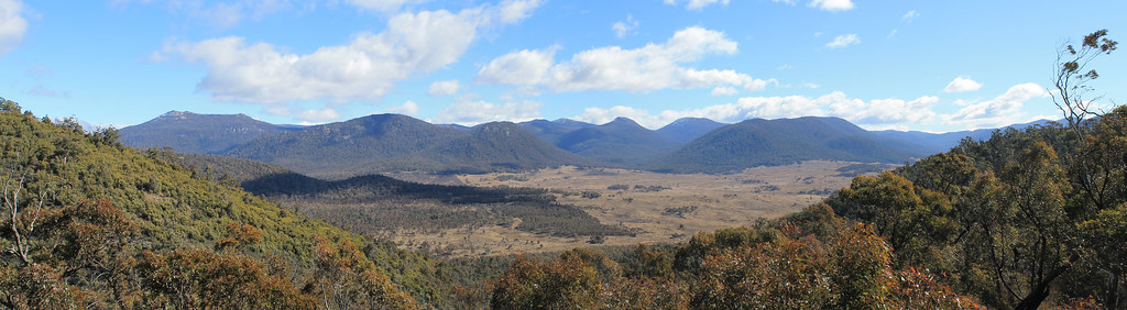
View from the lookout in Namadgi National Park in the Australian Capital Territory
The first trip in August was fairly relaxed. My supervisor from Glasgow came down for the week and we were joined by my supervisor from Australia and a local colleague of my Glasgow Supervisor's for a few days each. The Tablelands is a landscape dominated by rolling hills - sometimes mountainous - with gum tree forests and flat open grazing pastures in the valley bottoms. They spread a good distance, over 500km from north of Bathurst to south of Cooma, and almost 200km wide from Goulburn to Gundagai - roughly. When the European Australians first arrived to the Tablelands, the valley bottoms were soggy swampy meadows with sometimes large ponds in them. Water flowed through the landscape, though not in defined channels. With the introduction of grazing agriculture came lots of deforestation, which, paired with Australia's variable drought-dominated and flood-dominated climate regimes, led to the incision of these waterways into the valley bottoms, carving out deep gullies. As gullies were eroded in some parts of the landscape, the sediment released from them was deposited further downstream, covering the swampy meadows. Whether the cause of this widespread landscape degradation came from introduced grazing agriculture, from natural cyclical processes that happened to start at the same time as European grazing, or from fire-agricultural methods employed by Aboriginal Australians, we cannot be sure, and that is the purpose of my research.
So fieldwork involved me, and one of a handful of great field assistants, going into these gullies and collecting sediment samples from the gully walls and later I will determine burial ages for the sediment which will help me interpret when widespread gullying and sediment deposition on the Tablelands began.
While this region of Australia is arguably not all that scenic - there are no rough coasts, rainforests, mountains, or outback deserts - the rolling hills are beautiful and we frequently drove in and out of Australian bush land which provided plenty of opportunities to see amazing Australian wildlife.
In August, I was more focused on tuning my eyes to what was happening on the landscape. At one of our first stops, near Bevendale, we visited a site my Glasgow supervisor had previously worked on. A few years ago, to get to the landowners' house - we always asked for permission to gain access to land and let them know we were there - you'd just drive over a bridge spanning a 5 metre-deep gully. My supervisor was shocked to see when we got there that the bridge had been totally wiped out. We forded the stream and when we found the homeowners, they told us that the bridge had been washed out by the biggest flood they'd experienced. The water level rose up those 5 metres to the bridge and just plucked it up, carrying it downstream. This was not in any sort of gorge or steep landscape, nor was the upstream area all that large, but seasonally, this part of Australia can be subject to massive floods!
A few days later we visited another site along a stream called, Birchams Creek, and it ended up being one of my favorite sites that I returned to a few times. At this site, just 40 minutes outside of Canberra, the Australian capitol city, I was guaranteed to see at least 20 (sometimes upwards of 50+) kangaroos! Australians kind of see kangaroos like we, in Michigan, see deer. They are everywhere and often end up crushed by cars on the side of the road. But here, back in the countryside, they were everywhere and each time I visited, I would see them hopping up and down the hills, in and out of the paddock fences, and sleeping under trees in the middle of the day. So cute to see, too, when the little joeys are sticking their heads out of the mothers' pouches!
Overall, August field work was kind of dull - more driving than work. But I did get one experience most Australians do not: I was in the middle of a snowstorm! It was the second to last day of field work and we'd kind of exhausted the options of places to visit, so my supervisors and I took a drive to a peat bog on the southern slopes of the Brindabella Range which makes up the border between the Australian Capital Territory and New South Wales. We drove up through the mountains through Namadgi National Park, through a snow gum forest, and stopped at a scenic overlook where you could see the flat valley bottom below, surrounded by steep mountains. It was windy and cold, so we didn't stay long and kept driving down the other side of the mountains. We stopped at the Yaouk Peat Bog on the other side of the mountains and discussing how we might use it in my research and while we were there it started to snow. It wasn't really a blizzard, that would be exaggerating, but there were plenty of small specks of snow falling all around us as we got back into the car and drove toward Adaminaby for lunch. By the time we arrived and sat down in the small town's cafe, it was near blizzard conditions - big wet flakes of snow were swirling around outside and even the woman who ran the cafe ran outside with her camera because she had never seen anything like it! It cleared up enough as we left for me to see the Big Trout (Australia, like the US, is proud of their BIG roadside attractions) but then we drove back into the storm as we headed to Cooma and up to Queanbeyan.
October eventually rolled around and it was time to head back out into the field to actually collect some samples. I had two field assistants lined up to help me out over the two and half weeks of work and they were both great (we will call the first Britney and the second Tracy). Both were gung-ho undergrads who wanted to get experience with field work and couldn't have been better suited for the work. Britney was more interested in biology but hadn't had any field experience before and was curious to know what it was like and while I got excited about sediment and rocks she got excited about all the different animals we came across from sheep and horses to cats and puppies. Tracy was a seasoned environmental science undergrad who had a keen eye for approaching geologic problems and often kept me on track for what I was supposed to be doing. Both were Australians, which was important for me because I would be talking to landowners, asking their permission to go on their land, and knowing how suspicious Americans can be about people coming on their property, I didn't want to say the wrong thing or ask the wrong question, so it was good to have Britney and Tracy as field assistants. Also, both had excellent taste in music which was important for the long car rides.
Britney and I went into the field first, sticking around the Goulburn area. We visited a few streams nearby and collected samples, and scoped out a few more sites I could potentially come back to. But after a few days, Britney had to be back in Sydney so we drove the two hours back, I stayed the night in the city, and then picked up Tracy the next morning and drove back out to the field. Tracy and I went a bit further south, more toward Lake George - an inland lake with a large surface area (so it looked big) but a small depth of only 2 metres (so there wasn't much water). While at one of my sites, situated right next to a wide and long section of the stream that was more like a pool, we saw a few splashes and this little brown-backed critter with its nose just sticking out of the water, zig-zagging back and forth across the pool, spending a lot of time under the banks where sticks and weeds were all mashed together. It was mid-day, and though we both knew that platypuses are typically out in the evening and at night, we were sure that is what we saw! It was difficult getting photos of the animal (which I desperately wanted!) and when we asked some landowners further downstream if they ever saw any platypuses we were discouraged to hear that they'd only seen one platypus, thirty years before. They tried convincing us we saw a water rat, but the animal we saw did not have the white fur on its back like a water rat would have had and water rats swim on the surface whereas this critter spent most of its time underwater. Though unconfirmed, we decided that we had been some of the lucky few Australians who have seen the elusive platypus out in the wild and I got to check another Aussie animal off my list!
Tracy couldn't stay more than three days in the field, so off we drove, back to Sydney, where the next morning I exchanged field assistants again and Britney and I headed back toward Goulburn, but kept driving and eventually steered north toward Cowra. The next few days were fairly uneventful, and wet. Also, I was getting frustrated because I hadn't been to this part of the Tablelands before so I didn't really know where to go to find appropriate sample sites, so there was a lot of driving around. I felt so bad for Britney because she was so patient and tried to be helpful, but sometimes my stress got the better of me. But we got some good samples over those few days and met some friendly landowners who couldn't have been more helpful for us. It wasn't long before a few exciting things happened. We were driving in the hills around Mandurama and off in the distance, on the high hilltops, we could see snow. Britney had never seen real snow in her life before so I drove back up into the hills until we crossed the snow line and stopped the car. Now, I've been in real blizzards, buried under feet of snow, and spent so much time in good snow that I was pretty unimpressed by the light dusting of white we saw on the ground, but it was real fun to watch Britney get out and stomp around in it, packing it into a little snowball and throwing it, and I got a good kick out of her answer when I asked, "Well, what do you think?" and she responded, "It'sso WET!" Haha. It was a great moment and on the way back down the hill we crossed paths with a rural postman who was also stopping to take some photos of the snow. It was definitely a rarity for that time of year and a rarity for Australia in general! The next day we got a bit more excitement when I saw something unusual in one of the grazing paddocks - a small flock of weirdly gangly, 8-foot tall, dinosaur-like birds was strutting across the field a good distance away from the road, but I knew what they were immediately: Emus! I pulled over and grabbed my camera to take about one million photos of them. I wanted them to come closer and even though they didn't, we watched them for a good ten minutes or so!
And then November came around. It was time for me to head back into the field and collect some samples from sites I hadn't focused much time on before. I started off on my own this time, driving through the Blue Mountains north, back toward Manduarama to a site along Grubbenbun Creek I'd been to before, but didn't take samples. After Grubbenbun, the landowners gave me directions for the back-road route to get to Crookwell. It was already the evening and the two-hour drive took me through some beautiful dirt roads through tiny hill-towns with names like Thalaba, Abercrombie River, Peelwood, and Trunkey Creek. I would be sampling the next day north of the town of Laggan, so I stopped at the site to see if I could introduce myself to the landowners. The old couple who answered the door were so nice and and man had been living on the land since his family settled down here, the first European Australians to graze the land, way back in the 1830s! The next few days were standard work days. I'd go to the creek, clear off a fresh sediment surface from the gully wall and remove my sediment samples. After Laggan, I drove down to Queanbeyan where my Glasgow supervisor's former colleague, Jane, lived. Jane had been out with us for a few days in August and was happy to help me over the weekend. We went back to the Birchams Creek site, where again we saw dozens of kangaroos on the hillsides, and we also revisited a site on the western boundary of the Australian Capital Territory. Jane is a geologist and has had a bit of experience working on the Australian landscapes, so it was fantastic to work with someone who brought a professional geologist's perspective to my research and helped guide my field work strategy to be able to collect samples that would best answer my research questions.
But Jane could only help out over the weekend, so Monday I worked by myself again, and on Tuesday, I drove into Canberra to pick up my next field assistant, Drew. Drew had just finished his Honors Thesis on river erosion and sedimentation and happily, for me, was willing to give up a few days of surf to come dig around in the mud and dirt with me! I had a few hours before Drew arrived, though, so I checked out the Australian War Memorial on the outskirts of the city. Canberra isn't much as far as cities go, but it is chock full of museums! I only had about ten minutes in the War Memorial museum, but I will definitely be going back to spend more time there!
I retrieved Drew and we headed south for an hour or so and turned off down a long dirt road. I wanted to collect a different type of sample, mud from the valley bottom of a modern swampy meadow, one that hadn't been gullied through or buried yet. We saw a house that looked like they might own a bit of land and as we drove up, dog started running toward us and a very imposing man stood on the porch of the house. We exchanged hellos as we walked toward each other, and the mood changed immediately. This guy and his wife had just moved out into the country from a small town nearby and were in the process of building a Sabbatical Recording Studio in some of the sheds out back. I forget what his name was - MC something-or-other - but MC was really into his music and worked with local and international recording artists and he and his wife wanted to be surrounded by peace and quiet while working with artists who wanted to get out of your typical city sound studio and into a more relaxing setting for recording their music. They gave us a tour of their recording studio, which was a work in progress. And though I believed their story and liked MC's enthusiasm for music, we were still a little wary to follow them into these sheds where the studio was being built, though MC was so excited to show us the sound-proof rooms and a bathroom with a microphone built into the shower head so the artists could sing before their session and get rid of the jitters. I was actually pretty impressed and excited for their business. It was just such a cool combination of beautiful land, quiet scenery, and high-tech modern recording equipment! Though I do have to say, Drew and I both felt like we'd just stepped onto the set of a real-life horror movie when they took us on the tour of their studio. "Sure, come check out these sound-proof rooms. I won't knock you out with this hammer we're using to install the keyboard. Wait 'til you seethe sound booth shed!" But really, MC and his wife were great people to chat with!
Drew and I carried on with our work, and the next day drove south from Cooma to a little town called Dalgety and turned down a road that ran a 20 kilometre loop through grazing country. We were headed to a town on my map called Jimenbuen, which was at the far end of the loop road. The road we were on went from being paved to dirt and eventually it turned into a small two-track that wound through wide open grazing pastures. Eventually, though, the road stopped and we were definitely not in any sort of town but in front of a creepy old house. It didn't look like anyone was home and it didn't seem to be near anything else, so we decided we must have taken a wrong turn somewhere and started to head back. While on that little two-track, though, we spooked three emus which were only about 30 metres away! Drew told me to stop the car and roll down the window. Apparently emus are notoriously curious and sure enough, they started toward the car. I couldn't believe just how massive these birds are! They're at least 8 feet tall, with spindly legs, and a relatively small body compared to their long necks which are covered with thick, tufty feathers. Honestly, they just look top-heavy and like with any step they will tip over! They got bored with us after just a few minutes and took off in the opposite direction, but it was so cool to be so close to these amazing birds out in the wild!
November was a warm month to be doing field work in and the days were hot and sweaty and Drew and I were bothered by flies wherever we went those few days, but as quickly as field work started, it ended for the year and we drove back to Sydney after a few days in Cooma. So now, with samples in hand, I was ready to start getting some data back from my samples and the story of when landscape change started on the Tablelands was beginning to take shape. The story continues, but I am waiting to be trained in the laboratory to process the rest of the samples, and while I have a few weeks of field work in the books for 2013, nothing yet is planned.