Showing posts with label Stone Age. Show all posts

Saturday, February 14, 2015

Scotland: Kilmartin Glen, Mull, & Iona

Dates Traveled: 27-29 December 2014

Christmas was once again spent away from family this year, but this year would at least be exciting. One of my friends and I decided to head west from Glasgow to Oban with some stops along the way. When I moved back to Glasgow from Australia a year ago, a friend of one of my friends was looking at a wall map of the British Isles in my flat, pointed to an area south of Oban, and said, "You must go here, to Kilmartin Glen." He said that Kilmartin Glen is one of the most overlooked destinations for anyone interested in Scottish history and neolithic sites. So, after a day of recovering form boxing day laziness, we headed out from Glasgow.

Along the A83
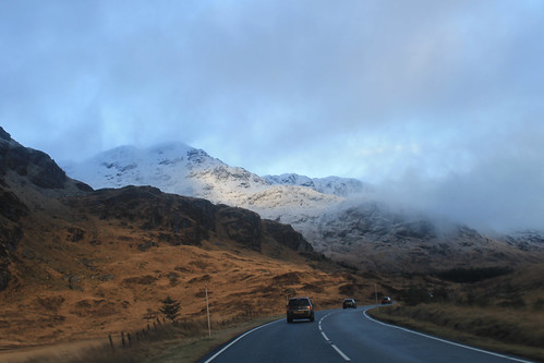
Driving along the A83 between Loch Lomond and Inverary
Winter is an absolutely beautiful time to visit Scotland. Sure, the days are incredibly short, but the snow on the hills makes it unlike anywhere else. Once away from the main cities, the roads get narrow and windy, which makes for getting anywhere quickly quite tricky! It took us a while to get out to Kilmartin Glen, via a coffee stop in Inverary, but a little after noon we pulled into our first stop, Dunadd, which was the first site of the first kings of Scotland, having been in use since the Iron Age. On the little hill above the glen is a rock with some footprints carved into them, possibly where the kings looked out - I imagine much like Mufasa and Simba from Pride Rock :)

A little bit further down the road are a series of standing stones dating back 5,000 years. We missed the winter solstice only by a few days, but it's pretty amazing how these stones would have lined up with the setting sun, even after 5,000 years! I'm often really amazed by how after thousands of years, and with all of our modern technology and knowledge, we still have no real idea what these stones or circles were used for! And while not as grand as the Ring of Brodgar in Orkney or as circular as the Drombeg Stone Circle in southwest Ireland, the stones are just as enigmatic, and there are a lot of them, including one site where five stones make an X figure in a field, apparently a very unusual arrangement. Starving, we stopped in at the Kilmartin Hotel and had a tasty pub supper before exploring the curchyard across the street with brilliant scenery looking down the Glen.

There were still a few things we wanted to see before it got dark and before we got to Oban, and even though it was only 3 o'clock in the afternoon, we were running short on daylight, so we hit the road again, winding around the coast, to the Bridge over the Atlantic. To be fair, this is a very nice looking stone bridge, arching high over a small tidal waterway, technically part of the Atlantic Ocean, separating the Scottish mainland from the small Isle of Seil. Apparently nowhere else (maybe in Scotland) is there a bridge over the Atlantic, so it is only here you can say you've "driven across the Atlantic Ocean." Not really much to see, we kept on to the small town on Seil of Ellenabeich, an old slate mining town that now consists of three rows of whitewash cottages. A beautifully small town that I would have liked to have stayed in a bit longer. Would have been a great place to write up my PhD thesis! While in Ellenabeich, the sun went down and we didn't want to be stuck on unlit country roads for too long, so we headed in to Oban, checked into our hotel, and met up with one of my Uni friends who was home visiting family for the holidays.

Mull Panorama
Snow-capped mountains on the Isle of Mull with Duart Castle in the foreground from the ferry from Oban to Mull.

We got up early the next morning, a brilliantly clear but chilly morning, to catch the ferry from Oban out to the Isle of Mull, a rugged island about an hour offshore from Oban. The views from the ferry back to the mainland of snow capped mountains were amazing, not to mention the snow capped peaks of Ben More, the only Munro on Mull. A little note for visiting Mull in the winter: Don't plan on relying on public transportation, especially on a Sunday! We were lucky to have a Range Rover, so the small single-track roads and ruts of Mull were a piece of cake, but be careful if you have a smaller car not to go off the edge of the road or you will get stuck! We headed immediately out to the westernmost point of Mull, a town called, Fionnphort, where we waited for the quick ferry out to the small Isle of Iona. Again, visiting in the winter and on a Sunday, you run the risk of either the ferry not running, or only making one trip out to Iona, but not back, so it's suggested you call the portmaster on Mull the day before to make sure the ferries are running!

Iona Abbey
Iona Abbey
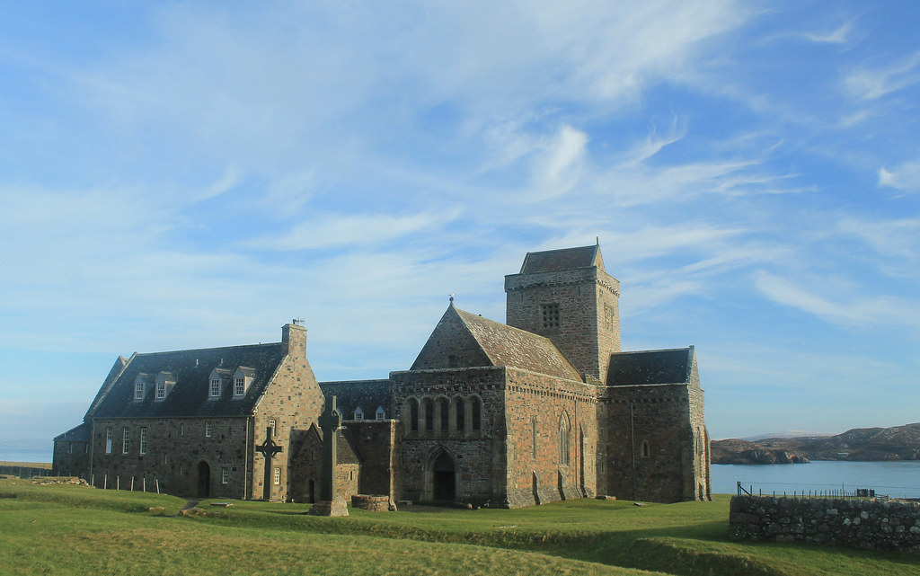
The sky was crystal clear, and though it wasn't windy, it was really cold! But while waiting for the ferry we did get to see a small fishing boat loading up for the day, and it must be quite a regular occasion because there was a seal who sidled right up to the boat begging for a bit of breakfast! The ferry finally arrived and we walked on, making sure to ensure it would come back from Iona! Now, Iona is a beautiful little island and I wish we had more time to spend there, but with the two hours we did, we made sure to walk over to the famed Iona Abbey, the former Catholic monastery where the Book of Kells was written. The Abbey survived Viking raids as well as the Protestant Reformation, and is now part of the Church of Scotland. So many tourists come out to Iona in the summer, it was nice to experience the island in winter when even the hostels were closed for the season! BUT, if you go on the weekend, you don't have to pay to get in to the grounds! We took a little walk up to the highest point on Iona, Dun I, for some breathtaking views to Mull and so many other Inner Hebridean islands.

Running short on time, we headed back to the ferry and crossed back over to Fionnphort, accompanied by dolphins jumping out of the water and playing in the wake of the ferry! Back in the car, we decided to take the small winding road around the rest of Mull. Now, I thought the road from the Mull ferry to Fionnphort was small, but it was nothing compared to the B8035, which was tucked right along the coast with rocky cliffs on one side, but provided amazing scenery, especially during sunset on such a clear day! The B8035 turns onto the B8073 and the road climbs up some very steep hills that any small car would have some trouble getting up! If you're in a small car, you definitely want to take the B8073 counterclockwise from Tobermory where it will be easier to go down these roads than up. Daylight was nearly gone as we arrived to Calgary Beach in the small locality of Calgary, the same that the Canadian metropolis is named after! But we couldn't stay long since the sun had now set and we still had about 30 minutes to drive to Tobermory for a quick fish dinner (not many places open on a winter Sunday), very quick because we had to get back down to the ferry docks to catch the last ferry back to the mainland.

Gylen Castle and Kerrera Coast
Gylen Castle on the southern end of Kerrera
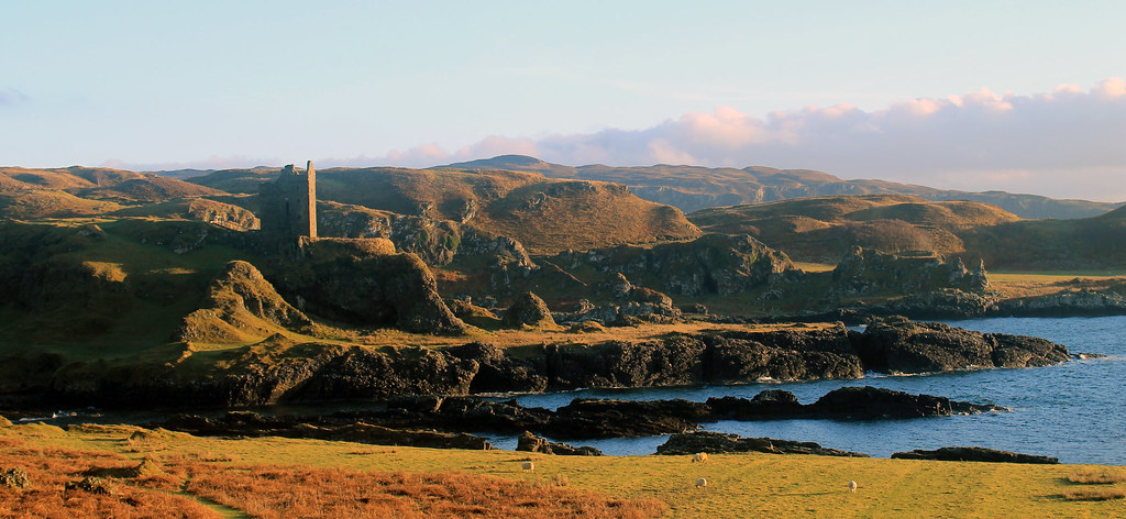
The following morning was yet again a clear day on the western Scottish coast, though much colder! Not wanting to waste time, we grabbed some breakfast and went to the small local ferry from Oban out to the small island, Kerrera. A privately-owned ferry, you signal the owner that you want a ride by sliding a big panel open on the mainland, revealing a big black square, and upon seeing it, the ferryman comes over to pick you up for the 5 minute crossing. We decided to do the 3.5 hour loop down to Gylen Castle at the southern end of the Island and back. Though not a strenuous walk, it felt long because it was so cold, especially in the shade, but the destination was amazing - a square castle with a small footprint exposed on a tall rocky knob over the coast. The castle was besieged and burned in 1647, though recently the Clan MacDougall began restorations. It's surely not much of a castle, but its position in the grassy hills along the coast sure makes it a great place that we had to ourselves! The rest of the circuit along the west side of the island isn't as scenic, and was a bit mushy underfoot, but there were a few brilliant moments in the setting sunlight over to Mull. Back in time for the ferry back to the mainland, we hopped back into the car and headed back up to Oban to pick up my friend who was coming with us back to Glasgow, and with that we were off back home.

Though I think we lucked out, weather-wise, the weekend was a great and most welcome break from city life in Glasgow, and so easy for a few days! Enjoy the photos:

Saturday, June 9, 2012

The Old Man of Hoy and Maeshowe

Travel Date: 04 June 2012
(Slideshow of photos at the bottom)

Today was much less hassling trying to get around. Buses were back up to their full schedules as were the ferries between islands. I got up early enough to hop a bus back to Stromness from Kirkwall and then had 10 minutes to get onto the little passenger ferry, taking me out to the island of Hoy. It was another sunny day, though still chilly, that provided me with great views of Stromness as we pulled out of the harbor and into the tidally forceful Scapa Flow. There was a little story I read, I think at the Flattie Bar yesterday while in Stromness, that described life on the water: people living there were sailors and fishermen by trade so they were very comfortable being on the water, but the kids who had their own little boats (the Flatties of the pub's name) were warned to not sail past black buoys placed out near the mouth of the harbor because from there on out, the tides and currents were much to strong and would carry them away, out to sea.

06042012 (2)
Leaving Stromness Harbor

Today, though, the ferry easily navigates the tides and we pulled out into the channel between mainland Orkney and Hoy. Again, here was an entrance to the protected harbor where the WWI and WWII British Navy Fleets were stationed, so you can still see the old watch-houses and bunkers along the islands that were used to protect that channel entrance from any German threat. They are abandoned now, but still stand in silent guard.

06042012 (13)
WWI/WWI-era look-outs on the shore of the isle of Graemsay with mountainous Hoy in the background
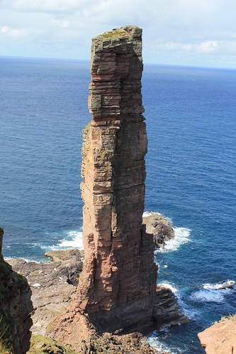
Hoy is a beautiful island. It has the most topography of any of the Orkney Islands and was visibly sculpted by glaciers during the last Glacial Maximum. One of its more modern features, however, is the Old Man of Hoy, the United Kingdom's tallest seastack (450 feet high)! A seastack is a tower of rock separated from the rest of a cliff-lined coast. They form as wave action strikes a rocky promontory, and as the waves refract around the head of the point, they erode the neck from two sides. Eventually, the neck of the promontory totally erodes through and all that is left is a giant stack of rock out to sea: hence the name seastack.

06042012 (24)
Docking at the isle of Hoy

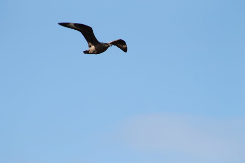
To get out to the Old Man of Hoy, you have a few options. You can prearrange a cab to pick you up at the ferry dock, you can sign up for a guided tour, you can bike out there, or you can hike the 6.5 miles from the docks, through glacially sculpted valleys, and then up to the site. I bought some new hiking boots when I was in Michigan for my sister's wedding and since I didn't want to pay for a bike rental or a cab, I decided to hike. The first mile and a half are all up a one-lane road leading away from the ferry dock, through sheep pastures, and through some moors. The road eventually turns, but hikers continue the next two and a half miles through the glacial valleys, which are protected as part of the Scottish National Bird Sanctuary. Because of this, though, I was warned by a local Orcadian that you kind of have to keep your eyes open for any divebombing Great Skua birds (called, Bonxies by the locals). They kind of soar around above you and if you get too close to their nests, they will squawk and dive toward you. I won't lie, I had a few stones in my hands just in case, and even shouted at a few that I thought were flying too close to me! There was a little reservoir up in the valley that most of the bonxies stuck to, and once I was past that, they were no longer a problem!

06042012 (35)
The lonely road out to the hiking path to Rackwick on the isle of Hoy

06042012 (40)
Watch out for the dive-bombing bonxies!

Further down the valley, tucked away in little stream valleys, are some of the last remaining wild Orcadian forest, that used to cover much of the islands. Over 5,000 years of constant settlement and agriculture, it's no wonder there is little left of these forests. But then the trail reconnects with the road which ends not much further in the little town (if you can call it that) of Rackwick.

06042012 (115)
Some of the original, most northerly native woodland in the British Isles

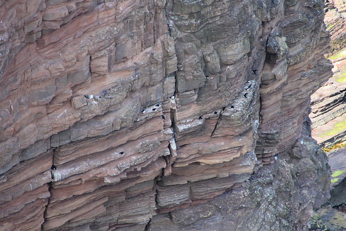
Rackwick is literally the end of the road, but it is a beautiful end of the road with a wide, sweeping beach with turquoise water, nestled between huge, enormous, sandstone cliffs. And I'm not talking 100-foot-high Sydney Coastal Walk cliffs, or even 200-foot-high Pictured Rocks cliffs, or even 400-foot-high Cliffs of Moher. These cliffs jut up 500-feet from the ocean far below (and they aren't even the tallest, which rise up over 1,000 feet!). So Rackwick is a beautiful end of the road, but not the end of the journey out to the Old Man of Hoy, which still requires a two and a quarter mile hike along cliffs and over coastal plateaus. But once you are there, it is such a treat! Standing 450-feet up from the ocean, far below, is this behemoth of stacked beds of sandstone, flanked to the south by similarly-high cliffs, and to the north by the massive 1,000 foot cliffs! Now, believe me when I say that the Cliffs of Moher are beautiful and stunning, but the fact that they are so accessible and overrun by tourists makes them a bit less wonderous, compared to these massive cliffs that only those willing enough to hike a few miles will ever get to.

06042012 (57)
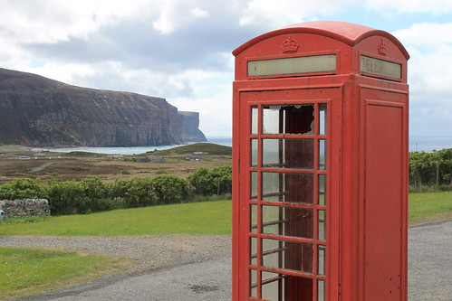
Old British Telephone booth at the Rackwick Hostel, looking down at the town and the massive sea cliffs

06042012 (75)
The Old Man of Hoy: 450 feet tall and the tallest sea-stack in the UK

06042012 (78)
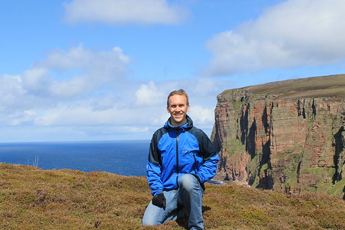
Me with the sea cliffs north of the Old Man of Hoy

06042012 (91)
Puffins! This was the best shot I could get, even with my 18x zoom lens... But some birdwatchers there told me of better places closer to Glasgow I can go to get better photos

I stayed out at the cliffs for a little while, enjoying my packed lunch of cheese, jerky, an apple, biscuits, and crisps, watching the sea birds (mostly seagulls, but I did see some puffins, too! - just very, very far below me...) and chatting with a few of the other visitors who were from all over the place: Germany, southern England, California... They all had a few good stories and we each helped the others take photos. It did start to sprinkle, just a thin band of rain, but it was also time to head back to the ferry dock. I wanted to take a more rigorous route up above the massive cliffs to the north, but being alone, without a detailed map, and on a time constraint, I decided it would be better to go back the way I came and leave the high-cliff route for another time. Back toward the ferry dock, a lot of tourists were having an afternoon tea at a little cafe. It was nice, but definitely priced more for the retired clientele who have a little bit more pocket change than your average student day-hiker, but I bought an Irn-Bru and gave my feet a rest in the yard, watching a chicken hobble around.

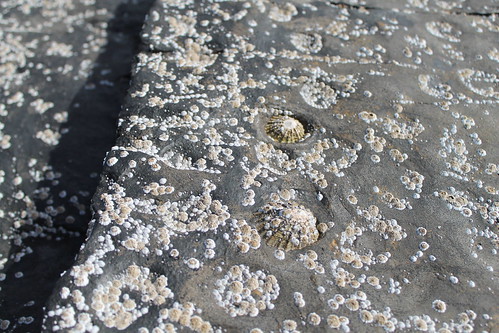
I had to catch the first afternoon ferry back to Stromness in order to get the right bus out to Maeshowe, which I wasn't able to get in yesterday. We had to wait for the ferry a little bit but it gave me time to explore the exposed rocky shoreline during low tide, which was covered in barnacles, limpets, algae, and seaweed. The ferry came and brought us back to Stromness where I had a little extra time before the bus, so I bought a beer at the Ferry Inn and listened to one final jam session by the remaining musicians in town for the Orkney Folk Festival. But then it was bus time and back to Maeshowe.

06042012 (157)
Limpets stuck to the bedrock at Hoy Harbor during low tide. As water washes over them, it erodes little pockets around each limpet creating a pitted pattern on the rock.

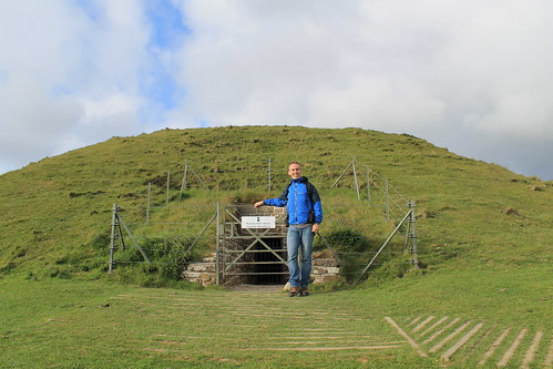
Maeshowe is a fantastic Neolithic site, nearly 5,000 years old. You have to book a tour in advance, and in the summer there are extra "twilight" tours in the evenings, which aren't really twilight since the sun pretty much never sets. To get into Maeshowe, you have to stoop quite low and walk through a ten-meter passageway lined in massive, single blocks of stone. Once inside, you're able to stand up in a square chamber with what was once a corbelled ceiling (but is now a poorly constructed brick dome structure put in place in the early 1900s). Maeshowe is similar to other chambered tombs of the area in that opposite the door and on either side wall are two recessed and L-shaped chambers. In other tombs of this age, human bones have been found stored in these chambers, grouped by bone-type, rather than full skeletons. It is thought that Maeshowe served a similar purpose but very few bones have actually been found there. It may have also served a more ceremonial purpose, archaeologists think, suggested by the fact that the entrance to the tomb directly faces the setting sun on the Winter Solstice. Curiously, on the solstice, the sun sets behind the massive mountains of Hoy, and it is thought that they also served some spiritual purpose. Furthermore, the ceremonial significance of Maeshowe is suggested by its proximity to the Standing Stones of Stenness, the Ring and Ness of Brodgar, and the Barnhouse Village.

In the 12th century, multiple groups of Vikings were vying for control of Orkney and one group started off one morning in Stromness but got caught in a storm and took shelter in Maeshowe, leaving cryptic messages of the runic alphabet carved into some of the stones. They spoke of the treasures of the North and one claimed to be a master writer of runes who and carved his message using a very famous axe, used to slay Gauk - don't ask me the history of that; all I know is that the axe was well-known.

My favorite bit about Maeshowe, though, again were the slabs of rock. The entrance tunnel was lined and covered with ten-meter long single slabs of sandstone, and the lintel above each of the recesses off the main chamber, which were five meters by at least three meters, were each carved of a single slab of rock. How those people 5,000 years ago were able to move such large pieces of rock over large distances still baffles me as well as archaeologists, and as to how it was done is still anyone's guess.

06042012 (197)
In front of the entrance to Maeshowe. No photos are allowed inside, but it's pretty amazing

06042012 (210)
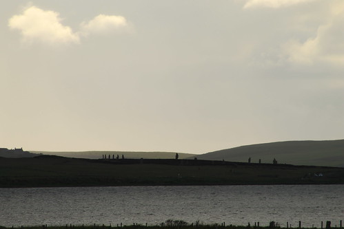
One last look over to the Ring of Brodgar

Upon leaving the tomb, I gave one last look around the landscape, taking a few more photos, before heading back to the visitors center to wait for the last bus into Kirkwall. I bought a few postcards and got some good music suggestions from the woman working the shop, and indulged myself into a wee tub of ice cream from the Orkney Creamery, which was delicious (I suggest the Toffee Swirl and the Orkney Original).

Back in Kirkwall, I ran into some girls who were out at the Old Man of Hoy when I was there that day, and we chatted a while over some coffees and snacks in a little craft shop/coffee house, Judith Glue. The girls were fun to chat with, but they had already eaten dinner and I needed some substantial food before 9pm, so I said goodbye to them and headed out to see my final fish and chips of the trip. I caught the shop just before they closed and took my food out to the harbor to eat. It wasn't quite 10pm yet and I realized that I did want to purchase something to remember Orkney by, and I went back to Judith Glue (which stays open until 10pm!) and purchased a few prints done by a local artist and a bottle of Dark Island, brewed by the Orkney Brewery - as suggested by a man at the pub where I got dinner the night before - and headed back to my hostel where I watched the Queen's Diamond Jubilee concert at Buckingham Palace and wrote my postcards. That night, as part of the Jubilee, beacons, or torches or bonfires, were being lit around the UK and the world in commonwealth countries. Stromness had their own beacon and I was tipped that Kirkwall would be having their own as well on top of a radio-antennae hill visible from the hostel's kitchen window. I kept getting up to see if I could see the fire, but it was either too small or they didn't have one, so I stayed in, repacking my bags, and finally dozing off to sleep.

My legs were sore, feet were covered in blisters, and my brain hurt from trying to piece together all the Orcadian history I had taken in over the past few days. But I fell asleep the moment my head hit the pillow and I would soon be saying goodbye to this beautiful but chilly island paradise of northern Scotland.

Thursday, June 7, 2012

Orkney by Bicycle and Kirkwall Sights

Travel Date: 03 June 2012
(There is a slideshow with more of my photos from this post at the bottom of this page.)

As I was trying to go to sleep last night, I was worried I wouldn't be able to get around Orkney today for one reason: it's Sunday. In America, Sundays really aren't much different than the other days of the week; shops close at 7pm instead of 9pm and you can't buy booze in Michigan until after noon, but bus schedules and businesses typically stay open. This is not the case in Europe and definitely not the case in Orkney. You get around Orkney on Sunday by your own vehicle (which I didn't have), a bike (which I couldn't get because the rental companies were closed), by hitchhiking (which I am reluctant to try), or by bus (which ran maybe six return journeys between Kirkwall and Stromness). Thus, my choice was clear - bus it was.

I got up early enough to take the bus into Stromness. I tried accessing the internet on my phone, which had a °-symbol where the 3G or E symbol usually is. As someone explained it to me, having ° is like having 2G (if there were such a thing). Regardless, I tried accessing the bike rental companies' websites to see if they were indeed closed on Sundays. The one was definitely closed, but I couldn't tell if Orkney Cycle Hire was open or not. So once in Stromness, I started wandering around the town, praying for a miracle, but deciding that Stromness wouldn't be all that bad of a place to get stranded for the day - afterall, the Orkney Folk Festival was in its last day and there were plenty of musicians around.

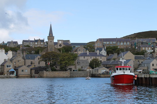
Stromness is a beautiful town. There is only one main road going through the central bit with one or two smaller roads running parallel up the hill and multiple other spur-roads (they were more alleyways) that turned off the main street. The main road was narrow, only wide enough for maybe a car and a pedestrian, and was in-laid with flagstone and cobbles. Above your head, zig-zagging all the way from the end of town into the town square in front of the Stromness hotel and harbor is a strand of colorful pennants like the type you'd see strung around a car dealership's lot. It was early and not too many people were out, but then my prayers were answered as I saw a sign for Orkney Cycle Hire and an arrow pointing to a patio where a man was walking out with a bike! I could rent a bike! I was so happy because I really wanted to do my sightseeing and now I'd be able to! I paid for my bike, an 18-gear hybrid, and zoomed down the narrow, empty streets of Stromness to a wee general store where  I picked up a few snacks for my day, and then pedaled out of town.

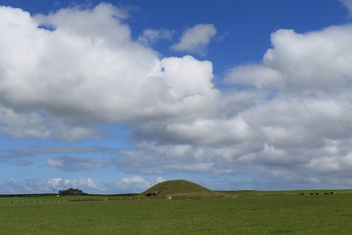
Orkney is not mountainous, so there are no really steep hills, but it's not flat either. I quickly learned that I was out of shape, though I soon got used to pedaling up the long inclines that are too steep to be flat, but too shallow to walk your bike up a short distance and coast down the hills. But it didn't matter, I was on two wheels, on an empty road, cycling past cows and sheep under a blue sky. My first stop was one of Orkney's do-not-miss sites that my Orkney Explorer pass covered entrance: the burial tomb of Maeshowe (pronounced mays-HOW), which is part of the Heart of Neolithic Orkney UNESCO World Heritage Site which includes all of the sites I had on my list. I got to Maeshowe only to be told that I was supposed to sign up for a tour time and that I could come back later that afternoon. I rescheduled for the following afternoon since my biking route wouldn't take me back toward Maeshowe that day again, but determined to carry on.
06032012 (9)
Maeshowe


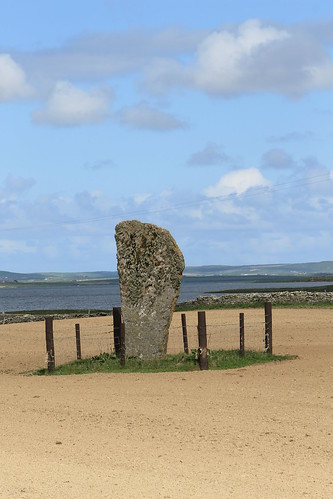
Just down the road from Maeshowe is a solitary standing stone called the Barnhouse Stone. It sits in the middle of a plowed field, surrounded by a square fence, maybe 3 meters on each side, so you can't really get to it, but interestingly, it is the smallest UNESCO-protected cultural site by area. Pretty cool!
06032012 (11)
The Barnhouse Stone


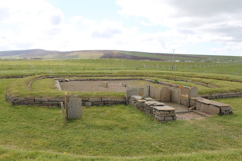
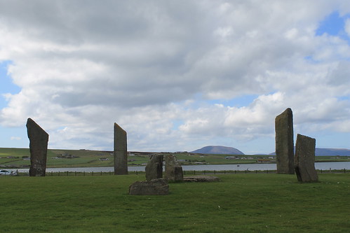
Two large lakes dominate the landscape here and a low ridge separating them is home to a host of other neolithic sites, the next of which I visited were the Standing Stones of Stenness. Originally, there were 11 (maybe 12) stones, 5-meters high, in a circle surrounding a central hearth, all of which was surrounded by a deep ditch that was only traversed by an earthen causeway. The site, like Maeshowe, is nearly 5000 years old and is thought to have been a ceremonial site. A few meters away in one direction is the Watchstone, of the same age, and a few meters in the other direction is a recent discovery of a settlement, Barnhouse Village, also 5,000 years old.
06032012 (20)
Standing Stones of Stenness


06032012 (28)
Barnhouse Village
Barnhouse Village was only discovered in 1984 by archaeologists who soon uncovered the foundations to eight structures including two ceremonial structures: one was larger than the other domestic structures of the village, and the other appeared to be two domestic structures fused into one - very much unlike the other structures here and at the nearby Skara Brae (see below).


In the same vicinity, sort of between the Watchstone, Stones of Stenness, and Barnhouse Village was yet another massive stone (the Odin Stone) that early drawings show having a hold carved through it. However, a non-Orcadian farmer moved to the site in the early 1800s and fussed that people were traipsing over his land, so he smashed the massive Odin Stone as well as some of the Stones of Stenness but was fortunately stopped by a massive protest by the locals. It is thought that this site in Orkney held particular significance of some kind due to the large number of sites being used at the same time including the Stones of Stenness, Barnhouse Village, Maeshowe, and the nearby Ring of Brodgar and Ness of Brodgar. It is even supposed that neolithic people from all over met at the Stones of Stenness for spiritual ceremonies here.

Down along the ridge that separates the two lakes (one of which is freshwater, while the other is salt water), past the Watchstone are even more neolithic structures. The Ring of Brodgar is a circle of stones, each of different sizes, shapes, and heights, on the perimeter of this wide henge (or flat circular area surrounded by a deep ditch). The site originally had 60 stones, only 27 of which are still seen today. I spent quite a while at the Ring of Brodgar taking it all in from many different angles, walking around its perimeter, and having my own guess at its purpose. I'm not sure what it is about neolithic sites that fascinates me. Maybe it's the fact that as a geologist, I'm drawn to stone structures? Maybe it's astronomical precision with which these stones are aligned? Maybe it's their antiquity? Maybe it's the fact that with all of our modern knowledge, we still have no clue as to what their purpose was? Maybe it's a combination of all the above; I'm not sure, but I could spend a very long time at these sites conjecturing.

06032012 (54)
Ring of Brodgar

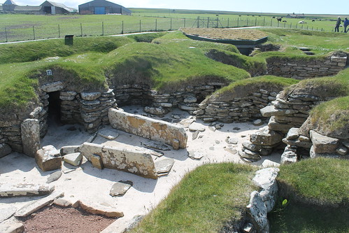
 It started to drizzle and I decided to take off to the site that made me want to come to Orkney in the first place: Skara Brae. I first heard of the ancient village of Skara Brae while listening to Bill Bryson's book, At Home: A Short History of Private Life, on tape driving to Michigan from Vermont last summer. I usually ear-tag pages in books I find interesting, but since I was driving, I couldn't do any more than search for some scrap paper and scribble down the name of this village, having no idea how it was spelled and hoping that I'd be able to decipher my scribbles later. Like the Barnhouse Village, Skara Brae was discovered by accident after a terrible storm struck the British Isles, killing hundreds of people. The storm ripped away the grassy field that covered this coastal site, revealing to the locals for the first time an intact village, 5,000 year old, with numerous dwellings and walkways connecting them. The dwellings all had the same internal plan, indicating that all inhabitants lived as equals to each other, and furniture including stone beds, dressers, hearths, and storage places were all intact. Unfortunately, some locals having a party in the nearby Skaill House decided to go investigate and knicked many of the original artifacts from Skara Brae.

Two things interested me about Skara Brae when listening to At Home. Firstly, of all the dwelling places, there was one that while it was set up just like the others was situated with a stone door to the entryway that could be shut and locked only from the outside. While the other houses at Skara Brae had doors, none were fitted with the locking mechanism, so it raises the question, what use could a seemingly peaceful community have for a dwelling place where someone could be shut and locked in? The second interesting bit that caught my attention was that some of the storage chambers at Skara Brae were fitted with drains and plumbing. Now, these weren't just stone alcoves with a hole in the bottom, but actual conduits leading away from the houses, draining into the ocean. It is remarkable that this society, older than Stonehenge and the Pyramids of Egypt, had the wherewithal to install drainage systems into their village, something that doesn't show up in other civilizations for another few centuries (and very far away, at that!).

Actually visiting Skara Brae was amazing (oh, by the way, it's also covered under the Orkney Explorer Pass). I hadn't realized that all of the passageways connecting the houses would have been covered, but the ceilings were so low that one would have to crouch to navigate their way through. Also, while the houses were mostly set up the same way, one of the houses had a storage chamber behind their stone dresser, only accessible by crawling under the dresser shelves, as if it were a hiding place. So many questions to be answered but with excavation being complete at the site (once a historic site is designated a UNESCO World Heritage Site, no more excavation can be carried out), and much of the original artifacts having been looted, we can only rely on supposition based on excavations of similar sites elsewhere. It is fortunate the site actually is protected, however, as coastal erosion in the Skaill Bay would have otherwise continued to eat away at the sand banks Skara Brae is built on, resulting in the site being lost to the ocean forever.
06032012 (76)
Skara Brae


Time was marching on and I needed to get back to Stromness in time to catch the last bus back to Kirkwall, so I hopped back on my bike and pedaled back to town. The bike ride back to Stromness was equally as beautiful as everything else I'd biked through. Orkney really is a biker's dream: wide, empty roads, quiet, with few cars passing (and those that do, even the tour buses, are sure to give you plenty of space and very non-threatening). My legs were happy to get a few nice long descents where I could just coast and talk to the cows and sheep as I went past.

With my bike returned, I did have a little time left to waste in Stromness, so I headed into the Flattie Bar just at the base of the Stromness Hotel, ordered a Scapa Special (from the Orkney Brewing Company), and drank it outside amongst the people celebrating the last night of the Folk Festival, under the waving flag of the Orkney Islands.

I got back to Kirkwall around 5pm and decided to do some sightseeing in Kirkwall, too. Right near St. Magnus Cathedral is the Earl's Palace, which was built in 1606 by Earl Patrick Stewart, half-brother to Mary, Queen of Scots, who granted him the Crown estates of Orkney and Shetland. Earl Patrick was considered to be an evil man who eventually had to sell his palace to pay for some debts, was jailed in Edinburgh, and killed on accounts of Treason. The palace fell into the hands of the Orkney Bishop, whose palace itself was just across the courtyard, and at one point connected. All that remains of either palace now are the stone walls, the rest having been destroyed in retaliation for Earl Patrick's treason. You can still walk around the ruins of the Earl's Palace and the Bishop's Palace and even climb the stairs up to the tops of some of the towers where you are rewarded with magnificent views of the Cathedral.

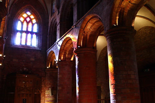
My mother would have scolded me big-time if I didn't take time to stop in the cathedral, so that was next on the list. It is a massive structure, built from red sandstone found throughout the island. Originally a Catholic church, and the seat of the Bishop, it was converted to a Protestant church during the English Reformation, and stripped of all Catholic symbolism, which is why many of the windows are no longer inlaid with stained glass. The rose window at the end of the nave faces west, and at 7pm in the Orkney summer, the sun shines right through the rose window, splashing color over the insides of the church in a beautiful way. Unfortunately, the organ wasn't being played, which would have made the visit extra special.
06032012 (109)
Sunset illuminating St. Magnus Cathedral


Finally, I was hungry and since it was still before 9pm, I headed to Helgi's for a beef pie and some more local beers from the Highland and Orkney Brewing Companies (the Orkney IPA and Northern Lights). I chatted with some locals while watching the BBC coverage of the Queen's Flotilla down the River Thames in London for her Diamond Jubilee, and then with a young guy from Florida who was taking on an apprenticeship at the Highland Park Distillery, which I'll have to visit next time I'm there.

Before it got too late, however, there was one more thing I wanted to see, and I knew I wouldn't have time to get to it tomorrow: the Churchill Barriers. We'd driven across the barriers on the coach ride into Kirkwall from the ferry docks, but I wanted to get a better look, so I hired a cab to quickly take me out there and back. The Orkney Islands surround a large, well-protected harbor called Scapa Flow. During the World Wars, the British used Scapa Flow as a home-base for their naval fleet. At the end of WWI the German naval fleet was in surrender in Scapa Flow, waiting to hear the results of the Treaty of Versailles. The message that Germany surrendered did not reach the German Commander of the fleet by the pre-arranged time, so he ordered his entire fleet of 74 vessels to scuttle themselves so that their ships could not fall into the hands of the British, who watched in horror as the boats all began to sink into the depths of the water.

If that isn't a good enough story, Scapa Flow's WWII history is even better, if better is the right term. The British Navy was based up at Scapa during the war and was constantly on the watch for German u-boats who might try and break through one of the dozens of channels between the islands to get into the harbor. Churchill sank numerous vessels to block some of these paths, while installing underwater mines and anti-submarine nets at others. Many of these structures built to guard the island channels are still standing today, even. But the story picks up when a German u-boat commander got a hold of aerial photos of one of the channels and decided that he could squeeze his boat between one of the British vessels holding one side of an anti-submarine net and the shore. And this is exactly what happened. The u-boat nearly ran aground sneaking around the anti-submarine nets, but did make it into the harbor and after making a few rounds torpedoed and sunk one of the British Battleships before making its escape. Over 800 men lost their lives in the attack. After the attack, Winston Churchill sent Italian POWs up to Scapa to build massive cement blockades across some of the narrower channels, including the one the submarine sneaked through, and beefed up the security of all other entrances to the harbor. The last place I wanted to stop at was the Italian Chapel, a little church built by the Italian POWs while working on the Barriers as a place of worship.
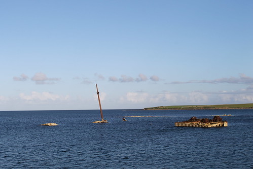
06032012 (130)
Blockships sunk into entrances of Scapa Flow
With that, the cabbie drove me back to Kirkwall where I quickly retreated to my hostel, cleaned up from the day, planned my timetable for the next day, and went to bed. I know this was a lot to do in one day, but like I said before, Orkney is a fascinating place with so much varied history, it's hard not to detail all I learned and my thoughts and experiences! Hopefully you made it to the end here, and you'll be rewarded with some nice photos below :)
Monday, August 22, 2011

Ireland: Back to the Cliffs of Moher and the Burren

Trip Date: August 7, 2011

For as small of a country as Ireland is - it's just a little bigger than West Virginia - it takes a long time to get anywhere! Mostly this is due to the narrow, winding roads, but it's also due in large part to the fact that the transportation infrastructure is dictated by the topography and Ireland is a very mountainous country! For these reasons, we got up early, finished packing, took showers, ate a quick breakfast, and prepared Agma for our departure. With suitcases packed as orderly as possible and everyone tight on space, we left Bantry shortly after 9am.

It took us a while to get back on to any major sort of highway, but we joined the big one just near Killarney and kept driving until the little town of Adare, just southwest of Limerick. It was a cute town with some neat ruins and churches and thatched roofs, but all in all, the few restaurants that were open were ex-pen-sive and I immediately got the feeling that this was the town where wealthy people from Limerick come to play golf... We stopped in Limerick, too, albeit very briefly for a late morning meal which we got in a restaurant beneath a parking garage after getting lost a little bit. I don't think anyone else was too psyched about stopping there but we didn't see much else open. The restaurant was big, however, and had a lot of large TV screens showing an Irish Hurling match.

Hurling is a game that goes back almost 4,000 years! It's central to Gaelic culture and each county in Ireland has a team. The players are all amateurs in the sense that none of them get paid, but being on a team is highly respected, and there is no way I would want to go toe to toe with any hurler. Hurling is a hybrid of soccer, rugby, lacross, and...well...quidditch (yup, I went there). Players on each team use their hands and a hurley (a type of stick) to hit the sliotar (ball) between uprights at the opponent's end of the field for a point or into the goalie-guarded net below the uprights for a goal (worth three points). There's a lot of smashing and grabbing and throwing and bouncing, but we caught on pretty quickly. The national championships are all played in Croke Park, a stadium in Dublin. Croke Park is interesting because it was here on Bloody Sunday in 1920 that English officers entered the stadium during a football match and started shooting into the crowds in retaliation for the murder of other English officers earlier in the day by Michael Collins. While the stadium is the third largest in Europe, only traditional Irish games administered by the Gaelic Athletic Association can be played in the stadium. All other sports that appear to have a direct competition with Irish sports, including rugby and association football, must now obtain special permission to use the facilities after a total ban was recently lifted.

Back on the highway after getting our fill of food and hurling (the sport), we were one our way back up to where I first came with Ryan and Sarah, to the Cliffs of Moher and the Burren. Britta and Carl, while having been to Ireland before, never got up to this part so this was especially exciting for them! We once again parked in the over-crowded, touristy parking lot at the cliffs and walked over. It was much better weather today than it was when I was here with Ryan and Sarah. Lizzie and Rob wanted to take photos like Sarah, Ryan, and I had done out on the adjoining private property, so we went off and let Dad, Britta, and Carl do their own thing. Dad watched Britta and Carl go up on another trail close to the cliff edge and while he enjoyed the views, he couldn't take the heights and went back to the car.
Beautiful Cliffs of Moher
Lookout castle at the cliffs
Clear view out to the Aryn Islands
Lizzie and Rob 400 feet up!
Me 400 feet up! (ocean for scale)
We found Dad back at the car and soon we were all packed in again, ready to head to the Burren, but not before taking a nice country road into the town of Doolin, famous all over the world for its traditional Irish pub music. A lot of people now say that Doolin is too overrun by tourists and non-traditional, non-Irish musicians that it's lost its charm. Just don't tell that to the people a Gus O'Connor's Pub because they seemed to be having quite a good time!
Neat castle on the road to Doolin
Irish group playing their tunes for no one in particular except themselves!
But this little guy was enjoying the music, too!
And another group in the room next to ours. Fantastic music!
Dad outside of Gus O'Connor's Pub
The last time that my family was in the Burren it was rainy and everyone was wet so the windows were fogged up and it was dark out, so we never really got a good chance to experience the Burren. That was in 2001 and I had the pleasure of already being here on this trip, so I brought them back to through the Burren by way of the Poulnabrone Portal Tomb. It started spitting a little bit so we didn't linger long and while one the road through the Burren we came across some good luck. We found the END of the rainbow!!
Back at the Poulnabrone Portal Tomb
Rob, Lizzie, and me
The rainbow ended right in that field!! If only we stopped to see if there was really a pot of gold there..
While you can see a lot of grass in the photo above, the Burren is much more rocky with extremely little vegetation of any sort, especially as you get closer to the shore and the town of Ballyvaughn. We drove the coastal route and pulled in to the town of Oranmore right around 9pm, found a cheap hotel, and then brought fish 'n' chips back to the room while playing a round of cards. And the next thing we knew, we only had one day left in Ireland.

Saturday, August 20, 2011

Ireland: Beara Peninsula and more of the Sheep's Head Peninsula and Bantry

Trip Date: August 6, 2011

Ryan and Sarah left early this morning to head back to Dublin for the day before their flight left which left Lizzie, Rob, Carl, Britta, my Dad, and me to continue exploring Ireland on our own. In southwest Ireland there are five major peninsulas that stick out into the Atlantic Ocean: the Dingle, Iveraugh, Beara, Sheep's Head, and Mizen Head Peninsulas. Already on this trip we explored four of the five (click the links) and today was the day we'd explore the fifth and final one - the Beara Peninsula. And it was about time, too since we'd been waking up looking at it every day of the trip!

But first, Dad wanted to see more of the Sheep's Head Peninsula and so while Carl slept in, the rest of us got in the van and drove up and over the ridge above Agma to the little town of Kilcrohane, stopping along the way to see a neat castle ruins in the morning sun. We walked around Kilcrohane in about five minutes and there isn't much there other than a neat old church, two small cafes, a hostel or two, and a tiny town store where we each got a little snack of sorts. The road out of Kilcrohane goes back up to the ridge of the Sheep's Head Peninsula where there are great views of the landscape and a ring fort in ruins.
Castle ruins on the Sheep's Head Peninsula
View from above Kilcrohane with a ring fort ruins on top of the hill and the Fastnet Rock Lighthouse way in the distance
Fastnet Rock Lighthouse
Ring fort ruins
Looking up to the ridge of the Sheep's Head Peninsula
We didn't leave for the Beara Peninsula until early afternoon as we didn't think it was going to take us that long to get out to the end of it. After all, it's only 30 miles long! With everyone packed into a mini-van and with our Ordnance Survey Ireland maps in had, we hit the road. The neat thing about the OSI maps is that they are incredibly detailed and mark each neolithic standing stone, ring fort, or burial tomb as well as any castles or abbeys or ruins of both, and only when you use those maps do you realize that these types of ruins are literally all over Ireland!

The first little stop we made was in the little town of Castletownbere, about two-thirds of the way out the Beara Peninsula. I think it's the biggest town on the peninsula and they have their own medical center there, but I was told by a girl in a shop in Bantry that any medical emergencies have to be brought back to Bantry! It's a neat town with the typical Irish one main road lined with pubs and shops and a church. We stopped in the McCarthy's Pub for a half-pint before going on our way and learned from the bartenders that the town and pub have been featured before in films. Now, whether you've seen or even heard of the films is a different story. My dad wrote down the names of the films and I've seen one of them so far called, Ondine, starring Colin Farrell. There was also a poster for a book by the same name as the pub, McCarthy's Pub, written by Pete McCarthy and has been reviewed to be, "...like Bryson without all the boring parts," so I couldn't not buy it, which was worth it because the bartender pulled out a huge notarizing stamp to make the purchase official! I haven't read it yet, but I'm excited to dive into it soon!
Church in Castletownbere
Pints, book, and notarizing stamp
Recreating the cover of the book
Just to the west of Castletownbere are some property gates that clearly mark the entrance to some grand estate. Turns out that this is the entrance to Dunboy Castle and the Puxley Mansion. Dunboy Castle is the site of the seat of the O'Sullivan Beare Clan who owned and ruled over the Beara Peninsula until it came under attack in 1601 from Cromwellian forces and finally fell in 1602. You can't really see much of the Dunboy Castle, though because the a land agent from Galway came into posession of the land in the late 1600s and added on the more formidable front of the Puxley Mansion. Down the road from the Puxley Mansion are the ruins of the Dunboy Monastery, built by a Spanish bishop in the early 1500s and later dismantled by pirates! It is unclear whether this Monastery was already in ruins by the time the English took over in 1602 or if those details belong to a Monastery built at the end of the Beara Peninsula. Nevertheless, buried in the ruins of the monastic chapel are the descendents of the O'Sullivan Beare clan, placed there in the late 1700s.
Ruins of the Dunboy Monastery
Group shot on the ruins
Though pretty simple and small, the ruins of the Monastery are pretty neat to explore
Old shipping quay used for the Dunboy Castle and/or the Puxley Mansion
The Dunboy Castle is attached to this building, but it is behind it so you can't see it from here. The Mansion was burned out by fire in the early 1900s and has since been restored and is going to open up as a modern hotel.
We kept driving for a while before making the turn onto the little single-lane road that brings you out to the very end of the Beara Peninsula, passing a neolithic portal tomb that is now in the middle of a cow field. A few settlements of B&Bs and tiny cafes are out here, but there's really not much else other than farmland. But what it must be like to live out here all year round! At the end of the Beara Peninsula is Ireland's only cable-car which brings farmers, hikers, visitors, and cows (yes, cows) back and forth from the mainland to Dursey Island, which has an old and varied history as well.

Vikings arrived in Ireland in 800 AD and found Dursey Island to be a good place to export Irish slaves back to Scandinavia. The island held this purpose until the Vikings left in 1150 AD, not long after they decided that Greenland would be a suitable place to explore and settle. The monastery on Dursey Island may be the one I referred to above that was built in the early 1500s and destroyed by pirates before 1600. Ireland should clarify this because now I'm confused! A castle, Oileán Beag, was also built on a small island near the larger Dursey Island, connected by a drawbridge. In the early 1600s the chieftan, Donal Cam, leading Irish resistant forces against English Royalist rule lost a battle at Kinsale down near Cork and fled to Dunboy Castle until that castle was taken by the English. The O'Sullivan Beare clan aided the English in attacking the castle built out on Dursey Island because Donal Cam had kidnapped the O'Sullivan clan's leader's wife, who was being held at Oileán Beag. The seige on Oileán Beag resulted in the razing of the castle, the rescue of Owen O'Sullivan's wife, and the massacre and pillaging of over 300 people. Today, Dursey Island is very peaceful and home to fishermen and farmers and is a fantastic place for hiking, wildlife viewing, and exploring, but the only way out to the island is by the cable car, which I've been told smells like cows...

We stayed out at the end of the Beara Peninsula for a little while reading all of the information signs before getting in the car and beginning the drive back to Bantry. Along the way, though, we stopped a few times for a quick snack and photos. 
Cow lying by a portal tomb

Sheep bouncing along at the end of the Beara Peninsula
 
Tír na nÓg is an Irish mytical land with no sickness or evil found at the ends of the world. If you remember in the movie, "Titanic" as the boat is sinking one of the third-class mothers is tucking her kids into bed while the water is rising and telling of the legendary land of Tír na nÓg. That's this place, but I guarantee that if you swim 25 km out that direction, you won't find anything but very deep water!
Me with the Skellig Islands off in the background
Irish farms on the Beara Peninsula
More farms
Ruins of a castle or signal tower on the Beara Peninsula
 
Standing stone off the road. These things are all over this part of Ireland!
The sun was setting by the time we got back into Bantry. Some of our group had not yet been to the Bantry House, the nice old hotel in town, so we quickly pulled up to the house and climbed the huge stairway to a hill overlooking the house and the bay for a few quick photos. We had one more sight to see before the sun set and that was the Kilnaurane Pillar Stone. A relict of the earliest Christian settlements in Ireland, the Kilnaurane is the oldest Christian symbol erected on the island - at least it is the oldest preserved Christian monument. It takes a little while to find as the roadside sign is covered by tree branches but it's worth the quick walk through fresh cow fields. I wish I had more information on it, but it's kind of hard to find any info on the internet so I'm not sure exactly how old it is or its whole story, unfortunately.
Lizzie and Rob on top of the hill behind the Bantry House
The beautifully overgrown Bantry House
Sunset over the Bantry House grounds
 
Me with the Kilnaurane Pillar Stone.
With another full day of sightseeing, we had one thing left to do on our last night in Bantry: hit up some of the pubs downtown! Dad wanted us to get a pint (half-pint for him) at the Anchor Tavern and the Denis Lucey pubs and Rob had seen another Bantry pub, Ma Murphy, featured in a calendar of Irish Pubs. So while the old guy had his half-pints, I taught Rob a thing or two about drinking pints! It was a very fun night ending with a late-night spaghetti dinner back at Agma before we all went to bed.
Creative Commons License
This work by Eric W. Portenga is licensed under a Creative Commons Attribution-NonCommercial-NoDerivs 3.0 Unported License.