Trip Date: August 5, 2011
It was another early morning in Agma and we all were determined to be on the road by 9am! We left Bantry early and started driving north to the town of Kenmare to start our driving tour of the ever-famous Ring of Kerry - arguably one of Ireland's most famous tourist destinations. Now, the Ring of Kerry was a stunning drive and I'll get into more detail about that, but the road to get there was equally as beautiful, especially in the morning when traffic wasn't too bad. The drive consisted of going through small towns and along a road cut right into the side of the Irish mountains and even going through a few tunnels blasted right into the rock!
 |
| Our departure was delayed due to traffic on the road |
 |
| One of the views along the drive from Bantry to Kenmare |
 |
| Road winding around the mountains |
Kenmare was a cute little town with the painted row houses, family-owned shops, green town square, and narrow bridges over creeks, but we didn't have time to stop and just drove through. (But if you wanted to see a neolithic stone circle without getting too far away from town, there's one right in Kenmare!) Numerous guidebooks told us that if we really wanted to get the most out of our drive along the Ring of Kerry, we should drive the ring clockwise instead of counterclockwise because all of the big tour buses go counterclockwise and while it's nerve-wracking having those things come barreling down the road toward you, it's more frustrating to be stuck behind a whole line of buses without being able to pass. That, and if you go counterclockwise like the tour buses you'll end up seeing all of the sites along with hundreds of other people...not really a fun way to do things!
The Kerry Peninsula is beautiful with stark, rugged mountains jutting up out of the sea on the southern side of the peninsula but with a more gentle slope down to the sea on the north side of the mountains. If you do
any driving in Ireland at all, I suggest picking up the Ordnance Survey Ireland road maps (available at any Tourist Information center). They are the most detailed road maps and they mark where every type of ruin or ancient tomb or fort is located and not just the popular ones you see on the maps. We drove west with the ocean on one side and mountains on the other until we came out to a nice little turn off with a good view of the ocean.
 |
| Tour bus passing Ryan's car early in the drive. They were lucky as this is an exceedingly wide road by Irish standards! |
 |
| Lizzie and Rob at our first little turn out |
 |
| The little cove looked almost caribbean! |
Just off of the main road from this first brief stop, we made our real first stop of our trip at a place called the Staigue Fort, one of the oldest and best preserved stone forts, erected a few centuries AD before Christianity came to Ireland. The Staigue Fort is presumed to be the fortress of a land owner or Chieftain who required some deal of security, possibly from invading clans. The Fort is an architectural masterpiece as it is about 20 feet high in some places and the walls are about 10 feet thick and none of the stones are held together with any sort of mortar! In its hey-day, the fort probably housed a number of tents and a few families. The only access to the fort was through a tiny covered entry-way which had two smaller walls coming in from either side so you had to almost go sideways through the portal.
 |
| The Staigue Fort |
 |
| Oh Lizzie |
 |
| The inside of the Staigue Fort, nearly 100 feet across! |
 |
| Sheep outside the fort. Sheep belonging to different farmers are allowed to graze together wherever, but they are each painted with a different color so farmers know which are theirs! |
 |
| Beautiful view from the fort out to the ocean |
 |
| Goodbye, Staigue Fort! |
With the Staigue Fort behind us, we got back on the main road and worked our way out to western end of the Ring of Kerry. The views of the oceans and the islands out there are just stunning when you get the chance to see them! It's hard not to take advantage of every little turn out for a photo opportunity, but you get the chance to see more ruins, ring forts, and beautiful landscapes!
 |
| Storms coming in off the ocean |
 |
| Irish countryside |
 |
| Small harbor |
 |
| Oh you know, just another ring fort in someone's backyard |
 |
| Yesterday, I mentioned how I wanted to go to the Skellig Islands. Well, these are them! They are 8 miles offshore and you can get boat access to the second (the one on the left). The white one on the right is home to a large gannet population and the rock is so white due to gannet droppings. The one on the left is Skellig Mikael and you hike up the 600 steps to get to the lower peak on the right side of the island. There, an ancient monastery is built with traditional dwellings that look like beehives made of stone. On the higher peak, to the left, is another hermitage, but that is now completely off limits without a license. Skellig Mikael is a UNESCO World Heritage Site. Next time, Skelligs...next time |
Around the end of the Ring of Kerry is a pretty town right on the water called, Waterville. Our cars had been separated and so we met back up there, but didn't spend any more time in the town. But that little visit did inform us that this was a town that Charlie Chaplain visited frequently. Who knew? The day was already getting on and we were getting hungry but we kept driving around the peninsula and didn't stop to eat until we got to Glenbeigh, because really, on the northern part of the Ring of Kerry, there aren't many landmarks to stop and visit, but you just sit in the car and enjoy the beautiful scenery!
We had a delicious lunch at the Towers Inn, right in the center of town, and made plans for the rest of the day. Britta and Carl had seen a castle in ruins right before entering Glenbeigh and Dad did not want to go any farther than he needed to for the day, so after lunch the three of them went to explore the castle, after which they drove into Killarney, the starting spot for most tour buses doing the Ring of Kerry. Killarney is a cool place that I've been to each time I've been to Ireland. Dad's car visited the Killarney National Park and the Muckross House, a very old mansion in the park. On their way home, or when they were in the Park, they got to see some of Ireland's larger wildlife in the form of three stags, bounding through the woods!
So while Dad's car had their adventure, I transferred over into Ryan's car with Sarah, Lizzie, and Rob and we continued up to the next peninsula to the north, the famous Dingle Peninsula! The town of Dingle (Anglicized version of An Daingean) is situated in what Ireland calls their Gaeltachts, regions of the country where the Celtic Irish culture is very much in tact in terms of the use of the Irish Gaelic language, the music, the craftsmanship, etc. But Dingle is caught in the middle of an interesting debate. When a part of Ireland became incorporated into one of these Gaeltachts, all of the signs are supposed to be in Irish, not English. Dingle, however, is one of Ireland's biggest tiny tourist towns and is known around the world as "Dingle" and not "An Daingean." Town leaders and Gaeltachts organizers came to the compromise that on official maps, both the Irish and English names would be seen, rather than eliminating the Irish name. On road signs, however, you see signs pointing you toward An Daingean with a sticker added below with the name Dingle in parentheses. One of the other things Dingle is famous for is its local dolphin, Fungie, who showed up in the harbor over 20 years ago as an orphaned baby and has become a local legend you can visit yourself if you pay for a harbor tour...
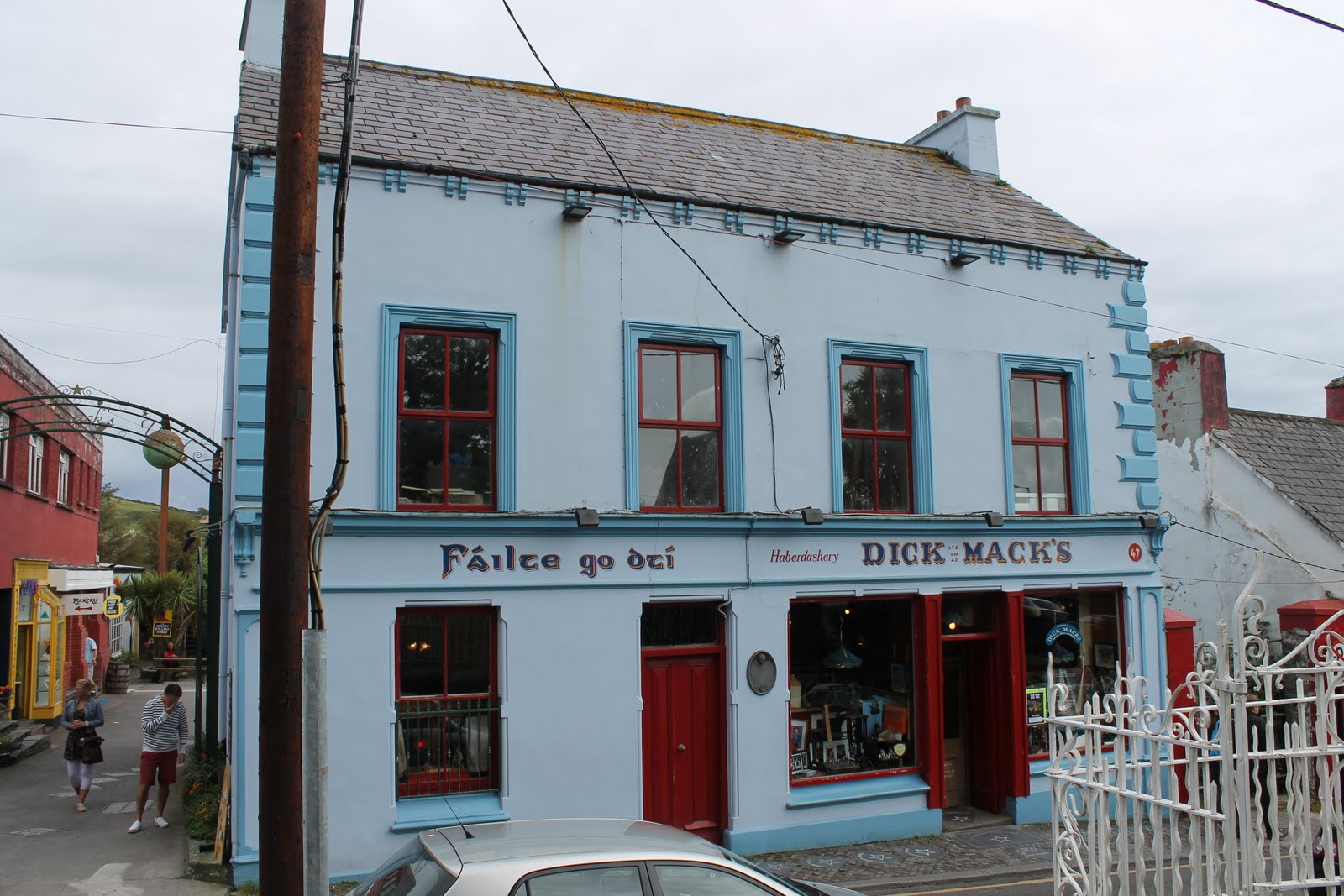
Our group split up in Dingle and we each wandered around our own ways with plans to meet back up at a pub right on the harbor front. When that time came, however, Ryan and Sarah had a better idea. They picked up a "Best of Ireland's Pubs by Town" coffee table book and the most famous pub in Dingle was a place called Dick Mack's and the book showed a photo of an older man dressed up as you would expect any traditional Irishman with an overcoat and hat. The book claimed that this was Oliver Mack, Dick Mack's son (or Grandson, I forget). Ryan and Sarah peeked in the bar before meeting up with us downtown and they kept going on about how, "Oliver Mack is there! Right now!" They convinced us all to go check out the pub and have our pint there. So we walked back up the hill to the pub and went in. Ryan and Sarah were immediately disappointed because they no longer saw Oliver sitting at the bar anymore. A little downtrodden, we got our pints anyway and found a table. But then, a miracle happened, and Oliver walked past the window behind our table to the bathroom. Immediately, Ryan got up and followed him (maybe he had to go to the bathroom, too). He came back with a huge grin on his face and said, "He talked to me!" We all got a good laugh at that and then noticed that Oliver was heading outside and sat down at a table out there. After everything that just happened - the hype, the pub, the man - I couldn't resist getting something on film, so I sauntered outside and checked out a few of the other shops that were off the alleyway, taking photos as I went along and took some of the church across the street (or that was my excuse to take a photo of Oliver Mack). We all got a kick out of the whole experience and it was probably one of the highlights of Ryan's trip!
 |
| Dick Mack's |
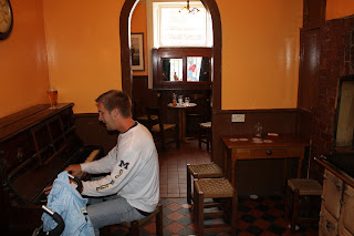 |
| Ryan was inspired by previous performers to jump on the piano in the pub and play a little tune |
 |
| The alleyway behind Dick Mack's |
 |
| The famous man of the evening himself |
 |
| Ryan and Sarah in front of Dick Mack's |
 |
| A statue of Fungie, the dolphin, in the Dingle Harbor |
We left Dingle a little bit later than we expected, but quickly got back on track, heading north out of town through the narrow and tiny Connor Pass, where in some places it is
literally too narrow to pass another car. In fact, we clipped mirrors with a car at one point. Luckily, everyone takes this pass slowly and because of its dimensions, it is impossible for tour buses to get through, so you never have to worry about that encounter!
 |
| People taking photos and flying kites up at Connor Pass |
 |
| Large fences and ruins down in the valleys. See sheep for scale |
 |
| Little creek cutting through the rocks |
 |
| Our turn to let cars go by where it's wide enough |
 |
| Their turn to let us go by! |
 |
| Irish countryside nestled into the mountains |
We drove another few hours toward Tralee and then down to Killarney. The countryside was beautiful, but everyone in the car was getting nappy by that point and I didn't beg to stop to take pictures every ten feet, as I had been doing before, so it was just a nice relaxing ride. Killarney, as I mentioned before, is where many tourists start their journey on the Ring of Kerry and not a lot of guidebooks have a lot of good things to say about the city: it's touristy, lost its charm, commercialized, and not worth stopping. But what they don't realize is that the influx of tourists to this town have created a thriving, vibrant downtown area with a million options for getting dinner or a drink or both. And with that many options, you're bound to find some good food for pretty darn cheap, which is what we found!
Killarney was interesting, but it was beginning to get dark and we had a long ways yet to get back to Bantry. The most direct route led us through the Killarney National Park which was just beautiful from I could see in the fading light. And we, too, saw our share of larger Irish wildlife. In fact, we almost hit it! But the few little deer on the side of the road luckily were smart enough not to venture out onto the road. By the time we got back to Kenmare, it was pretty much night time and driving through the countryside at night, on the windy roads, with only a little heads up from the headlight glow from approaching cars was very scary. We turned the radio off and just let Ryan focus on the road. We got back late, but safely, and for the rest of the night Ryan and Sarah started packing as they had plans to drive back to Dublin that very next morning.


No comments:
Post a Comment