Sunday, April 6, 2014

Australia: Skiing Perisher and Thredbo

Dates Traveled: 9-11 August 2013

It was a Thursday before a weekend I was not planning on leaving Sydney, but I had some friends driving down that night for a long ski weekend in Australia's Snowy Mountains. An invitation was given kind of last minute as someone had dropped out and there was suddenly space in the car. While my bank account said, "No," my heart said, "Go!" And soon, I was off for my first International skiing experience!

Australians don't seem to realise just how cool their own backyard is, it seems! Everyone I spoke to about skiing in Australia just kind of scoffed at their resorts and in a seemingly ashamed way told me that, "Well, it's nothing like New Zealand, or Japan, or the Rockies, or the Alps." But growing up in Michigan, skiing anywhere that is more than a big hill is pretty exciting for me! But it wasn't just the quality of skiing Australians scoffed at. When I told people I wanted to climb Mt. Kosciuszko, Australia's tallest peak, which is in the Snowy Mountains (in Kosciuszko National Park), the typical response was, "Oh, don't waste your time. You don't really climb it but walk up to the top, anyway." So because of all of this, I wasn't really sure what to expect. The main resorts in New South Wales are near the town of Jindabyne, pinched between the New South Wales-Victoria border and the Australian Capital Territory. I'd been to Jindabyne the previous November while doing field work and saw all of the rental facilities, restaurants, repair shops, and hotels that were all closed for the season then, and I figured that surely the skiing must be good enough to support this much infrastructure.

The Snowy Mountians
The aptly named Snowy Mountains, Australia's highest mountain range
Needless to say, I was confused about the trip, but was excited to go. There were five guys that I knew going, both skiers and snowboarders of various levels of expertise and after a night spent in Cooma, we stopped in Jindabyne to pick up a few sets of rentals for my friends, and continued on the road up to Perisher where we were going to spend two days skiing.

Let me say this, and let me be clear about something: Australian mountains are nothing to be ashamed of! The granite mountains were tall with wonderfully deep valleys and the white snow that blanketed the tops of the mountains contrasted awesomely with the green valleys! Of course they aren't Alps or Rockies, and the ski resorts are few, but that area is beautiful!

I quickly hurried in to get my rentals from the resort and by mid-morning, we were all set to go! The sun was shining and we all set off as a group around Perisher. I've never skied anything like Perisher before! The granite mountain was nicely rounded and there were huge outcrops sticking up out of the snow which made the resort to be a veritable playground for a quality skier. Plenty of little jumps to hit and nice tree-less runs that you could build up huge speeds with enough space to race in and out of the outcrops.

Cloud Cover
White-out conditions on top of Perisher
It didn't take long for our rather large group to splinter and my friend Craig and I were soon off to explore more challenging terrain. The west end of the resort is where the highest slopes are and we slowly worked our way up to the lifts on the far side. As the afternoon carried on, the weather started to get nasty and an incredibly dense fog moved in, but only blanketing the top of the mountains. We kept taking the lifts up, though it was pretty scary skiing down a slope on ice where you can only see a few metres in front of you! Once we got about a third of the way down, though, it was still foggy but you could see much farther, and then at the bottom everything cleared up just fine. We did that a few more times but the fog got worse and soon I couldn't see where Craig was. I noticed some orange posts in front of me to my left and to my right with a gap between. Knowing that the posts indicated huge rocks I should try to avoid, I decided to go through the middle. Looking over my shoulder for Craig to show him which way I went was a mistake because as soon as I did, my skis dropped out from under me as I went off some sort of steep edge and my body slammed into a snow bank below. I thank God there wasn't a rock there and that I had my helmet on, because I hit the ground hard! Somehow or other, Craig saw me and came to my aid laughing at me all the while.

Perisher
Perfect weather in a beautiful winter wonderland at Perisher
I was a little dazed, but got up quickly enough and we kept going until the lifts shut down for the night. The great thing about the bad weather that night was that it gave us a ton of awesome fresh powder for the next day, which weather-wise, was the best you could have. Clear and sunny, warm but skiable. Our group started off together, but again split up shortly into the day, meeting up every so often to do a few runs or get a coffee. One of the really weird (but cool) things about skiing in Australia is that you're skiing through gum trees which don't lose their leaves ever throughout the year. So while anywhere else in the world you ski through evergreens and leaf-less gray trees, in Australia, you ski through lush green vegetation. And the branches are high enough that there is plenty of room to maneuver through them like wide open glades. Like I said, Perisher was just a skiers playground! Plenty of great runs, fun terrain, and lots of variety!

The third day we switched it up a bit and headed to the nearby, and probably more popular resort of Thredbo. Thredbo occupies generally steeper terrain and the runs are your more typical alpine runs and lanes as opposed to Perisher's openness. Australia's highest lifted point is here, and it is well above the treeline so the winds just rip across the mountain top, blowing away much of the powder and leaving behind a thin sheen of ice that you really have to carve through to get your hold. It wasn't long before three of us headed up to the top (via a series of T-bar lifts, which I found really bizarre!).  Here too, there were big granite outcrops and Rick, Craig and I started off toward the Golf Course Bowl (not sure why it's called that - I get the bowl part, but not the rest), but it was roped off so we had to navigate our way down a different way. There was a turnoff to go down an insanely steep chute called Cannonball and Rick and Craig just took off. Not wanting to get too far behind, but being less adventurous than them, I took my time. And holy hell!! It was pretty much a vertical drop covered with moguls with nothing but ice to try and grip into! Needless to say, it put my skills to the test, but I got through.

THE TOP
The highest lifted point in Australia! Top of the world!
A fun thing we all did throughout the weekend was track our runs using the Alpine Replay app for our phones. The app has trail maps from ski resorts around the world loaded in and uses your GPS position while you're on a chairlift to figure out exactly where you are. It then monitors your speed, records the total elevation you've skied, and tracks the runs you've taken with GPS. It also uses the accelerometer inside the phone to log how many jumps you've landed and how much air time you've had throughout the day. Without meaning to, I checked my speed at the bottom of one of the runs I bombed down and saw that I reached a top speed of 79.4 kph (50 mph)!! For the rest of the day, I tried breaking the 80 kph barrier before I realised it was a reckless endeavor and that I'd end up seriously injuring myself if I didn't stop!

The Guys
The guys who ski!
Anyway, it was a great time with good friends and we had the most perfect weather for the weekend! By late afternoon of that third day, it was time to pack up and start the long six-hour drive back to Sydney. I may have learned to ski on little wee hills in Michigan, but I've skied the Green Mountains and the Appalachian Mountains in Maine, and I've got to hand it to Australia. Your resorts may be few, but they are fun and challenging and it was well worth taking some time out from my week to spend it in the Snowy Mountains with great friends!

Australia: Kings Canyon / Watarrka National Park

Travel Date: 20 August 2013

We didn’t have to wake up as early this morning as we did the previous morning, but after an early rise, and a quick pack up of our swags and gear back into the bus, we made the short drive to Kings Canyon in Watarrkah National Park. Kings Canyon lays claim to being the world’s largest canyon, surpassing all others including Arizona’s Grand Canyon, because “technically the Grand Canyon is a chasm.” I had even read that Kings Canyon was even more impressive than Uluru, so needless to say, my expectations were very high!

From the parking lot, Adam pointed out the canyon which cuts its way through the sandstone ridge to the north, and to the trail that we were taking which follows the rim of the canyon. Looking at it from the parking lot, it was clear that my expectations of grandeur were going to be dashed. Semantics aside, the canyon is definitely not bigger than the Grand Canyon (not by a long shot!) and in my opinion, not more spectacular than Uluru.

Kings Canyon Illumination
Panorama of Kings Canyon in Watarrka National Park

 With that said, Kings Canyon is marvelous! The trail heads up Heart Attack Hill to the top of the rim and winds in and out and between impressive sandstone formations that have weathered over time into these dome-like features. Erosion along joints – natural fractures in the rock – wore down the rock in grid-like patterns and some of these more deeply-eroded joints are what separate one dome from the next. And in the extreme case of Kings Canyon, stream erosion cut down hundreds of metres into the sandstone carving out a spectacularly beautiful canyon filled with eucalypts and other green trees. You might even recognise the landscape of Kings Canyon if you’ve ever seen the seminal Australian film, The Adventures of Priscilla Queen of the Desert as this is where the shot of the three drag queens stand on the Canyon’s edge in their fabulous dresses and feathery headwear!

Kings Canyon Vista
Dome structures created by erosion along joints in the sandstone dot the
landscape of Kings Canyon in Watarrka National Park
The trail eventually takes you to the narrowest part of Kings Canyon where you descend a few flights of stairs to The Garden of Eden, an aptly named oasis where water collects in large permanent water holes spanning the narrow canyon width with towering rock cliffs rising above your head. Palms and more tropical gum trees fill the lush Garden in stark contrast to the scrubby and white ghost gums growing up on top of the canyon. The ponds were a great place for a small lunch and break from the sun, but soon enough we headed up another flight of stairs and continued to an amazing canyon lookout where we could belly up to the edge of the canyon and look straight down the cliff faces!

The trail finishes by coming down the mouth of the canyon opposite Heart Attack Hill and those of us at the front of the group lamented as we waited for the stragglers who were taking photos of every single flower, rock, small lizard, spider, or whatever they could find. Adam was about at his wit’s end trying to keep us on schedule, but we eventually mustered back at the bus and we began the 6-hour drive back to Alice Springs.

Ghost Gum Trunk
Looking up the trunk of a ghost gum in Watarrka National Park
We had yet to use the bus’s 4WD capabilities, but instead of taking the paved road back to the Stuart Highway via the Lasseter Highway, we bounded off the pavement making a bee-line straight back to the Stuart via a series of dusty, dirty, bouncy, bumpy dirt roads that no normal vehicle would survive! It was great fun and the vibrating floor provided for a nice foot massage after three days of intense walking! Everyone seemed to be enjoying it except, of course, for the Canadian fashionista who clearly had no concept of what four-wheel-driving was all about. At one point, the bus came to a stop as Adam had to get a clear look as to how best to navigate through an area of soft sand. The fashionista opened her eyes as we stopped, looked out the window and in a moment that defies all logic turned to me and asked, “Is this Alice Springs?” There were no buildings to be seen anywhere around us and we’d only been on the road for a few hours, and in disbelief at her question just stared at her and shook my head. “We’ve still got at least three hours,” I said. She just scoffed and started getting all worked up again at how annoying it was that we weren’t there yet, and what was this bumpy road? She couldn’t even get a good nap! While she was a very nice person, surely with good intentions, I could not wait to get away from her negative attitude. It just astounded me that someone could be so unprepared and not have even the slightest idea of what she was signing up for when she booked her trip. She was a trooper and did everything the rest of us did with a smile, and a joke, and funny stories, but I was glad that in a few hours time, I was not going to have to listen to her complaints ever again!

The rest of the drive back to Alice Springs was pretty uneventful. We didn’t make any more stops, and we didn’t see any more wildlife, but that was alright. Once we were back on the paved road everyone started to nod off. Being on a trip for a few days, with the same people day-in and day-out can be tiring when you know who you’re with, but when personalities don’t match, 3 days can sometimes feel much longer!

Back in Alice Springs, everyone was dropped off at their hotels and hostels and I’m sure no one wanted anything more but to take a much-needed shower and just a bit of quiet alone time for a short while! I know I enjoyed mine! That night, though, we all reconvened at a pub for tour-discounted dinner and beers. It was sort of the last-hurrah as we all talked about our amazing three days in the Outback and talked about what our next planned adventures would be.

It was overall, a great three days of good company, amazing scenery, rich culture, and fun. It made me realise that organised tours and playing backpacker can be really fun, and sure, you might not see those people again, you all shared an experience, and that is really what traveling is all about, and this was no exception. An amazing three days were now over and I had one more night in Alice Springs before my flight left the next morning.

The morning of my flight, I had a few ours left to explore bits of Alice Springs and I walked to the café at the Olive Pink Botanic Garden across the River Todd. It is a much longer walk than it looks on the map, but the café was really good, and the botanic gardens were nice for a quiet morning before flying back to Sydney, re-entering the busy city life. A quick walk up the hill in the Botanic Gardens gave me one final glimpse of the dry, but brilliant landscape that is the Northern Territories and I’m already looking forward to the day that I return there.

Australia: Kata Tjuta

Travel Date: 19 August 2013

Just like watching the swirling colours of the sunset on Uluru the night before, watching the sunrise behind Uluru, illuminating its neighbouring rock formation, Kata Tjuta (better known as The Olgas) is not to be missed! Our tour was woken up nice and early in the pitch black and chilly cold. We quickly collected our belongings and rolled up our swags, and clambered into the tour bus for a 40-minute drive west to a viewing platform bang in the middle of the two amazing rock formations.

Uluru Sunrise
The sunrise in the east behind Uluru
The Olgas are in some ways more impressive than Uluru, albeit being much less known (though they feature prominently in the opening sequence to the Disney film The Rescuers Down Under). Whereas Uluru is one massive rock, Kata Tjuta is a cluster of towering rock stacks with rounded tops, and they are even taller than Uluru! Geologically, the rocks at Kata Tjuta and Uluru date back over 500 million years! An ancient mountain range to the west that was created during the Petermann Orogengy was the source for all of the sand and boulders that were eroded from the mountains and deposited in a large basin to the east of the mountains. Over time, these sediments built up and compressed earlier depositional strata into the sandstone and conglomerates that make up these rock formations. Over time, further compression and faulting tilted the rocks such that previously horizontal strata are now almost vertical! While Uluru is mostly sandstone, large boulders stick out of the steep conglomerate rock walls of Kata Tjuta.

We stopped at a designated viewing platform for the sunrise and along with at least one hundred other people waited as the sky started to lighten up behind Uluru to the east and eventually the sun peaked up over the horizon, silhouetting Uluru in the distance while illuminating the massive domes of The Olgas, turning them from shades of gray to pink to orange and yellow and red. It was a beautiful setting to be sure; however, the sheer number of people and cameras continuously clicking and the Canadian fashionista’s complaining about the cold made it much less peaceful as it could be, though if you could block those sounds out in your head, you could just imagine what it would have been like to see this every morning without the nearby roads or viewing platforms, and the whole experience takes you to a whole new place.

Breaking Light on Kata Tjuta
The breaking sunlight on Kata Tjuta (The Olgas)
Again, we had a lot of ground to cover today, and Adam, our guide, wasted no time in getting us back onto the bus and brought us to the parking lot at the locality of Petermann. The sun was already high in the sky. Considering the throng of people at the sunrise viewing platform, there were amazingly few people here at Kata Tjuta. As much as I loved how quiet it was here, it’s really too bad that so many thousands of people come all the way out here, to the middle of this huge country to get on a bus, drive to a viewing platform, take a few photos, and hop back on their plane. I can’t lie, I also took a lot of photos, but that is never enough for me. I couldn’t come all the way out here and not have an experience, to walk through the landscape, or listen to the wind and birds, or feel the sun’s radiating heat. I wish more people desired experiences in nature. Maybe we’d all have a better appreciation for our planet and our environments and become better, more humble people.

We got off the bus and prepared for a hike through the Valley of the Winds which takes you from the parking area between some of the massive rocks that are The Olgas and into the valley protected between them. Even in August, Australia’s winter, the sun can become too intense to be outside this far in the Outback, so any hikes should start promptly in the morning. The Olgas are also incredibly sacred to the local Aboriginal communities, but curiously, outside of those communities, no one knows why. At Uluru, there are places where you cannot take photos because of spiritual significance, but there are signs explaining why the site is sacred. At Kata Tjuta, nothing is off-limits, but the whole area holds such a deep spiritual importance that only those in the Aboriginal communities can know what it is!

Kata Tjuta - Valley of the Winds
Down in the Valley of the Winds at Kata Tjuta
The Valley of the Winds is aptly named as air from the heating rocks rises and pulls in air from the surrounding area that gets funneled and focused in the valleys between the rocks. It’s not a difficult walk into the valley, but it is a stunning walk as you work your way between amazingly steep rock walls with massive boulders sticking out. The valley itself is made up of gently rolling rocky hills with scrubby vegetation and a few gum trees dotting it. The walk takes about three hours, provides spectacular scenery dotted with intricate flowers, and is incredibly peaceful as anyone you walk past just smiles and nods their hellos, not wanting to ruin the quiet atmosphere. Because no one knows the real significance of Kata Tjuta, there almost isn’t much else to say because there is nothing to interpret.

We finished our walk in the late morning and set up our lunch back at the bus before we packed up at set off for another long drive. We left Kata Tjuta, passed Uluru once more, and drove the hour or so back to the Curtin Springs Roadhouse for a quick break before turning off the Lasseter Highway onto Luritja Road toward Watarrka National Park, home of Kings Canyon. We stopped once more to collect firewood for that night’s dinner that was a fun, if not frustrating pit stop. The Canadian fashionista hadn’t been with us the previous day when we collected firewood and was trying to write postcards to send back home as our bus drove down the bumpy, dusty dirt road. Trying to write while driving over washboard road conditions is no easy task, and one more than one occasion, she would slam down her pen and shout something along the lines of, “I’m trying to write a postcard! Can’t the bus just stop so I can finish? This is so hard!” Complaints that received nothing but an annoyed look from me as I asked her what she expected! My postcards were barely legible because of all of the bumping around, but I thought it was part of the fun! Not only was I describing to my family what I was doing, but they could actually see it in the squiggles in my lettering! She didn’t seem to understand and got even more flustered as the bus swerved to the left and right. Once we stopped, she finally finished her postcards (though she took her time, probably not wanting to get her clothes too dirty with all the red dust) while the rest of us ventured back out into snake country to collect firewood.

Camel Herd
A herd of feral camels in Australia
And we were in store for a treat before we left. As we loaded back onto the bus, someone spotted a little brownish-gold body bouncing between the trees and a single solitary dingo sauntered up to the bus! Frankly, I expected to see more dingoes than we did, but the curious little creature was the only one we saw and after figuring out we had nothing to offer it, he quickly sauntered away just as quickly as he came.

Further down the road, we were in for another treat as a massive herd of wild camels was socialising on the side of the road. Adam stopped our bus and we all got out, quietly stepping as close as we could to these amazing creatures without spooking them! There were dozens of them – mostly adults, but a few young ones, too and they just moved together, minding their own business. We stayed there, watching them for a while as another brilliant sunset lowered down toward the horizon. It was just such an odd sight, seeing the camels, not only because they are just funny looking animals, but because you just know they aren’t supposed to be there! The wild camel herds have naturalised so easily to the Australian Outback, their numbers can’t be culled. They’ve repopulated so well, and from such a small original stock, that people in the Middle East actually buy their camels back from Australia because the Australian camel genetics are so pure, they fetch quite a high price back in the Middle East!

The setting sun was blinding as we drove west  to Kings Canyon Resort but we eventually pulled in to our campsite for the night, got our fire up and blazing, made dinner, and set up our swags for another chilly night under brilliantly clear skies in the middle of the Outback.

Australia: Uluru


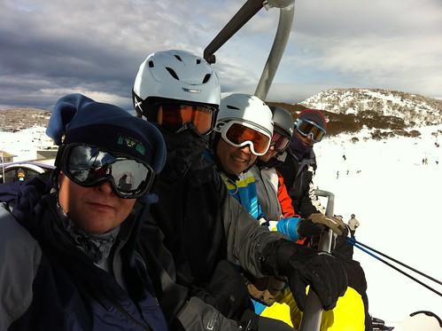
Travel Date: 18 August 2013

It was a rough morning trying to wake up on time and be out in front of the YHA Alice Springs in time to be picked up for my 3-day adventure in the Outback. Though I originally wanted to rent a 4WD and do the trek from Alice Springs to Uluru with friends, I wasn’t able to convince any of my friends to come along on this trip with me and I sure as hell wasn’t about to tempt fate by doing it on my own because with some of my travel luck, I’d inevitably get bogged down in some sand, run out of water, and get bitten by a snake trying to find a cell signal! So I booked a 3-day tour of some of the Outback’s most famous sites.

WayOutback tours offer a number of trips ranging from 3 days to over a week, some of which are more rugged than others. The one I’d booked was “all inclusive” in the sense that all food was provided for, sleeping arrangements were already made, and all I had to do was show up, sit down in the bus, and enjoy the scenery. Soon enough, a big…truck? I’m not entirely sure how to describe it. It was a vehicle that had the front cab of a small semi-truck and instead of a cargo hold on the back, it had a relatively small coach like a charter bus with big windows and two seats on either side. The bus accommodated 24 people and was jacked up on big 4WD tires.

Our driver, Adam, helped the two of us being picked up put our luggage in the storage hold on the back of the bus. It took us a while to pick up everyone else from their respective hotels and hostels around Alice Springs, but soon enough we had a nearly full bus with people from all over the world: an American girl, her father, and her Swedish friend, a hip-hop dance teacher from Amsterdam, a girl from Glasgow, an adventurous guy from Vancouver, and your typical handful of German and French backpackers.

The bus was chatty at first as we all were introducing ourselves and going through the typical banter common amongst backpackers in Australia, but it was still pitch black out and we had a good 6-hour drive ahead of us and soon enough everyone was sleeping.

The thing anyone needs to know about the Northern Territories is that there are very very few towns and everything is incredibly far apart! When you drive down the highway and come across a petrol station or bathroom, you stop and fill up and use the bathroom because you never know where the next one will be. Between the towns are small roadhouses that usually have a gas station, some hotel rooms, camping spots, toilets, and a bar.

Sleepy Dingo
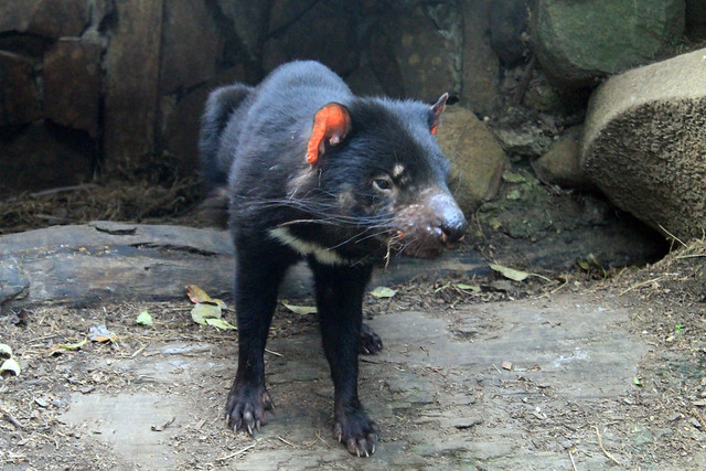
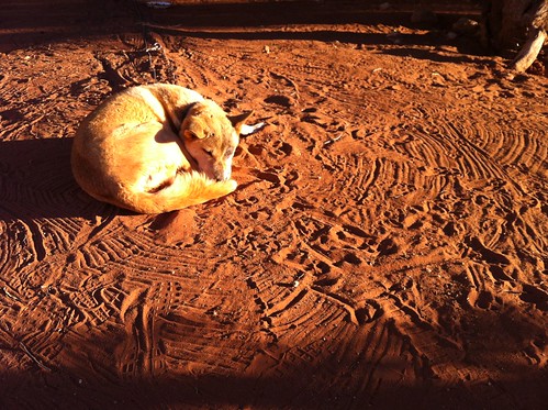
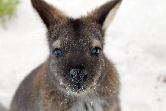
Sleeping dingo at the Stuart's Well Roadhouse south of Alice Springs
Our first stop was at one of these roadhouses, the Stuart’s Well Roadhouse, and it was the first chance we had to stretch our legs, and 
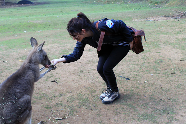
grab a coffee. This roadhouse was unique in that it also had a number of pens where Australian animals like emu, kangaroos, and various birds were on display 
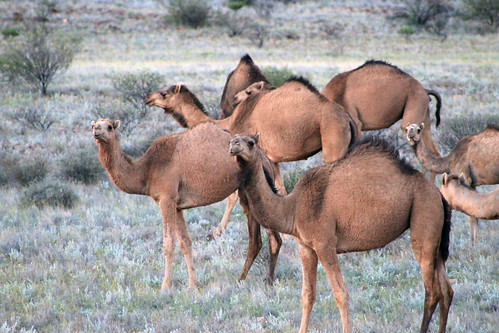
for tourists stopping in. But they also had two of the more unique sights in the Outback: camels and a dingo. Camels are obviously not native to Australia, but were imported from the Middle East because of their hardy survivalist instincts in desert environments and the preferred cargo animal over horses, which require a lot of water. A transcontinental telegraph cable was built from Adelaide to Darwin with Alice Springs being used as a transfer point along the way. Camels were used by the crew that laid down the cable. But like many non-native animals in Australia, some of the camels escaped and proliferated in the desert and today there are over one million wild camels roaming Western Australia and the Northern Territories. Dingoes were also introduced to Australia over 40,000 years ago and have also adapted and proliferated throughout the continent and have just recently been described as a separate canine species and not just a variety of wild dog. The one dingo at this roadhouse was old and used to tourists, so was not caged up and was pretty snoozy and docile.

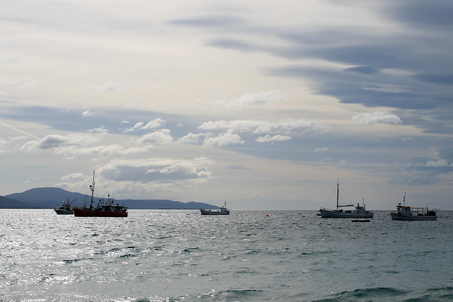
Adam, our driver, didn’t let us linger too long as we still had a long ways to go. We drove another few hours to the Erldunda Roadhouse for another bathroom break, and turned off the Stuart Highway onto the Lasseter Highway toward Uluru.

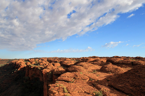
Most people have visions of Australia’s Outback as being rocky with lots of sandy deserts, dry eucalypts, and brilliant soils stained red by the rusting of iron in the dust and soil. These images are spot on what you actually see and it is beautiful! Nothing but flat land as far as the eye can see until a few low-lying rocky ridges or mesas rise up in the distance, 
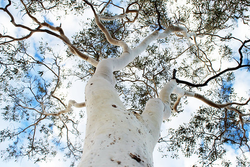
like Mt. Conner. But I was surprised at just how green it was! The trees were, by no means, lush and foresty, but the gum trees here were not as brown and dry as I thought they would be – really a testament to just how well-suited for every microclimate in Australia these trees are!

Mt. Conner
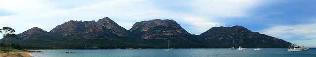
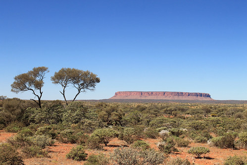
Mt. Conner off in the distance near Curtin Springs
We pulled off the main road shortly before the Curtin Springs roadhouse to collect some firewood for our campfire that night. Part of the reason why I booked this particular tour is that while everything was catered for us, we still had to participate in collecting firewood, preparing dinner, and washing up dishes. It gives you that little tinge of roughing it! Like anything in Australia, simple tasks, like collecting firewood carry inherent dangers. Out here, it was snakes. Some of the world’s most deadly snakes are found throughout Australia, but exceptionally potent ones here in the Outback. We had to be very careful when picking up dead wood that no snake was sunning itself nearby! But soon enough we had our firewood, and we made our pit stop at Curtin Springs, and carried on west to Uluru.

There were a lot of rocky plateaus and mesas in the distance along the Lasseter Highway and every time we thought we saw Uluru, Adam would shake his head and assured us and assured us, “You’ll know when you see it!” 
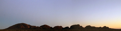
And sure enough, another few hours down the road, the rock loomed into view, dwarfing any and all other mesas we’d seen! Everyone knows what Uluru looks like as it’s one of the most photographed rocks in the world. And with good reason! It’s the world’s largest monolith – or single rock, and it juts up from the flat Outback surroundings to over 300 m in height. We kept driving closer and closer and Uluru kept getting bigger and bigger. Finally, we pulled into our campsite in Uluru-Kata Tjuta National Park.

I couldn’t wait to get up close with the massive rock, but it was going to have to wait a bit. A few more people were joining our tour, but were flying directly in to the airport at Uluru, rather than Alice Springs, so Adam gave us directions for lunch and he left to pick up the others. Soon he came back with a French family that had a few kids with them, and a blonde girl from Canada who was finishing up teaching fashion at a school in the Melbourne area. I’m not entirely sure if she knew what she was signing up for. Everyone else was dressed in hiking and outdoor gear and those of us who’d collected firewood were already covered in dust, whereas the Canadian fashionista rocked up in a flowy sequined top, hair done up like a pro, and flip flops more appropriate for a cocktails near the beach than heavy walking in the Outback!

With lunch in our stomachs, Adam gave us the cultural sensitivity talk about Uluru. The rock features in numerous Aboriginal stories about Tjurkupa – the creation time of the world – and is a very sacred site as it is the birthplace of the Anangu people who still reside at Uluru. As European Australians had a penchant to do, they named the rock after the Chief Secretary of South Australia (Ayer’s Rock) and it became known as Ayers Rock – Mount Olga National Park, under the government of the Northern Territories until 1985 when the park was given back to the traditional owners of the land and renamed Uluru – Kata Tjuta National Park. One of the most popular things to do at the park is to climb to Uluru’s summit and there is only one trail to the top, but because of Uluru’s sacred importance to the Aboriginal communities, doing the climb is not recommended by any of the tour companies who have access to the park, though they all allow the tourists the option.

Uluru Sunset
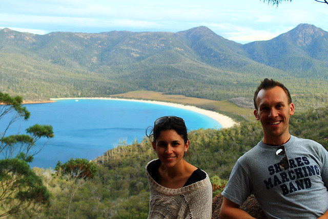
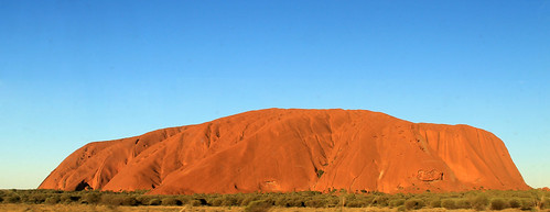
Finally here! Uluru!
As a geologist and someone who loves a good hike, I was really tempted to do the climb, but when our bus pulled into the parking lot and we saw a full charter bus-full of tourists swarming up the trail to the summit and I just felt sick from the blatant disrespect for this sacred site. A small group from our bus decided to do the hike, and I understand their decision, but I thought that in the long-run, I’d feel better knowing that I hadn’t tread on sacred ground without fully understanding its importance to the local people. Thousands of people do the climb each year and some of them even feel the need to pick up a little stone and take it home as a souvenir from Uluru. In the National Park’s Visitor Centre, though, there is a binder full of letters from people who, after taking the stones from Uluru, experienced so much bad luck and racked with guilt that they mailed the stone back to the park in an effort to rid themselves of their curses. These small rocks are now collectively known as Sorry Rocks.

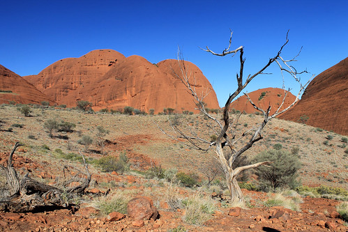
While the hikers did the climb, the rest of us did the short Mala Walk to Kantju Gorge. Uluru has a lot of curves creating alcoves along its base which are perfect for allowing water to pond and gives the appearance of little oases in the Outback. The Mala Walk took us past a number of sites that are featured in the creation stories of the local Anangu people. Some of the rock caves at Uluru’s base contain carvings and petroglyphs that are thousands of years old. The trail leads you to Kantju Gorge which features a small water hole at the base of a cascade of steps that have eroded into the steep sides of the rock over millennia.

By the time we got back to the parking lot, the hikers hadn’t yet returned, so the rest of us drove around to the Mutitjulu Waterhole around the other side of the rock where there is an even bigger waterhole and forms in the rocks tell the story of  Kuniya, a python woman who had traveled from the east. Kuniya’s nephew had been killed by the Liru, poisonous snakes. When Kuniya arrived, she exacted revenge for her nephew by taking her walking stick and striking the Liru with it, killing him.

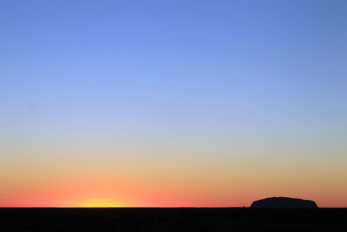
The day was getting on and sunset wasn’t far away. Next to the Uluru climb, one of the most popular events every day is to watch the sunset on Uluru. The bright orange sandstone takes on a new life as it’s shadows and colours change in the dimming light. Our bus pulled into a parking lot that was just swarming with tour buses and vans, each with their own cohorts of tourists sitting around make-shift tables while everyone sipped on champagne and snacked on finger-foods while watching one of the most beautiful sunsets in the world. The bright orange rocks faded in and out of various hues of red and pink as the sky behind it darkened. The shadow of the western horizon slowly works its way up the rock until the final moment when the only the tip of the rock is illuminated a gentle pink colour before the shadow envelops the entire rock. Even with all the people around, I was able to take a little walk down a path where there were far fewer people and the whole sunset just becomes a peaceful experience leaving little doubt that this gigantic rock is indeed an intensely spiritual place.

With the sunset over, we bussed back to our campsite where some of our group got a campfire started so we could cook dinner while the rest of us started to prepare our beds. There were large stationary tents at the site, but the weather was wonderfully mild and we all had the option of sleeping in swags under the stars. Swags are nothing more than a big canvas bag that has a rough sleeping pad inside and you then put your sleeping bag in the swag on the pad. A canvas flap can then be pulled over your head in case it were to rain. Swags feature heavily in Australian culture, most notably in the song “Waltzing Matilda” in which Matilda is actually the name of the man’s swag! I don’t think I ever met a respectable Australian who didn’t have a swag or hadn’t spent a night in one. Being in the middle of the Outback, at Uluru, there was, for me, little choice about spending a few nights sleeping under the countless stars in my swag.

With our stomachs full of food and beer, it wasn’t long before everyone was comfortably in their swags (or uncomfortably in the case of our Canadian fashionista!) and fast asleep. It wouldn’t be too long, after all, before we would wake up at 4 am for our next day’s worth of amazing Outback experiences!

Thursday, January 23, 2014

I'm Still Here and There's More to Come Soon

Hello readers! I just took a look at the viewing stats of my blog and I can't believe how much it's taken off this past year! (I kind of thought no one really visited it often enough to up the pressure to keep it fresh and new!)

It's been AGES since I've put up a new post and I apologise for that! My PhD research has been taking precedence of all of my writing time lately and I'm currently in the process of moving back to the UK from Australia, so you can imagine I don't have much time to write the kind of informative and quality posts I've been posting. But that doesn't mean there isn't anything in the works! I left off halfway through my trip to Australia's Northern Territory, but since then, I've visited the Whitsunday Islands, Cape Tribulation and the Great Barrier Reef, Denver and Vermont in the US, and a bit of time on New Zealand's South Island. Believe me, there is plenty more to come, but I just need a couple of long flights to just do it all!

Thanks for being patient!

Sunday, September 29, 2013

Australia: Alice Springs

Travel Date: 17 August 2013

Note: I am well beyond an outsider in Australia and there is a lot to learn about the Aboriginal cultures and ways of life. It is and can be a very sensitive topic in many Australian communities and if my wording or interpretation of what I learned is incorrect or offensive, please let me know. I am trying to be as truthful and as historically and culturally accurate as possible. Thanks!

Over the last few months, I've been watching the airline sales in Australia like a hawk. I was about halfway through my time in Australia for my PhD and was feeling a bit of a mid-Aussie-crisis and realised I might not get to see everything I wanted to if I didn't hurry. I'd planned to visit Australia's Red Centre in the southern Northern Territories in January when I have a bit more time, but then it dawned on me that the weather in the outback in January can be brutally hot! Then, a sale came in from Tiger Airways, from Sydney to Alice Springs and I just decided to book it. Now that I'm sitting in the airport waiting to head back home to Sydney, it was well worth the time off.

DAY 1 (3)
Alice Springs from ANZAC Hill and the western MacDonnell Ranges
Alice Springs is not a large town by Australian standards, though it is no tiny burb either. Because of its relative proximity to some of the outback's most famous sites, notably Uluru (the largest rock in the world), Kata Tjuta (aka The Olgas), and Kings Canyon, Alice receives a lot of tourism traffic by air as Aussies and backpackers alike flock here from all over the coastal towns and cities. Alice Springs has a more important place in modern Australian history, however, as being a telegraph relay station between Darwin on the northern coast of the Northern Territories and Adelaide on the southern shores of South Australia. The town even gets is Aussie name from a small pool of water seen near the Telegraph Station a few kilometres north of the present city, a rarity in the dry centre. In fact the pool of water was a temporary puddle, really - a result of previous rains which flooded the Todd River (which is otherwise a dry riverbed). For a short period of time in Australian history, there was a 9th territory - Central Australia - of which Alice Springs was its capital city. Eventually Central Australia merged with the Northern Territories and ceased to exist, but that didn't stop Alice Springs from remaining an important town in the otherwise desolate Ausralian Outback.

To the local Arrernte communities the land around Alice Springs was created by ancestral beings that created the landscape. Specifically, the MacDonnell Ranges were formed by three caterpillars moving across the country, digging their way through the land as they passed Alice Springs. Red river gums, found growing in the dry Todd River bed are sacred and believed to be ancient ancestor caterpillars as well. Another story involves a fight between an ancestral dingo and an anonymous adversary who both fought over a woman and in the midst of their fights created parts of the surrounding mountains including Mt. Gillen, a prominent point on the nearest mountain. The Aboriginal Australians have a deep connection with their surroundings because these ancestral beings formed every part of the landscape as they moved around and so these creation stories, or Dreamtime stories, form the foundation for all rules of social, political, and religious life in Aboriginal communities.

When I arrived in Alice Springs Saturday mid-day, I wasn't expecting much to be going on and thought I'd spend some time at the Natural History Museum, a few kilometres west of the town centre. After chatting to the receptionist at the YHA Hostel (a very nice hostel and in a great location) suggested a few other ideas and I settled on walking out of the city to the north where the original Telegraph Station was located. It was a beautiful walk through rocky sandstone and granite outcrops, red river gums, desert oaks, and beautiful wildflowers along the dry and dusty riverbed of the Todd River. The sun was roasting at midday but I finally reached the Telegraph Station after about an hour of walking only to find that there was a $9 fee to get in to the historic site. The very friendly lady (please note copious amounts of sarcasm here) working the small shop scoffed when I asked if there were student discounts and when I asked if there was anything to see without paying, she just pointed to the exit. So I walked around the fence enclosing the historic compound and then up a hill on which one of the Australian trig points, used as reference points for geographic mapping, was located and snapped a few photos of the MacDonnell Ranges to the west.

DAY 1 (34)
The US military personnel from nearby Pine Gap racing the ANZAC
servicemen in the hotly contested annual competition. The US
regained the winning title after last year's loss

Heading back into town along the River Walk I was in for a surprise. Contrary to my Lonely Planet Australia Guide (whose Alice Springs information urgently needs to be completely revamped!), one of the small city's most well-known and exciting events was happening on my arrival day: the Henley-on-Todd Regatta. Even though there is rarely any water flowing along the Todd River through Alice Springs, it is the site of one of Australia's most famous sailing races. Instead of actually sailing on water, the boats used in this regatta are just metal framed, canvas-wrapped "boats" that are picked up by the sailors and run along the race course on the dry river bed and back to the starting point. Hosted by the Mayor of Alice Springs and a number of other emcees, the boats are sponsored by local businesses and anyone in town, or from anywhere in Australia (or the world), can compete in various events including kayak, mini-yacht, and big-yacht races, hampster wheel relays, and tug-o-war for various age groups.

One of the main highlights of the event is a big-yacht race between the Australians and the Americans (military personnel from a nearby station). Apparently last year the Australians were the victors, but the Americans, racing in the USS Mayflower, prevailed this year and were quickly riddled by tongue-in-cheeck humour from the emcees but to great applause from the crowd who are just there for a good time. (The Americans also won the tug-o-war competition, as well, I might add!)
DAY 1 (40)
The Navy (left), The Vikings (centre), and The Pirates (right)
But the day's events culminate in the largest gunship battle to occur on Australian soil every year. Right at 4:30 three "ships" built onto the back of large trucks representing the Vikings, the Navy, and the Pirates enter the arena and drive around battling each other. The ships launch water balloons, fire coloured saw-dust canons, and hose each other down with high-pressure water guns all while trying to evade attacks from the other ships as the crowd cheers them on. Even though the Vikings were the first to run out of water and most-bullied by the Navy and Pirates, they seemed to be a long-time crowd favourite though it was the Pirates who came away victorious this year. The poor Navy lost despite their high-energy attacks and subsequently endured a host of adult-humoured, Village People, seamen-themed jokes from the announcers.

Interestingly enough, the Henley-on-Todd is probably the only regatta in the world to be cancelled due to wet weather as the usually dry riverbed surges with flash-flood waters flowing through the city (and this has happened at least once!).

After the Henley-on-Todd finished, I made my way up Alice Springs ANZAC hill where their memorial honouring fallen, former, and current armed service men and women dominates the town's skyline for a beautiful sunset over the western MacDonnell Ranges. It was my first taste for an outback sundown and what a sunset it was! The ever-present dust in the air in central Australia makes for beautiful red and blue sunsets and the silhouettes of the denuded mountains to the west made for a spectacular end to a great day.

Once the sun went down I found some quick take-away and went to bed since I was getting picked up the next morning for my 3-day outback tour.

Friday, July 5, 2013

Australia: Tasmania - Hobart

Trip Date: 28 April 2013

On my last day in Tasmania, Danielle had to do some work and dropped me off at the harbour in downtown Hobart. I bought a ticket for a ferry and admission to one of Australia's - if not the world's - premiere museums: the Museuem of Old and New Art (MONA). Before the ferry left, I spent about two hours walking around town and visiting the Tasmanian Museum where I learned more about the Tasmanian Tiger.

28APR2013 (6)
Hobart Post Office, Tasmania
The Tasmanian Tiger was the island's main predator before the arrival of Europeans. Once Europeans began grazing sheep in Tasmania the Tasmanian tigers were considered a nuisance because of their taste for sheep. The government put a bounty on every Tassie tiger that was killed and before long the only tigers left in existence were caged in zoos. But even that didn't last long and in the early 1900s the last Tassie tiger at the Hobart Zoo died. The tigers have not been seen since and the species is considered all but extinct. I say all but extinct because there is a very very VERY slight possibility that a population of tigers may have survived in the vast wilderness that covers Tasmania's southeast. Expeditions and surveys to find any remaining tigers have returned inconclusive. In the 1930s, after the last zoo tiger died, a biologist went looking for wild tigers and found footprints, but never found any tigers. Some people believe they still exist and sightings are reported but unconfirmed. I'd like to believe that life found a way and that some do exist, eluding humans for nearly a century. I like to believe this because the same story exists with mountain lions of Vermont - the catamount. While reports of them surface every now and then, there is no biological evidence that they still exist. But a few years ago, my Masters supervisor and I were driving to New York and on the rural highways of Vermont a large cat ran across the road in front of us. The cat we saw was definitely a cat, and much larger than a bobcat (which is larger than a housecat - or even a feral cat). To this day, I swear we saw a catamount and because of that I hold high hopes that the Tassie Tiger has cleverly maintained low populations in Tasmania's vast wildernesses.

28APR2013 (14)
Mt. Wellington looming above Hobart Harbour
Soon enough, I boarded the ferry from the city centre out along Port Arthur to the museum which is some distance up the River Derwent. The Lonely Planet guide for Australia says that this museum is one that is NOT TO BE MISSED and that it is "a veritable Disneyland for adults." Built right into the sandstone along the waterfront, the huge underground museum is home to a myriad of old and new art pieces including sarcophaguses, Aboriginal Australian art, modern sculpture art, interactive art, and modern paintings. Some of the exhibits I found utterly fascinating like "Kryptos" a dimly lit maze leading to an inner room; along the walls of "Kryptos" are words from the Epic of Gilgamesh in binary code and you get the sense you are entombing yourself as you walk toward the centre. Other pieces I liked included a huge wall of small Aboriginal paintings that fit together to form a much larger mural. There was also a room with a series of lightbulbs overhead. Visitors could take turns holding a handle of sorts which would record the pulse of their heartbeat and the lightbulb directly overhead would begin flashing in sync with your heartbeat. As each new visitor lit their lightbulb, the previous visitor's bulb would move down the line through a room that must have had hundreds of randomly flashing heart beats. But then there was the weird art, like a machine that was designed to replicated exactly the human digestive system. Every day the machine is fed food from the cafeteria and at 2pm the machine poops. Yes. This machine literally poops. It was disgusting and I don't really understand how it is considered art. Nevertheless, the day at MONA was absolutely a day worth the price of admission and I suggest anyone going to Hobart visit the museum because there is something for everyone there!

28APR2013 (37)
"Kryptos" at MONA
I took the ferry back into the city and Danielle met me down at the wharf and we walked over to Salamanca Markets, some of the oldest preserved buildings near Hobart's waterfront that now boast the city's best restaurants and shopping venues. We had delicious pizza from Cargo Bar and then stopped a few doors down at Jack Greene for a drink before heading back to her apartment for the night.

The night wasn't quite over yet as a huge full moon rose in the east and I couldn't help but run outside with my camera and try to capture this beautiful setting. We'll call it a mild success as I need a tripod!

The next morning, Danielle drove me out to the airport and I all too quickly found myself on my way back to Sydney. The five days in Tasmania were absolutely stunning with their jaw-dropping scenery, amazing food, wonderful people, cultural experiences, and wildlife encounters. It made working all through my Easter holiday weekend worth it. But, of course, like all of my trips, there is still so much I need to see in Tasmania and I am already planning my next trip back where I'll tackle Launceston, Cradle Mountain, and maybe even hike the Overland Trek! But that has to wait until another time.

Tasmania: Australia's Island State. Go there. You'll love it!

Australia: Tasmania - Tasmanian Devils

Trip Date: 27 April 2013

The morning after our night of no-sleep at the Coles Bay YHA, we woke up with some fresh coffee and breakfast at a wonderful new cafe in "downtown" Coles Bay with great panoramic views of the main mountain range of the Freycinet Peninsula. After we refueled our stomachs and the gas tank, we headed back toward Hobart, but turned off toward the town of Port Arthur out on the Tasman Peninsula.

Salt Pans
Tessellated Pavement on the Tasman Peninsula coast, Tasmania
Danielle got less sleep than I did the night before and when we reached the area around Eaglehawk Neck - a 100 metre wide isthmus - which has a number of geological sites of interest, she stayed in the car while I walked down to a unique site called the Tessellated Pavement. This rock shelf is exposed along the coast, not much higher than the water level. Hundreds of millions of years ago this location was under a lot of water and only the tiniest of sediments were transported out into the deep ocean. Tasmania was also glaciated at the time and larger rocks and pebbles stuck in iceberg ice floated out to the open ocean and as the ice melted, these larger sediments were dropped down onto the ocean floor. Over time these sediments became rock and various tectonic forces deformed the rock ever so slightly, but enough to crack the rocks, forming joints in three different directions. Today, the rock is exposed to salt weathering and wave action. The rock that is higher than the high-tide level allows salt crystals to grow large enough on the rock surface such that it wears that surface down more quickly than it wears down the joints. This process forms salt pans. Alternatively, the rocks exposed down by the water's edge and below the water's surface is inundated by water so frequently that salt crystals can't grow. Rather, the strong wave action picks up sand and abrades the rock and is funneled along the joints in the rock causing the joints to be more eroded than the rock surface and this creates these loaf-like structures. Both the loaves and the pans are exposed along the Tessellated Pavement and even though it is really a simple geologic site, it was beautifully fascinating.

Tasman Arch
The Tasman Arch on the Tasman Peninsula
Back in the car we drove across Eaglehawk Neck to the Tasman Arch - a large rock arch formed by wave action forming a cave along the coastal cliffs. Over time the inside of the cave erodes to the point where it is no longer able to support its roof and the ceiling caves in leaving behind the arch over the cave's entrance.

The day was getting on by this point and we were both getting tired. There was no way we were going to make it to Port Arthur, but we were close enough to another awesome destination: The Tasmanian Devil Conservation Park.

While in Australia, I started undertaking a challenge I hadn't expected to take: seeing all of the native Australian wildlife IN THE WILD. I've seen a lot on the mainland including platypus, emu, kangaroos, birds of all kinds, wombats, and echidnas (and I saw kiwis in New Zealand). So while in Tasmania I really wanted to see Tasmanian Devils in the wild. Unfortunately, the Tasmanian devil's populations has drastically dwindled after a contagious facial cancer decimated much of the healthy wild devils. Tasmania is now undertaking drastic measures to preserve healthy Tasmanian devils and save the species from meeting the same fate as the other Tasmanian predator - the Tasmanian tiger which was driven to extinction by European settlers after their arrival. The Tasmanian Devil Conservation Park is playing an active role in preserving the genetic diversity of the healthy Tassie devil population and I figured that spending $35 to see them in the conservation park rather than trying to find one in the wild would be money well-spent. We were not disappointed.

Handfed With Love
Danielle feeding a kangaroo at the Tasmanian Devil Conservation Park
near Port Arthur, Tasmania
We arrived at the Tassie Devil Conservation Park shortly before a scheduled feeding time and after paying our fees started walking through the park which also has a small family of kangaroos, a few wallabies, quolls, various birds, and four separate Tassie Devil enclosures. We helped the owner of the park feed the kangaroos for a good ten minutes which was SO fun! The kangaroos just hopped over to your hands, holding your hands with theirs, and nibbling the feed out of your hands. Little joeys hopped around excitedly and nuzzled right up to us!

Tassie Devils!
Tassie devil waking up for feeding time at the Tasmanian Devil
Conservation Park
But then it was time for the Tassie devil feeding and the devils knew it! In the one enclosure, right at feeding time, the two brother devils who were at first sleeping in their dens, became quite active and started chasing each other around the pen, snarling, and play-biting each other's snouts. They were quite vicious, but they were so much fun to watch. But then the devils stopped at the same time and looked at us - the owner had opened the cooler and the devils could smell the fresh wombat meat, which he tossed into the pen and the two brothers started a tag as they wrestled the meat away from one another. We must have spent at least 20 minutes watching the devils put on one of the best little shows for us, continuing the trend, as my friend, Danielle said, of, "Tasmania putting on a show just for me!" Once the devils were fed, they retreated to their dens and fell asleep, so Danielle and I walked around the park once more, saying goodbye to all the other residents before leaving.


On the way back to Hobart, we stopped once more at Eaglehawk Neck. The town of Port Arthur on the Tasman Peninsula was once home to one of the worst convict colonies in Tasmania and the British used the natural defenses of this peninsula - most notably this 100 metre stretch of land - to keep the convicts from escaping. Strung across Eaglehawk Neck was a string of vicious dogs chained up and trained to attack any convicts trying to escape the peninsula by land. The modern Tasmanians are using these natural defenses once again, but instead of using them to keep convicts from getting OFF the peninsula, they will be used to create and protect a healthy area of land, totally cleaned of infected Tasmanian devils. Devils are being completely removed from the peninsula and the healthy ones put in quarantine for two years to ensure they do not have the facial tumors. Once it is certain the Tasman Peninsula is cleared of infected devils, a series of triple-barrier fences and canals will be built and dug to keep infected devils from the newly-disease-free peninsula. With the fences and canals in place, quarantined Tassie devils will be reintroduced to the peninsula and if the Tasmanian efforts are successful, it is quite possible that the Tasmanian devils will be saved from extinction!

We were happy to have experienced the Tasmanian Devil Conservation Park, and now having crossed the devils off my must-see list, we began the drive back to Hobart where we readily crashed upon arrival at Danielle's apartment, exhausted from our two-day excursion up Tasmania's east coast.

Australia: Tasmania - Freycinet National Park

Trip Date: 26 April 2013

After a quick night in Hobart, my friend, Danielle, and I piled our things into her car and started our drive up the east coast of Tasmania. Our destination was Wineglass Bay in Freycinet National Park. When I first moved into my current apartment, my flatmate strongly suggested (no, he told me it was a must) that I go to Freycinet National Park because Wineglass Bay was so stunning it was just not to be missed!

Bicheno Waterfront
Fishing boats in Bicheno Harbour, Tasmania
Well, it took us a few hours to even get close, but we stopped a few times on the west side of Great Oyster Bay (west of the Freycinet Peninsula) for some photo ops and then drove past the Freycinet turn-off, continuing on up to the small seaside town of Bicheno. Not much ever seemed to be going on in Bicheno, but it sure looked like the perfect place for a vacation home. It still boasts a small fishing industry and some of the fishing boats were anchored offshore.

We stretched our legs along the waterfront for a few minutes and I was fascinated by the granite rock exposures along the beach - mostly because they had HUGE orthoclase feldspar mineral crystals - some as big as my finger! The tidal pools between the rocks were filled with little red sea anemones that twisted in the water as the waves came in and out. Bright orange lichens grew on the rocks, though we'd see more impressive lichens later on. We had a bit of fun posing in the dinghies pulled up on the harbour docks but soon headed back to the town and enjoyed a really good little lunch at a pizza cafe called, Pasini's.

Back in the car we drove south and headed down the access road to the small town of Coles Bay and the entry to Freycinet National Park. While many of Australia's national parks are essentially small tracts of land set aside solely for recreation without many stunning or staggering landscapes or ecosystems, Freycinet is different. Like the Blue Mountains, Royal, Uluru, Daintree, and Kakadu National Parks, Freycinet offers a spectacular mountain landscape with a few tall granite peaks with sparse vegetation growing up the slopes. As we turned the corner and the first view of Mt. Amos and Mayson loomed into view, my jaw hit the floor! I could already tell why my flatmate told me this was a park not to be missed!

Freycinet Panorama
Freycinet National Park seen from Coles Bay, Tasmania
We checked in to our hostel (the YHA in Coles Bay - which has impressively thin walls with two very loud groups of backpackers partying late through the night - avoid at all costs) and drove to the car park at the base of the trail to Wineglass Bay. It was late in the afternoon and we had limited time before the sun set, so we had to hurry a bit!

Wineglass Bay Lookout
My friend Danielle and me at the Wineglass Bay Lookout in
Freycinet National Park, Tasmania
The trail is well-traveled up to the Wineglass Bay lookout and winds its way through large granite boulders and banksia and gum bush. We stopped at the lookout and had amazing views of Wineglass Bay which is an inlet coming in off of the Southern Ocean ending in an impressively wide beach and some of the bluest of blue waters I've ever seen!

Not wanting to miss out on anything Danielle and I continued down the trail to the beach and were greeted by a solitary Bennett's wallaby who was saying hello to any of the beach's visitors, probably looking for food. He was definitely not skittish around people and while wallabies may be antisocial toward other wallabies, this little guy was certainly friendly toward me! I was able to get close enough that we had a little chat and I even took a selfie with my iPhone camera, much to Danielle's entertainment. Soon, the wallaby realised that my camera was not food and immediately became disinterested and hopped off to other hikers.

Wallaby Portrait
Portrait of a Bennett's Wallaby on the beach at Wineglass Bay in
Freycinet National Park, Tasmania
Danielle sat on the beach while I explored the coarse-sandy shores. A fishing boat was anchored not far offshore but was soon greeted by what we think was a police boat, likely wondering what a fishing boat was doing in protected National Park waters.

The rocks along the bay here were covered with the brilliantly-orange lichens we saw in Bicheno, and maybe it was the setting sun, but they seemed to be much more vivid in colour here! The sun was going down and we started back toward the car before it got too dark, and with perfect timing too, because as we neared the lookout the setting sun illuminated the clouds and rocks, almost setting them on fire! It was one of the most amazing sunsets I've ever seen, even by Australian standards! I can't tell if I've just become really good at taking photos of sunsets, or if Australia's sunsets are just always stunning, but it was just beautiful and I think my photos turned out quite nicely.

Sky on Fire
Sunset over Great Oyster Bay from Freycinet National Park (Yep, was really this red!)
Before heading back into Coles Bay we took a little drive up to Cape Tourville Lighthouse. It was now almost pitch black out and the moon was beginning to rise. The lighthouse is positioned on top of large bluffs overlooking the Southern Ocean and the winds started to pick up, making our walk around the lighthouse pretty chilly! I set up my camera a few times to try and get good nighttime photos of the lighthouse and coast, but without a tripod it was hard to keep the camera still while the shutter remained open long enough to get a decent exposure. The photos turned out pretty clear considering Danielle and I couldn't see each other even though we were only a few metres apart!

It was a perfect way to end a perfect day along Tasmania's east coast and we headed back into town for a dinner and drink at the pub before barely getting any sleep at the hostel. Yeah, while I recommend staying in Coles Bay, you're better off camping than trying to get any sleep at the hostel. But having such an amazing experience with the sunset and the wallaby easily made up for it!

Australia: Gordon River Cruise

Travel Date: 25 April 2013

25APR2013 (1)
ANZAC Park along the waterfront in Strahan
I woke up early in the morning at the YHA in Strahan, packed up my things, and loaded my bags into my rental car, and drove down to the Esplanade in the town centre for my first (and only) ANZAC Day Dawn Service. The Australia and New Zealand Army Corps (ANZAC) was the first organised armed services of both countries and were first deployed in World War I at the Battle of Gallipoli which was an effort by the Allies to capture Constantinople and thus monitor/block all sea trade to Russia (thanks, Wikipedia). What I did not have to look up, though, was that the battle was not successful for the Allied Forces and many Australians and New Zealanders lost their lives. ANZAC Day memorialises this Battle as well as all other military excursions that the two countries have been involved in since. It's essentially the Australian and New Zealand version of Memorial Day. Traditional services are held at dawn throughout Australia, and Strahan was no exception. I stopped in at the coffee shop among the 60 or so townspeople who were up early for the service. Soon, the townspeople formed a procession 3-across and walked over to an obelisk in ANZAC Park across the street (while I, and any other tourists, just wandered en masse). There was a nice little service with some prayers being read, a poem by a local high schooler, and some words from the town's mayor - all of which was constantly interrupted by a hoarde of geese, ducks, and seagulls in the park behind us, so it was kind of hard to hear. Then the mayor tried playing a recording of tradtional ANZAC music on a portable CD player, but couldn't get it to play. After about five minutes, the young high schooler who read the poem stepped up to help the elderly mayor. Thinking a young person would have the CD player going in no time, it surprised me when after another five minutes passed and the music hadn't started. It was then I realised how unique my age is: the mayor was maybe too old to be familiar with CD players and the high schooler was so used to iPods and mp3 players that she also didn't know how to work it! They eventually realised that if they put the CD player on solid ground, it would play just fine. The service soon ended and most everyone headed into the local hotel (pub) for breky and a coffee and rum mixture. I settled for coffee (plain) and a sandwich from the cafe next door.

It was a very bleak, grey, and drizzly morning, but I'd booked a ticket on the Gordon River Cruise (highly recommended by tour guides). Strahan is nestled in a little cove off of Macquarie Harbour, Australia's second largest harbour next to Melbourne's Port Phillip Bay, and fed by the Gordon River, which extends up into the vast wilderness of southwest Tasmania. I booked the trip for three reasons. Firstly, not having much time to hike into many of the wilderness areas of Tasmania, I thought this would be a fantastic way to "get into" the wild (yes, even if it is aboard a luxury catamaran). Secondly, it also stopped at the famous Sarah Island - one of Tasmania's most feared convict colonies out on a tiny island in the middle of the harbour - and I wasn't sure if I'd get to learn anything about Tasmania's harsh convict history during the rest of my trip. Thirdly, it included lunch!

The cruise left the docks in Strahan and immediately headed out toward the entrance to the harbour where we passed a few different lighthouses while passing through Hell's Gate. The convicts called the entrance to Macquarie Harbour Hell's Gate because of its isolation and hardships they knew they'd endure on Sarah Island as well as the fact that even though the surrounding area is beautiful, attempted escape almost certainly would lead to death either by British soldiers or the treacherous nature of the environment. Hell's Gate is only  a few tens of metres wide and is very shallow, so not too many large vessels can enter the harbour. Also because of the shallow and narrow entrance, it takes ebb tides more time to push their way into the harbour. In fact, the upper few metres of the harbour's water is freshwater supplied from the surrounding rivers and stained brown with tannin because the narrow entrance to the harbour makes it more difficult for the tides to flush out the harbour!

25APR2013 (30)
Lighthouse at Hell's Gate, the entrance to Macquarie Harbour, Tasmania
This has an added benefit to the local fishermen. Salmon and trout were introduced to Australia from Great Britain and because they require a certain balance of fresh and salt water, Macquarie Harbour is the perfect place for fish farms, of which there are many.

The boat turned around outside Hell's Gates, not wanting to get battered by the huge ocean waves, wind, and rain and went back into the harbour toward the opposite end where the Gordon River flows into it. As soon as we neared the entrance to the river, the water became much calmer and though it was still rainy and gray the trip became a bit more relaxed. We traveled up the river a few kilometres and learned about the native Huon Pines which grow in the area. Convicts at Sarah Island predominantly built ships out of the Huon Pine because the pine's pitch contained an oil which prevented worms from boring into the wood. Logging of the Huon Pines was so intense that all operations have since been halted and the species protected. Now, only National Park officials can remove Huon pine wood from the forests, and even then, it can only be wood from fallen trees. No Huon pines can be cut down.

25APR2013 (74)
Mouth of the Gordon River, flowing into Macquarie Harbour, Tasmania
We got off the boat and had a little walk on a boardwalk through the rainforest, which was very very rainy and allowed us to get up close with the Huon pines and a number of little mud chimneys built by crabs excavating down into it. Back on the boat, though, a buffet lunch was served with some of the freshest salmon you could hope for and local Tassie apples. Delicious!

The rain had stopped momentarily as we approached Sarah Island, home to one of the worst convict settlements in Tasmania, reserved only for those who repeated offense after arriving to Australia. The island is fraught with stories of cruelty, backstabbing, coercion, treachery, and violence I cannot even begin to recount the tales we heard. But the end of Sarah Island came with the installation of a commandant who had previously been a ship builder with no experience of managing convicts. But as soon as he started his post at the island, the violence decreased, the escape attempts stopped, and productivity increased immensely. It turns out that when you give convicts special things they want like alcohol and dignified sleeping quarters, you could get in return a very productive work force. But after news of fair treatment toward the convicts at Sarah Island reached the higher-ups in the British military, the settlement was shut down.

25APR2013 (122)
Convict settlement ruins on Sarah Island in Macquarie Harbour, Tasmania
Having spent enough time outside on the boat, I stayed inside the rest of the way back to the wharf. Arriving shortly after 2pm in Strahan, I rushed to get to my car because I knew I had very limited hours of daylight remaining and a very long way to go to get back to Hobart for the night! But as luck would have it, the rain started back up as soon as I got back in my car. Not just a drizzle, but one of the most blinding, white-out deluges I've ever driven through. I put my trust in the little car and its tires and just started heading down the road trying not to slow down through the very rough driving conditions where rain was flowing down the road and around corners. My wipers, though on at the highest setting, couldn't keep up with the rain. I bought petrol in Queenstown and then started my ascent into the mountains.

The change from the day before in the mining area, where all the hills had been stripped of vegetation and soil was unbelievable. Every single crevasse or nook between hills was GUSHING with unbelievably voluminous waterfalls! With nowhere for the rain to seep into, it just collected and rushed downhill!! The rain continued as I got up into the mountains, and though I was making good time, I was surely driving a little too dangerously for the conditions. But finally, a few hours later, as I came closer to Lake St. Clair, the rain let up as the weather was held back on the western side of Tasmania by the highly elevated mountains. While still wet, the rest of the drive was fairly smooth and pleasant and I made it back to the Hobart airport to drop of my rental car only about an hour after the sun went down.

Creative Commons License
This work by Eric W. Portenga is licensed under a Creative Commons Attribution-NonCommercial-NoDerivs 3.0 Unported License.