Wednesday, March 13, 2013

New Zealand: Te Paki Dunes, Whangaroa Lookout, Kiwis at Aroha Island

Date Traveled: 03 January 2013

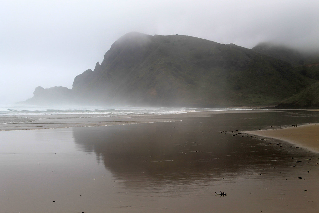
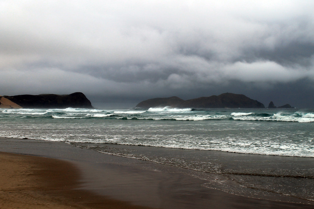
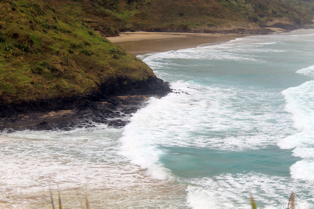
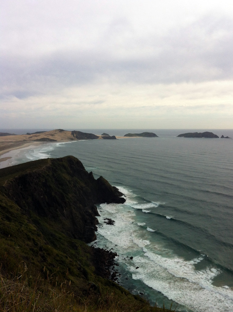
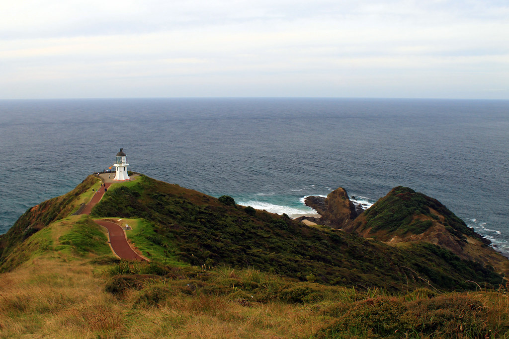
After a hellishly adventurous morning of hiking, soaking wet, in the rain out to New Zealand's westernmost point, I wasn't sure how much more adventure I'd be up for for the rest of the day. But then, as I was driving from Cape Reinga to Paihia, where I had accommodation booked that night, I passed the sign for Te Paki Sand Dunes and thought to myself, "I might not ever get the chance to come back this way in my life, so I might as well stop and see it now."

03JAN2013 (149)
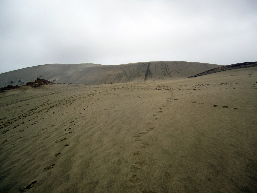
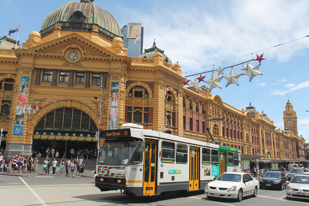
Coming over the first rise at Te Paki Sand Dunes
Good thing I did! Te Paki sand dunes are the highest dunes in New Zealand, and they are massive (though not as big as Sleeping Bear Dunes or Pictured Rocks). I parked my car and pulled out my rain gear, because it was still raining and I had had enough of being soaked to the bone, and crossed a shallow little stream to get to the base of the dunes. The blisters on my feet weren't enjoying being cramped up in shoes or sandals, even, so I went barefoot climbing the first steep ascent which opens up on top to a vast, wide, plateau of sand with a few rocky outcrops sticking out. On the other side of the plateau was another climb to what looked like the highest dune peak around and when I got to the top of that, I realised just how expansive the dune fields here are! According to Lonely Planet's New Zealand Guide, there are 7 square kilometres of dunes here offering all sorts of recreation activities like sand tobogganing (which you can rent from the little van in the parking lot) and the start (or end) of the famous 4WD off-roading expedition up/down 90 Mile Beach is also here.

Well, I knew I wasn't going to spend a huge amount of time here, so when I got to the top, I had a nice look around, took some photos of the area, and then starting heading down. But this wasn't just any saunter down the sandy slopes. Oh, no! Growing up going to the beaches, one of my favourite things to do was go dune jumping. Usually this involves finding a nice sturdy tussock of grass near the top of the dune, getting a running start, and then throwing yourself off that tussock into the air and landing on the downslope surface of the dune. If you land on your feet without breaking your legs, it's possible to then use that momentum and run all the way down the rest of the hill. There was no dune grass here, but the sand slope was steep and a good running start was all I needed and with arms windmilling through the air, I ran down in big, leaping steps to the sandy plateau.

Here on the plateau, one of the rock outcrops caught my interest. It was circular from above and looked almost dome-like except that while the middle of the dome and its edges were still in tact, the rest had eroded out by some means of chemical or physical weathering. Up on the dune slope I'd just run down, there were a few other people using their footsteps to make large pictures in the sand. I think the one group of kids must have been from Switzerland since they made a big square with the cross in the middle.

I crossed the sandy plateau and dune-jumped my way back down to the creek and crossed over to my car, brushed off and got back on the road. Not much further down the cape, there was a sign pointing toward "New Zealand's Northernmost Pub" and I thought I should stop in for a bite to eat and charge my phone at the same time. I figured it would be some British-esque pub with a warm fire, carved wood booths, and a generally cozy atmosphere. Boy was I wrong. This place I don't think ever was cozy or welcoming, and while the staff was friendly and accommodating, I didn't want to stay there a moment longer than I needed to and I don't suggest anyone stop here. You will be sorely disappointed!

03JAN2013 (167)
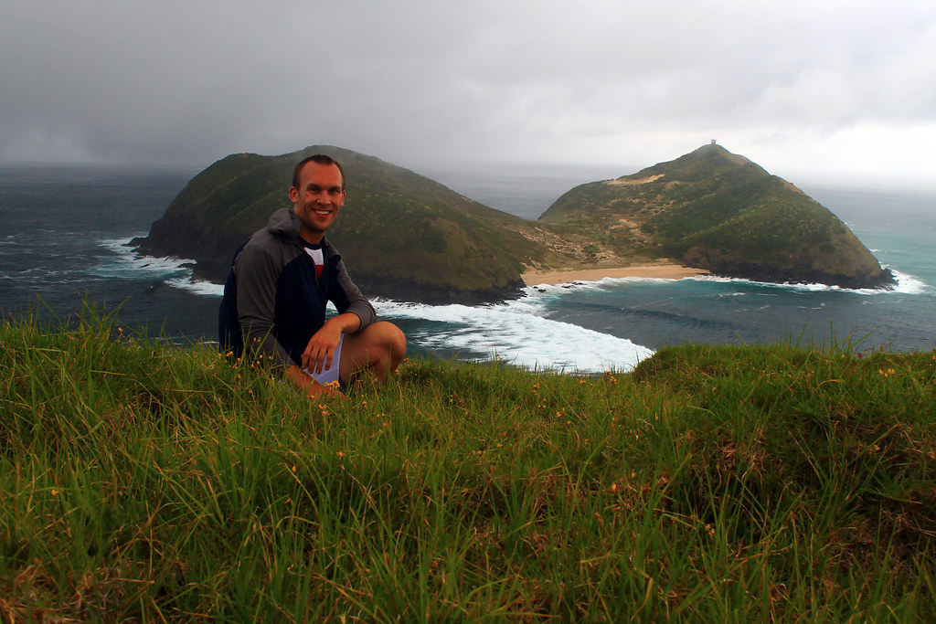
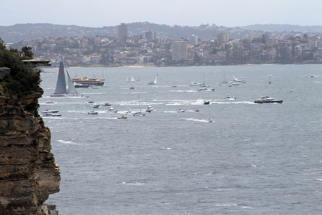
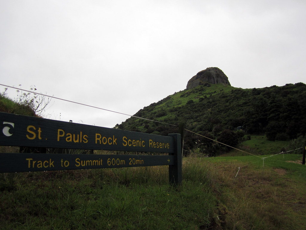
The Whangaroa lookout
Finally, I was on the road again and kept driving for a few hours, listening to local Maori radio which had some good music on there, including a lot of Christian songs I remember singing in elementary school, but sung in Maori with a South Pacific twist. I'd read about another spot that I thought might be worth looking into. The hills in and around the town of Whangaroa (remember, in New Zealand, Wh- is pronounced F-) are generally forested except for their tops which are exposed, bare, rocky knobs made of conglomerates and granite - if I remember right! The hilltop in Whangaroa offers an awesome 360° vista of the entire area and the Whangaroa Bay right next to it. I found the parking area at the Saint Paul's Rock Scenic Reserve and started up the trail which was really slippery thanks to the mixture of mud and rain. To get to the top of the rock, though, the trail climbs up through the exposure and you need to hold on to chains fastened into the rock to pull yourself up to the top! It was a nice view indeed. Even in the gray late-afternoon you could see all the way out to the ocean, see all of Whangaroa Bay, and even an expansive oyster farm.

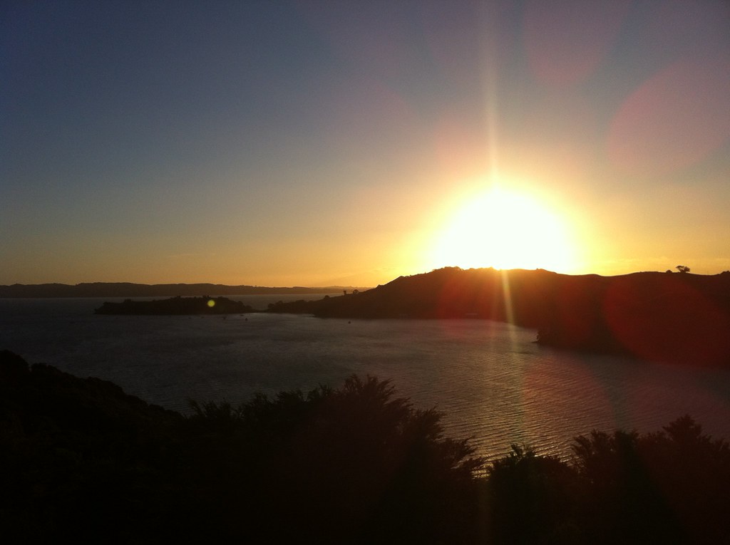
I didn't stay long, though, just long enough to get a 360° panoramic shot but then I got back in the car and kept driving. My destination for the night was the Aroha Island Ecological Centre, just east of Kerikeri. I'd read about Aroha Island in the Lonely Planet guide and after reading that they have a few northern brown kiwi birds living on the island, I didn't think I had a choice but to book a camping spot here! Kiwis are exceptionally rare in the wild in New Zealand. In fact, many New Zealanders haven't seen a kiwi in the wild! Since I've been on my "must see all Australian wildlife in the wild" kick, I figured I may as well add kiwis to the list and do my best to see them in their native habitat, too! And Aroha Island was the perfect place for that; they offered nightly tours of the island for an additional charge saying that most tours see a kiwi. But when I checked in, the lovely woman at the Welcome Centre said they weren't doing any tours...but that I could use one of their flashlights and have a map of the island and see if I could see them for myself!

I set up my tent in the last remaining hours of daylight and backed up all of my photos from my hiking adventures at Cape Reinga to my iPad, waiting for darkness to settle in. The woman told me that the kiwis are seen all hours of the night and that they start roaming around 10:30pm. I was told to not make much noise because while kiwis have bad eyesight, they hear very well; I was also told to use the flashlight given to me which had a red filter on it because the kiwis couldn't see that red light, and that any regular flashlight would scare them off for sure. It started raining again, though not too hard, and I figured I'd have to put my rain gear back on if I didn't want to get wet, but that meant I'd be making a lot of noise while walking along the path. The island isn't large and only take about 30 minutes to walk the perimeter, so I set off with the red light and the map.

The woman also mentioned that I would know the kiwis were there long before seeing them because they make a very distinct snuffling noise. Kiwis are different from most birds in that their nostrils are located at the end of their beaks and since they use their beaks to sift through the soil while looking for food, they constantly have to clear their airways and in doing so make a very dry wheezing sound. Well, even with that information, I couldn't hear much more than the rain dripping through the leaves and my rain pants brushing up against each other. I moved so slowly along the path, thinking every noise was a kiwi, that it took me about half an hour just to walk half the island. I started along the other half thinking I was on a wild goose - errr kiwi - chase when I heard it!

03JAN2013 (193)
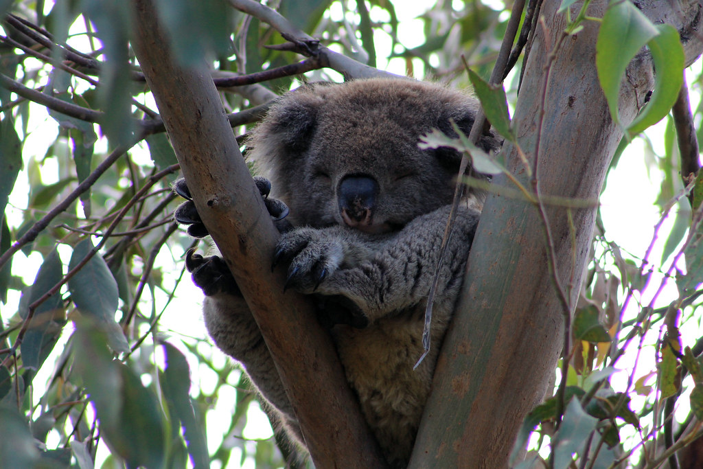
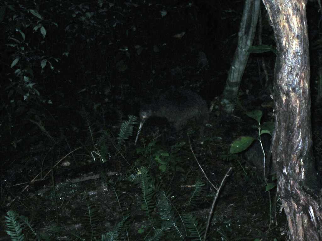
One of the two wild northern brown kiwis I saw on Aroha Island
Above the pitter-patter of the rain I thought I heard people talking and I thought it must be some other kiwi-scouts, but looking ahead, I didn't see any lights but kept hearing a dry, scraping, snuffle sound. I rounded the corner in the path, and sure enough, right in front of me, no more than 2 metres away were two adult kiwis! They were big! I mean big compared to what I imagined them. I always thought they were maybe the size of a grapefruit, but these were each the size of a rugby ball, stuck up on what looked like three spindly legs, but then I realised the third leg was just their beak! I didn't want to make too much noise but I wanted to get closer to see if I could get some photos of them with my phone. I'm not sure if it was the rain or if their hearing isn't as great as the woman told me, but I was able to sneak within a metre of them both without them realising, or caring, that I was there! I just stood there for about 20 minutes watching these amazing birds do their thing, rooting through the soil along the path looking for food, and they eventually moved off and started heading down the hill toward the water. I decided that if they were going to leave, I'd try getting a few photos of them with my flash on, and while they moved away after the first flash, they didn't seem to be terrified by it and stayed relatively close, so I took a few more before leaving them to eat in peace! I think my heart was pumping just as much as it had been that morning when I was trying not to be swept out to sea by incoming waves! Here, on tiny Aroha Island, was some young Yank who just wanted to see kiwis in the wild, and with very minimal effort was able to do what so few people have ever had the opportunity to do!


Needless to say, at the end of the day, hiking 15 kilometres, climbing a large sand dune, hiking to the top of a rocky lookout, and successfully sighting some wild kiwis, I was exhausted and slept very very well! The next morning, as I was packing up my tent, some very friendly ducks came by to wish me safe travels and to thank me for staying at Aroha Island, insisting that I recommend it to anyone who wants to have wild kiwi adventures while traveling through New Zealand. I told them I surely would!

Sunday, March 10, 2013

New Zealand: Cape Maria Van Diemen

Date Traveled: 03 January 2013

This is the day I almost died...twice.

Fog had rolled in to Tapotupotu Bay overnight and while it was light in the morning when I first woke, it was not too visible. I was at least refreshed from a good night's sleep, listening to the constant crash of the waves on the beach. I grabbed my camera and tried taking a few shots of the beach before packing everything up into my car, and then I drove back out and up to the parking lot at Cape Reinga, which was easier said than done because the thick fog decreased my visibility to maybe 10m in front of the car!

I figured that like the day before, the fog would lift around mid-day and the weather would clear as the day went on, so I dressed appropriately for that: sneakers, gym shorts, moisture-wicking shirt, a long-sleeved thermal, and a waist pack with two half-litre water bottles, about four granola bars, some red pepper slices, a few apples in the plastic bag from the grocery store, and some nuts. I figured that would be all I needed and even though I had rain gear with me, I decided to leave it in the car.

Cape Reinga in Morning Fog
Cape Reinga Lighthouse in the blue morning fog

I walked down and out to the Cape Reinga Lighthouse again to try and get some good morning photos through the dense blue fog. On the way, I was dive-bombed by a few seagulls who were likely protecting their nest, but I should have taken it as a sign to just go back to my car. After visiting the lighthouse once more, I took the turn off down the path to the beach and it was eerily quiet with no one else around at 8am. The path runs right along the edge of sharp cliffs dropping down hundreds of metres to the rugged ocean below. I wanted to try and get some good shots looking down the cliff, but I knew better than to go too close to the edge, especially when the rocks were slick with fog.

I got down to the beach, which was kind of split into two sections. The beach I was on was a little tiny cove pinched between the cliffs I'd just hiked down and a steep little promontory about 20 metres on the other side of the beach. The ocean was very very rough this morning and straight lines of wave-trains rolled in one after another, constantly crashing over themselves, but the tide was low so I was easily able to walk around that steep promontory. But first, I sat and watched a cormorant at the water's edge for a few minutes before it got spooked by how close I was getting and flew off.

Cape Reinga
Cape Reinga, shrouded in mist, and reflected onto the beach
As I walked the 5 kilometres down the beach I couldn't get over the power of the ocean and the amazing beauty of the islands off Cape Maria Van Diemen in the distance through the fog and ocean spray. I was amazed at how quiet it seemed to be, almost the calm before a big storm. Other than the slight breeze and the waves crashing, there wasn't much to listen to other than the occasional chirp from some shore bird. Waves came in and left these glimmering thin sheets of water that slowly receded back into the ocean, allowing the surrounding hillsides to be reflected in them. It was a peaceful, almost mystical setting and with no one else on the beach, it was quite eerie!

About an hour and a half into my walk, the sky seemed to be trying to clear up as I forded a wide, but shallow, stream and followed the trail blazes (not extremely well-marked, mind you) up another promontory stuck between the middle of the sandy dune fields and the ocean. The rock of this tall hill was mostly these very slippery pink, green, yellow, and grey clays which if you weren't careful, you would see up close as your feet slid out from under you, sending you crashing to the ground. The surrounding dunes had creeped up the side of this hill over hundreds and thousands of years, and many of the bright-orange trail signs had been partially buried, so I had to be careful to keep my bearings about me. Even in the grey light, however, the landscape was beautiful. The trailing roots of the dune grasses were often exposed and looked like a long rope that had been draped across the dunes with a shoot of grass growing out every 10 centimetres or so. These ropes of roots criss-crossed the dunes and in some places, pretty purple flowers were growing on raised tussocks of dune grass.

Dune Flowers
Flowers growing on grassy tussocks in the dunes on Cape Reinga Beach
The trail wound it way around the hill, through the dunes, and on the other side, a wide expanse of dunes swept its way down to the beach toward the hilly knob that is Cape Maria Van Diemen. I almost missed the trail markers had I not seen the half-buried wooden sign pointing me in that direction. Cape Maria van Diemen did not seem too far away, but I soon realised how deceiving the landscape here could be. It felt like I'd been walking a good ten minutes toward the point, yet it didn't seem to get any closer! I did eventually come to a little rise, giving me a good look south down the coast and right out to a massive seastack, eroded away from the mainland by ages of wave action. But it was here I realised I was going to be in for some trouble.

While the weather seemed to want to clear up an hour earlier, it was on this rise that I got my first look at the weather over the Tasman Sea and all I could see was a wall of tall, dark, gray clouds. The clouds were a good distance offshore, but the wind was pushing them my way, and I could already start to feel the occasional rain drop. Being stubborn, I refused to turn myself around. After all, I was right at the bottom of the last rocky rise that was the westernmost tip of New Zealand. I could see the little utilitarian lighthouse at the top of the knob and decided that I couldn't hike out this far and not get up to that point, so I briskly started my walk up the hill. It wasn't too steep but the hillside was covered in these bushy, long-leafed plants and it was difficult to tell where exactly the trail was. I had to be careful because the trail I thought I was on was no more than a metre away from a steep drop down onto a rocky platform below and I didn't want to step into a hole covered by the plants and tumble down. Soon enough, I got to the top where the bushes thinned and grass took over. The view was impressive, looking back up to Cape Reinga off in the distance, and to Motuopao Island just offshore with its own private beach and another little light station on top. I scrambled to set up my camera on my pack so I could take a timer-shot of myself on top of Cape Maria Van Diemen as proof I'd been there, and as soon as I was satisfied with one of the two photos I took, the rain came.

Cape Maria Van Diemen
Me on top of Cape Maria Van Diemen with Matuopao Island behind
I quickly emptied out the plastic bag my apples were in so I could wrap my camera - my bulky DSLR camera - into something waterproof and packed everything into the limited space inside the waist pack. I made sure my shoes were tied and my long sleeves were pulled over my hands because the drizzle had turned into a steady light right and it was not a warm rain. I hurried back to the bottom of the rocky hill at the end of Cape Maria Van Diemen and started my ascent up that wide, wind-swept sandy slope that seemed to take forever to get down. By the time I was halfway up that sandy slope, I was soaked. I was fortunate to have remembered to wear water-wicking clothing so even though I was wet, it wasn't stuck to my body like a cotton shirt would have been. And the woolly thermal I was wearing was at least keeping me somewhat warm in the cold rain, but I was still worried. I knew that hypothermia could easily set in and that symptoms of hypothermia included disorientation, poor decision making, and loss of a sense of time. Never having experienced hypothermia before, it was a challenge trying to decipher if any of the feeling I had were mental or actual physical. I grabbed a few protein-rich snacks out of my pack to make sure I wasn't going hungry and drank some of my water to make sure I wouldn't also get dehydrated.

By the time I got to the top of the sandy ramp, I was drenched - not a single bit of my clothes or person was dry or really warm for that matter. I knew I had to retrace my trail through the sand dunes behind the clayey headland, but once the ocean was out of sight, everything started to look the same. I did my best to follow the orange trail markers, but they weren't often visible, so I did my best to go back the way I thought I came, but each dune looked the same as the next and with footprints making trails in all sorts of directions, I couldn't figure out which was the way I came! I knew the ocean was generally off to my left and so I carried on.

Two figures started approaching me - they had been hiking from Cape Reinga, the direction I needed to go. I figured that since I was wet and they were wet I should at least let them know I was okay and ask if they had everything they needed, like water and food. They ended up being two girls, one from Scotland and the other from Ireland, who had met at a hostel and decided to do one of the loop trails in the area. They had indeed come from Cape Reinga but were covered in mud (apparently the mixture of rain and clay rocks had really made the ground very slippery and mucky) and after checking that we were all okay, wet but okay, we each went our own ways. I tried following their tracks and came across those clayey spots, taking my time to be careful so as not to slip and do something stupid like break my ankle. I definitely slipped and fell a few times, but other than being covered in sticky mud, I was alright.

I still couldn't really find the trail and began to wonder if I'd double-backed on myself and was heading in the opposite direction I wanted to be in. I was beginning to think I really did have hypothermia and that my brain was already starting to disorient my body. But I kept checking the time on my phone to give me a sense that I was moving forward and making progress and had a few more snacks and sips of water. There was going to be no way that the last people to see me ever was going to be two hiker-strangers. I just couldn't allow that. I thought of my family back at home, my folks who I hadn't been able to see over Christmas, my sister and her her husband who had just announced to us a week before that they were going to have a baby, and my brother and his wife who'd just been married that summer before. Thinking of them reset my resolve and I became determined to get back to my car. All I needed was to find my way back to the long beach walk. Once there, I at least knew where the trail was! I couldn't see the ocean yet, but I could see the upper reaches of the stream I'd crossed right before having to climb this hill, so I reoriented myself and after going up and down the next few rises I came to a lookout right above the stream I'd crossed before and believe me, it was a wonderful sight to see!

Cape Maria Van Diemen
After the initial rain, I was able to take out my camera again. This is looking
back to Cape Maria Van Diemen and Matuopao Island with the dark
storm clouds coming in off the Tasman Sea
By the time I got down to the stream, the rain had stopped, though it was still windy, and I was definitely not going to dry out. I also still had another hour and a half hike to get back to the parking lot, so I rinsed my shoes off in the stream to empty them of any sand. I even stopped to take my camera out again, giving it a chance to dry off somewhat, but then I was off again and high-tailed it down the beach as fast as I could without overexerting myself.

The rain held off as I got nearer to the path at the bottom of the Cape Reinga cliffs, I realised I had one more obstacle in my way. As luck would have it, when I walked out from Cape Reinga the ocean was at low tide and the beach surrounding that steep little promontory was well wide enough. Not so on the way back. High tide was on its way in and the unrelenting wave trains were starting to crash over the rocky base of the promontory. I looked up into the foliage on the promontory for any sign of a trail I could take to go up and over the headland and while I found on that took me a few metres, it quickly disappeared and I carefully made my way back to the beach. It appeared I had three options: 1. Try the trail again and bushwhack my way over the promontory; 2. Wait for high tide to ebb back out away from the promontory; or 3. try my luck and passing around the rocky base before high tide got too high.

I decided to go for option number 3. The tide was still coming in but it wasn't all the way in yet, so I slung my camera over my back and carefully started finding footholds in the rock, hugging the base of the cliff as I shimmied across. The waves were breaking just a few metres away from me and the whitewater was splashing up over my feet. The going was slow, but at least there wasn't much distance to go. A few times I had to really hold fast to the rock wall and wait for a wave train to come through and then try to quickly hop across wide fractures in the rock between waves, but at least once the wave train caught up with me and bubbly water rising up well over my ankles. A few long reaches to sturdy foothold were almost missed, but after about 10 minutes, I made it around the headland to the safety of the little beach and cove on the other side. I took a few really deep breaths and looked back at where I'd just come from and was so immensely thankful to the Man Upstairs that I'd had the strength and perseverance to trust that my survival instincts would kick in and carry my across.

Cape Reinga Beach Headland
Looking back down at the rocky headland I had to skirt since there
was no trail over the top. At high tide, the wave trains kept pounding
the rocks and were big enough for water to rise over my feet!
And now, as the rain started to fall again, I quickly packed up my camera again and started the final ascent up the trail to the pathway at the lighthouse where throngs of people in ponchos were aimlessly wandering around, complaining about how miserable they felt and how wet they were, and I just brushed past them envying them and their rain-proof ponchos and dry clothes and otherwise warm tourist experience thinking, "If you only knew where I've just been, what I've just gone through, and what it took just to get back here!" As soon as I got back to my car, I pulled out my dry clothes and ran into the toilets to change out of the soaking wet clothes I'd spent the last three hours in.

Knowing I was safe in my car, back in dry clothes, I thought back to the previous five hours and came to a few conclusions. Firstly, it was so incredibly stupid of me to not have told anyone where I was going or what my plans were. I should have left a note in my car window saying what time I'd left and which direction I'd headed. And I should have checked the weather report (though there was no mobile service way out here or store to buy a newspaper from). Other than those untaken precautions, I also flipped through some of my photos and realised that I had done a hike that is epic in good weather and seemed legendary to me that I'd done it in the adverse conditions I'd been in. I decided that when all was said and done, it was an amazing experience I would jump at the opportunity to do again (of course being a bit more smart in my planning).

I said a few more "thank yous" to God before turning the key in the ignition, blasting on the heat, and driving off down the road back toward the mainland. It was only 1:00pm and I still had so much more to do today!

Saturday, March 9, 2013

New Zealand: Cape Reinga

Travel Date: 2 January 2013

I said my goodbyes to my friends Martin and Lydia and left Waiheke Island early the next morning, catching a ferry back to Auckland where I lugged all of my gear about a kilometre through the city and picked up my rinky-dink car from Omega Car Rentals (Folks, their cars are old, cheap, and overpriced. Their customer service is dodgy at best. They were a very unhelpful company to rent from.) and was soon on my way up New Zealand's Highway 1 to Cape Reinga at the very northern tip of the North Island. While Google Maps says it is only a 5 hour drive, they assume there is no one else on the road, no accidents, you don't need to stop for petrol, you're not doing the drive during a holiday, and that the one toll road is operational... It took me almost 5 hours just to get from Auckland to Kaitaia at the turn-off to Cape Reinga.

That's not to say the drive wasn't pretty. In fact on Highway 1 you end up driving away from the coast for a little while but then you come up and over a large hill and are met with this expansive view of the Whangarei Heads ("wh" in New Zealand is pronounced "f") which are these staggering, precipitous cliffs jutting up out of the ocean, and it's then you realise that while you've been driving through "hilly" country, it is nothing compared to some of New Zealand's topography! Another beautiful and fun part of the drive was going through Mangamuka Gorge near Raetea Forest. Here, the road just goes up and up and up and up and up and up and up these tight winding, curving bends in the two-lane road where, at times, the road was tipped to the side on a 20°-angle, it seemed! I was a bit nervous because I was running low on petrol and worried that I wouldn't make it to the top of the road before running out. I just needed to make it to the top so I could put the poor little car in neutral and coast down the other side of the mountain! (I eventually made it).

I stopped in Kaitaia for some groceries and food since there are no stores or petrol stations out on the Cape itself. And then I started my drive out to the tip of the island. There is only one road to use and the drive is 110 km away from all civilisation. While you can't see it from the road, off to the left is Ninety Mile Beach (it's not 90 miles long!) which many visitors to NZ either hike or take their 4-wheel-drive utes on day trips, being careful to watch the tides so their cars don't end up being fed to the ocean. But honestly, for most of that drive there is little scenery to see until you get to the last 30-40km where the road really utilises the hilly terrain and give you amazing views of this thin peninsula with the Tasman Sea to the west and the Pacific Ocean to the east.

I wasn't too interested in the scenery here, though; I was more worried about securing a tent camping space at the Tapotupotu Bay campgrounds, run by the NZ Dept. of Conservation. The campsite doesn't take reservations, and I was worried that during peak holiday season, the whole campsite would be full, so I was mostly in a hurry to get to the campground and secure a spot for my tent. Eventually the road starts another large ascent up these rocky mountains and off to the left I could the the wide expansive sand dunes of Maria van Diemen Land (NZ's westernmost point), which would also be my target for tomorrow. Finally, I saw the turnoff for Tapotupotu Bay and took it, going a few kilometres down the dusty dirt road. Luckily, it was well-used and not too steep so my junky Nissan Sunny had no problem getting down the switchbacks to a tiny little sandy cove stuck between two rocky headlands: Tapotupotu Bay!

Coastal beaches stuck between headlands like this often have a high beach berm (2-3m) behind which is a flat lagoon with sandy banks, and it was all this high land that the campsite occupied. There were specific sites for RVs and one large grassy strip along the beach's edge where you can just pitch your tent where there's room, of which there was plenty and I had no problem finding a nice grassy area far from other tents. I paid the campsite attendant and set up my tent, but then I got back into my car and drove back out to the main road and turned right to drive the last few kilometres out to the lighthouse at Cape Reinga.

Cape Reinga Coast
Maria Van Diemen Land (the westernmost point
of New Zealand) as seen from Cape Reinga
Cape Reinga is a spiritual place in Maori culture. It is believed that all Maori people originated from a place called Hawaiki somewhere in the Pacific Ocean and Kupe, the earliest Maori explorer from Hawaiki, believed Te Rerenga Wairua (Cape Reinga) to be the place where spirits would return to Hawaiki after death. Because of the spiritual nature of the site, tourists are strongly requested to not eat or drink anything past the parking lot - which, unfortunately, many less well-behaved tourists and respectful tourists neglect to notice. There is a nicely paved walkway that loops around from the parking lot down a hill and out to the lighthouse. In 1928, the organiser of the Ratana faith - a Christian group of Maori people - prophesied that "a great light would one day shine out on the world" from Cape Reinga and according to the displays around the area, some believe that the building of the Cape Reinga Light fulfills that prophecy. Below the light station is another little rocky point, Te Reinga, juts out into the merging waters of the Tasman Sea and the Pacific Ocean on the side of which grows a solitary kahika tree called, Te Aroha and it is here that departed spirits descent to the ocean waters on the roots of the tree and begin their return journey to Hawaiki.

I cannot imagine what it would be like to visit Cape Reinga when the parking lot is full of tour buses because it is such a spiritual place, I imagine the vast number of people crowding the point would ruin its serenity. Fortunately, the night I visited, there were only a handful of tourists. It was so peaceful and quiet, the only sounds being those of the waves crashing on the rocky coast below, a few sea birds, and the wind blowing through the grassy hillsides. The air was warm and comfortable and you could see the turquoise waters of the  Pacific merging with the darker waters of the Tasman off the coast where a thin band of mixing water left a visible stripe a good distance off shore. To the west, clear views out to the long beach leading to Maria van Diemen's Land and the rocky hills marking the western most point of NZ. Off the point of Maria van Diemen's Land are a few more grass-covered islands, and a good distance from land to the north is another little archipelago called, Manawa Tawhi - or Panting Breath. A Maori chief once swam to those islands from the main land, naming them for his physical state upon arriving. While no one lives out there now, Maori people lived there until about 200 years ago! What an existence that must have been!

Cape Reinga Lighthouse and Te Reinga
Cape Reinga Lighthouse and Te Reinga below. The dark line near the horizon is the mixing line between the waters
of the Tasman Sea to the west (left) and the Pacific Ocean to the east (right)
The sun was dipping toward the horizon and I thought I'd wait for it to set, but I soon realised it had a ways to go yet, so I headed back to the campsite to make a little dinner and explore the beach there. I'd met a guy from Auckland at the Lighthouse who, like me, was just taking a week-long break, exploring and taking photos, and we met again on the beach, taking photos and chatting, watching the sky turn a brilliant pink colour as the sun finally set behind the rocky promontory on the west side of the beach. But it was soon time to turn in for the night. I'd decided that the next morning I was going to hike out to Maria van Diemen's Land - a 15km return-trip hike.

Thursday, March 7, 2013

New Zealand: Waiheke Island and Stoney Batter

Dates Traveled: 30 December 2012 - 2 January 2013

After spending a few hours on Rangitoto Island with my friends Martin and Lydia, we ferried back to the Auckland wharf, grabbed my bags from storage, and caught the last ferry of the day out to Waiheke (why-HEK-ee) Island where Martin's family stays. Waiheke is a 45-minute ferry ride out from Auckland and it is a wine-lover's paradise with dozens of vineyards strewn across the island. (I am not a wine connoisseur, so I don't really know what types of wine grow best in Auckland Harbour) The island is surrounded by sparkling water, private coves and inlets, and because of the loose sedimentary rock underneath, the hills are very steep and I don't think there was a straight road on the island! Quite a few people live on the island in a number of little communities connected to the wharf by the main road, but even more private drives twist and turn their way through sheep and cow pastures, over steep ascents, and between white sandy beaches. It reminded me a lot of Cape Cod, Martha's Vineyard, or Nantucket due to it's seclusion, it's high-end residents, it's scenic water views, and the awful traffic (though nothing really outdoes Cape Cod traffic on a Friday summer afternoon!).

Martin's whole family was celebrating the holidays at his parent's place and they couldn't have been more welcoming to me, refusing to let me do anything but relax, eat, and help myself to wine or beer no matter how much I insisted I could help out! The house was situated way back away from any main road and up on a hill with a beautiful view of the little cove below, the New Zealand mainland across the water, and the sun setting down behind the adjacent hillside, all surrounded by native forests! It was spectacular! After I set up my tent in the back yard, Lydia, Martin, and I walked down to the water's edge and strolled along the pebbly perimeter of the estuary. It was high tide then, but during low tide the water retreats and reveals an expansive shelf of sticky, mucky, salt marsh. Little crabs darted around the rocks, and rock oysters were fastened to almost every little bit of rock covered by water at high tide.

Sunset over Awaararoa Bay
Sunset over Awaararoa Bay (don't ask me how to pronounce that!) on Waiheke Island
To be honest, not much happened those next few days. We did go to Onetangi Beach the morning after I arrived and spent a few hours there. Being as terrified of swimming in the ocean as I am, I was determined on this trip to start getting over that fear! I'm a fine swimmer, but I just am hesitant when it comes to the ocean. Well, I enjoyed the warm waters of Onetangi Beach, but the wind was a bit much so we decided to call it quits and headed over to Wild on Waiheke, a beautiful vineyard/brewery with delicious pizzas and beer, cider, and wine (had to try a bit of each!) and there were all sorts of games for Martin and Lydia's little nieces and nephews to play, but it looked too fun so we eventually joined in the extra-large chess set and bocci ball - but there were also more grown-up activities like volleyball, laser-skeet shooting, and archery! Soon, though, the rest of the family headed back to the house while Martin, Lydia, and I drove up to the Peacock Sky Vineyard, which the rest of the family had raved about earlier, for a little bit of a wine tasting. It was good wine, and the food they paired it all with was delicious, but again, I just don't know my wines well enough to be able to say, "The acidity of the Cab Sav really brought out the flavour of the garlic chicken skewer." (I don't even know if cab savs have acidity or if they pair well with chicken. Probably not. Oh well. I do know that Cab Sav is a wine, though, so there's a plus!

Waiheke Island Vineyards
Rows of grapes on Waiheke Island
On the way back down the road to the house we saw a few pukekos which are these birds with brilliant navy blue plumage and a bright red beak perched up on top of spindly legs. There were just two of them rummaging around a fence post, but I didn't have my camera handy enough to get a photo of them before they darted off. People always say that New Zealand is the place to go if you want the Down Under experience where no animals will kill you (unlike Australia) and this is true. What took me by surprise were the number of amazing birds here! Not only did we see the pukekos, but at night you could hear moreporks calling to each other across the bay (here's a YouTube video which doesn't show much, but you can at hear their distinct, "More-pork!" calls), and during the day we would frequently see tuis (TOO-ees) flitting through the trees with their black bodies and white bobble-feathers at their necks. Also, just down along the bay below the house is a protected nesting ground for the shore dottrels and we frequently saw them flying around.

I think it was New Year's Eve by this point and after a great barbecue dinner and the little kids soon went to bed. Us adults then sat around drinking and playing a card game called, "asshole" which was really fun and I'll probably introduce it to my family at some point - but I forgot how to play... That was a nightly occurrence, but after playing this night, we walked up the very steep driveway to the top of the hill to see if we could get a good show from the Auckland New Year's Fireworks. Well, we saw the fireworks, but they were extremely uninspired and dull. There were maybe two or three big sprays of pyrotechnics from the top of the Sky Tower, but then the show was over and we had to manage our way back down the driveway.

The next morning was the first day of the new year and Martin and his brother impressed us all with homemade eggs benedict and it wasn't long before everyone packed up into the cars for a mini day-trip out to the northeast point on the island to the Stoney Batter Historic Reserve - a WWII gun battery that was part of a network of stations around the perimeter of the Hauraki Gulf. Built by the Kiwis and funded by the US Military, this network of battlements were set up to protect Hauraki Gulf and Auckland Harbour from any incoming threat from the enemy. The US got involved because the US Navy's ships used the protection of Auckland Harbour during the war. Stoney Batter's guns could fire far beyond the line of sight so the various radio stations would report the location of an enemy ship to the radio control centre on top of Rangitoto Island who then would call to Stoney Batter and let them know which way to point their weapons. While the threat of enemy invasion was real (3 Japanese subs did sneak past Sydney Harbour's defenses and sank a British battleship), the enemies never came and the battery never saw real action. The entire complex is pretty astonishing though - the three gun batteries are all connected by over a kilometre of underground tunnels which you can tour with the aid of a very bright torch, provided by the very knowledgeable woman who was attending the station, though she was a bit gruff and insisted on giving a little lamb a bottle of formula before taking our money. There is also a little "museum" there which is nothing more than a storage room full of photos, maps, and bits and bobs from the machinery that used to be in the tunnel systems. It appears as though the tunnels and bunkers are being renovated, but we couldn't be sure. It was nice to get out of the heat though and into the dark, dank, echoey tunnels! It's definitely something to check out if you're ever there. Once we got out of the tunnels and back into sunlight we walked up the hills in the sheep paddocks to the outside of the batteries and the views of the Gulf were so clear we could easily see Great and Little Barrier Islands way off in the distance!

Stoney Batter Tunnels
Exploring the depths of Stoney Batter Historical Site
On the way back to the house, the whole family regrouped at Man o' War Vineyards for some tasty cheeses, olives, meats, and some wine, of course! What a fun time we had just sitting around talking, joking, watching the little kids play cricket, and eating! But the day was hot and everyone was exhausted so back home we went and while everyone else decided to do a little napping, I nipped down to the bay and took a stroll to the dottrel preserve and around the bend to a wide beach used as the launching site for rock oyster farmers whose farms were just out in the little bay. I was leaving the next morning so I also got my things together to make a quick pack-up in the morning and the rest of the evening was just relaxed on the porch looking out over the water while the sun set over the hills.

No better way to welcome in a New Year than this!

Tuesday, March 5, 2013

New Zealand: Auckland and Rangitoto Island

Dates Traveled: 29 December 2012-2 January 2013

New Zealand became the 15th country I've been to (or 18th, depending on how you count the countries of the UK) late last year. I knew I wasn't going to be able to afford the ticket back to the US for Christmas/New Year's but then I heard that my friends Lydia and Martin - classmates of mine from Vermont - were going to be spending a few weeks in Auckland with Martin's family, half of whom live there, for the holidays. I politely asked, not wanting to intrude on their family time, if I could stay with them for a few days, figuring that if I couldn't get home to see family, I may as well see friends in a new country. And with their blessing, I planned my week-long trip, packed my bags and tent, and was on my way.

I flew Air New Zealand for the first time and was giddy with excitement when the Flight Safety Demonstration Video came on because being shortly after The Hobbit came out in cinemas, New Zealand's Middle Earth tourism sector was booming again. The video was well done and includes all of your favorite Hobbit/Lord of the Rings stars teaching you about the safety features of the aircraft. Take a look:
And upon landing, the fun just continues as you exit the airport through a tunnel of rocks presumably from the Dwarf Kingdom and once you reach the baggage claim area you are greeted by one of the Dwarf Lords! I don't think I could stop smiling!

I had a little bit of trouble getting my tent and camping gear through customs. Because both Australia and New Zealand have sensitive native species, both governments to above and beyond the call of duty to make sure you're not tracking foreign-born plants or animals along with you or your gear. It takes an extra 15 minutes when you pick up your bags, but if your stuff is dirty, you'll get a free wash out of it! But soon I was on my way on a shuttle bus into Auckland.

It was almost 9PM when I arrived at the City Road YHA hostel, which was a nasty, dirty, bare-bones hostel, and I was told I'd be lucky to find anything open for dinner, so I quickly stashed my bags in my room and headed out in search of a good New Zealand bite to eat; I found a Manhattan pizza by the slice shop about to close up, but they gave me a few pieces of pie which I scarfed down and then headed out to explore what I could being so late. I took a stroll down Queen Street into the CBD which still had all the Christmas lights and decorations up. It is a pretty city, about the size of Grand Rapids, Michigan, I'd say, though its skyline is more iconic, I think - especially with the domineering Sky Tower which was all lit up at night and rather beautiful! I found a few local pubs on Vulcan and Durham Lanes where I started my New Zealand beer sampling, really enjoying my Moa Original Lager. I didn't stay out too late because I needed to get up early enough to meet Lydia and Martin down at the ferry wharf.

30DEC2012 (8)
Auckland city skyline from the Rangitoto Ferry. It's an impressive little city, but I stress it is a little city - very walkable and not ever too busy. Quite relaxing, really!
The next morning was Sunday and while it was early, it was not bright and threatened to rain all day. I dropped my bags off at a hostel's storeroom closer to the CBD and waited for Lydia and Martin's ferry from Waiheke Island to come in. And sure enough, right on time, I saw my two good friends, who I hadn't seen since their wedding a year and a half ago in Vermont! It was so good to see familiar faces, especially after a less than exciting Christmas. We went back to Vulcan Lane for a nice breakfast, though we missed our ferry out to Rangitoto Island and had to wait another 45 minutes for the next ferry which gave us a little bit of time to walk around the CBD, do a little bit of souvenir shopping, and catch the next ferry on time.

Auckland is a city built on a series of hills that have all, in their past, been active cones of volcanoes since about 250,000 years ago. Rangitoto Island is the most recent of these volcanoes, having erupted only 600 years ago! Before Rangitoto erupted, there was an island in the harbour, but Rangitoto rose up out of the water right next to Motutapu Island, and Rangitoto is huge! It's hard to believe that this island erupted out of the Earth within the history of human habitation of New Zealand (having been discovered by the Maori people only about 800 years ago!). While mostly forested now, there are still wide expanses of bare basalt (lava rocks) where plants haven't yet colonised. One of the dominant species found on Rangitoto, and throughout New Zealand for that matter, is the pohutukawa tree (PUH-hoo-tuh-KAH-wuh) - a very regal tree with wide, shady, leafy branches and hundreds of bristly red flowers. The pohutukawa is revered in Maori culture and it is now illegal to remove the trees from wherever they grow.

30DEC2012 (12)
Rangitoto Island from the Ferry Wharf
The ferry ride took about half an hour to get to the island and offered some nice views of the city, though the weather was still threatening rain. Once to Rangitoto we started the relatively short and easy ascent up to the caldera at the top which only took about an hour. At the top, the first thing we came to was the gaping pit that is the caldera of the volcano. It was a bit odd because you typically think that at the top of a mountain there should be a summit, but with volcanoes you get to the top only to look down into that hole. And it was deep! I'm not sure the measure, but I was impressed with how deep it went!

30DEC2012 (49)
The red flowers of the pohutukawa tree on Rangitoto Island
Because of it's high elevation and unique position guarding Auckland Harbour, a radio station was built as part of New Zealand's WWII defenses and a few of the buildings are still up near the top. The weather was starting to clear up and we were getting our first clear views of the skyline and the rest of Auckland Harbour with it's beautiful islands poking up out of the water, and far off in the distance to the north and east we could see the larger islands of Great Barrier and Little Barrier Islands and the Coromandel Peninsula. If there's one thing I learned about this part of New Zealand it is that volcanic activity makes very large landforms that dominate the landscape around them! And if I thought Rangitoto and the Auckland volcanic field was impressive, I was sure in for some awestriking moments in the days to come.

On the way down from the Rangitoto Summit we followed another short trail to the Lava Tunnels. These tunnels are formed when the very fluid basaltic lava flows down the side of the volcano. The surface of the flow is in contact with the cold air and it forms an insulating crust under which the hot lava can continue to flow. This process forms these conduits or lava tubes which can be large enough to crawl through once the lava all hardens. A great example of lava tubes can be found at Craters of the Moon National Monument & Preserve in Idaho in the US. We navigated our way through a few of the tunnels and then had to hi-tail it back to the ferry wharf to catch the ferry back to Auckland so we could be on time to catch our ferry out to Waiheke Island.

Saturday, February 9, 2013

Australia: Boxing Day in Sydney

26 December 2013

Well, my first Christmas away from home and family was more than dull. Let's be frank. It was terrible. Sydney was rainy, gloomy, and gray. I would much rather have been at home in Michigan in the cold and snow, driving 10 miles under the speed limit because of icy roads, shoveling the driveway, and spending an extra five minutes just putting boots and winter gear on every time I left the house. Oh, I wouldn't have minded the extra ten minutes it takes to get the car running, brush off the snow, and scrape off the ice from the windshield. Had I had a nice sunny day down at the beach in 30-40°C (90-110°F) weather, maybe my tone would be different, but nah.

Christmas Eve wasn't bad, though. A friend of mine had some friends over at his apartment for a nice cookout on his new grill (or in Aussie terms, to have a barbecue on his new barbecue), which was fun, but I left around 10:30 because I wanted to maintain some semblance of Christmas tradition so I headed down to really the only church I know of, St. Mary's Cathedral, for part of their Christmas Eve services. Really, I just wanted to hear and sing some traditional Christmas Carols like our church back at home does for the midnight service, but I arrived at the Cathedral an hour late for that. It was packed, though, and every single seat in the nave was full with spare pews lining the outer aisles, but few spare seats; people were standing and sitting wherever there was an open spot on the floor. I did, however, find a seat next to a very nice Asian woman who reminded me a lot of my grandmothers. She was there for the services, too, unlike many of the tourists poking their heads in, but between songs and scripture, she was all ears and wanted to know what an American like me was doing in Sydney, why I wasn't at home with family, and why I would come to St. Mary's if I was not Catholic. I smile thinking about her because even though I'd never met her before and never will see her again, I sensed that she wasn't spending her holiday with many family members either, and so in some way we were supposed to sit next to each other and be a surrogate family for the next two hours.

The service was very nice and included your traditional scripture readings (albeit all sung on the same note like in all Catholic churches which I do not understand - kind of like the sing-speaking in "Les Misérables"), the classic carols (which when over 500 people join in with the organ in a massive Cathedral is amazing!), and all of those little other Catholic rites or call-and-response songs that seemingly everyone knows but follows no real melody and for an outsider like me is just complete confusion! But I did my best and I wasn't there to nit-pick the service. It was very well done and quite inspiring to share that experience with so many people! It's a good feeling to know that churches still do fill up these days, even if it is just for Christmas.

Midnight passed and the service finally came around to partaking in communion, which I know that since I'm not Catholic, I do not take at a Catholic church. I also know, from my Aunt's church back at home, that serving communion to a few hundred people can take over an hour, so with a Cathedral full of people, I figured it would take until next Christmas! I said, "Merry Christmas," to my surrogate-grandmother and ducked out of the Cathedral. Sydney was empty, and since I wasn't tired yet, I walked down to Martin Place (the Wall Street of Sydney) to see the Christmas Tree they had set up, and then walked up George Street to the Town Hall station where I caught the last train home.

Merry Christmas, everyone!
Martin Place Christmas Tree, Christmas Day 2012
Since I've already mentioned how not-great Christmas was, I'll move on to Boxing Day! Boxing Day is a holiday celebrated in most other current or former British Empire countries and commonwealths. It is the day that workers would receive gifts from their employers upon returning to work after Christmas. Nowadays, most everyone has Boxing Day off and there are lots of festivities around the city, the most exciting of which is the Sydney to Hobart (capital of Tasmania) Yacht Race which begins at the Harbour Bridge. All of the boats, ships, and yachts then race out to the Harbour Heads, out into the Pacific Ocean and then follow the coast all the way down to Tasmania. It is a massive event and I was told to make sure to get a good view somewhere near the Harbour Heads, which I was going to do but not after treating myself to a breakfast fit for a king: scrambled eggs, french toast, real bacon, and pineapple - delicious! The time it took me to make and eat breakfast set me back, though, so I caught a bus out to Watsons Bay, the suburb right on the South Head, distraught that I was sure I'd miss the good spots because the traffic was heavy and people were everywhere! But as it turns out, I found a great little spot on the edge of the cliffs at the Gap Park where my view was looking directly north to the North Head, perfect for watching the Yachts come through the Harbour Mouth and turn to head south.

Wild Oats XI Rounds the Bend

For a while there was no excitement other than watching the 14 helicopters flying around overhead like a swarm of flies. But then a series of motor boats rounded the South Head and soon enough Wild Oats XI came streaming through the mouth of the Harbour, sails full, and you quickly realise just how big some of this boats are! I was a good distance away and above the yacht, but comparing the size of the yacht to the size of the cliffs behind her at North Head, you came to the conclusion that there wasn't much difference! (Wild Oats XI, by the way, eventually won the race.) Soon to follow were a few more large yachts and a dozens more smaller yachts, each being accompanied by a speedboat and being followed by locals in their own speedboats, tourists on the Manly Ferry, and patrons out on the tall-ship, the James Craig. Once the yachts made their way past North and South Heads, they were in the open ocean, turned south, and started following the coast toward Hobart, their final destination, almost 1,200 kilometres away!


It was fantastic to watch and be part of such a large crowd, but soon the crowd thinned and I headed over to the Laings Point Reserve, spread out my blanet, took out a few papers and a beer and read in the shade of a tree, with beautiful views of the city all around! Overall, not an entirely bad Boxing Day...though I forget what I did with the rest of the day...

Relaxing Boxing Day

Wednesday, February 6, 2013

Australia: The Great Ocean Road

Dates Traveled: 10-11 December 2012

After spending two full days in peaceful, delicious, and relaxing Melbourne, my friend Caitlyn and I picked up our rental car and hit the road! Not only did we hit the road, but we hit one of the most scenic, best roads in all of Australia: The Great Ocean Road!

The Great Ocean Road starts in Torquay, about an hour and a half south from Melbourne. Knowing that from this point on, there would be only a few towns with grocery stores, Caitlyn and I stocked up on food for the road. I'd driven to Torquay but Caitlyn hadn't driven in the two years she'd been in Australia, so I let her take the wheel from here on out, which was fine, because being a geologist I like to look at the rocks and coastlines and landscapes which is kind of a hazard while behind the wheel!

It didn't take long for us to get out of Torquay and through the small coastal town of Anglesea before we got a taste of what the next 200 kilometres would be like as the road stretched right along the tops of staggering cliffs, windswept beaches, and some of the most colourful water I've ever seen. Not only was it bluer than blue, but parts were emerald, turquoise, green, and gray and since the coast borders the Southern Ocean, where some of the world's largest waves are created, portions of the coastline were bleached white with seafoam and breaking waves.

Down the road from Anglesea is the town of Airey's Inlet with a magnificently white and red lighthouse you could see from a good distance away. It was late morning and we decided it would be a good place to stop for lunch. This part of the coast was inundated with lava and ash 29 million years ago from a volcano whose caldera was right at this point. Global sea-level rose around 24 million years ago and the basaltic rocks got covered with thick layers of sandy limestones. Now, at the base of the cliffs here the basalt rocks are more eroded from wave action than the limestone above it which forms the rocky cliffs and headlands along the Great Ocean Road.

We spent the next hour driving along these cliffs and beaches, but also into the backs of coves where small rivers flowed into the ocean and up the hills skirting the dense coastal forests. In the little town of Lorne - which seemed to be a sort of more posh holiday town - we turned inland up Erskine Falls Road, not necessarily to see the falls, but because of the wildlife. See, I did a little bit of research before hitting the road because one of the things I wanted to check of my list was seeing koalas out in the wild, and lucky for us, some of the best koala-spotting territory is in the coastal forests of the Great Ocean Road. One of the tips was to drive up Erskine Falls Road and we were sure to see the little furry critters in the trees. Well, we didn't see any koalas, nor did we really get a good feel for Erskine Falls because the path down to the falls was under construction... At least it was a pretty little detour.

Back on the road, we passed through the town of Wye River (another spot the guidebooks said we'd be sure to see koalas) and shortly thereafter, we did stop in Kennett River to find some toilets, which were in an RV/camping holiday park across the road from the ocean. I stopped in to the park's office to see if they could give us some tips on where and how to spot wild koalas. We were in luck! Just that morning the office clerk had seen a few in a tree in one of their camping lots and we were free to have a look around. So after emptying our bladders, we strolled through the caravan park with cameras in hand. We knew what koalas looked like from photos, but had no real idea what to be looking for or in what type of eucalyptus tree they'd be in. But then, just as plain as day, we looked up into a tree and saw three or four koalas lounging around in the higher branches of the tree!

Kennett River Koala!
Koala snoozing in Kennett River
It was awesome! These little gray puffs of fur just lazily walk from one branch to the other, stretching their arms out to reach for a clump of leaves and then pull it toward them with surprising dexterity! And then they eat or sleep, or both at the same time it seemed! Koalas are pretty simple animals, but they were fascinating to watch and with our cameras, we circled the tree looking for the best angle to take a photo. It was odd because we'd been looking for these guys for a while not knowing what to look for, but once we found them it was if we couldn't stop finding them! On our way back to the car we saw some other road-trippers by a tree where another koala was perched right in the crook of some branches just out of arm's reach and this time there were no twigs blocking it from view and he just sat there looking from side to side, just begging to have his photo taken! I've never really had such an incredible wildlife experience before with such a rare animal that even many Australians have not seen in the wild. But it would only get better from here.

Back in the car, we drove a little ways up the Grey River Road right from Kennett River and stopped just a few hundred metres up the road because again there was a koala just chilling out on a eucalyptus branch right at eye-height, and this guy was hungry! Without really paying much attention to us, he kept eating and eating in perfect photographic poise! Caitlyn and I had him to ourselves for a good few minutes before a crowd of people walked up from down the road. Satisfied with our amazing encounter, we hopped back in the car and drove on.

The afternoon was drawing on and shortly we arrived in the small town of Apollo Bay where we stayed at the spacious, clean, and quiet Apollo Bay Eco YHA. YHAs are oftentimes notorious for having run-down accommodation for cheap (I'm looking at you YHA Auckland City Road...), but this was completely different. Everything about it was designed to be sustainable - from the no flush toilets (they flush if you really need them to), to big plate-glass windows that let in heaps of natural light, to the herb garden. And for $50/night for a room with two beds, it was perfect! We checked in but then got back in the car because we wanted to go check out the Cape Otway Light Station at the Australian mainland's second southern-most point.

The road to the lighthouse is a 20 minute turnoff from the Great Ocean Road and winds through Great Otway National Park without any other cars on the road. It was along this road that we came upon not just one or three koalas in a little tree, but an entire colony of koalas. It would be impossible to miss seeing them as there were dozens of them hanging out in a handful of trees with wide branches stretching across the road and back into the forests behind them. We stopped the car and stepped out taking quality photo after quality photo. And these ones weren't just eating (some were) but others were actively calling to each other in these terrible-sounding grunts, groans, and screams. It was soo bizarre! I tried catching some of it on film, but it didn't turn out great. Caitlyn and I sat there looking into the trees, bewildered, and amazed at what we were seeing! You couldn't ever see anything like this in a zoo, and the best part was it was totally free and we had these dozens of koalas totally to ourselves!

If it weren't for seeing these koalas here, our little afternoon detour would have been a bust because the lighthouse was closed for the day, anyway, so back to Apollo Bay it was. Caitlyn took a quick shower and I walked down to the harbour to take some photos at sunset and we met at a little Chinese restaurant where I was introduced to handcrafted beers from the local Prickly Moses microbrewery. The beer was delicious (I had the Summer Ale, Otway Ale, Red Ale, and Otway Stout throughout the course of the night) and I particularly liked, Moses, the echidna on the logo.

The next day was a big day. We had some impressive sights to see and yet we had to be back at the Melbourne Airport by 7pm to catch our flight home. That morning, we couldn't resist trying to blueberry pancakes at the Bay Leaf Cafe right on the main road in Apollo Bay, and we were not disappointed with the homemade stack of pancakes, bacon, and maple syrup. It was a brekkie to die for and I think I can say it was my only culinary winning-pick of our trip since Caitlyn was the one who found all of our delicious meals in Melbourne!

We got back on the road, stopping only a few times to check out a lookout over secluded beaches, but we had a new destination in mind that we wanted to be sure to save enough time for: The Twelve Apostles!

Possibly the crowning glory of the Great Ocean Road, The Twelve Apostles are a series of seastacks, or pillars of rock separated by the rest of the rocky coastline by erosion and wave action eating away at their bases. And the stretch of coast between Princetown and Port Campbell, is home to Port Campbell National Park and one of the most recognizable natural features of Australia. We parked the car at the Gippsland Steps and followed the path down to the beach where, save for a handful of other tourists taking photos, was relatively empty. Empty and beautiful! It was a sunny day with a bright blue sky and we meandered down the shoreline gawking up at the massive seastack in front of us! And surprise! It wasn't until we actually got closer to the seastack that we realised it was blocking another enormous pillar of rock behind it! As beautiful as this site was, we were in luck because these weren't even part of The Twelve Apostles!

Just down the road from the Gippsland Steps is the Twelve Apostles Visitor Center (which is nothing more than toilets and a cafe) but we walked along the path, under the road, out to lookout points right at the edge of the tops of the cliffs. It was from this point, looking north up the coast, that the classic photographs of the mammoth blocks of stone are taken. Originally, the area was known as the sow and piglets, but it was soon renamed The Twelve Apostles because locals figured that would entice more tourists - and they were right. But don't be fooled by the name: there are more (or less) than 12 seastacks depending on who you talk to or what you consider to be the difference between a seastack and an eroded pile of rock. Nevertheless, this is an awe-inspiring vista that is worth spending some time at! I was hoping we could find a way down to the beach, but there did not appear to be any paths or trails, so after an hour or so, we hopped in the car and continued on to Loch Ard Gorge.

The Loch Ard Gorge gets its name from one of the most storied shipwrecks along this reach of the coast - arguably one of the most dangerous waterways in the world. The Loch Ard was carrying 54 people on board at the end of a three-month voyage to Melbourne from England. On 31 May 1878 mists shrouded the coastline here and once they lifted the Loch Ard found itself in a precarious situation right next to the massive cliffs and while Captain Gibb tried steering the ship away from the cliffs, strong winds and currents carried the ship into a reef and oncoming waves slammed up against the sides of the ship and swells eventually caused the ship to sink. Only two of the 54 people on board survived, an Irish immigrant and the ship's apprentice, both of whom were carried into Loch Ard Gorge (a protected inlet from the treacherous coast). It was hard to imagine such trauma happening in such a beautiful place, but easy to see how an unforgiving ocean, strong winds, and rocky coastline create the perfect recipe for disaster! Caitlyn and I walked along the cliff tops and down into Loch Ard Gorge for a quick gander at the beach but were soon on our way.

The rest of the day involved driving the short distance to Port Campbell where we had a very average fish 'n' chips lunch and beer before heading inland toward Melbourne Airport to catch our flight back to Sydney that evening.

I am always amazed at how much you can pack into such a short vacation if you're willing to put the energy into doing it! I mean, over the course of four days we saw a historic jail, ate at tons of amazing restaurants, visited museums, drove 200 kilometres over some of the most rugged and beautiful coastal scenery in Australia, and saw wild koalas up-close. Four days! It's why I love traveling. There is so much to see in the world with so little time to see it all, but you sure can come close!

Monday, February 4, 2013

Australia: Melbourne

Dates Traveled: 8-9 December 2012

After spending a week at a geomorphology conference (and the months before it preparing), my friend, Caitlyn and I decided it was time for a bit of sightseeing. She's been in Australia for a while and hadn't yet been down to Melbourne and since I also had not yet been down there, we found a cheap deal on tickets with EasyJet and the day after my conference ended, were on our way to Victoria where we would spend two days in Melbourne and two days driving the famous Great Ocean Road!

Melbourne (pronounced "MEL-bin" and not "mel-BORNE" as my dad likes to say) was awesome! It's the second largest city in Australia, only a half-million behind Sydney, but has been able to retain a larger amount of it's Victorian charm. A lot of people say that Sydney is the cosmopolitan international city in Australia whereas Melbourne is the cosmopolitan Australian city in Australia, and I was able to see that. The city, while big and having everything a big city must, was so much quieter than Sydney and it just felt more relaxed and easy-going. In fact, it took us a while to figure out why the city was so quiet, and we realised it is because there are no buses in the whole of the Downtown area! It's true! Melbourne has maintained its tram network, the world's largest, which dates back to 1885! And while the trams are noisy when they rumble on by, once they are gone, you don't hear anything but cars going by, which is so much quieter than buses constantly starting and stopping.

Flinders Street Station
Melbourne tram in front of Flinders Street Station
We flew into Tullamarine Airport (Melbourne International) and were able to hop a bus to the city for relatively cheap, and then the bus company, after dropping us off at the Southern Cross Train Station, had other mini buses that drove us right to our hostel, free of charge! Caitlyn booked us a room in a clean hostel, right down near Federation Square, arguably the main central meeting place in the city. The hostel, the Greenhouse Backpackers, was located just around the corner from Federation Square on Flinders Lane, right in the middle of all sorts of alleyways lined with tiny cafés and coffee shops and stores of all kinds. We were super-hungry and Caitlyn, who had planned most of the goings-on of the Melbourne part of our trip, led the way east to a Chinese restaurant, Chin Chin, she heard about and we gorged ourselves on a delicious smattering of menu items. Caitlyn was always on the lookout for restaurants that didn't just offer your everyday generic menu items but something more and unique that you couldn't just get anywhere else. I was glad she'd done her research because we dined like royalty in Melbourne!

After lunch, as full as we were, we walked back toward the hostel and wandered around the lanes and alleys for a little bit, taking in some of the nearby sights including the magnificent Flinders Street Station and St. Paul's Cathedral. It felt a bit odd walking around because it was early December and everything was decked out in Christmas decorations all over the city, but it was HOT! It was such a weird feeling seeing and hearing all the Christmas cheer without the cold and the snow that we are used to back home in Michigan! But our destination was another place Caitlyn had heard about called, Little Cupcakes. After walking past it two or three times, we finally found it and stepped in for a wee coffee and some of the dare I say cutest cupcakes I'd ever seen!

It was still early in the afternoon and we decided we'd walk off our lunch on the way to the Old Melbourne Gaol (jail), an historic building in both the city's and Australia's past. We got there right before the last tour started, and while it was a bit more expensive than the general ticket to get in, it was SO worth it! You get put in a group that is led into the Gaol as if you had been arrested. The men are lined up across from the women and everyone is given an inmate card with the background of a convict and then your guide, the Warden, makes it very clear that you are to follow all rules of the Gaol and address him or her as Sir or Ma'am throughout the tour. It's kind of funny at times, but if you have a good guide, like we did, you quickly become afraid of stepping out of line (though humourous comments were appreciated). The warden checks you for any contraband and then leads you into the holding cells for the inmates, one of which is a giant padded room, and you learn how certain inmates, like the pedophiles, get a separate outdoor space in the yard during physical activity time because otherwise they'd surely be beaten to a pulp by the other inmates. It seems short, but the tour took about half an hour and culminated in a photo op where you get to hold up the inmate clapboard and have your mugshot taken! The tour only takes you through the holding cells, but the other half of the Gaol is in the main Men's hall - three stories of cells just like in the movies, lining a central corridor with walkways around the perimeter and stairways at the ends. In each cell you learn about specific convicts, or about jailed women, or immigrants, or whatever the case may be, but the Gaol is almost most famous for being where Ned Kelly, the famous Australian outlaw, had his last meal before being hanged.

Thoroughly worn out by history, Caitlyn and I headed back toward the hostel, but not without stopping at the James Squire brewhouse (which I thought was just a Melbourne thing, but apparently the first James Squire brewery is along the Parramatta River near Sydney). The beer was good anyway and we were back to the hostel soon enough for a wee nap before once again heading out for more alcohol and food! We got dressed up a bit and Caitlyn lead the way to Mamasita for some delicious late-night Mexican food and drinks in this upstairs restaurant that was well-worth the 20-minute wait for a table! Good food, delicious drinks, and great music put us right in the mood to find a place to go out for the evening. And while we asked around for a good place to find free live music, no one could tell us of anything nearby aside from places with $20 covers, so we went off to find our own adventure.

And find it we did in the form of Cherry Bar on AC/DC Lane where there was a live band covering The Doors in celebration of Jim Morrison's birthday. It wasn't really a dive-bar per se in that it was crowded, loud, and everyone was having a great time! The band played for another hour or so before calling it quits, and we followed suit, headed back to the hostel and crashed pretty quickly into bed.


We woke up early the next morning and headed off to one of the nearby cafés in the alley-ways for a good breakfast place. We found a place, and it was good, but the food was pretty generic, and not much to remember. Caitlyn wanted to do a bit of shopping so we stopped in a few stores and then headed out to the Queen Victoria Markets which are the largest open-air markets in the Southern Hemisphere. Frankly, I was pretty unimpressed; the market stalls were filled with the usual knick-knacks, Aussie t-shirts, and iPhone covers that you can find in Sydney's Paddy's Markets. Maybe the produce was good, but we weren't planning on cooking, and there was only one aisle, off to the side, where local Melbournian vendors were selling their art. Needless to say, we didn't stay long but made our way over to La Trobe street and hopped on one of the free trams that loops the Downtown area.

Back at Federation Square, Caitlyn and I decided to split up for a few hours. She stayed in the Square and stopped into the Australian Centre for the Moving Image and National Gallery of Victoria and I took my camera and headed off to the massive Botanical Gardens. While much of Melbourne is relatively flat, the Botanical Gardens are anything but! Paths wander in and out of groves and parks and plazas and statues of royalty, but I eventually found myself looking up at the the Shrine of Remembrance, Melbourne's ANZAC (Australia and New Zealand Army Corps) Memorial. Sydney's is nice, but Melbourne's is Grand! I hadn't planned on spending as much time as I did there, but the memorial is so full of symbolism in the carved reliefs high up in the central sanctuary and an outer hall with the flags of each of the main branches of the armed services. You find marvelous views of Melbourne's skyline from the rooftop terrace of the Memorial and down in the crypts are more rooms honoring fallen soldiers and special moments in military history.

Looking at my watch, I needed to get a move on to meet Caitlyn back at the hostel but I still had a bit more of the Botanical Gardens to walk through, and I was going to go a little out of my way to see the Melbourne Olympic Stadium (which I found out is actually the Cricket Grounds and farther than I was willing to walk!). But I did walk along Batman Avenue and I passed the Rod Laver Arena where the Australian Open is held.

The afternoon was drawing on and after rendezvousing, we headed out to the suburb of Fitzroy to have dinner and beers at the Little Creatures Dining Hall where we had delicious pizza and amazing doughnuts!! Fitzroy reminded me a lot of Burlington, Vermont, with its anything-goes attitude, hole-in-the-wall boutiques and cafes, and somewhat bohemian vibe. I think it was in Fitzroy that we decided what we'd do with the rest of our evening and concluded that the best option would be to go to an open-air cinema in St. Kilda, hosted by Ben & Jerry's Ice Cream to see a showing of the sing-a-long version of Grease! Haha.

The trams took us from Fitzroy down to St. Kilda and there was plenty of time before the movie started for us to walk out to the end of the St. Kilda Pier Breakwater where the Lonely Planet Guidebook mentioned we could see tiny fairy penguins swim ashore to their nests in the rocks of the breakwater at sundown. Not too many people were out on the breakwater when we got there which allowed us to enjoy a little bit of fresh air out and watch kite surfers on Port Phillip Bay in front of the Melbourne skyline. We didn't see any penguins swimming ashore, but more people were coming out to the breakwater and soon we noticed tourists pointing between the rocks and shoving their cameras into the holes. Clearly, there were nesting penguins already ashore and we walked right past them! I kind of felt bad for the little penguins, having all those cameras and flashes being shoved in their faces, but they took it like champs and either didn't notice or pretended not to, anyway. I was conflicted because I didn't want to be part of the mob, but these were the first penguins I'd seen in the wild and had to have my own proof, so I briefly joined the mob of tourists, took my photo and left. The sun was actually setting now, so we headed over to the open-air cinema, got our free samples of B&J ice cream, rented some seats (and blankets because it was windy and freezing!), and kicked back to enjoy singing along to Danny and Sandy, Frenchie, Rizzo, Jan, Kenicke, Doodie, and the other guy. I should have known, or realised before, but it only dawned on me that Sandy was a new student from Australia, played by then-breakout-star Olivia Newton-John. Who knew? Apparently everyone else.

Once the movie was over, Caitlyn and I headed back into town to get some sleep before our road-trip started the next morning. But before any good road-trip can start, one must have a good, filling breakfast, and Caitlyn was back on top of things and we found ourselves the next morning having an amazing breakfast at The Hardware Sociéte where I wish I could remember what I had for brekkie because it was to die for! And Caitlyn was in Heaven, too, snapping photos of the light and cheerful café before heading back to the hostel one last time to pick up our bags and then it was off to pick up the rental car for our journey along the Great Ocean Road!
Creative Commons License
This work by Eric W. Portenga is licensed under a Creative Commons Attribution-NonCommercial-NoDerivs 3.0 Unported License.