Sunday, June 15, 2014

New Zealand: Queenstown and Aoraki/Mt. Cook National Park

Travel Dates: 4-14 December 2013

Right, so continuing on this trend of finally writing backed-up blog posts, this one's a monster simply because of the photos I had to reorganise to get here! Last December, though, I had the great pleasure of being able to tag along and help teach a glacial geology and geomorphology field trip to the central region of New Zealand's South Island. Having been to the North Island and having experienced the northern- and western-most points of the North Island and explored the watery wonderland of the Bay of Islands, I was totally pumped to get to some of the more staggering New Zealand scenery we all know from Lord of the Rings!

After three hours of one of the most turbulent flights I'd been on in a while (and I'd just return to Sydney from a trip to Denver and Vermont), we landed in Queenstown, the adventure capital of New Zealand. The flight in over the Southern Alps was beautiful. Being early December, New Zealand was just emerging from winter and all of the mountains still had substantial snow on them! We wasted no time in picking up our three passenger buses and trailer, and with 24 student in tow, set right off out of Queenstown to the Kawarau Bridge, famous for being the original bungee jump in New Zealand. Of course, we were there to learn about New Zealand's past glacial geology, climate, and geomorphology - or how the landscapes develop and change through time. Along the first few days the students would be presenting small mini-reports on different aspects of these topics and we weren't letting any second go to waste!

After learning about New Zealand's loess deposits, accumulations of wind-blown dust that were deposited under colder dryer conditions during the last glacial period, we headed off the main highway, taking the Crown Range Road to Wanaka where we'd spend the first night. We stayed at a small hostel/motor park near the shores of Lake Wanaka, which fills one of the many glacially-sculpted valleys east of the Southern Alps, including Lakes Wakatipu, Ohau, Pukaki, and Tekapo. Early the next morning, I got up early for a short walk along the lake, looking out across to the beautiful Mt. Alta rising across the shores. Our destination by the end of the day was Mt. Cook Village in Aoraki/Mt. Cook National Park, but we had plenty of stops to make before calling it a day.
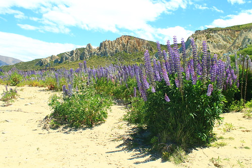
Clay Cliffs and Lupin
Purple lupin growing at the Clay Cliffs near Omarama
We took Lindi's Pass toward Omarama before doubling back across the Ahuriri River to the Clay Cliffs, a geological formation of very soft rocks exposed along the active Osler Fault. The cliffs are a deeply dissected feature that is the site of an ongoing battle between the uplifting tectonic fault and erosion. We stayed here for a short while and had lunch along the Ahuriri River, a beautiful place to dip your feet in the refreshing water and have a bite to eat. We made one more stop to the former river outlet of Lake Pukaki before it was dammed and diverted but also had time to stop at the southern end of Lake Pukaki to get a sense of what we were in for for the next few days.

Aoraki/Mt. Cook
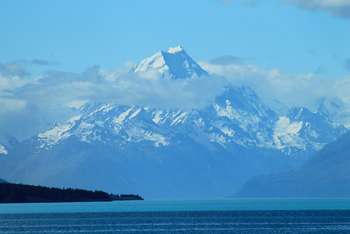
Aoraki/Mt. Cook (3,724 m/12,218 ft) looming over Lake Pukaki
The weather was bright and sunny and fairly few clouds against a blue sky, and from here, far off in the distance, was the brilliantly majestic peak of Aoraki (or Mt. Cook), the highest point in New Zealand at 3,724 meters (12,218 ft) above sea level! We had to stop here because the view was simply breathtaking, and because Aoraki is apparently often shrouded in clouds, we thought this might be our only chance to see its entire height! And I should mention Lake Pukaki because it was amazing in its own way. There is so much powdered rock, crushed by glacial erosion that gets washed into the lake that it takes on a very milky appearance which reflects the sky on a sunny day, turning it a turquoise colour that is really only best matched by a Crayola crayon of the same colour!

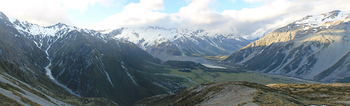
It was windy, so we got back into the vans and started the fairly long drive down the Mt. Cook Road toward Mt. Cook Village, the views along which were absolutely stunning. I'm jealous of the students in my van because they got to stare out the windows the entire time, while I had to keep my eyes on the road. But if you want a fun road to drive along, this is one of them. It just rolls and wraps its way long the lake and the ever-impressive Southern Alps just keep looming in the distance! Well, if the drive wasn't thrilling enough, once you're past the head of the lake, you begin driving through the wide and flat river valley that drains the Mueller, Tasman, and Hooker Lakes which are all fed by glaciers. And while you can't see the glaciers, as they are hidden by huge glacial moraines and tucked away around the mountains, you do see the incredible wall of ICE that is known as the Huddleston Glacier, which frankly, I thought was one of the most impressive things I've ever seen! It's just this massive, steep wall of ice that you just couldn't stop looking at!

Aoraki/Mt. Cook National Park
Looking down to the Mt. Cook Village from the Red Tarns. The Huddleston Glacier is the big wall of ice plastered
on the side of the Southern Alps in the distance. Mueller Lake and its end moraine seen in the bottom of the valley.
Aoraki (the Maori name for Mt. Cook) features prominently in Maori history. The Maori people believed the South Island to be a canoe that Aoraki and his brothers were using to voyage the world. It tipped and the brothers climbed onto the top of the overturned canoe and turned to stone. Geologically, Mt. Cook is positioned in the Southern Alps which are the result of convergence along the Alpine Fault which is the boundary between the Indo-Australian tectonic plate and the Pacific plate. The fault is mostly a dexteral strike-slip fault, but there is oblique convergence which has uplifted the mountains on the South Island. It is the Alpine Fault that causes most of the earthquakes in New Zealand, and also as it cuts across the north part of the South Island it goes offshore east of the North Island where subduction of the Pacific plate under the Indo-Australian plate results in the volcanism the North Island is famed for!

Well, while all of the students were excited to get out of the vans and start eating and drinking for the night, I had picked up a wee trail map and having heard that weather is rarely clear in the park, I thought I'd take advantage of it by doing a short hike up to the Red Tarns, some small ponds perched high up the mountains above Mt. Cook Village. Luckily summer in the Southern Hemisphere means plenty of light late into the evening, so I didn't have much to worry about - other than breaking my ankle with no one around! Well, the hike up was unrelentlessly steep, but I eventually made it to the tarns, which in and of themselves aren't that impressive, but you don't make that kind of hike to look at a pond, but for the view of the rest of the valley. Up here, you're so high up above the valley that you can see up and over Mt. Wakefield to Mt. Cook as well as up the Tasman River valley to The Armchair and Malcher Peak. The weather was holding up, so I decided to climb even higher to the shoulder of Sebastopol, the lowest peak in the National Park. Catching my breath, I decided my hunger would win over my want to reach the summit, so I raced down a big scree slope and headed back to dinner at the Mt. Cook Village.
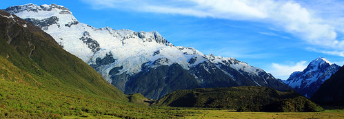

Aoraki/Mt. Cook National Park
The Huddleston Glacier and Mt. Sefton (left), Aoraki/Mt. Cook (right), and the Mueller
Glacier's end massive end-moraine (centre-bottom)
Weather was clear the next morning again, blue skies and few clouds, so I walked up toward The Hermitage - the famously fancy resort hotel in the National Park that looks directly over to Mt. Cook - for a few morning photos before joining back up with the students. We drove up to the Mueller Glacier overlook for a few more student talks. During one of the talks, we all of a sudden heard this huge crack that sounded like thunder, followed by a cascade of booms and crashes. It was so startling that everyone turned their heads to the glaciers behind us. Though we couldn't see anything, it was pretty obvious we'd just heard a massive block of ice break off the Huddleston Glacier, falling down onto the Mueller Glacier below. Coincidentally, the student giving his report was just talking about ice falls. Talk about timing!

Blue Ice
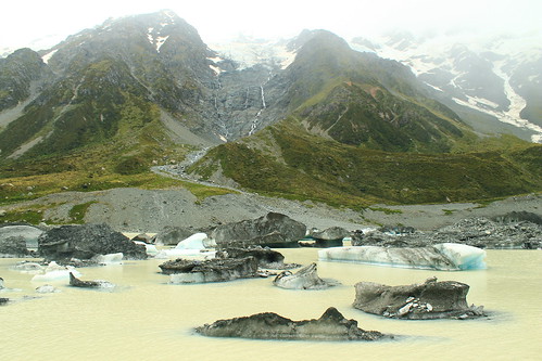
Icebergs from the Hooker Glacier floating in Hooker Lake
Once the student talks were done, we started the long hike up to Hooker Lake and the Hooker Glacier that sits right at the base of Mt. Cook. We continued to hear booms of breaking ice behind us during the hour-long walk up to Hooker Lake, which was cool, but the weather turned, which was not. We could see the clouds rising up from the west and flowing over the mountain tops to our left as the wind picked up and threatened to rain us in. But, being geologists, we go out in anything and this certainly didn't stop us and the last few students presented their mini-reports. You couldn't really see the mountain peaks by this point, but you could still get great views over Hooker Lake which was just chockers full of icebergs in various stages of melting, all shapes and sizes! By the time we left Hooker Lake, the weather had cleared up once again, permitting us to drive around to the next valley over to the Tasman Glacier and Lake.

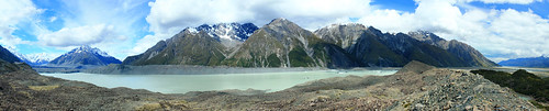
Tasman Glacier and Lake Panorama
Lake Tasman is a recent feature to the landscape, having only formed in the last 40 years after the Tasman Glacier (left)
retreated to its current position!
Lake Tasman is impressive, if not for its size (7 kilometres long!), for the fact that 40 years ago, it was not there! Forty years ago the Tasman Glacier's terminus was at the lookout most visitors take the short walk up to from the car park. Now, however, Tasman Glacier ends in the lake and icebergs calve off its front. Though the retreat is impressive and offers the opportunity to take speed boat tours around the lake, it just means our changing climate is killing off these magnificent glaciers!

We headed back out of Aoraki/Mt. Cook National Park toward the town of Twizel where we'd be based for the remainder of the trip. Over the next 5-6 days, the students would be working on small group projects in the area, and we, the trip leaders, would drive them wherever they needed to go. But first, we had another stop to get to up beyond Lake Ohau on the other side of Twizel. By the time we got beyond the shores of Lake Ohau, the weather came back with a vengeance.

The next day was fairly uneventful. The rough weather had cleared up and the students used the day to plan their projects. Twizel itself is a pretty dull town. It was founded as a working camp during the construction of the dams that were built on Lake Ohau, but remained a popular stopover point for travelers going to Mt. Cook (not to mention cheaper than staying in Aoraki/Mt. Cook National Park. While there are some nice coffee shops and cafes in the main shopping area, there isn't much to speak of - especially of the locals. While eating dinner at the Power Station Bistro I noticed one man down his beer outside and promptly walk to a short brick wall and urinate on it! Welcome to Twizel, indeed!

I played chauffer for students heading up back into Aoraki/Mt. Cook National Park over the next three days to collect data for their projects. Depending on which group was where, and when they needed to get to their next stops, I often had anywhere from an hour to a few hours by myself before I had to meet any of the students and move them. This was nice because it gave me time to do a few shorter walks and explore the park a bit more. One of the days I walked up the Mueller Glacier trail to see the head of the glacier which had retreated around the corner of its valley, out of sight from the main view point. Right at the bottom of the Huddleston Glacier. No one else was up this far and I enjoy sitting in the sun in the middle of this amazing landscape. I felt so fortunate to be able to experience it in all its sun-shiny glory!
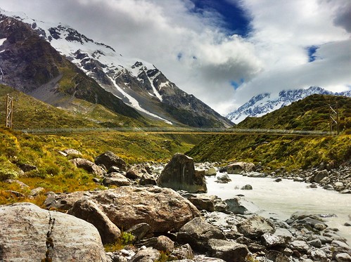
Hooker River and Bridge
Suspension footbridge over the Hooker River. Aoraki/Mt. Cook shrouded in clouds
I also joined a few student groups on their quests to collect field data. This varied from walking up along the crest of the lateral moraine along the edge of Tasman Lake looking for students who had gotten well-ahead of me, helping students measure boulder dimensions in streams coming down from creeks draining the steep valleys to the west of Mt. Cook Village, and taking one more walk up to the iceberg choked Hooker Lake.

I had no plans to see any more of the South Island on this trip, and though I was a bit let down about not being able to do that before arriving, I don't think I could have asked for a more amazing experience that just being able to wander and explore the Hooker and Tasman Valleys in Aoraki/Mt. Cook National Park. It really must be one of the most spectacular landscapes I've been to. It's drastic, but accessible; staggeringly expansive, but easy to get around; busy with tourists, but big enough that you don't have to go far to get away from them!
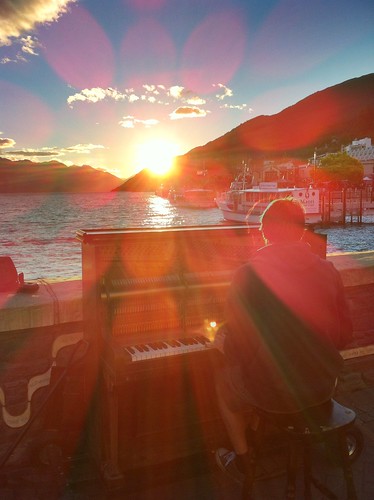
Queenstown Pianist
Pianist playing his own music during a beautiful Queenstown sunset
over Lake Wakatipu
The students had a final day in Twizel to write up and hand in their reports, so the last day near the mountains wasn't all that exciting. Finally, we were ready to leave Twizel and made the long drive back to Queenstown for our last night in New Zealand. We arrived early afternoon and many of us had previously signed up to go whitewater rafting to celebrate the end of a long week. We dropped our things off at the hostel and met down in the town at Queenstown Rafting where we were fitted up with wetsuits and packed into large vans with a trailer packed with rafts in tow behind us. This is no big deal, except to get to the launch site, we had to drive down Skippers Road, a long, very tightly-winding road that is cut into the side of mountains with very steep slopes! To put it in perspective, if you sat next to the window, you couldn't see the edge of the road and it looked like there was nothing beneath the van! In fact in one or two places, there almost wasn't anything beneath the van... One tight turn has been so abused that the edge of the road has eroded to the point that side of the van on the inside of the road gets scratched by the rocks sticking out of the slope! At another point on Skippers Road, the road appears to be intact, but when you look back up at it from the river, you see that a big chunk of rock, that would otherwise support the road, has simply fallen away! If you're afraid of this kind of driving, there's no hope for you because no matter which side of the van you sit on, you're going to be exposed to one of these hazards!!!

But the rafting itself was awesome! I've only been whitewater rafting once before on the New River in West Virginia where the water levels that year were low enough that the big rapids had diminished many of the rapids, so I wasn't sure what to expect. Well, the Shotover River is pretty much a narrow, narrow canyon with rocky cliffs on either side and in most places the river is as wide as the raft! I've got to give it to the raft guides because they have some of the hardest jobs in the world in keeping us all safe! While we didn't flip, like we did on the New River, there were so many times I thought we were goners! Two girls did fall out at one point, but we safely got them back on the raft just before they were pinned between the rocks and raft! The trip culminates a tunnel that was blasted into the mountianside to funnel water for gold mining in the mid-1800s, the final rapid is shooting down the mill run right where every raft in front of us was waiting and watching, hoping someone would flip. We didn't, but had a great time and it was an awesomely adventurous way to end a week in New Zealand!

That night was spent out in Queenstown watching a beautiful sunset over Lake Wakatipu and eventually some mechanical bull-riding in one of the town's innumerable options of Western/Cowboy-themed bars. Flights back to Sydney the next afternoon gave me a little bit of time to walk around the local Saturday markets along the lakeshore in what ended up being a very nice sunny relaxing way to end my last visit to New Zealand in a long time! Definitely not the last, but a long time at least!

Saturday, June 7, 2014

Scotland: Beinn Narnain, Beinn Ime, and Ben Vorlich (Munros 3-5)

Beinn Narnain and Beinn Ime

Date: 27 May 2014

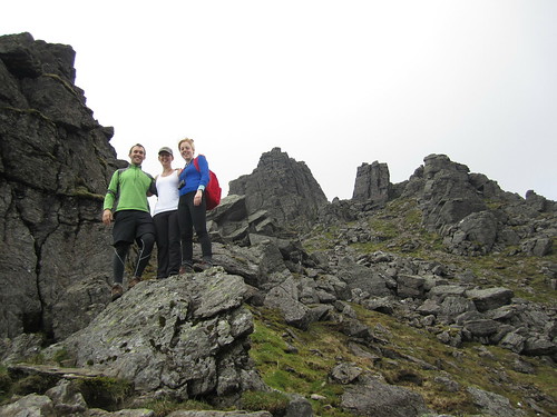
I've said it before, but it's worth saying again: when the weather is nice in Scotland, you've got to go take advantage of it! Luckily, as a student, as long as my work gets done on time, it (kind of) doesn't matter when I do it. So when the sun comes out, it's time to go! A few weeks ago, my classmates Hazel and Ruth and I headed off to Arrochar, west of Glasgow near Loch Lomond to hike a few of the Munros in the Arrochar Alps. It was supposed to rain a little bit in the afternoon, but it was clear now and we decided to take the steeper route to the summit of Beinn Narnain and get that over and done with first, figuring if it was rainy later, the steep slope would be too slippery to come down.

It was the right decision. The path up from the Argyle Forest Park parking lot to the summit is a long and tiresome, seemingly never-ending steep trail from sea level right up to 600 meters before it finally levels out for a little while. Once you're up and out of the forest, the views are magnificent and when you get to the part that levels out, stunning views of the craggy peaks of The Cobber loom into view.

The Spearhead
Final ascent up Beinn Narnain through The Spearhead
But of course with all hillwalking, there are about three or four "false peaks" that make it seem like you're almost there, but then...nope! One of these false peaks was the Cruach nam Miseag and we really thought we might be to the summit. Instead it was just a vantage point where we could see the trail go down in elevation before winding its way up between huge rock outcrops called The Spearhead! A few hikers were threading their way through The Spearhead and we could hear their voices echoing while we sat and had a wee break. The rest of the trail wasn't terrible, however. It turns out that getting up through The Spearhead didn't take long at all and as a geologist, the blocky and square outcrops that towered overhead were just fascinating!

After one last rocky gully we clambered up through, we found ourselves on the top of the mountain - not the summit yet, mind you, but it was a flat walk from here. We stopped for a few photos looking over Loch Lomond from the top of The Spearhead and eventually made it to the cairn and trig point at Beinn Narnain's summit of 926 metres (3,038 ft). We stayed up there a little while to catch our breath and had a good look around us. It was quite cloudy, but the sun poked through every now and again, and the cloud base was higher than the mountains, so we had good views of all of the other Arrochars and even Ben Lomond across the lake.

Beinn Ime
Over and down from Beinn Narnain to Beinn Ime. Looking
back at it, the trail up Beinn Ime just looks squidgy!
We could see the next mountain over, Beinn Ime, from the top of Beinn Narnain and decided that it didn't look too awfully far off. Besides, the walk down to the "bealach" (which I think is the name for the saddle between two peaks) and up to the top of Beinn Ime was smooth, looked fairly shallow, and quite grassy, so it couldn't have been that bad, right?

While getting down to the bealach from Beinn Narnain wasn't bad, the bealach and the majority of the slope up to Beinn Ime was totally waterlogged from rain we'd had the previous few days. It wasn't all that warm, and soon conditions became worse as our feet sank into soggy, squidgy, grass, and our socks became soaked with cold water. As Hazel put it, it was a long plod. We didn't talk much and instead just kept one foot in front of the other until the path hardened underfoot and became more clear up at the higher elevations. A walker coming down the mountain told us we weren't too far off, and sure enough, the trail quickly leveled off and we walked along the ridge to the cairn at the summit of Beinn Ime, the highest of the Arrochar Alps at 1,011 metres (3,317 ft). Being so high, it was really windy, but luckily previous hikers had created a sort of a fortress around the cairn that blocked some of the wind, so we sat there having our lunch with the best view around!

It was windy and chilly enough, and our feet were still wet, that we didn't stay for too long and started the long plod down the mountain. Fortunately, the trail back to the car looped down the valley between Beinn Narnain and The Cobbler, so we didn't have any more walking upslope. We stopped for some snacks at some large boulders at the foot of The Cobbler but didn't stay too long. The rain came in just as we were getting back to the car, so while we weren't too wet, it did get us in the end. Good thing we hadn't gone down the real steep slope we started on!

(there's more below the slideshow)


Ben Vorlich

06 June 2014


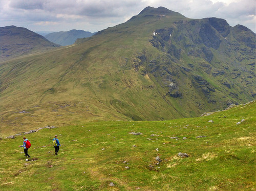
I decided to trade my Friday for my Saturday and since it was sunny on Friday, head off to the one last remaining Munro in the Arrochar Alps I'd yet to tackle - Ben Vorlich. I'd seen Ben Vorlich from my hikes up Ben Vane and the Beinns Narnain and Ime, and the reviews from Walk Highlands said to expect a steep and unrelenting climb to the summit ridge. The reviews were not joking! Luckily, I was hiking on my own yesterday, so I could take my own pace. Once I found the trailhead, as the reviews said, it just goes up. And up. And up. Though the trail is well-defined, it is not just steep, but wet, and mucky. So much so that one misstep could mean face-planting it into the hillslope which would not be good because there were a lot of rocks, too!

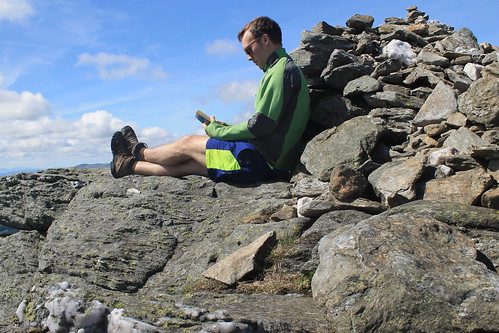
Ben Vorlich Summit
Ben Vorlich - a good place to have a read!
The walk up the slope gets you about 400 metres in elevation over the valley below, and even though the trail started to cut over along the side of the mountain, it sure didn't feel any less steep. The views started to get amazing though as the low clouds all around me started to clear. And near the top of the slope, massive rock outcrops and cliff-forming bedrock created an awesome geologic playground to be walking through! Even the mucky trail was shining with the weathered mica minerals that reflect sunlight so well.

Well, eventually the trail flattens out, kind of, but there is still a ways to go to get to the summit. And even when you get to the trig point, you're still not there because the actual summit is another short walk beyond! But once you're there, you know you're there - 943 metres (3,094 ft) is hard to miss! Not too many people were up at the summit, so it was nice and quiet. And though it was a bit windy, I was able to find a little crevice between some rocks, out of the wind where I could have my lunch and finish reading a book I've been trying to get through. It was so much nicer having time to enjoy the peace and quiet of the summit, rather than being rushed to get to the next one or forced off by inclement weather.

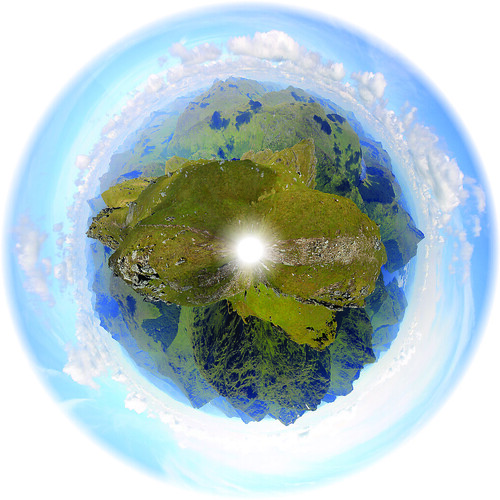
Trig Point Panorama
The panoramic planet I stitched together from the trig point
on Ben Vorlich
But soon enough, I felt it was time to start heading back down to the car park at Inveruglas where I'd been dropped off by the CityLink bus and was getting picked up from them, too. By the time I started walking down the weather was pretty much sunny and warm and I took my time with photography experiments and some of the best Loch Lomond scenery I've seen yet! The trail down the slippery slope I started on wasn't too bad going down, though I did slip a number of times, but before I knew it I was back down heading to the car park with plenty of time to spare. When I got there, the sun was warm on the rocks at the lake's edge, so I found a good comfortable spot, took off my boots and finished my book. Great day away, but tomorrow will have to be a work day. I just hope it actually rains so I don't feel guilty for taking a Friday off!

Sunday, May 25, 2014

United Arab Emirates: 9 Hours in Dubai

Date: 04 February 2014

At the end of January, I'd finished my time in Australia and it was time to fly back to Glasgow. The University booked my flights and since Qantas offered the cheapest airfare at the time, I was flown back to Glasgow via Dubai. Now, I'd never been to a Middle Eastern country before, though I imagined Dubai would be to the Middle East what Singapore is to Asia, that is all the uniqueness of a culturally different place with many of the capitalistic comforts of home. Oh, the fact that I'd be able to get around without knowing any Arabic was a major plus!

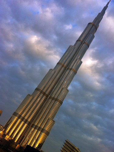
Burj Khalifa at Sunrise
The towering Burj Khalifa - World's Tallest Building
at sunrise in Dubai
I'd looked up a lot of reviews of the city before I left, and spoke with a few friends who'd been before. I wanted to be sure that I didn't just pass through the UAE (like I passed through Japan on my way home from Singapore a few years back), but that I experienced something uniquely Dubai-an. My flight landed early in the morning and I had 9 hours until my departing flight back to Glasgow. I figured 9 hours would surely be enough for me to get through customs, leave the airport, find my way onto the train, and then over to the Burj Khalifa - the world's tallest building.

In fact, with such a short period of time in the city, I figured the only thing I'd comfortably have time to do that was unique to Dubai was to get to the Burj Khalifa, take a trip up to the observation deck, come back down and return to the airport with plenty of time to spare in case security at the airport took a while.

It was fairly easy getting out of the airport after having figure which signs meant "This way to the Arrival Hall" and then figuring out which customs line I should get in to took a little help from one of the attendants. But getting through proved no big feat, and with a US passport you can easily get out of the airport to see the city for the day. The public rail system in Dubai was super easy to use and navigate, once you had a map in front of you, but it was like no other train ride I'd been on before! It was still early in the morning and the foreign workers heading to offices and construction sites were packing into the train at every stop. The seats were lined up parallel to the sides of the trains with the rest of the interior saved for standing room. Across from me, however, the bench was full but at one stop a man from southern Asia boarded the train and just sat down on the laps of two men who were already sitting on the seat! The reactions of the two men were priceless: one was listening to his iPhone and kind of woke up, looked at the guy who'd parked half of his bum on the guy's lap, but went back to sleep. The other guy just nervously sat there, giving annoyed sideways glances at his unwelcome lap-sitter, but still never said anything! I tried imagining what the reaction in Chicago or New York would be. Surely not as passive!

I got off the train at the stop for the Burj Khalifa and headed down the very long walkway from the train station to the Dubai Mall, but it was only 9am and every single store was closed. Nothing really opens in Dubai until 10am but the mall was still open to walk around in, even if the escalators and lights weren't on. But I made my way down to the ground floor and out to Downtown Dubai, the main plaza and huge fountain/pool in front and at the base of the Burj Khalifa.

Sheikh Zayed Road
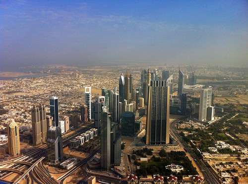
Dubai skyscrapers lining the Sheikh Zayed Road
The Burj Khalifa is the world's tallest structure, standing at 2,722 feet (over half a mile high!) and has 163 floors, of which the public can access the Observation Deck on the 124th floor (over a quarter-mile up)! Having previously purchased a ticket, I was able to get in early enough in the morning that there was no huge line-up in front of me. In fact, I had the elevator up to the Observation Deck to myself for a 60-second quick lift up those 124 floors. I was thinking the observation deck would be like the Sears Tower (Willis be damned!), all enclosed, especially being that high up, but the majority of viewing platforms were actually outside with little gaps in the 20-foot high windows that you could stick your camera out to get a clean picture. But I tell you, I get so nervous when I see people doing that, and I surely don't trust myself to not drop my phone or camera. But the views were amazing! to the north was the Persian Gulf with its beautiful blue waters. And in all other directions was desert. Miles and miles of desert. And it doesn't take much to kick up a lot of sand into the air, and even though it was barely noon, the mixture of haze and sand made viewing anything with any semblance of clarity near impossible.

With the observation deck getting more crowded with obnoxious tourists, I headed back down to the main floor, took a few more photos outside, and then hopped on the train back to the airport. I figure that the next time I'm there, I'll try and spend more time seeing the cultural sights, but doing the Burj Khalifa was enough for me for the day and I found a small lounge chair in the airport and had a little snooze before my flights to Glasgow took off.

Scotland: Ben Lomond and Ben Vane (Munros 1 & 2)

Ben Lomond
 
Date: 15 April 2014

A few weeks back, Glasgow experienced a rare weather phenomenon: we had eight days of beautifully sunny and warm weather! The first of these days, we'd been coming out of rainy doldrums and being Scotland we weren't sure how long the sun would stay, so even though it was a Tuesday, a friend of mine from the University and I decided we'd take advantage of the weather while it was still good, made plans, and drove out to Loch Lomond and the Trossachs National Park, taking a small one-lane windy road around the north shore of the famous lake to the foot of Ben Lomond - the southernmost of the Scottish Munros.

Scotland is famous for its brilliant hillwalking everywhere, but especially in the Highlands. Here, any peak that is over 3,000 feet above sea level is classified as a Munro - anything less is classified as either a Corbett (2,500-3,000 ft above sea level) or a Graham (2,000-2,500 ft asl). There are 282 Munros, and anyone who attempts to climb them all is called a Munro Bagger. Having never done any hillwalking in Scotland before (save maybe the walk to the Old Man of Hoy in the Orkney Islands), I figured what better way to claim my first peak than to hike up to the summit of the southernmost Munro as well as being the peak with the name of the National Park it is in!

The walk took us about six hours, round-trip, and while it was not a challenging hike, per se, it was a beautiful one, nonetheless. Ben Lomond is tall (974 meters, or 3,196 feet above sea level) and since you start very near sea level, the whole elevation is yours to climb. Well...climb is a bit of an overstatement. The walk up Ben Lomond is a pretty easy ramp along a well-marked trail. About three quarters of the way up, the ramp does steepen and the going gets a bit slower, but it's still not challenging if you take your time.

Loch Lomond
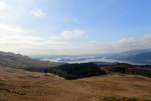
Beautiful views of Loch Lomond all the way up to the summit
My friend and I kept a good pace the entire way up to the top. We had to since even though the sun was out, the wind was a bit chilly, but the views from the walk of both the summit - which would be hidden by clouds for short periods of time - and the beautiful lake beneath us were stunning! There was still snow up at the top on the steep, north-facing slopes, and though we enjoyed it at first, we quickly steered away from it, realising that the possibility that any of the snow packs could collapse and avalanche down the mountain was pretty high!

By the time we got to the summit, the weather had cleared up enough for some good photos and the views of the Arrochar Alps across the lake and the Trossachs to the north were great! We had lunch up there shortly after 1:00 pm, but didn't stay long since we still had to descend. Rather than going down the same way we came up, we headed down a smaller ridge that ran parallel to the lakeshore, bringing us right back to the parking lot. Once down from the top, the wind died down a bit more and the clouds all but vanished. We stopped for a wee snack and watched a Royal Air Force jet fly through the lake valley below us for some sort of training mission. By the time we got to the car, it was nearly 4pm so we had one last little snack on the lakeshore before heading back into Glasgow.

(there's more below the Ben Lomond slideshow!)


Ben Vane

Date: 19 April 2014

Later on in the same week - again, the weather couldn't have been better - a larger group of my friends from the office and I carpooled out to the south side of Loch Lomond to climb Ben Vane, another Munro, 915 metres (3,002 feet) above sea level. While not as high as Ben Lomond, Ben Vane offered up some extra challenges. Mainly, we had to find our own path from the access road up to the path on the trail guide, and higher up the trail got quite steep and we zig-zagged our way up between large rock outcrops, scrambled over boulders and other rocks, and slipped our way over some small snow patches, all the while dodging sheep and trying to keep our feet dry while walking over purely soggy ground!

Sheep and Ben Lomond
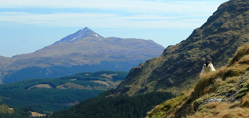
One of the many sheep that dotted the hillslopes on the way up Ben Vane - keeping a keen
eye on us as we summit the Munro. Ben Lomond in the background.

It was great, though. We started off at the Inveruglas parking lot on the shores of Loch Lomond and had to walk up a very long access road past a hydro power station. We couldn't find the trail from the access road up to the ridge we were supposed to follow to the summit so we just marched on up a big long slope, dotted with boulders and massive rock outcrops sticking up from the water-saturated muck beneath our feet. We had perfect views over Ben Lomond and Loch Lomond and with plenty of shaggy sheep running every which way, there were plenty of pure-Scotland moments!

Once we got to the top of the ridge, we followed its gradual path up to the base of the real mountain. Here, the path took steep hairpin turns with large steps up over rocks with a big outcrop every so often that offered a good place to take a break for a moment and steal some fantastic views of the surrounding Arrochar Alps!

The walk was a long and steep one - a bit more strenuous than Ben Lomond. It was one of those mountains that every time you think you reach the summit, there's more to go! The path eventually gives way to some scrambling up and around some rocks, down some rocks, and over some snow banks, but we finally reached the top and were rewarded with stunning views of Ben Lomond, Ben Ime, A'Chrois, the Cobbler, and Beinn Narnain. The schist rock that underlies the Arrochar Alps stuck out in many places at the summit, showing off its beautifully warped and metamorphosed structure, giving the whole summit an incredibly unique geologic feel!

The thing with Munro Bagging (at least from what I've experienced in the two hikes I've done), is that you don't linger at the summits for very long. We stayed up at the top for maybe fifteen minutes before turning right back around and heading down. But the whole walk was well worth it. We had a good group of people, a fantastically nimble dog, and stunning weather! And I can't wait to tick-off the other Munros of the Arrochar Alps off my list soon!

Sunday, April 6, 2014

Australia: Whitsunday Islands in a Weekend

Trip Date: 06-08 September 2013


A few months ago, back in early September, I took off early and flew from Sydney to Hamilton Island, one of the entry airports to the Whitsunday Islands on the central Queensland Coast. I’d heard about the Whitsundays from a couple of friends who’d been there before and the more I looked into it, the more these pristine islands, world-famous for their sailing cruises, appealed to me.

Whitsunday Islands
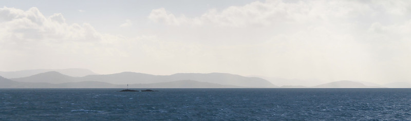
The beautifully hazy Whitsunday Islands

If you’re traveling on a budget and have the time, you might consider flying in to Mackay a few hours to the south. But if you sign up for discount airlines’ emails, you can get affordable tickets right into either Proserpine airport at Airlie Beach (on the mainland) or into Hamilton Island airport on, well, Hamilton Island. When I booked my tickets Hamilton Island was my best entry point and it was still cheaper and more convenient to buy a round-trip ferry ticket to Airlie Beach on the mainland than it is to fly into Mackay and find your way up to Airlie Beach. Alternatively, if you have a good couple of hundred of dollars in your pocket, which I as a student do not, you can just stay out on Hamilton Island in one of their very swanky accommodations.

I got in on a Friday afternoon while the flight was smooth most of the way up, the winds coming in off the Pacific made for a very bumpy and tipsy landing – one of the worst I’ve experienced in a while! With that said, the views coming in to Hamilton Island are stunning. Beautiful blue water, dozens of lush green islands, and stunningly white sandy beaches. It makes landing on a short island runway all worth it!

The weather wasn’t all that great and I began preparing myself for a less-than-relaxing sunny beach weekend than I expected. While waiting for the ferry to take us to the mainland, the clouds came in dark and ominous and at times spitted a bit of rain. Back in February of 2013, a massive storm struck the islands causing widespread damage that was still visible in September as some boats were still washed up onto breakwaters, shoals, and jetties – but of course none of the tourism ads show that but rather want you to think it is always sunny here (something the girls in the row in front of me on the plane clearly had in mind). It all just depends on what you get and you should just prepare yourself to have fun no matter what.

And that was my plan. I’d booked a bed at the YHA in Airlie Beach and planned on doing some beach-visiting, snorkeling, and bushwalking while I was here over the next day and a half. Like all other YHA hostels I’ve stayed at, the one in Airlie was fine for accommodation, though maybe a bit more utilitarian. It was quiet when you wanted it to be and comfortable, though, so I had no problems with it. It is a backpackers’ accommodation though, and one thing you can’t get away from is the constant pressure to socialise with anyone else who happens to be staying in your room. I’d booked a bed in a dorm and there was a nice guy from Sweden in there who immediately started chatting me up. I was fine with that for a few minutes, but the incessant need for him to keep asking me questions about where I was from, why I was in Airlie Beach, and what I was going to do there started driving me crazy. After a series of me giving him one word responses, I decided I needed a sign that reads, “The only reason I’m staying here is because it’s cheap,” especially if I keep staying at hostels rather than the more expensive beach-side resorts.

Cormorant Welcome
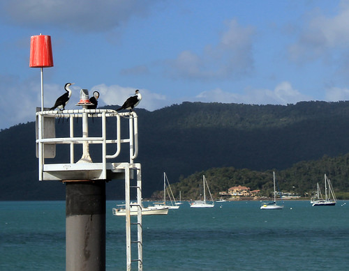
The cormorant welcoming committee in Airlie Beach
I really wasn’t trying to be antisocial, but I had already decided on the flight in that this was going to be a nice me-weekend. Unfortunately, Airlie Beach is just not a place for that as backpackers are literally everywhere and the atmosphere in nearly all of the local pubs and bars plays testament to the party scene Airlie is so well known for.

I decided on a pub for a burger desert – it doesn’t really matter which pub; they’re all crap and went back to the hostel to test out my new LifeProof waterproof iPhone case. Initially, I’d wanted to invest in a GoPro camera for all of the snorkeling I was going to be doing over the next few months, but they’re not cheap and instead I decided an iPhone case was the next best thing. Customer reviews did nothing but rave about LifeProof cases and for $70, I figured I’d take the risk and after unpackaging the case in the hostel and submerging it in a rubbish bin full of water (without the phone in it, of course) for half an hour, the inside proved to be perfectly dry. I was happy with it enough to give it a go out on the reefs.

Early the next morning, me and a few other backpackers (I hate using that term for myself, but it’s just easier) were picked up from the YHA by Ocean Rafting, a company I found through Trip Advisor which is eco-certified and boasts their pro-environmentalism vehemently on their website. Considering the Earth is continuously warming and ocean acidification an ever increasing problem, I figured it would be responsible of me to go out to the islands and reefs with a company that so clearly cares about the environment they take tourists to. Ocean Rafting also was appealing because their boats only take ~25 people on them so you get a much more personalised and intimate tour of the Whitsundays. Finally, Ocean Rafting has a sister company in Cape Tribulation (Ocean Safari) and you can get a small discount if you book a combo trip with both companies and since I’d be going up to Cape Tribulation in October when my family visited, I figured I might as well save a few bucks!

We were some of the first ones out to the dock where our boat, Thunderstruck, was moored and it took a while for everyone else on our tour to show up, but soon we were all squeezed into our wetsuits – a new experience for me – and stepping on to Thunderstruck which was an open-topped speedboat with large pontoons on either side. We could either sit on the benches or on the pontoons and our van-driver that morning said today was a perfect day to ride up front or on the pontoons since the swell coming in off the ocean was still pretty big and the boat was designed for wavy conditions. I had no intention of missing out on any bit of adventure, so I rocked on up to the front row of benches with a truly Irish couple – the guy had a penchant for saying, “Fuck” and “Shit” every other word – which got to be a bit much by the end of the day, but they were good company.

The sun was not out in full brightness yet, but I could tell that the rough weather experienced on my arrival the night before was clearing up and by the time we picked another few people up from Daydream Island and passed through the Molle Islands, the clouds had disappeared and it was obviously going to be a great day! There are dozens of islands in the Whitsundays and when big ocean swells hit them, the waves are refracted around the islands, funneled between narrow passages, and come at you from every which way, which made our boat ride out to the channel between Hook and Whitsunday Islands incredibly bouncy and fun! People were screaming as the prow of the boat lifted up over a wave and came crashing down into the trough on the other side. Our morning driver was right – the choppier the water, the better the ride is on these boats!

We passed through the narrow channel between Hook and Whitsunday Islands and turned right to follow the shoreline of Whitsunday Island which rose up from the sea in steep, bare granite cliffs. It wasn’t before long and the boat slowed down on the opposite side of a skinny peninsula that separated us from the famous Whitehaven Inlet and beach. We hiked up to the ridgeline of this skinny peninsula barefoot and in our wetsuits through the subtropical heat and humidity to a vantage point from which you can see Whitehaven Beach in all of its pristine, white, sandy glory!

Whitsunday Islands National Park
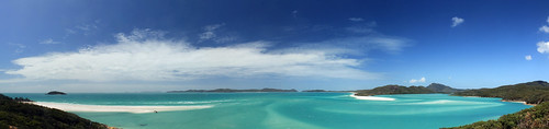
Beautiful turquoise waters and white sand of Whitehaven Beach and Whitsunday Inlet.

To the local Aboriginal people, the Whitsunday Islands are sacred and focus heavily in their Dreamtime stories and of particular significance are the literally thousands of stingrays that call the estuary home. The estuary itself is not terribly long but it is quite wide and the stream flowing out to the ocean is clearly marked from the white sandy deposits by its bold, brilliant, turquoise colour. From the viewing platform, you see not only the stunning estuary, but you look down over bright white sand spits built by longshore currents transporting sand down from Whitehaven beach which stretches as far as you can see in front of you. Geologically, the sand on Whitehaven Beach has been transported hundreds of kilometers along the Australian coast and the purest quartz sand grains are eventually deposited along the beach as coastal currents eddy between the Islands. The fine silica sand is so pure that even on the hottest days it is quite cool to the touch because quartz just does not retain heat well. It is easy to see why the Whitsunday Islands are designated a UNESCO World Heritage Site.

We didn’t linger long at the viewing platform, abandoning it for lunch down on the white sand spit at the mouth of the estuary. The great thing about the tour with Ocean Rafting is that they are the only company allowed to anchor in the estuary itself. No other company is allowed to anchor here and no one is allowed to remove anything from the beach or any of the islands due in part to their listing as a World Heritage site, but also due to their sacred significance to the local Aboriginal people. Only one organization has legally been allowed to remove sand from the beach. Back when NASA was building the Hubble Telescope, they needed the purest silica in the world to melt and form the telescope’s lenses, as any impurity at all would ruin the telescope’s capabilities of photographing space’s wonders.

We spent about an hour on the white sand spit trying to keep our lunches from being stolen by seagulls. No one really talked and while I think it was because of the sun and hunger, I’d like to believe it was because everyone was in awe at this magnificent gem of natural beauty!

After lunch, our boat took us back north toward Hook Island and through what the captain and tour guide referred to as the Devil’s Washing Machine – an area of water where the swirling eddies converge together and the ocean’s wave double in height! Sitting on the side pontoon of the boat, with nothing to hold on to but a small canvas strap between my legs, this proved to be much bouncier of a ride than if I’d had a seat in the boat but it was amazingly fun feeling your body leave your seat as the boat falls back to the water after running off the crest of a wave!

Soon we arrived at the first of our two snorkeling sites on the east side of Hook Island. This was the first time I was going to have willingly jumped into the ocean since I went snorkeling in New Zealand’s Bay of Islands, which was the beginning of conquering my personal and very irrational fear of the ocean! I knew that putting myself in with a group of people who weren’t afraid to just jump in the ocean would pressure me into not being a chicken, but then while the captain was explaining what we’d be seeing at this site, his deckhand pulled a jar of fish food out and started throwing the little kernels of food into the water. As he did this schools of fish too many to count would swarm the water where the food landed – mostly schools of a blue-yellow fish (NOT SURE WHAT IT’S CALLED??).  But what worried me the most was the much larger Maori wrasse – massive fish that can grow to six feet in length with large beak-like mouths. Supposedly, Maori wrasse are harmless, but their size was intimidating enough for me to hold back on the boat much longer than everyone else, petrified to jump in in case one of these massive fish were to sneak up on me!

But money talks, and I reminded myself that I’d bought the waterproof iPhone case for this purpose and that I needed to put it to good use. I slipped on my flippers, tucked my camera into the sleeve of my wetsuit, donned my mask and snorkel and flopped off the side of the boat. I was in, and it was amazing! Whereas we saw heaps of sea urchins and seaweed amongst the rocks snorkeling in New Zealand, there was nothing but fish and coral here! Huge stacks of all of the coral you’ve seen in movies, books, and pictures and just as many types I’d never seen or heard of before! There were loads of fish – mostly the ones schooling around the food but also rainbow parrotfish, big fish, small fish, and yes, even the great Maori wrasse which I saw sneaking up on me from behind, though turned away before getting too close to me!

We were in the water for about an hour before being called back to the boat, which didn’t take me long as I didn’t dare venture too far away, but took some of the more intrepid explorers a wee bit longer. Because of the windy weather that hit the islands on the previous few days, sand had been stirred up all around the islands that made visibility low and the captain thought we might have better luck a few bays further around the island. We made the short trip to the next bay and spent another hour or so exploring the corals here. Indeed visibility was better and I was a bit more adventurous and tried seeing as much of the reef as I could. It was truly like being in an underwater wonder world and even I was amazed at how quickly my inhibitions melted away under the spell of the reef.

Hook Island Reef
Parrotfish on the reef!
I think everyone should be able to experience a tropical reef up close at some point in their life  - though the scientist in me cautions anyone who does to be very conscious about what company they use to get to the reefs. Climate change, warming ocean waters, and acidifying oceans are killing reefs all around the world. They are some of the most delicate and fragile ecosystems in the world yet are crucial for the survival and sustenance of all the oceans.

It was getting late and we boarded the boat one last time before finishing our circumnavigation of Hook Island, past the old resort of Hayman Island, and back toward Airlie Beach. The seas were still rough but I wasn’t upset I once more found myself riding the pontoon on the way back for one of the wettest rides on the boat!

There’s nothing to report from my second night in Airlie Beach because it’s a dive and not worth wasting words on.

I woke up early on my third day in the Whitsundays and walked back to the ferry docks to catch the first ferry back to Hamilton Island. My flight back to Sydney wasn’t until later in the afternoon, but I wanted to do a bit of bushwalking and it looked like there were some great trails on Hamilton Island. Indeed, once you get past all of the resort villas, bungalows, hotels, condos, and conference centres, you find a track that leads up to the rocky lookout called, Passage Peak.

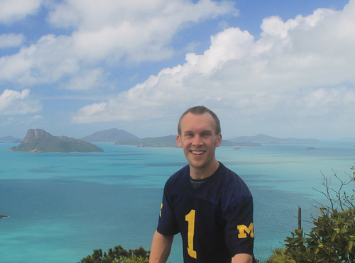
It only took about an hour to reach the peak, though unless you’re an avid hiker, I’d plan on it taking more than that. The weather was hot, but the sky was perfectly clear for looking out over the islands from one of the highest points in the islands! Fluffy white clouds marched through the sky in endless precession, casting shadows on the clear turquoise water. I had a nice chat with some other bushwalkers at the top and they pointed out some pairs of whales they’d seen while I told them about Whitehaven Beach which you could see over the lush green slopes of neighboring Whitsunday Island. Though it was Sunday in Australia, it was a Michigan Game-Day Saturday back home, and in true fashion, I proudly wore my UM Jersey, which I also had to explain to the other hikers, but they generously took photos of me, saving me from yet more selfies. Eventually they left and thus left me to one of the most spectacular viewing points of natural beauty I’ve ever seen!

Wherever You Go, Go Blue!
Going Blue during a bushwalk to the summit of Passage Peak on
Hamilton Island. I believe we beat Indiana that day!
I had plenty of time to walk back to the airport, so I took my time with it singing Michigan Songs from Glee Club on the way down since I think it was the weekend we beat Indiana. I called and chatted to my sister over lunch and then made my way to the airport which is conveniently within walking distance from the marina and after not too long was back in the air headed home to Sydney. 

My weekend in the Whitsunday Islands reaffirmed what I’ve learned so often in Australia: it does not take much time or money to have amazing experiences in beautiful locations. I was away for less than three days, yet I have some of the most vivid memories of nature, landscapes, the ocean, and animals I’ve ever had. If you get the chance, go! To the Whitsundays, absolutely, but also to anywhere you’ve been wanting to see!
 

Australia: Skiing Perisher and Thredbo

Dates Traveled: 9-11 August 2013

It was a Thursday before a weekend I was not planning on leaving Sydney, but I had some friends driving down that night for a long ski weekend in Australia's Snowy Mountains. An invitation was given kind of last minute as someone had dropped out and there was suddenly space in the car. While my bank account said, "No," my heart said, "Go!" And soon, I was off for my first International skiing experience!

Australians don't seem to realise just how cool their own backyard is, it seems! Everyone I spoke to about skiing in Australia just kind of scoffed at their resorts and in a seemingly ashamed way told me that, "Well, it's nothing like New Zealand, or Japan, or the Rockies, or the Alps." But growing up in Michigan, skiing anywhere that is more than a big hill is pretty exciting for me! But it wasn't just the quality of skiing Australians scoffed at. When I told people I wanted to climb Mt. Kosciuszko, Australia's tallest peak, which is in the Snowy Mountains (in Kosciuszko National Park), the typical response was, "Oh, don't waste your time. You don't really climb it but walk up to the top, anyway." So because of all of this, I wasn't really sure what to expect. The main resorts in New South Wales are near the town of Jindabyne, pinched between the New South Wales-Victoria border and the Australian Capital Territory. I'd been to Jindabyne the previous November while doing field work and saw all of the rental facilities, restaurants, repair shops, and hotels that were all closed for the season then, and I figured that surely the skiing must be good enough to support this much infrastructure.

The Snowy Mountians
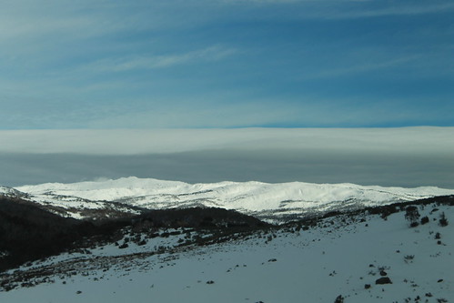
The aptly named Snowy Mountains, Australia's highest mountain range
Needless to say, I was confused about the trip, but was excited to go. There were five guys that I knew going, both skiers and snowboarders of various levels of expertise and after a night spent in Cooma, we stopped in Jindabyne to pick up a few sets of rentals for my friends, and continued on the road up to Perisher where we were going to spend two days skiing.

Let me say this, and let me be clear about something: Australian mountains are nothing to be ashamed of! The granite mountains were tall with wonderfully deep valleys and the white snow that blanketed the tops of the mountains contrasted awesomely with the green valleys! Of course they aren't Alps or Rockies, and the ski resorts are few, but that area is beautiful!

I quickly hurried in to get my rentals from the resort and by mid-morning, we were all set to go! The sun was shining and we all set off as a group around Perisher. I've never skied anything like Perisher before! The granite mountain was nicely rounded and there were huge outcrops sticking up out of the snow which made the resort to be a veritable playground for a quality skier. Plenty of little jumps to hit and nice tree-less runs that you could build up huge speeds with enough space to race in and out of the outcrops.

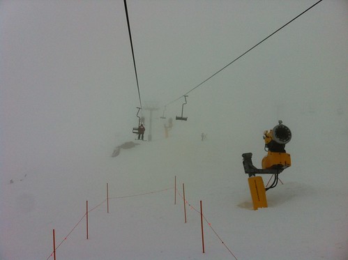
Cloud Cover
White-out conditions on top of Perisher
It didn't take long for our rather large group to splinter and my friend Craig and I were soon off to explore more challenging terrain. The west end of the resort is where the highest slopes are and we slowly worked our way up to the lifts on the far side. As the afternoon carried on, the weather started to get nasty and an incredibly dense fog moved in, but only blanketing the top of the mountains. We kept taking the lifts up, though it was pretty scary skiing down a slope on ice where you can only see a few metres in front of you! Once we got about a third of the way down, though, it was still foggy but you could see much farther, and then at the bottom everything cleared up just fine. We did that a few more times but the fog got worse and soon I couldn't see where Craig was. I noticed some orange posts in front of me to my left and to my right with a gap between. Knowing that the posts indicated huge rocks I should try to avoid, I decided to go through the middle. Looking over my shoulder for Craig to show him which way I went was a mistake because as soon as I did, my skis dropped out from under me as I went off some sort of steep edge and my body slammed into a snow bank below. I thank God there wasn't a rock there and that I had my helmet on, because I hit the ground hard! Somehow or other, Craig saw me and came to my aid laughing at me all the while.

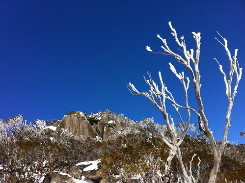
Perisher
Perfect weather in a beautiful winter wonderland at Perisher
I was a little dazed, but got up quickly enough and we kept going until the lifts shut down for the night. The great thing about the bad weather that night was that it gave us a ton of awesome fresh powder for the next day, which weather-wise, was the best you could have. Clear and sunny, warm but skiable. Our group started off together, but again split up shortly into the day, meeting up every so often to do a few runs or get a coffee. One of the really weird (but cool) things about skiing in Australia is that you're skiing through gum trees which don't lose their leaves ever throughout the year. So while anywhere else in the world you ski through evergreens and leaf-less gray trees, in Australia, you ski through lush green vegetation. And the branches are high enough that there is plenty of room to maneuver through them like wide open glades. Like I said, Perisher was just a skiers playground! Plenty of great runs, fun terrain, and lots of variety!

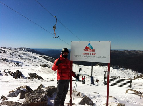
The third day we switched it up a bit and headed to the nearby, and probably more popular resort of Thredbo. Thredbo occupies generally steeper terrain and the runs are your more typical alpine runs and lanes as opposed to Perisher's openness. Australia's highest lifted point is here, and it is well above the treeline so the winds just rip across the mountain top, blowing away much of the powder and leaving behind a thin sheen of ice that you really have to carve through to get your hold. It wasn't long before three of us headed up to the top (via a series of T-bar lifts, which I found really bizarre!).  Here too, there were big granite outcrops and Rick, Craig and I started off toward the Golf Course Bowl (not sure why it's called that - I get the bowl part, but not the rest), but it was roped off so we had to navigate our way down a different way. There was a turnoff to go down an insanely steep chute called Cannonball and Rick and Craig just took off. Not wanting to get too far behind, but being less adventurous than them, I took my time. And holy hell!! It was pretty much a vertical drop covered with moguls with nothing but ice to try and grip into! Needless to say, it put my skills to the test, but I got through.

THE TOP
The highest lifted point in Australia! Top of the world!
A fun thing we all did throughout the weekend was track our runs using the Alpine Replay app for our phones. The app has trail maps from ski resorts around the world loaded in and uses your GPS position while you're on a chairlift to figure out exactly where you are. It then monitors your speed, records the total elevation you've skied, and tracks the runs you've taken with GPS. It also uses the accelerometer inside the phone to log how many jumps you've landed and how much air time you've had throughout the day. Without meaning to, I checked my speed at the bottom of one of the runs I bombed down and saw that I reached a top speed of 79.4 kph (50 mph)!! For the rest of the day, I tried breaking the 80 kph barrier before I realised it was a reckless endeavor and that I'd end up seriously injuring myself if I didn't stop!

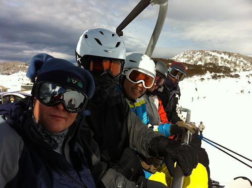
The Guys
The guys who ski!
Anyway, it was a great time with good friends and we had the most perfect weather for the weekend! By late afternoon of that third day, it was time to pack up and start the long six-hour drive back to Sydney. I may have learned to ski on little wee hills in Michigan, but I've skied the Green Mountains and the Appalachian Mountains in Maine, and I've got to hand it to Australia. Your resorts may be few, but they are fun and challenging and it was well worth taking some time out from my week to spend it in the Snowy Mountains with great friends!

Australia: Kings Canyon / Watarrka National Park

Travel Date: 20 August 2013

We didn’t have to wake up as early this morning as we did the previous morning, but after an early rise, and a quick pack up of our swags and gear back into the bus, we made the short drive to Kings Canyon in Watarrkah National Park. Kings Canyon lays claim to being the world’s largest canyon, surpassing all others including Arizona’s Grand Canyon, because “technically the Grand Canyon is a chasm.” I had even read that Kings Canyon was even more impressive than Uluru, so needless to say, my expectations were very high!

From the parking lot, Adam pointed out the canyon which cuts its way through the sandstone ridge to the north, and to the trail that we were taking which follows the rim of the canyon. Looking at it from the parking lot, it was clear that my expectations of grandeur were going to be dashed. Semantics aside, the canyon is definitely not bigger than the Grand Canyon (not by a long shot!) and in my opinion, not more spectacular than Uluru.

Kings Canyon Illumination
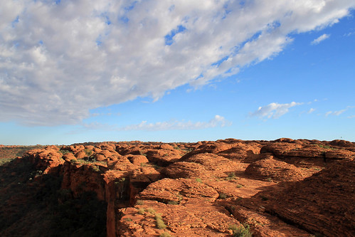
Panorama of Kings Canyon in Watarrka National Park

 With that said, Kings Canyon is marvelous! The trail heads up Heart Attack Hill to the top of the rim and winds in and out and between impressive sandstone formations that have weathered over time into these dome-like features. Erosion along joints – natural fractures in the rock – wore down the rock in grid-like patterns and some of these more deeply-eroded joints are what separate one dome from the next. And in the extreme case of Kings Canyon, stream erosion cut down hundreds of metres into the sandstone carving out a spectacularly beautiful canyon filled with eucalypts and other green trees. You might even recognise the landscape of Kings Canyon if you’ve ever seen the seminal Australian film, The Adventures of Priscilla Queen of the Desert as this is where the shot of the three drag queens stand on the Canyon’s edge in their fabulous dresses and feathery headwear!

Kings Canyon Vista
Dome structures created by erosion along joints in the sandstone dot the
landscape of Kings Canyon in Watarrka National Park
The trail eventually takes you to the narrowest part of Kings Canyon where you descend a few flights of stairs to The Garden of Eden, an aptly named oasis where water collects in large permanent water holes spanning the narrow canyon width with towering rock cliffs rising above your head. Palms and more tropical gum trees fill the lush Garden in stark contrast to the scrubby and white ghost gums growing up on top of the canyon. The ponds were a great place for a small lunch and break from the sun, but soon enough we headed up another flight of stairs and continued to an amazing canyon lookout where we could belly up to the edge of the canyon and look straight down the cliff faces!

The trail finishes by coming down the mouth of the canyon opposite Heart Attack Hill and those of us at the front of the group lamented as we waited for the stragglers who were taking photos of every single flower, rock, small lizard, spider, or whatever they could find. Adam was about at his wit’s end trying to keep us on schedule, but we eventually mustered back at the bus and we began the 6-hour drive back to Alice Springs.

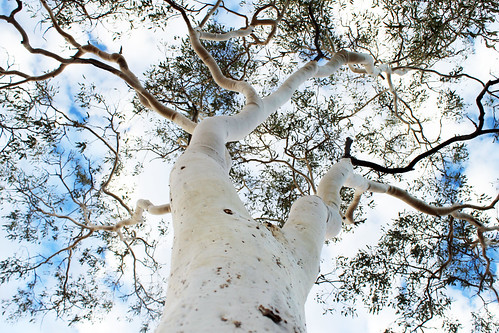
Ghost Gum Trunk
Looking up the trunk of a ghost gum in Watarrka National Park
We had yet to use the bus’s 4WD capabilities, but instead of taking the paved road back to the Stuart Highway via the Lasseter Highway, we bounded off the pavement making a bee-line straight back to the Stuart via a series of dusty, dirty, bouncy, bumpy dirt roads that no normal vehicle would survive! It was great fun and the vibrating floor provided for a nice foot massage after three days of intense walking! Everyone seemed to be enjoying it except, of course, for the Canadian fashionista who clearly had no concept of what four-wheel-driving was all about. At one point, the bus came to a stop as Adam had to get a clear look as to how best to navigate through an area of soft sand. The fashionista opened her eyes as we stopped, looked out the window and in a moment that defies all logic turned to me and asked, “Is this Alice Springs?” There were no buildings to be seen anywhere around us and we’d only been on the road for a few hours, and in disbelief at her question just stared at her and shook my head. “We’ve still got at least three hours,” I said. She just scoffed and started getting all worked up again at how annoying it was that we weren’t there yet, and what was this bumpy road? She couldn’t even get a good nap! While she was a very nice person, surely with good intentions, I could not wait to get away from her negative attitude. It just astounded me that someone could be so unprepared and not have even the slightest idea of what she was signing up for when she booked her trip. She was a trooper and did everything the rest of us did with a smile, and a joke, and funny stories, but I was glad that in a few hours time, I was not going to have to listen to her complaints ever again!

The rest of the drive back to Alice Springs was pretty uneventful. We didn’t make any more stops, and we didn’t see any more wildlife, but that was alright. Once we were back on the paved road everyone started to nod off. Being on a trip for a few days, with the same people day-in and day-out can be tiring when you know who you’re with, but when personalities don’t match, 3 days can sometimes feel much longer!

Back in Alice Springs, everyone was dropped off at their hotels and hostels and I’m sure no one wanted anything more but to take a much-needed shower and just a bit of quiet alone time for a short while! I know I enjoyed mine! That night, though, we all reconvened at a pub for tour-discounted dinner and beers. It was sort of the last-hurrah as we all talked about our amazing three days in the Outback and talked about what our next planned adventures would be.

It was overall, a great three days of good company, amazing scenery, rich culture, and fun. It made me realise that organised tours and playing backpacker can be really fun, and sure, you might not see those people again, you all shared an experience, and that is really what traveling is all about, and this was no exception. An amazing three days were now over and I had one more night in Alice Springs before my flight left the next morning.

The morning of my flight, I had a few ours left to explore bits of Alice Springs and I walked to the café at the Olive Pink Botanic Garden across the River Todd. It is a much longer walk than it looks on the map, but the café was really good, and the botanic gardens were nice for a quiet morning before flying back to Sydney, re-entering the busy city life. A quick walk up the hill in the Botanic Gardens gave me one final glimpse of the dry, but brilliant landscape that is the Northern Territories and I’m already looking forward to the day that I return there.

Australia: Kata Tjuta

Travel Date: 19 August 2013

Just like watching the swirling colours of the sunset on Uluru the night before, watching the sunrise behind Uluru, illuminating its neighbouring rock formation, Kata Tjuta (better known as The Olgas) is not to be missed! Our tour was woken up nice and early in the pitch black and chilly cold. We quickly collected our belongings and rolled up our swags, and clambered into the tour bus for a 40-minute drive west to a viewing platform bang in the middle of the two amazing rock formations.

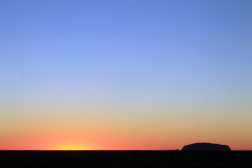
Uluru Sunrise
The sunrise in the east behind Uluru
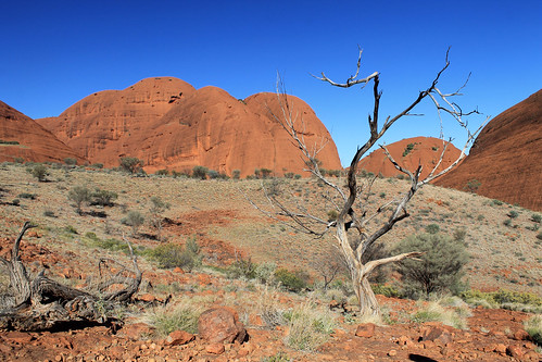
The Olgas are in some ways more impressive than Uluru, albeit being much less known (though they feature prominently in the opening sequence to the Disney film The Rescuers Down Under). Whereas Uluru is one massive rock, Kata Tjuta is a cluster of towering rock stacks with rounded tops, and they are even taller than Uluru! Geologically, the rocks at Kata Tjuta and Uluru date back over 500 million years! An ancient mountain range to the west that was created during the Petermann Orogengy was the source for all of the sand and boulders that were eroded from the mountains and deposited in a large basin to the east of the mountains. Over time, these sediments built up and compressed earlier depositional strata into the sandstone and conglomerates that make up these rock formations. Over time, further compression and faulting tilted the rocks such that previously horizontal strata are now almost vertical! While Uluru is mostly sandstone, large boulders stick out of the steep conglomerate rock walls of Kata Tjuta.

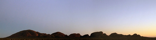
We stopped at a designated viewing platform for the sunrise and along with at least one hundred other people waited as the sky started to lighten up behind Uluru to the east and eventually the sun peaked up over the horizon, silhouetting Uluru in the distance while illuminating the massive domes of The Olgas, turning them from shades of gray to pink to orange and yellow and red. It was a beautiful setting to be sure; however, the sheer number of people and cameras continuously clicking and the Canadian fashionista’s complaining about the cold made it much less peaceful as it could be, though if you could block those sounds out in your head, you could just imagine what it would have been like to see this every morning without the nearby roads or viewing platforms, and the whole experience takes you to a whole new place.

Breaking Light on Kata Tjuta
The breaking sunlight on Kata Tjuta (The Olgas)
Again, we had a lot of ground to cover today, and Adam, our guide, wasted no time in getting us back onto the bus and brought us to the parking lot at the locality of Petermann. The sun was already high in the sky. Considering the throng of people at the sunrise viewing platform, there were amazingly few people here at Kata Tjuta. As much as I loved how quiet it was here, it’s really too bad that so many thousands of people come all the way out here, to the middle of this huge country to get on a bus, drive to a viewing platform, take a few photos, and hop back on their plane. I can’t lie, I also took a lot of photos, but that is never enough for me. I couldn’t come all the way out here and not have an experience, to walk through the landscape, or listen to the wind and birds, or feel the sun’s radiating heat. I wish more people desired experiences in nature. Maybe we’d all have a better appreciation for our planet and our environments and become better, more humble people.

We got off the bus and prepared for a hike through the Valley of the Winds which takes you from the parking area between some of the massive rocks that are The Olgas and into the valley protected between them. Even in August, Australia’s winter, the sun can become too intense to be outside this far in the Outback, so any hikes should start promptly in the morning. The Olgas are also incredibly sacred to the local Aboriginal communities, but curiously, outside of those communities, no one knows why. At Uluru, there are places where you cannot take photos because of spiritual significance, but there are signs explaining why the site is sacred. At Kata Tjuta, nothing is off-limits, but the whole area holds such a deep spiritual importance that only those in the Aboriginal communities can know what it is!

Kata Tjuta - Valley of the Winds
Down in the Valley of the Winds at Kata Tjuta
The Valley of the Winds is aptly named as air from the heating rocks rises and pulls in air from the surrounding area that gets funneled and focused in the valleys between the rocks. It’s not a difficult walk into the valley, but it is a stunning walk as you work your way between amazingly steep rock walls with massive boulders sticking out. The valley itself is made up of gently rolling rocky hills with scrubby vegetation and a few gum trees dotting it. The walk takes about three hours, provides spectacular scenery dotted with intricate flowers, and is incredibly peaceful as anyone you walk past just smiles and nods their hellos, not wanting to ruin the quiet atmosphere. Because no one knows the real significance of Kata Tjuta, there almost isn’t much else to say because there is nothing to interpret.

We finished our walk in the late morning and set up our lunch back at the bus before we packed up at set off for another long drive. We left Kata Tjuta, passed Uluru once more, and drove the hour or so back to the Curtin Springs Roadhouse for a quick break before turning off the Lasseter Highway onto Luritja Road toward Watarrka National Park, home of Kings Canyon. We stopped once more to collect firewood for that night’s dinner that was a fun, if not frustrating pit stop. The Canadian fashionista hadn’t been with us the previous day when we collected firewood and was trying to write postcards to send back home as our bus drove down the bumpy, dusty dirt road. Trying to write while driving over washboard road conditions is no easy task, and one more than one occasion, she would slam down her pen and shout something along the lines of, “I’m trying to write a postcard! Can’t the bus just stop so I can finish? This is so hard!” Complaints that received nothing but an annoyed look from me as I asked her what she expected! My postcards were barely legible because of all of the bumping around, but I thought it was part of the fun! Not only was I describing to my family what I was doing, but they could actually see it in the squiggles in my lettering! She didn’t seem to understand and got even more flustered as the bus swerved to the left and right. Once we stopped, she finally finished her postcards (though she took her time, probably not wanting to get her clothes too dirty with all the red dust) while the rest of us ventured back out into snake country to collect firewood.

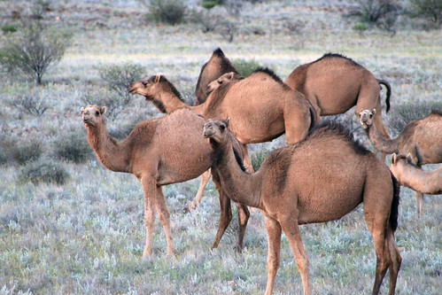
Camel Herd
A herd of feral camels in Australia
And we were in store for a treat before we left. As we loaded back onto the bus, someone spotted a little brownish-gold body bouncing between the trees and a single solitary dingo sauntered up to the bus! Frankly, I expected to see more dingoes than we did, but the curious little creature was the only one we saw and after figuring out we had nothing to offer it, he quickly sauntered away just as quickly as he came.

Further down the road, we were in for another treat as a massive herd of wild camels was socialising on the side of the road. Adam stopped our bus and we all got out, quietly stepping as close as we could to these amazing creatures without spooking them! There were dozens of them – mostly adults, but a few young ones, too and they just moved together, minding their own business. We stayed there, watching them for a while as another brilliant sunset lowered down toward the horizon. It was just such an odd sight, seeing the camels, not only because they are just funny looking animals, but because you just know they aren’t supposed to be there! The wild camel herds have naturalised so easily to the Australian Outback, their numbers can’t be culled. They’ve repopulated so well, and from such a small original stock, that people in the Middle East actually buy their camels back from Australia because the Australian camel genetics are so pure, they fetch quite a high price back in the Middle East!

The setting sun was blinding as we drove west  to Kings Canyon Resort but we eventually pulled in to our campsite for the night, got our fire up and blazing, made dinner, and set up our swags for another chilly night under brilliantly clear skies in the middle of the Outback.
Creative Commons License
This work by Eric W. Portenga is licensed under a Creative Commons Attribution-NonCommercial-NoDerivs 3.0 Unported License.