Christmas was once again spent away from family this year, but this year would at least be exciting. One of my friends and I decided to head west from Glasgow to Oban with some stops along the way. When I moved back to Glasgow from Australia a year ago, a friend of one of my friends was looking at a wall map of the British Isles in my flat, pointed to an area south of Oban, and said, "You must go here, to Kilmartin Glen." He said that Kilmartin Glen is one of the most overlooked destinations for anyone interested in Scottish history and neolithic sites. So, after a day of recovering form boxing day laziness, we headed out from Glasgow.
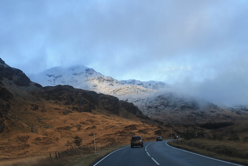
Driving along the A83 between Loch Lomond and Inverary
Winter is an absolutely beautiful time to visit Scotland. Sure, the days are incredibly short, but the snow on the hills makes it unlike anywhere else. Once away from the main cities, the roads get narrow and windy, which makes for getting anywhere quickly quite tricky! It took us a while to get out to Kilmartin Glen, via a coffee stop in Inverary, but a little after noon we pulled into our first stop, Dunadd, which was the first site of the first kings of Scotland, having been in use since the Iron Age. On the little hill above the glen is a rock with some footprints carved into them, possibly where the kings looked out - I imagine much like Mufasa and Simba from Pride Rock :)
A little bit further down the road are a series of standing stones dating back 5,000 years. We missed the winter solstice only by a few days, but it's pretty amazing how these stones would have lined up with the setting sun, even after 5,000 years! I'm often really amazed by how after thousands of years, and with all of our modern technology and knowledge, we still have no real idea what these stones or circles were used for! And while not as grand as the Ring of Brodgar in Orkney or as circular as the Drombeg Stone Circle in southwest Ireland, the stones are just as enigmatic, and there are a lot of them, including one site where five stones make an X figure in a field, apparently a very unusual arrangement. Starving, we stopped in at the Kilmartin Hotel and had a tasty pub supper before exploring the curchyard across the street with brilliant scenery looking down the Glen.
There were still a few things we wanted to see before it got dark and before we got to Oban, and even though it was only 3 o'clock in the afternoon, we were running short on daylight, so we hit the road again, winding around the coast, to the Bridge over the Atlantic. To be fair, this is a very nice looking stone bridge, arching high over a small tidal waterway, technically part of the Atlantic Ocean, separating the Scottish mainland from the small Isle of Seil. Apparently nowhere else (maybe in Scotland) is there a bridge over the Atlantic, so it is only here you can say you've "driven across the Atlantic Ocean." Not really much to see, we kept on to the small town on Seil of Ellenabeich, an old slate mining town that now consists of three rows of whitewash cottages. A beautifully small town that I would have liked to have stayed in a bit longer. Would have been a great place to write up my PhD thesis! While in Ellenabeich, the sun went down and we didn't want to be stuck on unlit country roads for too long, so we headed in to Oban, checked into our hotel, and met up with one of my Uni friends who was home visiting family for the holidays.
Snow-capped mountains on the Isle of Mull with Duart Castle in the foreground from the ferry from Oban to Mull.
We got up early the next morning, a brilliantly clear but chilly morning, to catch the ferry from Oban out to the Isle of Mull, a rugged island about an hour offshore from Oban. The views from the ferry back to the mainland of snow capped mountains were amazing, not to mention the snow capped peaks of Ben More, the only Munro on Mull. A little note for visiting Mull in the winter: Don't plan on relying on public transportation, especially on a Sunday! We were lucky to have a Range Rover, so the small single-track roads and ruts of Mull were a piece of cake, but be careful if you have a smaller car not to go off the edge of the road or you will get stuck! We headed immediately out to the westernmost point of Mull, a town called, Fionnphort, where we waited for the quick ferry out to the small Isle of Iona. Again, visiting in the winter and on a Sunday, you run the risk of either the ferry not running, or only making one trip out to Iona, but not back, so it's suggested you call the portmaster on Mull the day before to make sure the ferries are running!
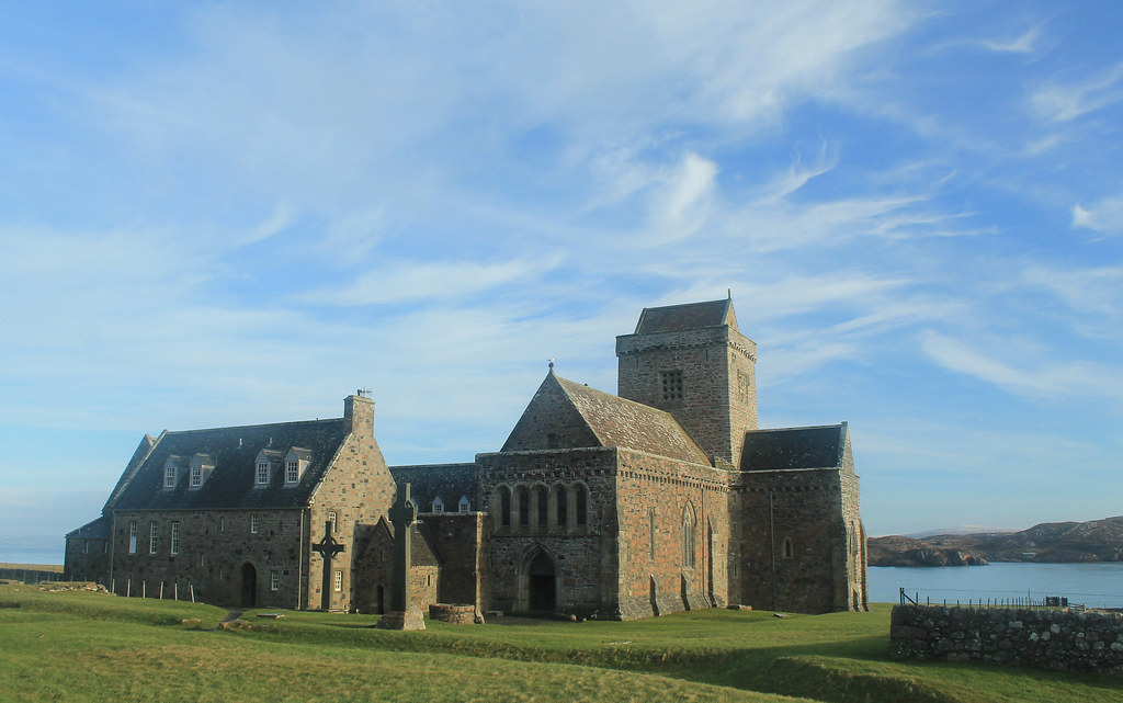
Iona Abbey
The sky was crystal clear, and though it wasn't windy, it was really cold! But while waiting for the ferry we did get to see a small fishing boat loading up for the day, and it must be quite a regular occasion because there was a seal who sidled right up to the boat begging for a bit of breakfast! The ferry finally arrived and we walked on, making sure to ensure it would come back from Iona! Now, Iona is a beautiful little island and I wish we had more time to spend there, but with the two hours we did, we made sure to walk over to the famed Iona Abbey, the former Catholic monastery where the Book of Kells was written. The Abbey survived Viking raids as well as the Protestant Reformation, and is now part of the Church of Scotland. So many tourists come out to Iona in the summer, it was nice to experience the island in winter when even the hostels were closed for the season! BUT, if you go on the weekend, you don't have to pay to get in to the grounds! We took a little walk up to the highest point on Iona, Dun I, for some breathtaking views to Mull and so many other Inner Hebridean islands.
Running short on time, we headed back to the ferry and crossed back over to Fionnphort, accompanied by dolphins jumping out of the water and playing in the wake of the ferry! Back in the car, we decided to take the small winding road around the rest of Mull. Now, I thought the road from the Mull ferry to Fionnphort was small, but it was nothing compared to the B8035, which was tucked right along the coast with rocky cliffs on one side, but provided amazing scenery, especially during sunset on such a clear day! The B8035 turns onto the B8073 and the road climbs up some very steep hills that any small car would have some trouble getting up! If you're in a small car, you definitely want to take the B8073 counterclockwise from Tobermory where it will be easier to go down these roads than up. Daylight was nearly gone as we arrived to Calgary Beach in the small locality of Calgary, the same that the Canadian metropolis is named after! But we couldn't stay long since the sun had now set and we still had about 30 minutes to drive to Tobermory for a quick fish dinner (not many places open on a winter Sunday), very quick because we had to get back down to the ferry docks to catch the last ferry back to the mainland.
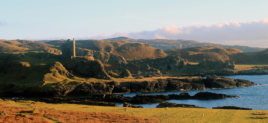
Gylen Castle on the southern end of Kerrera
The following morning was yet again a clear day on the western Scottish coast, though much colder! Not wanting to waste time, we grabbed some breakfast and went to the small local ferry from Oban out to the small island, Kerrera. A privately-owned ferry, you signal the owner that you want a ride by sliding a big panel open on the mainland, revealing a big black square, and upon seeing it, the ferryman comes over to pick you up for the 5 minute crossing. We decided to do the 3.5 hour loop down to Gylen Castle at the southern end of the Island and back. Though not a strenuous walk, it felt long because it was so cold, especially in the shade, but the destination was amazing - a square castle with a small footprint exposed on a tall rocky knob over the coast. The castle was besieged and burned in 1647, though recently the Clan MacDougall began restorations. It's surely not much of a castle, but its position in the grassy hills along the coast sure makes it a great place that we had to ourselves! The rest of the circuit along the west side of the island isn't as scenic, and was a bit mushy underfoot, but there were a few brilliant moments in the setting sunlight over to Mull. Back in time for the ferry back to the mainland, we hopped back into the car and headed back up to Oban to pick up my friend who was coming with us back to Glasgow, and with that we were off back home.
Though I think we lucked out, weather-wise, the weekend was a great and most welcome break from city life in Glasgow, and so easy for a few days! Enjoy the photos:
Right, so continuing on this trend of finally writing backed-up blog posts, this one's a monster simply because of the photos I had to reorganise to get here! Last December, though, I had the great pleasure of being able to tag along and help teach a glacial geology and geomorphology field trip to the central region of New Zealand's South Island. Having been to the North Island and having experienced the northern- and western-most points of the North Island and explored the watery wonderland of the Bay of Islands, I was totally pumped to get to some of the more staggering New Zealand scenery we all know from Lord of the Rings!
After three hours of one of the most turbulent flights I'd been on in a while (and I'd just return to Sydney from a trip to Denver and Vermont), we landed in Queenstown, the adventure capital of New Zealand. The flight in over the Southern Alps was beautiful. Being early December, New Zealand was just emerging from winter and all of the mountains still had substantial snow on them! We wasted no time in picking up our three passenger buses and trailer, and with 24 student in tow, set right off out of Queenstown to the Kawarau Bridge, famous for being the original bungee jump in New Zealand. Of course, we were there to learn about New Zealand's past glacial geology, climate, and geomorphology - or how the landscapes develop and change through time. Along the first few days the students would be presenting small mini-reports on different aspects of these topics and we weren't letting any second go to waste!
After learning about New Zealand's loess deposits, accumulations of wind-blown dust that were deposited under colder dryer conditions during the last glacial period, we headed off the main highway, taking the Crown Range Road to Wanaka where we'd spend the first night. We stayed at a small hostel/motor park near the shores of Lake Wanaka, which fills one of the many glacially-sculpted valleys east of the Southern Alps, including Lakes Wakatipu, Ohau, Pukaki, and Tekapo. Early the next morning, I got up early for a short walk along the lake, looking out across to the beautiful Mt. Alta rising across the shores. Our destination by the end of the day was Mt. Cook Village in Aoraki/Mt. Cook National Park, but we had plenty of stops to make before calling it a day.
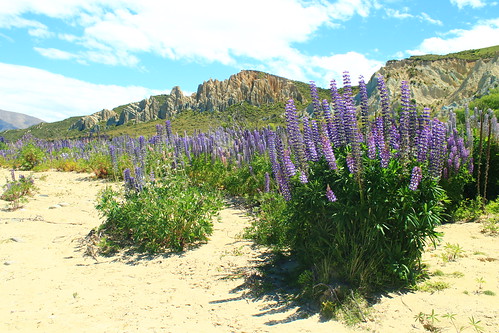
Purple lupin growing at the Clay Cliffs near Omarama
We took Lindi's Pass toward Omarama before doubling back across the Ahuriri River to the Clay Cliffs, a geological formation of very soft rocks exposed along the active Osler Fault. The cliffs are a deeply dissected feature that is the site of an ongoing battle between the uplifting tectonic fault and erosion. We stayed here for a short while and had lunch along the Ahuriri River, a beautiful place to dip your feet in the refreshing water and have a bite to eat. We made one more stop to the former river outlet of Lake Pukaki before it was dammed and diverted but also had time to stop at the southern end of Lake Pukaki to get a sense of what we were in for for the next few days.
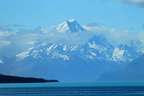
Aoraki/Mt. Cook (3,724 m/12,218 ft) looming over Lake Pukaki
The weather was bright and sunny and fairly few clouds against a blue sky, and from here, far off in the distance, was the brilliantly majestic peak of Aoraki (or Mt. Cook), the highest point in New Zealand at 3,724 meters (12,218 ft) above sea level! We had to stop here because the view was simply breathtaking, and because Aoraki is apparently often shrouded in clouds, we thought this might be our only chance to see its entire height! And I should mention Lake Pukaki because it was amazing in its own way. There is so much powdered rock, crushed by glacial erosion that gets washed into the lake that it takes on a very milky appearance which reflects the sky on a sunny day, turning it a turquoise colour that is really only best matched by a Crayola crayon of the same colour!
It was windy, so we got back into the vans and started the fairly long drive down the Mt. Cook Road toward Mt. Cook Village, the views along which were absolutely stunning. I'm jealous of the students in my van because they got to stare out the windows the entire time, while I had to keep my eyes on the road. But if you want a fun road to drive along, this is one of them. It just rolls and wraps its way long the lake and the ever-impressive Southern Alps just keep looming in the distance! Well, if the drive wasn't thrilling enough, once you're past the head of the lake, you begin driving through the wide and flat river valley that drains the Mueller, Tasman, and Hooker Lakes which are all fed by glaciers. And while you can't see the glaciers, as they are hidden by huge glacial moraines and tucked away around the mountains, you do see the incredible wall of ICE that is known as the Huddleston Glacier, which frankly, I thought was one of the most impressive things I've ever seen! It's just this massive, steep wall of ice that you just couldn't stop looking at!
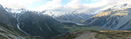
Looking down to the Mt. Cook Village from the Red Tarns. The Huddleston Glacier is the big wall of ice plastered
on the side of the Southern Alps in the distance. Mueller Lake and its end moraine seen in the bottom of the valley.
Aoraki (the Maori name for Mt. Cook) features prominently in Maori history. The Maori people believed the South Island to be a canoe that Aoraki and his brothers were using to voyage the world. It tipped and the brothers climbed onto the top of the overturned canoe and turned to stone. Geologically, Mt. Cook is positioned in the Southern Alps which are the result of convergence along the Alpine Fault which is the boundary between the Indo-Australian tectonic plate and the Pacific plate. The fault is mostly a dexteral strike-slip fault, but there is oblique convergence which has uplifted the mountains on the South Island. It is the Alpine Fault that causes most of the earthquakes in New Zealand, and also as it cuts across the north part of the South Island it goes offshore east of the North Island where subduction of the Pacific plate under the Indo-Australian plate results in the volcanism the North Island is famed for!
Well, while all of the students were excited to get out of the vans and start eating and drinking for the night, I had picked up a wee trail map and having heard that weather is rarely clear in the park, I thought I'd take advantage of it by doing a short hike up to the Red Tarns, some small ponds perched high up the mountains above Mt. Cook Village. Luckily summer in the Southern Hemisphere means plenty of light late into the evening, so I didn't have much to worry about - other than breaking my ankle with no one around! Well, the hike up was unrelentlessly steep, but I eventually made it to the tarns, which in and of themselves aren't that impressive, but you don't make that kind of hike to look at a pond, but for the view of the rest of the valley. Up here, you're so high up above the valley that you can see up and over Mt. Wakefield to Mt. Cook as well as up the Tasman River valley to The Armchair and Malcher Peak. The weather was holding up, so I decided to climb even higher to the shoulder of Sebastopol, the lowest peak in the National Park. Catching my breath, I decided my hunger would win over my want to reach the summit, so I raced down a big scree slope and headed back to dinner at the Mt. Cook Village.
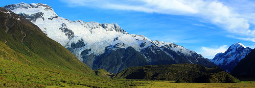
The Huddleston Glacier and Mt. Sefton (left), Aoraki/Mt. Cook (right), and the Mueller
Glacier's end massive end-moraine (centre-bottom)
Weather was clear the next morning again, blue skies and few clouds, so I walked up toward The Hermitage - the famously fancy resort hotel in the National Park that looks directly over to Mt. Cook - for a few morning photos before joining back up with the students. We drove up to the Mueller Glacier overlook for a few more student talks. During one of the talks, we all of a sudden heard this huge crack that sounded like thunder, followed by a cascade of booms and crashes. It was so startling that everyone turned their heads to the glaciers behind us. Though we couldn't see anything, it was pretty obvious we'd just heard a massive block of ice break off the Huddleston Glacier, falling down onto the Mueller Glacier below. Coincidentally, the student giving his report was just talking about ice falls. Talk about timing!
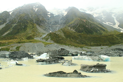
Icebergs from the Hooker Glacier floating in Hooker Lake
Once the student talks were done, we started the long hike up to Hooker Lake and the Hooker Glacier that sits right at the base of Mt. Cook. We continued to hear booms of breaking ice behind us during the hour-long walk up to Hooker Lake, which was cool, but the weather turned, which was not. We could see the clouds rising up from the west and flowing over the mountain tops to our left as the wind picked up and threatened to rain us in. But, being geologists, we go out in anything and this certainly didn't stop us and the last few students presented their mini-reports. You couldn't really see the mountain peaks by this point, but you could still get great views over Hooker Lake which was just chockers full of icebergs in various stages of melting, all shapes and sizes! By the time we left Hooker Lake, the weather had cleared up once again, permitting us to drive around to the next valley over to the Tasman Glacier and Lake.
Lake Tasman is a recent feature to the landscape, having only formed in the last 40 years after the Tasman Glacier (left)
retreated to its current position!
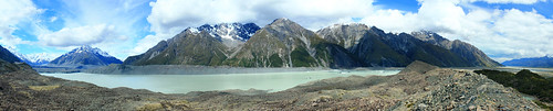
Lake Tasman is impressive, if not for its size (7 kilometres long!), for the fact that 40 years ago, it was not there! Forty years ago the Tasman Glacier's terminus was at the lookout most visitors take the short walk up to from the car park. Now, however, Tasman Glacier ends in the lake and icebergs calve off its front. Though the retreat is impressive and offers the opportunity to take speed boat tours around the lake, it just means our changing climate is killing off these magnificent glaciers!
We headed back out of Aoraki/Mt. Cook National Park toward the town of Twizel where we'd be based for the remainder of the trip. Over the next 5-6 days, the students would be working on small group projects in the area, and we, the trip leaders, would drive them wherever they needed to go. But first, we had another stop to get to up beyond Lake Ohau on the other side of Twizel. By the time we got beyond the shores of Lake Ohau, the weather came back with a vengeance.
The next day was fairly uneventful. The rough weather had cleared up and the students used the day to plan their projects. Twizel itself is a pretty dull town. It was founded as a working camp during the construction of the dams that were built on Lake Ohau, but remained a popular stopover point for travelers going to Mt. Cook (not to mention cheaper than staying in Aoraki/Mt. Cook National Park. While there are some nice coffee shops and cafes in the main shopping area, there isn't much to speak of - especially of the locals. While eating dinner at the Power Station Bistro I noticed one man down his beer outside and promptly walk to a short brick wall and urinate on it! Welcome to Twizel, indeed!
I played chauffer for students heading up back into Aoraki/Mt. Cook National Park over the next three days to collect data for their projects. Depending on which group was where, and when they needed to get to their next stops, I often had anywhere from an hour to a few hours by myself before I had to meet any of the students and move them. This was nice because it gave me time to do a few shorter walks and explore the park a bit more. One of the days I walked up the Mueller Glacier trail to see the head of the glacier which had retreated around the corner of its valley, out of sight from the main view point. Right at the bottom of the Huddleston Glacier. No one else was up this far and I enjoy sitting in the sun in the middle of this amazing landscape. I felt so fortunate to be able to experience it in all its sun-shiny glory!
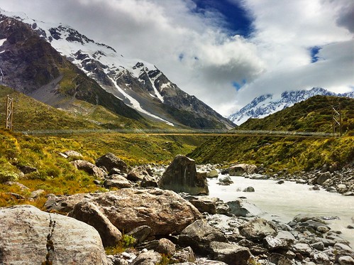
Suspension footbridge over the Hooker River. Aoraki/Mt. Cook shrouded in clouds
I also joined a few student groups on their quests to collect field data. This varied from walking up along the crest of the lateral moraine along the edge of Tasman Lake looking for students who had gotten well-ahead of me, helping students measure boulder dimensions in streams coming down from creeks draining the steep valleys to the west of Mt. Cook Village, and taking one more walk up to the iceberg choked Hooker Lake.
I had no plans to see any more of the South Island on this trip, and though I was a bit let down about not being able to do that before arriving, I don't think I could have asked for a more amazing experience that just being able to wander and explore the Hooker and Tasman Valleys in Aoraki/Mt. Cook National Park. It really must be one of the most spectacular landscapes I've been to. It's drastic, but accessible; staggeringly expansive, but easy to get around; busy with tourists, but big enough that you don't have to go far to get away from them!
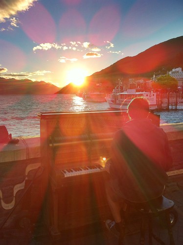
Pianist playing his own music during a beautiful Queenstown sunset
over Lake Wakatipu
The students had a final day in Twizel to write up and hand in their reports, so the last day near the mountains wasn't all that exciting. Finally, we were ready to leave Twizel and made the long drive back to Queenstown for our last night in New Zealand. We arrived early afternoon and many of us had previously signed up to go whitewater rafting to celebrate the end of a long week. We dropped our things off at the hostel and met down in the town at Queenstown Rafting where we were fitted up with wetsuits and packed into large vans with a trailer packed with rafts in tow behind us. This is no big deal, except to get to the launch site, we had to drive down Skippers Road, a long, very tightly-winding road that is cut into the side of mountains with very steep slopes! To put it in perspective, if you sat next to the window, you couldn't see the edge of the road and it looked like there was nothing beneath the van! In fact in one or two places, there almost wasn't anything beneath the van... One tight turn has been so abused that the edge of the road has eroded to the point that side of the van on the inside of the road gets scratched by the rocks sticking out of the slope! At another point on Skippers Road, the road appears to be intact, but when you look back up at it from the river, you see that a big chunk of rock, that would otherwise support the road, has simply fallen away! If you're afraid of this kind of driving, there's no hope for you because no matter which side of the van you sit on, you're going to be exposed to one of these hazards!!!
But the rafting itself was awesome! I've only been whitewater rafting once before on the New River in West Virginia where the water levels that year were low enough that the big rapids had diminished many of the rapids, so I wasn't sure what to expect. Well, the Shotover River is pretty much a narrow, narrow canyon with rocky cliffs on either side and in most places the river is as wide as the raft! I've got to give it to the raft guides because they have some of the hardest jobs in the world in keeping us all safe! While we didn't flip, like we did on the New River, there were so many times I thought we were goners! Two girls did fall out at one point, but we safely got them back on the raft just before they were pinned between the rocks and raft! The trip culminates a tunnel that was blasted into the mountianside to funnel water for gold mining in the mid-1800s, the final rapid is shooting down the mill run right where every raft in front of us was waiting and watching, hoping someone would flip. We didn't, but had a great time and it was an awesomely adventurous way to end a week in New Zealand!
That night was spent out in Queenstown watching a beautiful sunset over Lake Wakatipu and eventually some mechanical bull-riding in one of the town's innumerable options of Western/Cowboy-themed bars. Flights back to Sydney the next afternoon gave me a little bit of time to walk around the local Saturday markets along the lakeshore in what ended up being a very nice sunny relaxing way to end my last visit to New Zealand in a long time! Definitely not the last, but a long time at least!
It was a rough morning trying to wake up on time and be out
in front of the YHA Alice Springs in time to be picked up for my 3-day
adventure in the Outback. Though I originally wanted to rent a 4WD and do the
trek from Alice Springs to Uluru with friends, I wasn’t able to convince any of
my friends to come along on this trip with me and I sure as hell wasn’t about
to tempt fate by doing it on my own because with some of my travel luck, I’d
inevitably get bogged down in some sand, run out of water, and get bitten by a
snake trying to find a cell signal! So I booked a 3-day tour of some of the Outback’s
most famous sites.
WayOutback tours offer a number of trips ranging from 3 days
to over a week, some of which are more rugged than others. The one I’d booked
was “all inclusive” in the sense that all food was provided for, sleeping
arrangements were already made, and all I had to do was show up, sit down in the
bus, and enjoy the scenery. Soon enough, a big…truck? I’m not entirely sure how
to describe it. It was a vehicle that had the front cab of a small semi-truck
and instead of a cargo hold on the back, it had a relatively small coach like a
charter bus with big windows and two seats on either side. The bus accommodated
24 people and was jacked up on big 4WD tires.
Our driver, Adam, helped the two of us being picked up put
our luggage in the storage hold on the back of the bus. It took us a while to
pick up everyone else from their respective hotels and hostels around Alice
Springs, but soon enough we had a nearly full bus with people from all over the
world: an American girl, her father, and her Swedish friend, a hip-hop dance
teacher from Amsterdam, a girl from Glasgow, an adventurous guy from Vancouver,
and your typical handful of German and French backpackers.
The bus was chatty at first as we all were introducing
ourselves and going through the typical banter common amongst backpackers in
Australia, but it was still pitch black out and we had a good 6-hour drive
ahead of us and soon enough everyone was sleeping.
The thing anyone needs to know about the Northern
Territories is that there are very very few towns and everything is incredibly
far apart! When you drive down the highway and come across a petrol station or
bathroom, you stop and fill up and use the bathroom because you never know
where the next one will be. Between the towns are small roadhouses that usually
have a gas station, some hotel rooms, camping spots, toilets, and a bar.
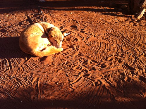
Sleeping dingo at the Stuart's Well Roadhouse south of Alice Springs
Our first stop was at one of these roadhouses, the Stuart’s
Well Roadhouse, and it was the first chance we had to stretch our legs, and
grab a coffee. This roadhouse was unique in that it also had a number of pens
where Australian animals like emu, kangaroos, and various birds were on display
for tourists stopping in. But they also had two of the more unique sights in
the Outback: camels and a dingo. Camels are obviously not native to Australia,
but were imported from the Middle East because of their hardy survivalist
instincts in desert environments and the preferred cargo animal over horses,
which require a lot of water. A transcontinental telegraph cable was built from
Adelaide to Darwin with Alice Springs being used as a transfer point along the
way. Camels were used by the crew that laid down the cable. But like many
non-native animals in Australia, some of the camels escaped and proliferated in
the desert and today there are over one million wild camels roaming Western
Australia and the Northern Territories. Dingoes were also introduced to
Australia over 40,000 years ago and have also adapted and proliferated
throughout the continent and have just recently been described as a separate
canine species and not just a variety of wild dog. The one dingo at this
roadhouse was old and used to tourists, so was not caged up and was pretty
snoozy and docile.
Adam, our driver, didn’t let us linger too long as we still
had a long ways to go. We drove another few hours to the Erldunda Roadhouse for
another bathroom break, and turned off the Stuart Highway onto the Lasseter
Highway toward Uluru.
Most people have visions of Australia’s Outback as being
rocky with lots of sandy deserts, dry eucalypts, and brilliant soils stained
red by the rusting of iron in the dust and soil. These images are spot on what
you actually see and it is beautiful! Nothing but flat land as far as the eye
can see until a few low-lying rocky ridges or mesas rise up in the distance,
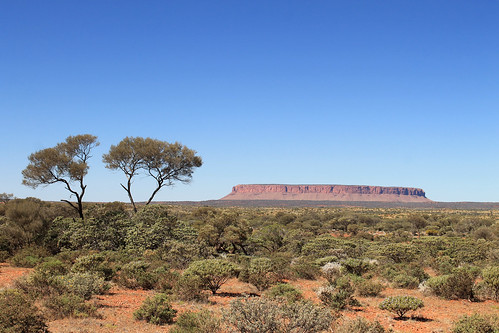
like Mt. Conner. But I was surprised at just how green it was! The trees were,
by no means, lush and foresty, but the gum trees here were not as brown and dry
as I thought they would be – really a testament to just how well-suited for
every microclimate in Australia these trees are!
Mt. Conner off in the distance near Curtin Springs
We pulled off the main road shortly before the Curtin
Springs roadhouse to collect some firewood for our campfire that night. Part of
the reason why I booked this particular tour is that while everything was
catered for us, we still had to participate in collecting firewood, preparing dinner,
and washing up dishes. It gives you that little tinge of roughing it! Like
anything in Australia, simple tasks, like collecting firewood carry inherent
dangers. Out here, it was snakes. Some of the world’s most deadly snakes are
found throughout Australia, but exceptionally potent ones here in the Outback.
We had to be very careful when picking up dead wood that no snake was sunning
itself nearby! But soon enough we had our firewood, and we made our pit stop at
Curtin Springs, and carried on west to Uluru.
There were a lot of rocky plateaus and mesas in the distance
along the Lasseter Highway and every time we thought we saw Uluru, Adam would
shake his head and assured us and assured us, “You’ll know when you see it!”
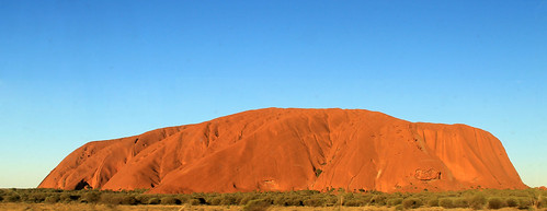
And sure enough, another few hours down the road, the rock loomed into view,
dwarfing any and all other mesas we’d seen! Everyone knows what Uluru looks
like as it’s one of the most photographed rocks in the world. And with good
reason! It’s the world’s largest monolith – or single rock, and it juts up from
the flat Outback surroundings to over 300 m in height. We kept driving closer
and closer and Uluru kept getting bigger and bigger. Finally, we pulled into
our campsite in Uluru-Kata Tjuta National Park.
I couldn’t wait to get up close with the massive rock, but
it was going to have to wait a bit. A few more people were joining our tour,
but were flying directly in to the airport at Uluru, rather than Alice Springs,
so Adam gave us directions for lunch and he left to pick up the others. Soon he
came back with a French family that had a few kids with them, and a blonde girl
from Canada who was finishing up teaching fashion at a school in the Melbourne
area. I’m not entirely sure if she knew what she was signing up for. Everyone
else was dressed in hiking and outdoor gear and those of us who’d collected
firewood were already covered in dust, whereas the Canadian fashionista rocked
up in a flowy sequined top, hair done up like a pro, and flip flops more
appropriate for a cocktails near the beach than heavy walking in the Outback!
With lunch in our stomachs, Adam gave us the cultural
sensitivity talk about Uluru. The rock features in numerous Aboriginal stories
about Tjurkupa – the creation time of the world – and is a very sacred site as
it is the birthplace of the Anangu people who still reside at Uluru. As
European Australians had a penchant to do, they named the rock after the Chief
Secretary of South Australia (Ayer’s Rock) and it became known as Ayers Rock –
Mount Olga National Park, under the government of the Northern Territories
until 1985 when the park was given back to the traditional owners of the land
and renamed Uluru – Kata Tjuta National Park. One of the most popular things to
do at the park is to climb to Uluru’s summit and there is only one trail to the
top, but because of Uluru’s sacred importance to the Aboriginal communities,
doing the climb is not recommended by any of the tour companies who have access
to the park, though they all allow the tourists the option.
Finally here! Uluru!
As a geologist and someone who loves a good hike, I was
really tempted to do the climb, but when our bus pulled into the parking lot
and we saw a full charter bus-full of tourists swarming up the trail to the
summit and I just felt sick from the blatant disrespect for this sacred site. A
small group from our bus decided to do the hike, and I understand their
decision, but I thought that in the long-run, I’d feel better knowing that I
hadn’t tread on sacred ground without fully understanding its importance to the
local people. Thousands of people do the climb each year and some of them even
feel the need to pick up a little stone and take it home as a souvenir from
Uluru. In the National Park’s Visitor Centre, though, there is a binder full of
letters from people who, after taking the stones from Uluru, experienced so
much bad luck and racked with guilt that they mailed the stone back to the park
in an effort to rid themselves of their curses. These small rocks are now
collectively known as Sorry Rocks.
While the hikers did the climb, the rest of us did the short
Mala Walk to Kantju Gorge. Uluru has a lot of curves creating alcoves along its
base which are perfect for allowing water to pond and gives the appearance of
little oases in the Outback. The Mala Walk took us past a number of sites that
are featured in the creation stories of the local Anangu people. Some of the
rock caves at Uluru’s base contain carvings and petroglyphs that are thousands
of years old. The trail leads you to Kantju Gorge which features a small water
hole at the base of a cascade of steps that have eroded into the steep sides of
the rock over millennia.
By the time we got back to the parking lot, the hikers
hadn’t yet returned, so the rest of us drove around to the Mutitjulu Waterhole
around the other side of the rock where there is an even bigger waterhole and
forms in the rocks tell the story of Kuniya, a python woman who had traveled from
the east. Kuniya’s nephew had been killed by the Liru, poisonous snakes. When Kuniya
arrived, she exacted revenge for her nephew by taking her walking stick and striking
the Liru with it, killing him.
The day was getting on and sunset wasn’t far away. Next to
the Uluru climb, one of the most popular events every day is to watch the
sunset on Uluru. The bright orange sandstone takes on a new life as it’s
shadows and colours change in the dimming light. Our bus pulled into a parking
lot that was just swarming with tour
buses and vans, each with their own cohorts of tourists sitting around
make-shift tables while everyone sipped on champagne and snacked on
finger-foods while watching one of the most beautiful sunsets in the world. The
bright orange rocks faded in and out of various hues of red and pink as the sky
behind it darkened. The shadow of the western horizon slowly works its way up
the rock until the final moment when the only the tip of the rock is
illuminated a gentle pink colour before the shadow envelops the entire rock.
Even with all the people around, I was able to take a little walk down a path
where there were far fewer people and the whole sunset just becomes a peaceful
experience leaving little doubt that this gigantic rock is indeed an intensely
spiritual place.
With the sunset over, we bussed back to our campsite where
some of our group got a campfire started so we could cook dinner while the rest
of us started to prepare our beds. There were large stationary tents at the
site, but the weather was wonderfully mild and we all had the option of
sleeping in swags under the stars. Swags are nothing more than a big canvas bag
that has a rough sleeping pad inside and you then put your sleeping bag in the
swag on the pad. A canvas flap can then be pulled over your head in case it
were to rain. Swags feature heavily in Australian culture, most notably in the
song “Waltzing Matilda” in which Matilda is actually the name of the man’s
swag! I don’t think I ever met a respectable Australian who didn’t have a swag
or hadn’t spent a night in one. Being in the middle of the Outback, at Uluru,
there was, for me, little choice about spending a few nights sleeping under the
countless stars in my swag.
With our stomachs full of food and beer, it wasn’t long
before everyone was comfortably in their swags (or uncomfortably in the case of
our Canadian fashionista!) and fast asleep. It wouldn’t be too long, after all,
before we would wake up at 4 am for our next day’s worth of amazing Outback
experiences!
On my last day in Tasmania, Danielle had to do some work and dropped me off at the harbour in downtown Hobart. I bought a ticket for a ferry and admission to one of Australia's - if not the world's - premiere museums: the Museuem of Old and New Art (MONA). Before the ferry left, I spent about two hours walking around town and visiting the Tasmanian Museum where I learned more about the Tasmanian Tiger.
Hobart Post Office, Tasmania
The Tasmanian Tiger was the island's main predator before the arrival of Europeans. Once Europeans began grazing sheep in Tasmania the Tasmanian tigers were considered a nuisance because of their taste for sheep. The government put a bounty on every Tassie tiger that was killed and before long the only tigers left in existence were caged in zoos. But even that didn't last long and in the early 1900s the last Tassie tiger at the Hobart Zoo died. The tigers have not been seen since and the species is considered all but extinct. I say all but extinct because there is a very very VERY slight possibility that a population of tigers may have survived in the vast wilderness that covers Tasmania's southeast. Expeditions and surveys to find any remaining tigers have returned inconclusive. In the 1930s, after the last zoo tiger died, a biologist went looking for wild tigers and found footprints, but never found any tigers. Some people believe they still exist and sightings are reported but unconfirmed. I'd like to believe that life found a way and that some do exist, eluding humans for nearly a century. I like to believe this because the same story exists with mountain lions of Vermont - the catamount. While reports of them surface every now and then, there is no biological evidence that they still exist. But a few years ago, my Masters supervisor and I were driving to New York and on the rural highways of Vermont a large cat ran across the road in front of us. The cat we saw was definitely a cat, and much larger than a bobcat (which is larger than a housecat - or even a feral cat). To this day, I swear we saw a catamount and because of that I hold high hopes that the Tassie Tiger has cleverly maintained low populations in Tasmania's vast wildernesses.
Mt. Wellington looming above Hobart Harbour
Soon enough, I boarded the ferry from the city centre out along Port Arthur to the museum which is some distance up the River Derwent. The Lonely Planet guide for Australia says that this museum is one that is NOT TO BE MISSED and that it is "a veritable Disneyland for adults." Built right into the sandstone along the waterfront, the huge underground museum is home to a myriad of old and new art pieces including sarcophaguses, Aboriginal Australian art, modern sculpture art, interactive art, and modern paintings. Some of the exhibits I found utterly fascinating like "Kryptos" a dimly lit maze leading to an inner room; along the walls of "Kryptos" are words from the Epic of Gilgamesh in binary code and you get the sense you are entombing yourself as you walk toward the centre. Other pieces I liked included a huge wall of small Aboriginal paintings that fit together to form a much larger mural. There was also a room with a series of lightbulbs overhead. Visitors could take turns holding a handle of sorts which would record the pulse of their heartbeat and the lightbulb directly overhead would begin flashing in sync with your heartbeat. As each new visitor lit their lightbulb, the previous visitor's bulb would move down the line through a room that must have had hundreds of randomly flashing heart beats. But then there was the weird art, like a machine that was designed to replicated exactly the human digestive system. Every day the machine is fed food from the cafeteria and at 2pm the machine poops. Yes. This machine literally poops. It was disgusting and I don't really understand how it is considered art. Nevertheless, the day at MONA was absolutely a day worth the price of admission and I suggest anyone going to Hobart visit the museum because there is something for everyone there!
"Kryptos" at MONA
I took the ferry back into the city and Danielle met me down at the wharf and we walked over to Salamanca Markets, some of the oldest preserved buildings near Hobart's waterfront that now boast the city's best restaurants and shopping venues. We had delicious pizza from Cargo Bar and then stopped a few doors down at Jack Greene for a drink before heading back to her apartment for the night.
The night wasn't quite over yet as a huge full moon rose in the east and I couldn't help but run outside with my camera and try to capture this beautiful setting. We'll call it a mild success as I need a tripod!
The next morning, Danielle drove me out to the airport and I all too quickly found myself on my way back to Sydney. The five days in Tasmania were absolutely stunning with their jaw-dropping scenery, amazing food, wonderful people, cultural experiences, and wildlife encounters. It made working all through my Easter holiday weekend worth it. But, of course, like all of my trips, there is still so much I need to see in Tasmania and I am already planning my next trip back where I'll tackle Launceston, Cradle Mountain, and maybe even hike the Overland Trek! But that has to wait until another time.
Tasmania: Australia's Island State. Go there. You'll love it!
After a quick night in Hobart, my friend, Danielle, and I piled our things into her car and started our drive up the east coast of Tasmania. Our destination was Wineglass Bay in Freycinet National Park. When I first moved into my current apartment, my flatmate strongly suggested (no, he told me it was a must) that I go to Freycinet National Park because Wineglass Bay was so stunning it was just not to be missed!
Fishing boats in Bicheno Harbour, Tasmania
Well, it took us a few hours to even get close, but we stopped a few times on the west side of Great Oyster Bay (west of the Freycinet Peninsula) for some photo ops and then drove past the Freycinet turn-off, continuing on up to the small seaside town of Bicheno. Not much ever seemed to be going on in Bicheno, but it sure looked like the perfect place for a vacation home. It still boasts a small fishing industry and some of the fishing boats were anchored offshore.
We stretched our legs along the waterfront for a few minutes and I was fascinated by the granite rock exposures along the beach - mostly because they had HUGE orthoclase feldspar mineral crystals - some as big as my finger! The tidal pools between the rocks were filled with little red sea anemones that twisted in the water as the waves came in and out. Bright orange lichens grew on the rocks, though we'd see more impressive lichens later on. We had a bit of fun posing in the dinghies pulled up on the harbour docks but soon headed back to the town and enjoyed a really good little lunch at a pizza cafe called, Pasini's.
Back in the car we drove south and headed down the access road to the small town of Coles Bay and the entry to Freycinet National Park. While many of Australia's national parks are essentially small tracts of land set aside solely for recreation without many stunning or staggering landscapes or ecosystems, Freycinet is different. Like the Blue Mountains, Royal, Uluru, Daintree, and Kakadu National Parks, Freycinet offers a spectacular mountain landscape with a few tall granite peaks with sparse vegetation growing up the slopes. As we turned the corner and the first view of Mt. Amos and Mayson loomed into view, my jaw hit the floor! I could already tell why my flatmate told me this was a park not to be missed!
Freycinet National Park seen from Coles Bay, Tasmania
We checked in to our hostel (the YHA in Coles Bay - which has impressively thin walls with two very loud groups of backpackers partying late through the night - avoid at all costs) and drove to the car park at the base of the trail to Wineglass Bay. It was late in the afternoon and we had limited time before the sun set, so we had to hurry a bit!
My friend Danielle and me at the Wineglass Bay Lookout in
Freycinet National Park, Tasmania
The trail is well-traveled up to the Wineglass Bay lookout and winds its way through large granite boulders and banksia and gum bush. We stopped at the lookout and had amazing views of Wineglass Bay which is an inlet coming in off of the Southern Ocean ending in an impressively wide beach and some of the bluest of blue waters I've ever seen!
Not wanting to miss out on anything Danielle and I continued down the trail to the beach and were greeted by a solitary Bennett's wallaby who was saying hello to any of the beach's visitors, probably looking for food. He was definitely not skittish around people and while wallabies may be antisocial toward other wallabies, this little guy was certainly friendly toward me! I was able to get close enough that we had a little chat and I even took a selfie with my iPhone camera, much to Danielle's entertainment. Soon, the wallaby realised that my camera was not food and immediately became disinterested and hopped off to other hikers.
Portrait of a Bennett's Wallaby on the beach at Wineglass Bay in
Freycinet National Park, Tasmania
Danielle sat on the beach while I explored the coarse-sandy shores. A fishing boat was anchored not far offshore but was soon greeted by what we think was a police boat, likely wondering what a fishing boat was doing in protected National Park waters.
The rocks along the bay here were covered with the brilliantly-orange lichens we saw in Bicheno, and maybe it was the setting sun, but they seemed to be much more vivid in colour here! The sun was going down and we started back toward the car before it got too dark, and with perfect timing too, because as we neared the lookout the setting sun illuminated the clouds and rocks, almost setting them on fire! It was one of the most amazing sunsets I've ever seen, even by Australian standards! I can't tell if I've just become really good at taking photos of sunsets, or if Australia's sunsets are just always stunning, but it was just beautiful and I think my photos turned out quite nicely.
Sunset over Great Oyster Bay from Freycinet National Park (Yep, was really this red!)
Before heading back into Coles Bay we took a little drive up to Cape Tourville Lighthouse. It was now almost pitch black out and the moon was beginning to rise. The lighthouse is positioned on top of large bluffs overlooking the Southern Ocean and the winds started to pick up, making our walk around the lighthouse pretty chilly! I set up my camera a few times to try and get good nighttime photos of the lighthouse and coast, but without a tripod it was hard to keep the camera still while the shutter remained open long enough to get a decent exposure. The photos turned out pretty clear considering Danielle and I couldn't see each other even though we were only a few metres apart!
It was a perfect way to end a perfect day along Tasmania's east coast and we headed back into town for a dinner and drink at the pub before barely getting any sleep at the hostel. Yeah, while I recommend staying in Coles Bay, you're better off camping than trying to get any sleep at the hostel. But having such an amazing experience with the sunset and the wallaby easily made up for it!
Hi everyone. It's become the time in my PhD where I really cannot afford to provide you with the long posts of the past. I noticed there was a lot of repetition between the blog text and the photo captions and so I am going to try and minimise redundancy by giving a brief overview of where I went, what I did, and how I got there with more detail of what I saw and learned in the Flikr photo captions. I don't really know how many people read this thing through and through, so I hope you can appreciate my changes.
So, back to my trip to New Zealand waaayy back in January...
...I left off at the end of a harrowing day of near-death experiences and kiwi encounters and by the next morning, I felt I was due some rest and relaxation. I drove in to the town of Keri Keri for some breakfast at the little Cafe Zest which had some of the best blueberry muffins I've had in a very long time and then on to Paihia, the entrance to New Zealand's famed Bay of Islands. The Bay of Islands was my main destination, ever since seeing ads for it in my local rail station in Sydney. I'd read that it is useless to visit the Bay of Islands if you don't actually go on the water, so I found myself a YHA hostel on a houseboat called, Rock the Boat, but more on that in the next post. Rock didn't leave until 5pm later that day so I had all morning and afternoon to myself.
Waitangi Flagpole at the site where the Treaty of
Waitangi was signed between the British and
the Maori peoples in 1840.
The town over from Paihia is Waitangi and is famous for being the site where the British colonists and many Maori tribes came together to sign a treaty, giving the Maori recognition of their right to the land, provided the Maori with the status of British citizens, but gave the British Crown control and governance of New Zealand. Not everything was really fully agreed upon and many Maori chiefs refused to sign. Nevertheless, the treaty became a symbol for New Zealand independence, much like the Declaration of Independence in the US. The grounds include the site where the treaty was signed, where the first Governor of New Zealand had his house (a very modest one), a traditional Maori meeting house, and one of the largest canoes (waka in Maori) in the world.
When I drove up I was greeted at the entrance by some young men and women dressed in traditional Maori clothes inviting me in. It made me very skeptical at how kitchy this site was going to be - I though cheesy reenactments and a badly presented tour were in store, especially at the price of $45 to gain entrance to the Treaty Grounds, a tour, and a ticket to a cultural performance. I thought to myself, I'm only here once so I'd better see what it's about, and in the end I could not have been proven more wrong or found a better way to spend $45 in a day!
I had about half an hour to explore the Treaty Grounds on my own but then I made my way over to the Meeting House where we were greeted by the young woman who was out front. She had a very cheery demeanor as she explained the significance of the cultural performance we were about to witness. We were told that we, as visitors, were a tribe and she selected a tribal leader for us. We were then going to be tested as a tribe by the hosting tribe (the performers) to determine whether we came in peace or in war. And then the show started with the hosting tribal leader stepping out in front of us swinging a piece of wood on a string around him, making whooshing noises in the air, snarling with his tongue stuck out and his eyes bulged so you could see as much white of them as was possible. He was shortly joined by two other men in their intimidation dance and a small group of women came out on the veranda and started to chant. Finally, the host tribal chief laid down a leaf (or feather or flower?) on the ground and our chief picked it up. We were seen as friends and welcomed into the Meeting House.
The Maori tribal chief beginning the welcoming ceremony to Whare
Runanga, the Meeting House. Through intimidating dance, snarls,
facial expressions, and weaponry, his goal is to see if we came in peace.
While we were instructed to treat the outside ceremony very seriously, the attitude of the show changed immediately once we were inside. We were introduced through song and dance to traditional Maori customs, stories, weapons, and history for the next 45 minutes. The music was enchanting, the performers amazingly talented, and I was in awe for the entire show, sitting there with a big smile on my face, thinking how much the rest of my family would enjoy this! The Meeting House itself was just as incredible as the performance with wooden tikis carved into panels and geometric murals painted on the walls.
After the show, the performers greeted us outside in the courtyard and those of us who have no shame were allowed to hold some of the Maori weapons for a photo op, giving our try at intimidation... Let's just say I didn't quite play the part as well as the performers!
I then joined up with a tour group and we walked the grounds, led by a colourful storyteller of a tour guide to the different sites, including the large, 117-foot long waka (canoe), traditionally carved in one piece from the felled trunk of a totara tree in a sacred ceremony in celebration of the 100th anniversary of the signing of the Treaty of Waitangi in 1940. The 3-meter wide stump of the tree used for its construction is housed at the end of the waka's canopy and is just massive! The waka itself was built as a war canoe that could carry 135 people! It actually floats and is taken out onto the bay from time to time for special celebrations.
If you ever find yourself in the Bay of Islands area, do not miss this site!!!! It is well worth the $45 and well worth an afternoon of your time!
I said my goodbyes to my friends Martin and Lydia and left Waiheke Island early the next morning, catching a ferry back to Auckland where I lugged all of my gear about a kilometre through the city and picked up my rinky-dink car from Omega Car Rentals (Folks, their cars are old, cheap, and overpriced. Their customer service is dodgy at best. They were a very unhelpful company to rent from.) and was soon on my way up New Zealand's Highway 1 to Cape Reinga at the very northern tip of the North Island. While Google Maps says it is only a 5 hour drive, they assume there is no one else on the road, no accidents, you don't need to stop for petrol, you're not doing the drive during a holiday, and that the one toll road is operational... It took me almost 5 hours just to get from Auckland to Kaitaia at the turn-off to Cape Reinga.
That's not to say the drive wasn't pretty. In fact on Highway 1 you end up driving away from the coast for a little while but then you come up and over a large hill and are met with this expansive view of the Whangarei Heads ("wh" in New Zealand is pronounced "f") which are these staggering, precipitous cliffs jutting up out of the ocean, and it's then you realise that while you've been driving through "hilly" country, it is nothing compared to some of New Zealand's topography! Another beautiful and fun part of the drive was going through Mangamuka Gorge near Raetea Forest. Here, the road just goes up and up and up and up and up and up and up these tight winding, curving bends in the two-lane road where, at times, the road was tipped to the side on a 20°-angle, it seemed! I was a bit nervous because I was running low on petrol and worried that I wouldn't make it to the top of the road before running out. I just needed to make it to the top so I could put the poor little car in neutral and coast down the other side of the mountain! (I eventually made it).
I stopped in Kaitaia for some groceries and food since there are no stores or petrol stations out on the Cape itself. And then I started my drive out to the tip of the island. There is only one road to use and the drive is 110 km away from all civilisation. While you can't see it from the road, off to the left is Ninety Mile Beach (it's not 90 miles long!) which many visitors to NZ either hike or take their 4-wheel-drive utes on day trips, being careful to watch the tides so their cars don't end up being fed to the ocean. But honestly, for most of that drive there is little scenery to see until you get to the last 30-40km where the road really utilises the hilly terrain and give you amazing views of this thin peninsula with the Tasman Sea to the west and the Pacific Ocean to the east.
I wasn't too interested in the scenery here, though; I was more worried about securing a tent camping space at the Tapotupotu Bay campgrounds, run by the NZ Dept. of Conservation. The campsite doesn't take reservations, and I was worried that during peak holiday season, the whole campsite would be full, so I was mostly in a hurry to get to the campground and secure a spot for my tent. Eventually the road starts another large ascent up these rocky mountains and off to the left I could the the wide expansive sand dunes of Maria van Diemen Land (NZ's westernmost point), which would also be my target for tomorrow. Finally, I saw the turnoff for Tapotupotu Bay and took it, going a few kilometres down the dusty dirt road. Luckily, it was well-used and not too steep so my junky Nissan Sunny had no problem getting down the switchbacks to a tiny little sandy cove stuck between two rocky headlands: Tapotupotu Bay!
Coastal beaches stuck between headlands like this often have a high beach berm (2-3m) behind which is a flat lagoon with sandy banks, and it was all this high land that the campsite occupied. There were specific sites for RVs and one large grassy strip along the beach's edge where you can just pitch your tent where there's room, of which there was plenty and I had no problem finding a nice grassy area far from other tents. I paid the campsite attendant and set up my tent, but then I got back into my car and drove back out to the main road and turned right to drive the last few kilometres out to the lighthouse at Cape Reinga.
Maria Van Diemen Land (the westernmost point
of New Zealand) as seen from Cape Reinga
Cape Reinga is a spiritual place in Maori culture. It is believed that all Maori people originated from a place called Hawaiki somewhere in the Pacific Ocean and Kupe, the earliest Maori explorer from Hawaiki, believed Te Rerenga Wairua (Cape Reinga) to be the place where spirits would return to Hawaiki after death. Because of the spiritual nature of the site, tourists are strongly requested to not eat or drink anything past the parking lot - which, unfortunately, many less well-behaved tourists and respectful tourists neglect to notice. There is a nicely paved walkway that loops around from the parking lot down a hill and out to the lighthouse. In 1928, the organiser of the Ratana faith - a Christian group of Maori people - prophesied that "a great light would one day shine out on the world" from Cape Reinga and according to the displays around the area, some believe that the building of the Cape Reinga Light fulfills that prophecy. Below the light station is another little rocky point, Te Reinga, juts out into the merging waters of the Tasman Sea and the Pacific Ocean on the side of which grows a solitary kahika tree called, Te Aroha and it is here that departed spirits descent to the ocean waters on the roots of the tree and begin their return journey to Hawaiki.
I cannot imagine what it would be like to visit Cape Reinga when the parking lot is full of tour buses because it is such a spiritual place, I imagine the vast number of people crowding the point would ruin its serenity. Fortunately, the night I visited, there were only a handful of tourists. It was so peaceful and quiet, the only sounds being those of the waves crashing on the rocky coast below, a few sea birds, and the wind blowing through the grassy hillsides. The air was warm and comfortable and you could see the turquoise waters of the Pacific merging with the darker waters of the Tasman off the coast where a thin band of mixing water left a visible stripe a good distance off shore. To the west, clear views out to the long beach leading to Maria van Diemen's Land and the rocky hills marking the western most point of NZ. Off the point of Maria van Diemen's Land are a few more grass-covered islands, and a good distance from land to the north is another little archipelago called, Manawa Tawhi - or Panting Breath. A Maori chief once swam to those islands from the main land, naming them for his physical state upon arriving. While no one lives out there now, Maori people lived there until about 200 years ago! What an existence that must have been!
Cape Reinga Lighthouse and Te Reinga below. The dark line near the horizon is the mixing line between the waters of the Tasman Sea to the west (left) and the Pacific Ocean to the east (right)
The sun was dipping toward the horizon and I thought I'd wait for it to set, but I soon realised it had a ways to go yet, so I headed back to the campsite to make a little dinner and explore the beach there. I'd met a guy from Auckland at the Lighthouse who, like me, was just taking a week-long break, exploring and taking photos, and we met again on the beach, taking photos and chatting, watching the sky turn a brilliant pink colour as the sun finally set behind the rocky promontory on the west side of the beach. But it was soon time to turn in for the night. I'd decided that the next morning I was going to hike out to Maria van Diemen's Land - a 15km return-trip hike.
After spending a few hours on Rangitoto Island with my friends Martin and Lydia, we ferried back to the Auckland wharf, grabbed my bags from storage, and caught the last ferry of the day out to Waiheke (why-HEK-ee) Island where Martin's family stays. Waiheke is a 45-minute ferry ride out from Auckland and it is a wine-lover's paradise with dozens of vineyards strewn across the island. (I am not a wine connoisseur, so I don't really know what types of wine grow best in Auckland Harbour) The island is surrounded by sparkling water, private coves and inlets, and because of the loose sedimentary rock underneath, the hills are very steep and I don't think there was a straight road on the island! Quite a few people live on the island in a number of little communities connected to the wharf by the main road, but even more private drives twist and turn their way through sheep and cow pastures, over steep ascents, and between white sandy beaches. It reminded me a lot of Cape Cod, Martha's Vineyard, or Nantucket due to it's seclusion, it's high-end residents, it's scenic water views, and the awful traffic (though nothing really outdoes Cape Cod traffic on a Friday summer afternoon!).
Martin's whole family was celebrating the holidays at his parent's place and they couldn't have been more welcoming to me, refusing to let me do anything but relax, eat, and help myself to wine or beer no matter how much I insisted I could help out! The house was situated way back away from any main road and up on a hill with a beautiful view of the little cove below, the New Zealand mainland across the water, and the sun setting down behind the adjacent hillside, all surrounded by native forests! It was spectacular! After I set up my tent in the back yard, Lydia, Martin, and I walked down to the water's edge and strolled along the pebbly perimeter of the estuary. It was high tide then, but during low tide the water retreats and reveals an expansive shelf of sticky, mucky, salt marsh. Little crabs darted around the rocks, and rock oysters were fastened to almost every little bit of rock covered by water at high tide.
Sunset over Awaararoa Bay (don't ask me how to pronounce that!) on Waiheke Island
To be honest, not much happened those next few days. We did go to Onetangi Beach the morning after I arrived and spent a few hours there. Being as terrified of swimming in the ocean as I am, I was determined on this trip to start getting over that fear! I'm a fine swimmer, but I just am hesitant when it comes to the ocean. Well, I enjoyed the warm waters of Onetangi Beach, but the wind was a bit much so we decided to call it quits and headed over to Wild on Waiheke, a beautiful vineyard/brewery with delicious pizzas and beer, cider, and wine (had to try a bit of each!) and there were all sorts of games for Martin and Lydia's little nieces and nephews to play, but it looked too fun so we eventually joined in the extra-large chess set and bocci ball - but there were also more grown-up activities like volleyball, laser-skeet shooting, and archery! Soon, though, the rest of the family headed back to the house while Martin, Lydia, and I drove up to the Peacock Sky Vineyard, which the rest of the family had raved about earlier, for a little bit of a wine tasting. It was good wine, and the food they paired it all with was delicious, but again, I just don't know my wines well enough to be able to say, "The acidity of the Cab Sav really brought out the flavour of the garlic chicken skewer." (I don't even know if cab savs have acidity or if they pair well with chicken. Probably not. Oh well. I do know that Cab Sav is a wine, though, so there's a plus!
Rows of grapes on Waiheke Island
On the way back down the road to the house we saw a few pukekos which are these birds with brilliant navy blue plumage and a bright red beak perched up on top of spindly legs. There were just two of them rummaging around a fence post, but I didn't have my camera handy enough to get a photo of them before they darted off. People always say that New Zealand is the place to go if you want the Down Under experience where no animals will kill you (unlike Australia) and this is true. What took me by surprise were the number of amazing birds here! Not only did we see the pukekos, but at night you could hear moreporks calling to each other across the bay (here's a YouTube video which doesn't show much, but you can at hear their distinct, "More-pork!" calls), and during the day we would frequently see tuis (TOO-ees) flitting through the trees with their black bodies and white bobble-feathers at their necks. Also, just down along the bay below the house is a protected nesting ground for the shore dottrels and we frequently saw them flying around.
I think it was New Year's Eve by this point and after a great barbecue dinner and the little kids soon went to bed. Us adults then sat around drinking and playing a card game called, "asshole" which was really fun and I'll probably introduce it to my family at some point - but I forgot how to play... That was a nightly occurrence, but after playing this night, we walked up the very steep driveway to the top of the hill to see if we could get a good show from the Auckland New Year's Fireworks. Well, we saw the fireworks, but they were extremely uninspired and dull. There were maybe two or three big sprays of pyrotechnics from the top of the Sky Tower, but then the show was over and we had to manage our way back down the driveway.
The next morning was the first day of the new year and Martin and his brother impressed us all with homemade eggs benedict and it wasn't long before everyone packed up into the cars for a mini day-trip out to the northeast point on the island to the Stoney Batter Historic Reserve - a WWII gun battery that was part of a network of stations around the perimeter of the Hauraki Gulf. Built by the Kiwis and funded by the US Military, this network of battlements were set up to protect Hauraki Gulf and Auckland Harbour from any incoming threat from the enemy. The US got involved because the US Navy's ships used the protection of Auckland Harbour during the war. Stoney Batter's guns could fire far beyond the line of sight so the various radio stations would report the location of an enemy ship to the radio control centre on top of Rangitoto Island who then would call to Stoney Batter and let them know which way to point their weapons. While the threat of enemy invasion was real (3 Japanese subs did sneak past Sydney Harbour's defenses and sank a British battleship), the enemies never came and the battery never saw real action. The entire complex is pretty astonishing though - the three gun batteries are all connected by over a kilometre of underground tunnels which you can tour with the aid of a very bright torch, provided by the very knowledgeable woman who was attending the station, though she was a bit gruff and insisted on giving a little lamb a bottle of formula before taking our money. There is also a little "museum" there which is nothing more than a storage room full of photos, maps, and bits and bobs from the machinery that used to be in the tunnel systems. It appears as though the tunnels and bunkers are being renovated, but we couldn't be sure. It was nice to get out of the heat though and into the dark, dank, echoey tunnels! It's definitely something to check out if you're ever there. Once we got out of the tunnels and back into sunlight we walked up the hills in the sheep paddocks to the outside of the batteries and the views of the Gulf were so clear we could easily see Great and Little Barrier Islands way off in the distance!
Exploring the depths of Stoney Batter Historical Site
On the way back to the house, the whole family regrouped at Man o' War Vineyards for some tasty cheeses, olives, meats, and some wine, of course! What a fun time we had just sitting around talking, joking, watching the little kids play cricket, and eating! But the day was hot and everyone was exhausted so back home we went and while everyone else decided to do a little napping, I nipped down to the bay and took a stroll to the dottrel preserve and around the bend to a wide beach used as the launching site for rock oyster farmers whose farms were just out in the little bay. I was leaving the next morning so I also got my things together to make a quick pack-up in the morning and the rest of the evening was just relaxed on the porch looking out over the water while the sun set over the hills.