Showing posts with label Glaciers. Show all posts

Sunday, June 15, 2014

New Zealand: Queenstown and Aoraki/Mt. Cook National Park

Travel Dates: 4-14 December 2013

Right, so continuing on this trend of finally writing backed-up blog posts, this one's a monster simply because of the photos I had to reorganise to get here! Last December, though, I had the great pleasure of being able to tag along and help teach a glacial geology and geomorphology field trip to the central region of New Zealand's South Island. Having been to the North Island and having experienced the northern- and western-most points of the North Island and explored the watery wonderland of the Bay of Islands, I was totally pumped to get to some of the more staggering New Zealand scenery we all know from Lord of the Rings!

After three hours of one of the most turbulent flights I'd been on in a while (and I'd just return to Sydney from a trip to Denver and Vermont), we landed in Queenstown, the adventure capital of New Zealand. The flight in over the Southern Alps was beautiful. Being early December, New Zealand was just emerging from winter and all of the mountains still had substantial snow on them! We wasted no time in picking up our three passenger buses and trailer, and with 24 student in tow, set right off out of Queenstown to the Kawarau Bridge, famous for being the original bungee jump in New Zealand. Of course, we were there to learn about New Zealand's past glacial geology, climate, and geomorphology - or how the landscapes develop and change through time. Along the first few days the students would be presenting small mini-reports on different aspects of these topics and we weren't letting any second go to waste!

After learning about New Zealand's loess deposits, accumulations of wind-blown dust that were deposited under colder dryer conditions during the last glacial period, we headed off the main highway, taking the Crown Range Road to Wanaka where we'd spend the first night. We stayed at a small hostel/motor park near the shores of Lake Wanaka, which fills one of the many glacially-sculpted valleys east of the Southern Alps, including Lakes Wakatipu, Ohau, Pukaki, and Tekapo. Early the next morning, I got up early for a short walk along the lake, looking out across to the beautiful Mt. Alta rising across the shores. Our destination by the end of the day was Mt. Cook Village in Aoraki/Mt. Cook National Park, but we had plenty of stops to make before calling it a day.
Clay Cliffs and Lupin
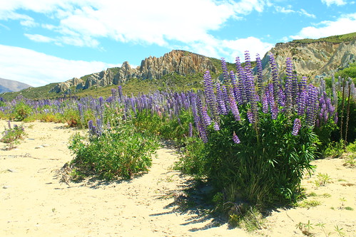
Purple lupin growing at the Clay Cliffs near Omarama
We took Lindi's Pass toward Omarama before doubling back across the Ahuriri River to the Clay Cliffs, a geological formation of very soft rocks exposed along the active Osler Fault. The cliffs are a deeply dissected feature that is the site of an ongoing battle between the uplifting tectonic fault and erosion. We stayed here for a short while and had lunch along the Ahuriri River, a beautiful place to dip your feet in the refreshing water and have a bite to eat. We made one more stop to the former river outlet of Lake Pukaki before it was dammed and diverted but also had time to stop at the southern end of Lake Pukaki to get a sense of what we were in for for the next few days.

Aoraki/Mt. Cook
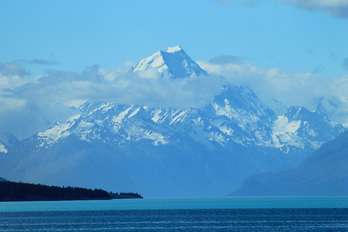
Aoraki/Mt. Cook (3,724 m/12,218 ft) looming over Lake Pukaki
The weather was bright and sunny and fairly few clouds against a blue sky, and from here, far off in the distance, was the brilliantly majestic peak of Aoraki (or Mt. Cook), the highest point in New Zealand at 3,724 meters (12,218 ft) above sea level! We had to stop here because the view was simply breathtaking, and because Aoraki is apparently often shrouded in clouds, we thought this might be our only chance to see its entire height! And I should mention Lake Pukaki because it was amazing in its own way. There is so much powdered rock, crushed by glacial erosion that gets washed into the lake that it takes on a very milky appearance which reflects the sky on a sunny day, turning it a turquoise colour that is really only best matched by a Crayola crayon of the same colour!

It was windy, so we got back into the vans and started the fairly long drive down the Mt. Cook Road toward Mt. Cook Village, the views along which were absolutely stunning. I'm jealous of the students in my van because they got to stare out the windows the entire time, while I had to keep my eyes on the road. But if you want a fun road to drive along, this is one of them. It just rolls and wraps its way long the lake and the ever-impressive Southern Alps just keep looming in the distance! Well, if the drive wasn't thrilling enough, once you're past the head of the lake, you begin driving through the wide and flat river valley that drains the Mueller, Tasman, and Hooker Lakes which are all fed by glaciers. And while you can't see the glaciers, as they are hidden by huge glacial moraines and tucked away around the mountains, you do see the incredible wall of ICE that is known as the Huddleston Glacier, which frankly, I thought was one of the most impressive things I've ever seen! It's just this massive, steep wall of ice that you just couldn't stop looking at!

Aoraki/Mt. Cook National Park
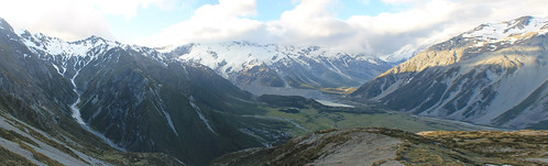
Looking down to the Mt. Cook Village from the Red Tarns. The Huddleston Glacier is the big wall of ice plastered
on the side of the Southern Alps in the distance. Mueller Lake and its end moraine seen in the bottom of the valley.
Aoraki (the Maori name for Mt. Cook) features prominently in Maori history. The Maori people believed the South Island to be a canoe that Aoraki and his brothers were using to voyage the world. It tipped and the brothers climbed onto the top of the overturned canoe and turned to stone. Geologically, Mt. Cook is positioned in the Southern Alps which are the result of convergence along the Alpine Fault which is the boundary between the Indo-Australian tectonic plate and the Pacific plate. The fault is mostly a dexteral strike-slip fault, but there is oblique convergence which has uplifted the mountains on the South Island. It is the Alpine Fault that causes most of the earthquakes in New Zealand, and also as it cuts across the north part of the South Island it goes offshore east of the North Island where subduction of the Pacific plate under the Indo-Australian plate results in the volcanism the North Island is famed for!

Well, while all of the students were excited to get out of the vans and start eating and drinking for the night, I had picked up a wee trail map and having heard that weather is rarely clear in the park, I thought I'd take advantage of it by doing a short hike up to the Red Tarns, some small ponds perched high up the mountains above Mt. Cook Village. Luckily summer in the Southern Hemisphere means plenty of light late into the evening, so I didn't have much to worry about - other than breaking my ankle with no one around! Well, the hike up was unrelentlessly steep, but I eventually made it to the tarns, which in and of themselves aren't that impressive, but you don't make that kind of hike to look at a pond, but for the view of the rest of the valley. Up here, you're so high up above the valley that you can see up and over Mt. Wakefield to Mt. Cook as well as up the Tasman River valley to The Armchair and Malcher Peak. The weather was holding up, so I decided to climb even higher to the shoulder of Sebastopol, the lowest peak in the National Park. Catching my breath, I decided my hunger would win over my want to reach the summit, so I raced down a big scree slope and headed back to dinner at the Mt. Cook Village.

Aoraki/Mt. Cook National Park
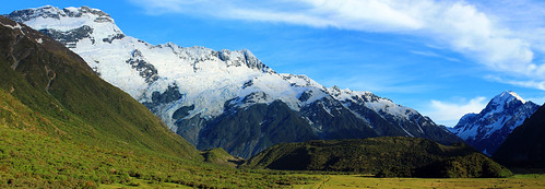
The Huddleston Glacier and Mt. Sefton (left), Aoraki/Mt. Cook (right), and the Mueller
Glacier's end massive end-moraine (centre-bottom)
Weather was clear the next morning again, blue skies and few clouds, so I walked up toward The Hermitage - the famously fancy resort hotel in the National Park that looks directly over to Mt. Cook - for a few morning photos before joining back up with the students. We drove up to the Mueller Glacier overlook for a few more student talks. During one of the talks, we all of a sudden heard this huge crack that sounded like thunder, followed by a cascade of booms and crashes. It was so startling that everyone turned their heads to the glaciers behind us. Though we couldn't see anything, it was pretty obvious we'd just heard a massive block of ice break off the Huddleston Glacier, falling down onto the Mueller Glacier below. Coincidentally, the student giving his report was just talking about ice falls. Talk about timing!

Blue Ice
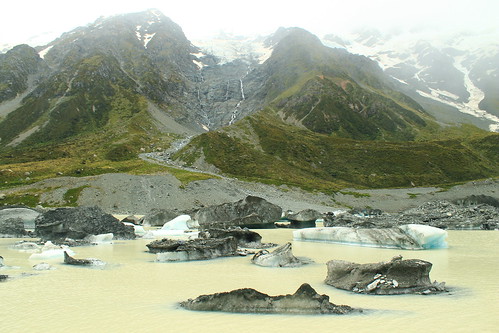
Icebergs from the Hooker Glacier floating in Hooker Lake
Once the student talks were done, we started the long hike up to Hooker Lake and the Hooker Glacier that sits right at the base of Mt. Cook. We continued to hear booms of breaking ice behind us during the hour-long walk up to Hooker Lake, which was cool, but the weather turned, which was not. We could see the clouds rising up from the west and flowing over the mountain tops to our left as the wind picked up and threatened to rain us in. But, being geologists, we go out in anything and this certainly didn't stop us and the last few students presented their mini-reports. You couldn't really see the mountain peaks by this point, but you could still get great views over Hooker Lake which was just chockers full of icebergs in various stages of melting, all shapes and sizes! By the time we left Hooker Lake, the weather had cleared up once again, permitting us to drive around to the next valley over to the Tasman Glacier and Lake.

Tasman Glacier and Lake Panorama
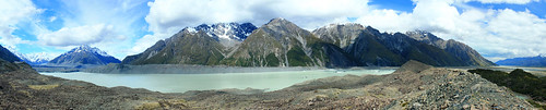
Lake Tasman is a recent feature to the landscape, having only formed in the last 40 years after the Tasman Glacier (left)
retreated to its current position!
Lake Tasman is impressive, if not for its size (7 kilometres long!), for the fact that 40 years ago, it was not there! Forty years ago the Tasman Glacier's terminus was at the lookout most visitors take the short walk up to from the car park. Now, however, Tasman Glacier ends in the lake and icebergs calve off its front. Though the retreat is impressive and offers the opportunity to take speed boat tours around the lake, it just means our changing climate is killing off these magnificent glaciers!

We headed back out of Aoraki/Mt. Cook National Park toward the town of Twizel where we'd be based for the remainder of the trip. Over the next 5-6 days, the students would be working on small group projects in the area, and we, the trip leaders, would drive them wherever they needed to go. But first, we had another stop to get to up beyond Lake Ohau on the other side of Twizel. By the time we got beyond the shores of Lake Ohau, the weather came back with a vengeance.

The next day was fairly uneventful. The rough weather had cleared up and the students used the day to plan their projects. Twizel itself is a pretty dull town. It was founded as a working camp during the construction of the dams that were built on Lake Ohau, but remained a popular stopover point for travelers going to Mt. Cook (not to mention cheaper than staying in Aoraki/Mt. Cook National Park. While there are some nice coffee shops and cafes in the main shopping area, there isn't much to speak of - especially of the locals. While eating dinner at the Power Station Bistro I noticed one man down his beer outside and promptly walk to a short brick wall and urinate on it! Welcome to Twizel, indeed!

I played chauffer for students heading up back into Aoraki/Mt. Cook National Park over the next three days to collect data for their projects. Depending on which group was where, and when they needed to get to their next stops, I often had anywhere from an hour to a few hours by myself before I had to meet any of the students and move them. This was nice because it gave me time to do a few shorter walks and explore the park a bit more. One of the days I walked up the Mueller Glacier trail to see the head of the glacier which had retreated around the corner of its valley, out of sight from the main view point. Right at the bottom of the Huddleston Glacier. No one else was up this far and I enjoy sitting in the sun in the middle of this amazing landscape. I felt so fortunate to be able to experience it in all its sun-shiny glory!
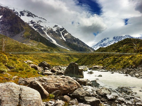
Hooker River and Bridge
Suspension footbridge over the Hooker River. Aoraki/Mt. Cook shrouded in clouds
I also joined a few student groups on their quests to collect field data. This varied from walking up along the crest of the lateral moraine along the edge of Tasman Lake looking for students who had gotten well-ahead of me, helping students measure boulder dimensions in streams coming down from creeks draining the steep valleys to the west of Mt. Cook Village, and taking one more walk up to the iceberg choked Hooker Lake.

I had no plans to see any more of the South Island on this trip, and though I was a bit let down about not being able to do that before arriving, I don't think I could have asked for a more amazing experience that just being able to wander and explore the Hooker and Tasman Valleys in Aoraki/Mt. Cook National Park. It really must be one of the most spectacular landscapes I've been to. It's drastic, but accessible; staggeringly expansive, but easy to get around; busy with tourists, but big enough that you don't have to go far to get away from them!
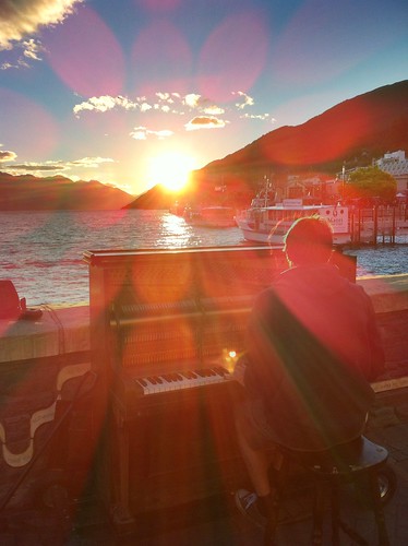
Queenstown Pianist
Pianist playing his own music during a beautiful Queenstown sunset
over Lake Wakatipu
The students had a final day in Twizel to write up and hand in their reports, so the last day near the mountains wasn't all that exciting. Finally, we were ready to leave Twizel and made the long drive back to Queenstown for our last night in New Zealand. We arrived early afternoon and many of us had previously signed up to go whitewater rafting to celebrate the end of a long week. We dropped our things off at the hostel and met down in the town at Queenstown Rafting where we were fitted up with wetsuits and packed into large vans with a trailer packed with rafts in tow behind us. This is no big deal, except to get to the launch site, we had to drive down Skippers Road, a long, very tightly-winding road that is cut into the side of mountains with very steep slopes! To put it in perspective, if you sat next to the window, you couldn't see the edge of the road and it looked like there was nothing beneath the van! In fact in one or two places, there almost wasn't anything beneath the van... One tight turn has been so abused that the edge of the road has eroded to the point that side of the van on the inside of the road gets scratched by the rocks sticking out of the slope! At another point on Skippers Road, the road appears to be intact, but when you look back up at it from the river, you see that a big chunk of rock, that would otherwise support the road, has simply fallen away! If you're afraid of this kind of driving, there's no hope for you because no matter which side of the van you sit on, you're going to be exposed to one of these hazards!!!

But the rafting itself was awesome! I've only been whitewater rafting once before on the New River in West Virginia where the water levels that year were low enough that the big rapids had diminished many of the rapids, so I wasn't sure what to expect. Well, the Shotover River is pretty much a narrow, narrow canyon with rocky cliffs on either side and in most places the river is as wide as the raft! I've got to give it to the raft guides because they have some of the hardest jobs in the world in keeping us all safe! While we didn't flip, like we did on the New River, there were so many times I thought we were goners! Two girls did fall out at one point, but we safely got them back on the raft just before they were pinned between the rocks and raft! The trip culminates a tunnel that was blasted into the mountianside to funnel water for gold mining in the mid-1800s, the final rapid is shooting down the mill run right where every raft in front of us was waiting and watching, hoping someone would flip. We didn't, but had a great time and it was an awesomely adventurous way to end a week in New Zealand!

That night was spent out in Queenstown watching a beautiful sunset over Lake Wakatipu and eventually some mechanical bull-riding in one of the town's innumerable options of Western/Cowboy-themed bars. Flights back to Sydney the next afternoon gave me a little bit of time to walk around the local Saturday markets along the lakeshore in what ended up being a very nice sunny relaxing way to end my last visit to New Zealand in a long time! Definitely not the last, but a long time at least!

Sunday, May 25, 2014

Scotland: Ben Lomond and Ben Vane (Munros 1 & 2)

Ben Lomond
 
Date: 15 April 2014

A few weeks back, Glasgow experienced a rare weather phenomenon: we had eight days of beautifully sunny and warm weather! The first of these days, we'd been coming out of rainy doldrums and being Scotland we weren't sure how long the sun would stay, so even though it was a Tuesday, a friend of mine from the University and I decided we'd take advantage of the weather while it was still good, made plans, and drove out to Loch Lomond and the Trossachs National Park, taking a small one-lane windy road around the north shore of the famous lake to the foot of Ben Lomond - the southernmost of the Scottish Munros.

Scotland is famous for its brilliant hillwalking everywhere, but especially in the Highlands. Here, any peak that is over 3,000 feet above sea level is classified as a Munro - anything less is classified as either a Corbett (2,500-3,000 ft above sea level) or a Graham (2,000-2,500 ft asl). There are 282 Munros, and anyone who attempts to climb them all is called a Munro Bagger. Having never done any hillwalking in Scotland before (save maybe the walk to the Old Man of Hoy in the Orkney Islands), I figured what better way to claim my first peak than to hike up to the summit of the southernmost Munro as well as being the peak with the name of the National Park it is in!

The walk took us about six hours, round-trip, and while it was not a challenging hike, per se, it was a beautiful one, nonetheless. Ben Lomond is tall (974 meters, or 3,196 feet above sea level) and since you start very near sea level, the whole elevation is yours to climb. Well...climb is a bit of an overstatement. The walk up Ben Lomond is a pretty easy ramp along a well-marked trail. About three quarters of the way up, the ramp does steepen and the going gets a bit slower, but it's still not challenging if you take your time.

Loch Lomond
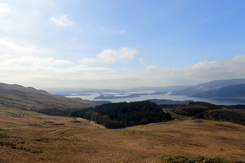
Beautiful views of Loch Lomond all the way up to the summit
My friend and I kept a good pace the entire way up to the top. We had to since even though the sun was out, the wind was a bit chilly, but the views from the walk of both the summit - which would be hidden by clouds for short periods of time - and the beautiful lake beneath us were stunning! There was still snow up at the top on the steep, north-facing slopes, and though we enjoyed it at first, we quickly steered away from it, realising that the possibility that any of the snow packs could collapse and avalanche down the mountain was pretty high!

By the time we got to the summit, the weather had cleared up enough for some good photos and the views of the Arrochar Alps across the lake and the Trossachs to the north were great! We had lunch up there shortly after 1:00 pm, but didn't stay long since we still had to descend. Rather than going down the same way we came up, we headed down a smaller ridge that ran parallel to the lakeshore, bringing us right back to the parking lot. Once down from the top, the wind died down a bit more and the clouds all but vanished. We stopped for a wee snack and watched a Royal Air Force jet fly through the lake valley below us for some sort of training mission. By the time we got to the car, it was nearly 4pm so we had one last little snack on the lakeshore before heading back into Glasgow.

(there's more below the Ben Lomond slideshow!)


Ben Vane

Date: 19 April 2014

Later on in the same week - again, the weather couldn't have been better - a larger group of my friends from the office and I carpooled out to the south side of Loch Lomond to climb Ben Vane, another Munro, 915 metres (3,002 feet) above sea level. While not as high as Ben Lomond, Ben Vane offered up some extra challenges. Mainly, we had to find our own path from the access road up to the path on the trail guide, and higher up the trail got quite steep and we zig-zagged our way up between large rock outcrops, scrambled over boulders and other rocks, and slipped our way over some small snow patches, all the while dodging sheep and trying to keep our feet dry while walking over purely soggy ground!

Sheep and Ben Lomond
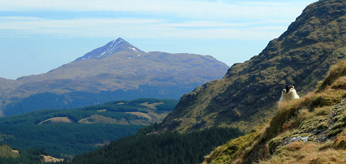
One of the many sheep that dotted the hillslopes on the way up Ben Vane - keeping a keen
eye on us as we summit the Munro. Ben Lomond in the background.

It was great, though. We started off at the Inveruglas parking lot on the shores of Loch Lomond and had to walk up a very long access road past a hydro power station. We couldn't find the trail from the access road up to the ridge we were supposed to follow to the summit so we just marched on up a big long slope, dotted with boulders and massive rock outcrops sticking up from the water-saturated muck beneath our feet. We had perfect views over Ben Lomond and Loch Lomond and with plenty of shaggy sheep running every which way, there were plenty of pure-Scotland moments!

Once we got to the top of the ridge, we followed its gradual path up to the base of the real mountain. Here, the path took steep hairpin turns with large steps up over rocks with a big outcrop every so often that offered a good place to take a break for a moment and steal some fantastic views of the surrounding Arrochar Alps!

The walk was a long and steep one - a bit more strenuous than Ben Lomond. It was one of those mountains that every time you think you reach the summit, there's more to go! The path eventually gives way to some scrambling up and around some rocks, down some rocks, and over some snow banks, but we finally reached the top and were rewarded with stunning views of Ben Lomond, Ben Ime, A'Chrois, the Cobbler, and Beinn Narnain. The schist rock that underlies the Arrochar Alps stuck out in many places at the summit, showing off its beautifully warped and metamorphosed structure, giving the whole summit an incredibly unique geologic feel!

The thing with Munro Bagging (at least from what I've experienced in the two hikes I've done), is that you don't linger at the summits for very long. We stayed up at the top for maybe fifteen minutes before turning right back around and heading down. But the whole walk was well worth it. We had a good group of people, a fantastically nimble dog, and stunning weather! And I can't wait to tick-off the other Munros of the Arrochar Alps off my list soon!

Saturday, June 9, 2012

The Old Man of Hoy and Maeshowe

Travel Date: 04 June 2012
(Slideshow of photos at the bottom)

Today was much less hassling trying to get around. Buses were back up to their full schedules as were the ferries between islands. I got up early enough to hop a bus back to Stromness from Kirkwall and then had 10 minutes to get onto the little passenger ferry, taking me out to the island of Hoy. It was another sunny day, though still chilly, that provided me with great views of Stromness as we pulled out of the harbor and into the tidally forceful Scapa Flow. There was a little story I read, I think at the Flattie Bar yesterday while in Stromness, that described life on the water: people living there were sailors and fishermen by trade so they were very comfortable being on the water, but the kids who had their own little boats (the Flatties of the pub's name) were warned to not sail past black buoys placed out near the mouth of the harbor because from there on out, the tides and currents were much to strong and would carry them away, out to sea.

06042012 (2)
Leaving Stromness Harbor

Today, though, the ferry easily navigates the tides and we pulled out into the channel between mainland Orkney and Hoy. Again, here was an entrance to the protected harbor where the WWI and WWII British Navy Fleets were stationed, so you can still see the old watch-houses and bunkers along the islands that were used to protect that channel entrance from any German threat. They are abandoned now, but still stand in silent guard.

06042012 (13)
WWI/WWI-era look-outs on the shore of the isle of Graemsay with mountainous Hoy in the background
Hoy is a beautiful island. It has the most topography of any of the Orkney Islands and was visibly sculpted by glaciers during the last Glacial Maximum. One of its more modern features, however, is the Old Man of Hoy, the United Kingdom's tallest seastack (450 feet high)! A seastack is a tower of rock separated from the rest of a cliff-lined coast. They form as wave action strikes a rocky promontory, and as the waves refract around the head of the point, they erode the neck from two sides. Eventually, the neck of the promontory totally erodes through and all that is left is a giant stack of rock out to sea: hence the name seastack.

06042012 (24)
Docking at the isle of Hoy

To get out to the Old Man of Hoy, you have a few options. You can prearrange a cab to pick you up at the ferry dock, you can sign up for a guided tour, you can bike out there, or you can hike the 6.5 miles from the docks, through glacially sculpted valleys, and then up to the site. I bought some new hiking boots when I was in Michigan for my sister's wedding and since I didn't want to pay for a bike rental or a cab, I decided to hike. The first mile and a half are all up a one-lane road leading away from the ferry dock, through sheep pastures, and through some moors. The road eventually turns, but hikers continue the next two and a half miles through the glacial valleys, which are protected as part of the Scottish National Bird Sanctuary. Because of this, though, I was warned by a local Orcadian that you kind of have to keep your eyes open for any divebombing Great Skua birds (called, Bonxies by the locals). They kind of soar around above you and if you get too close to their nests, they will squawk and dive toward you. I won't lie, I had a few stones in my hands just in case, and even shouted at a few that I thought were flying too close to me! There was a little reservoir up in the valley that most of the bonxies stuck to, and once I was past that, they were no longer a problem!

06042012 (35)
The lonely road out to the hiking path to Rackwick on the isle of Hoy

06042012 (40)
Watch out for the dive-bombing bonxies!

Further down the valley, tucked away in little stream valleys, are some of the last remaining wild Orcadian forest, that used to cover much of the islands. Over 5,000 years of constant settlement and agriculture, it's no wonder there is little left of these forests. But then the trail reconnects with the road which ends not much further in the little town (if you can call it that) of Rackwick.

06042012 (115)
Some of the original, most northerly native woodland in the British Isles

Rackwick is literally the end of the road, but it is a beautiful end of the road with a wide, sweeping beach with turquoise water, nestled between huge, enormous, sandstone cliffs. And I'm not talking 100-foot-high Sydney Coastal Walk cliffs, or even 200-foot-high Pictured Rocks cliffs, or even 400-foot-high Cliffs of Moher. These cliffs jut up 500-feet from the ocean far below (and they aren't even the tallest, which rise up over 1,000 feet!). So Rackwick is a beautiful end of the road, but not the end of the journey out to the Old Man of Hoy, which still requires a two and a quarter mile hike along cliffs and over coastal plateaus. But once you are there, it is such a treat! Standing 450-feet up from the ocean, far below, is this behemoth of stacked beds of sandstone, flanked to the south by similarly-high cliffs, and to the north by the massive 1,000 foot cliffs! Now, believe me when I say that the Cliffs of Moher are beautiful and stunning, but the fact that they are so accessible and overrun by tourists makes them a bit less wonderous, compared to these massive cliffs that only those willing enough to hike a few miles will ever get to.

06042012 (57)
Old British Telephone booth at the Rackwick Hostel, looking down at the town and the massive sea cliffs

06042012 (75)
The Old Man of Hoy: 450 feet tall and the tallest sea-stack in the UK

06042012 (78)
Me with the sea cliffs north of the Old Man of Hoy

06042012 (91)
Puffins! This was the best shot I could get, even with my 18x zoom lens... But some birdwatchers there told me of better places closer to Glasgow I can go to get better photos

I stayed out at the cliffs for a little while, enjoying my packed lunch of cheese, jerky, an apple, biscuits, and crisps, watching the sea birds (mostly seagulls, but I did see some puffins, too! - just very, very far below me...) and chatting with a few of the other visitors who were from all over the place: Germany, southern England, California... They all had a few good stories and we each helped the others take photos. It did start to sprinkle, just a thin band of rain, but it was also time to head back to the ferry dock. I wanted to take a more rigorous route up above the massive cliffs to the north, but being alone, without a detailed map, and on a time constraint, I decided it would be better to go back the way I came and leave the high-cliff route for another time. Back toward the ferry dock, a lot of tourists were having an afternoon tea at a little cafe. It was nice, but definitely priced more for the retired clientele who have a little bit more pocket change than your average student day-hiker, but I bought an Irn-Bru and gave my feet a rest in the yard, watching a chicken hobble around.

I had to catch the first afternoon ferry back to Stromness in order to get the right bus out to Maeshowe, which I wasn't able to get in yesterday. We had to wait for the ferry a little bit but it gave me time to explore the exposed rocky shoreline during low tide, which was covered in barnacles, limpets, algae, and seaweed. The ferry came and brought us back to Stromness where I had a little extra time before the bus, so I bought a beer at the Ferry Inn and listened to one final jam session by the remaining musicians in town for the Orkney Folk Festival. But then it was bus time and back to Maeshowe.

06042012 (157)
Limpets stuck to the bedrock at Hoy Harbor during low tide. As water washes over them, it erodes little pockets around each limpet creating a pitted pattern on the rock.

Maeshowe is a fantastic Neolithic site, nearly 5,000 years old. You have to book a tour in advance, and in the summer there are extra "twilight" tours in the evenings, which aren't really twilight since the sun pretty much never sets. To get into Maeshowe, you have to stoop quite low and walk through a ten-meter passageway lined in massive, single blocks of stone. Once inside, you're able to stand up in a square chamber with what was once a corbelled ceiling (but is now a poorly constructed brick dome structure put in place in the early 1900s). Maeshowe is similar to other chambered tombs of the area in that opposite the door and on either side wall are two recessed and L-shaped chambers. In other tombs of this age, human bones have been found stored in these chambers, grouped by bone-type, rather than full skeletons. It is thought that Maeshowe served a similar purpose but very few bones have actually been found there. It may have also served a more ceremonial purpose, archaeologists think, suggested by the fact that the entrance to the tomb directly faces the setting sun on the Winter Solstice. Curiously, on the solstice, the sun sets behind the massive mountains of Hoy, and it is thought that they also served some spiritual purpose. Furthermore, the ceremonial significance of Maeshowe is suggested by its proximity to the Standing Stones of Stenness, the Ring and Ness of Brodgar, and the Barnhouse Village.

In the 12th century, multiple groups of Vikings were vying for control of Orkney and one group started off one morning in Stromness but got caught in a storm and took shelter in Maeshowe, leaving cryptic messages of the runic alphabet carved into some of the stones. They spoke of the treasures of the North and one claimed to be a master writer of runes who and carved his message using a very famous axe, used to slay Gauk - don't ask me the history of that; all I know is that the axe was well-known.

My favorite bit about Maeshowe, though, again were the slabs of rock. The entrance tunnel was lined and covered with ten-meter long single slabs of sandstone, and the lintel above each of the recesses off the main chamber, which were five meters by at least three meters, were each carved of a single slab of rock. How those people 5,000 years ago were able to move such large pieces of rock over large distances still baffles me as well as archaeologists, and as to how it was done is still anyone's guess.

06042012 (197)
In front of the entrance to Maeshowe. No photos are allowed inside, but it's pretty amazing

06042012 (210)
One last look over to the Ring of Brodgar

Upon leaving the tomb, I gave one last look around the landscape, taking a few more photos, before heading back to the visitors center to wait for the last bus into Kirkwall. I bought a few postcards and got some good music suggestions from the woman working the shop, and indulged myself into a wee tub of ice cream from the Orkney Creamery, which was delicious (I suggest the Toffee Swirl and the Orkney Original).

Back in Kirkwall, I ran into some girls who were out at the Old Man of Hoy when I was there that day, and we chatted a while over some coffees and snacks in a little craft shop/coffee house, Judith Glue. The girls were fun to chat with, but they had already eaten dinner and I needed some substantial food before 9pm, so I said goodbye to them and headed out to see my final fish and chips of the trip. I caught the shop just before they closed and took my food out to the harbor to eat. It wasn't quite 10pm yet and I realized that I did want to purchase something to remember Orkney by, and I went back to Judith Glue (which stays open until 10pm!) and purchased a few prints done by a local artist and a bottle of Dark Island, brewed by the Orkney Brewery - as suggested by a man at the pub where I got dinner the night before - and headed back to my hostel where I watched the Queen's Diamond Jubilee concert at Buckingham Palace and wrote my postcards. That night, as part of the Jubilee, beacons, or torches or bonfires, were being lit around the UK and the world in commonwealth countries. Stromness had their own beacon and I was tipped that Kirkwall would be having their own as well on top of a radio-antennae hill visible from the hostel's kitchen window. I kept getting up to see if I could see the fire, but it was either too small or they didn't have one, so I stayed in, repacking my bags, and finally dozing off to sleep.

My legs were sore, feet were covered in blisters, and my brain hurt from trying to piece together all the Orcadian history I had taken in over the past few days. But I fell asleep the moment my head hit the pillow and I would soon be saying goodbye to this beautiful but chilly island paradise of northern Scotland.

Wednesday, November 9, 2011

Panoramas: Part 1

Do you ever have software sitting on your computer that you just wish you knew how to use? Well, a few years ago, I bought a package including Adobe Illustrator/Photoshop/Reader and pretty much just used the Illustrator/Reader parts without really knowing what to do with Photoshop. Well, I've been learning a few things lately and maybe gotten a little carried away with using the photomerge capabilities. Since then, I've been finding photos from my travels that I never thought I would be able to stitch together. Now that I know....I've been going crazy! So here are a few of my first photomerging projects:

The Gros Ventre Range in Wyoming. Photo was taken from near the top of Battle Mountain along the Hoback River. University of Michigan Camp Davis (2007)

The Nopah Range in southern Nevada (California?). I forget exactly where the photo was taken, but I was on a Geology field trip with the University of Michigan Geology Department (2007)

Cliffs of Moher along the west coast of Ireland, County Clare. Taken during my family's trip to Ireland earlier this year (2011)

My sister with the Fernsehturm, Rotes Rathaus, and Alexanderplatz behind her. Taken from the top of the Berlinerdom. (2011)

Three glaciers flowing into a fjord in Greenland. Taken from our C130 transport plane. (2011)

Greenland Ice Sheet. Taken east of Kangerlussuaq. (2011)

View of the Russel Glacier from downstream in the Watson River valley, east of Kangerlussuaq, Greenland. (2011)

Greenland Ice Sheet (2011)

Walking down the little road to the Greenlandic town of Igaliku. It was in this town, the next day, a polar bear was shot. (2011)

Looking down on the ruins of Erik the Red's homestead in the town of Quassiarsuk, Greenland. (2011)

Downtown Singapore. Taken from the top of the Marina Bay Sands Hotel and Casino. (2011)

The iconic Three Sisters and the Jamison Valley in the Blue Mountains of Australia, just west of Sydney. Taken from Echo Point. (2011)

Valley of the Waters in the morning from the top of Wentworth Falls in the Blue Mountains, Australia. (2011)

Monday, May 30, 2011

Helicoptering Over Greenland

Early the next morning, our crew woke up for our typical Greenlandic breakfast of soft-boiled/scrambled eggs, bacon, greasy sausage, grapefruit, and an assortment of cereals. We ate in a hurry because we had an appointment to be at the airport early so we could get in as much time collecting samples with a helicopter as possible. The area around Narsarsuaq is vast and in order to get what we wanted in the time we had, we couldn't waste it on foot. We had three hours of rotor-time to work with, measured by the length of time from take-off to touch-down.

The weather was not perfect for us, and we were going to have to run our flight-plan by the pilot to see if what we wanted to do matched what his abilities and the weather would allow us. Our helicopter is only navigable by sight - so if the pilot can see where he wants to go, we can go there. The clouds were low in the morning, so we were not sure what exactly we would be able to do, but our pilot did not seem worried at all.
Our mode of transportation for the day. To the CHOPPER!!
Discussing our travel plans with the pilot.
If you've never been in a helicopter before, you need to ride in one as soon as you can! It's not to be missed, and even though you feel a bit more exposed than you are in an airplane, I never felt unsafe at all. Our pilot was incredibly professional and would not fly us anywhere he did not feel comfortable going. We headed up the fjord, passing one of the only "forests" in Greenland - it's actually a little research facility, but a forest nonetheless.
One of the only "forests" in Greenland
We got off to a good start, collecting a few samples in quick succession. But while we were just starting to gain elevation in one of the glacial valleys, snow started to fall, and not the fluffy kind. It was a pellet-type of snow that kind of bounced off of our jackets. We decided that while the clouds were low we would collect a few bedrock and boulder samples and hiked up a hill to pick some good specimens. The snow kept coming down harder, and we weren't sure if the pilot would be able to get us up to higher elevations to get more samples. Wouldn't you know, though, that by the time we got back to the helicopter, the snow stopped.
The pilot then, in about two minutes, took us from near sea-level to an elevation of over 1,000 meters (I think - it was very high up!).

It was awesome how the helicopter could just set down on any flat, tiny piece of rock. Our pilot was so smooth in setting it down, though a few times he had to try a few different spots because we were on weak snow or one of the skids was on top of a boulder or something of that nature. Inevitably, his piloting prowess shone through and we collected numerous samples from all different elevations.
Collecting samples
One of the numerous waterfalls we flew over
The past week, it seems everyone in Narsarsuaq helped to build this bridge over the river. The center section was put in place a while ago, but the waters flowed over their banks and you couldn't get to the bridge, so they added extensions to it. We were the first people to actually use it. They did a good job and none of us fell in the river!
Taking notes in the snow
And then we were on top of the mountains!
The mountain peaks rising above a frozen lake and the ice sheet in the background with some giant nunataks sticking up through the ice sheet.
Getting rock samples from high up in the mountains
After getting rock samples from the mountains, we flew up the valley for a few more sediment samples. Our ultimate destination were some streams directly coming out from glaciers coming off the ice sheet. To get there, we flew over a HUGE frozen lake that is just begging to catastrophically break and flood down into the valley. But then we got to the first glacier - much different that the ice sheet we saw up in Kangerlussuaq. Here the ice was incredibly thick and just kind of ended in a steep bulge. It was a little tricky finding sand-sized sediment here as the energy of the stream flowing out from the glacier this close to it is usually very high and the smaller sized sands are easily carried away. But we got what we came for and the pilot took us over to another tongue of the ice sheet. It's amazing how different each glacier we saw was completely different. This one was very steep, but it didn't bulge; rather, it came down in a sharp slope and ended abruptly. After bagging our sample here, we started flying to another glacier a good distance away. The pilot remarked how flat and huge the outwash terraces were and that they would be a pilot's dream to land on. He also liked that nature makes the perfect runway and that a contractor couldn't make a flatter surface.
Bulging glacier front
Me in front of the glacier
The river is cutting a canyon through the flat outwash terraces
Sampling in front of the steep-front glacier
As we took off for the next glacier, we flew over one of the most absolutely beautiful landscapes I have ever seen! During the melting season, the water from these two glaciers fills a valley, but is blocked at one end and a lake is formed. Large chunks of the glaciers calve off and float away into the lake. Later on the in the season, the lake will drain and the large icebergs will eventually be left behind to sit on the valley floor. We flew over this in the non-melt season, so the bergs were just sitting there! It was something none of us had ever seen before - even in photographs from textbooks! The other amazing thing about this landscape, which textbook photos allude to, is the color of the ice. You see in photos the bright blue, cerulean color of the ice and if you're like me, you think, "The ice can't be that blue." But in fact it is! Again, this is one of those times that photos just don't do reality justice!
The "Dead Ice" valley
The big iceberg here is like 60 feet tall!


Deep blue coloring of the ice down in the fissures
Flying back over a glacier, the ice reaches a steep  drop in the rock beneath it and kind of cascades down
More deep-blue meltwater pools
Even though we had plenty of rotor-time left, our pilot was reaching the end of his shift and we had to get back to the airport. But we did stop and collect a few more samples - some very near to the mouth of another glacier some down a glacial valley right between humongous mountain peaks and some right near one of the most active calving-glaciers in southern Greenland.
Our next glacial destination. This one looks like it just spreads out over the landscape like a giant pancake!
The glacial margin. Here it is very thin and gently slopes up.

Flying over a gorge carved into the rock
This valley was tucked right between some HUGE mountains!
And a fjord filled with icebergs!
We asked to see how much it would cost to keep the airport open a few more hours, and after hearing it would set us back $8,000 we decided to call it a day. But then we heard that someone else was paying to keep the airport open for other reasons, so we quickly refueled the copter and took off for another few hours to get a few remaining samples from high, unhikable, places. We didn't end up lucking out with the samples, but I got some great photos of the Narsarsuaq area from it!
Ice bergs on the way back to the airport
One last sampling site for the day
View of the surrounding fjords and mountains
More icy fjords


The calving margin of this glacier and the vast number of icebergs choking the fjord
Once we got back to the airport, even though we were flying around all day, we were exhausted!! We had used our helo-time very well and got to see so much of southern Greenland that other people only dream of seeing. And to have seen it all by air in a helicopter, continuously lifting off and setting down on the ground, hovering in mid-air - it could not have been any cooler or beautiful. The next few days were going to have a lot to live up to. And they would, in their own special way!
Creative Commons License
This work by Eric W. Portenga is licensed under a Creative Commons Attribution-NonCommercial-NoDerivs 3.0 Unported License.