Showing posts with label Scotland. Show all posts

Monday, April 20, 2015

Scotland: Dunrobin Castle

Date: 05 April 2015

Keeping this one short: A few weekends ago, I was up north with some friends, enjoying a relaxing Easter Weekend, totally off the grid, which doesn't take long if you have O2 as a mobile provider! With perfect weather, we decided to head up to Dunrobin Castle on eastern shore of Scotland's Highlands, just outside of Golspie. Though the castle has truly had a sordid past - it was the home of the Duke of Sutherland who played a prominent role in the Highland Clearances - the castle and its gardens are pretty magnificent.

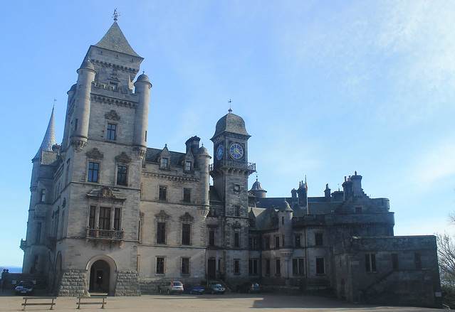
Dunrobin Castle
Dunrobin Castle in Golspie, Scotland
We arrived just on time to catch the falcon display, which is an hour-long show run by the resident falconer. The falconer works with and trains numerous birds of prey (hawks, owls, and falcons) that came to the castle after being found injured, and they live there, putting on educational shows for families. The falconer was great and kept moving around the gardens, and right on his cue whichever bird he was working with would swoop down over the crowd (or through it in the case of the owl!), showing off their amazing abilities.

We stopped in the castle for lunch and a tour of the huge building, hoping to see one of its resident ghosts or find a secret passage, but found none. After a quick photoshoot on the back patio, overlooking the gardens and the North Sea, we worked our way back to Golspie for a lazy and quick walk along the beach with stunning views over to the Cairngorms in the distance. No better way to spend a day over Easter weekend!


Saturday, February 14, 2015

Scotland: Beinn Chabhair & Ben Chonzie (Munros 14 & 15)

Wow, it's been a while since I've posted any photos from my hillwalks to Scotland's Munros, those peaks over 3,000 feet. My last post, I realise, was about 6 months ago, and it was shortly thereafter that my friend, Hazel, and I did our last hillwalk of the summer (yes, this post is a long-time coming!).

Beinn Chabhair
21 September 2014

It was a Sunday in  September, and we weren't really looking to do anything big, but we wanted to get out into the hills before winter kicked in, and before I headed back to the US for the month of October. We decided that a short walk was in order, and according the Walk Highlands website, Beinn Chabhair should only be 5-6 hours, and that was about right. The walk is pretty much in three stages. The first stage is a walk up a steep, shrubby hill with nice passages of the Ben Glas Burn waterfall. On the way up, an elderly couple was on their way down, and they made a point of stopping to tell us to watch out for ticks, because they were, "jumping out of the bushes," and, "have four sets of jaws!!" Hazel looked a bit ill at that news and wondered if we should stop and go back. I wasn't planning on turning back, even though I only had shorts. Hazel at least had the option of covering up, which she did until we got high enough to feel that we'd gotten through the worst of it without seeing a single damn tick!

Meall nan Tarmachan Ridge
A bit more than halfway up the trail from Lochan Beinn Chabhair
to the summit.
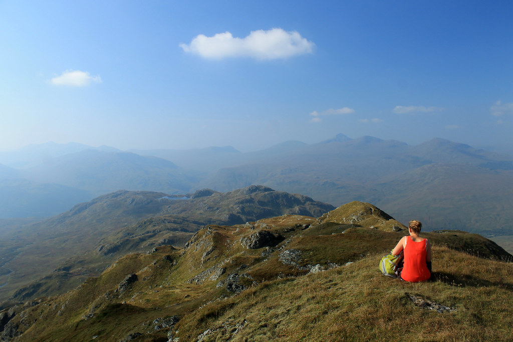
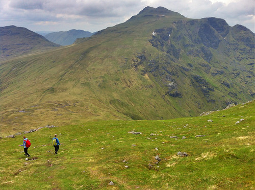
The second stage of the walk is across mostly flat ground, but mucky, marshy ground in a landscape that was really disorienting, even with a map in clear weather. I definitely was happy we weren't doing this walk in the fog, rain, or snow. It was a long traverse up the valley to Lochan Beinn Chabhair where the third stage started up the rocky track to the exposed ridgeline up to the summit. The day was perfect for this type of scenery and we had amazing views back over Loch Lomond to the Arrochar Alps and to the Munros around Crianlarich, and we spent a lot of time taking photos! After chatting to a few sheep along the trail, we eventually made it to the summit of Beinn Chabhair at 933 m (3,061 ft) where we had a bit of lunch before turning around and heading back down. The walk back down didn't take too long, and since it was just going back up the same way we came, there wasn't any new scenery, but the haze had picked up making the sunlight and views a bit more mystical. Overall, a great walk for a quick day out!

This post continues for Ben Chonzie below the Beinn Chabhair slideshow, so keep scrolling!


Ben Chonzie
08 February 2015

It took about five months to get back out into the hills, but just last weekend a small group of friends and I took advantage of a clear, but cold, day to do some hillwalking in the southeast highlands, choosing Ben Chonzie, a gradual and easy walk up to a broad summit. The drive from Glasgow to the parking area for the walk, north of Comrie, took well more than an hour, and along some narrow country roads where you could see the sheen of ice over the road in places, but we eventually all made it and joined a host of other hillwalkers taking advantage of the nice weather.

The Hillwalkers
Up along Ben Chonzie's summit ridge, with the snow-covered
Ben Lawyers range in the distance.
The walk up the hill was only clear of snow for the first little bit, but the trail quickly became snow covered, making for some slick moments and little falls, but luckily the trail followed a car track for most of the way up the Munro, but then the trail deviated up a few hundred metres of snowy patches and bare rock, and I was glad to have bought some slip-on YakTrax for my boots for a bit of extra traction. The last stretch of the walk is along a long flat ridge, totally exposed to the cold and the wind, which was really brisk, but the cold air gave us crisp views over to the Ben Lawyers Range and further on to the foothills of the Cairngorms! We were buffeted by the wind on the final approach to the summit at 931 m (3,054 ft) but got there just to find that the one wind-proof side of the summit cairn was occupied by another group of walkers, so we didn't stay long. The area around Ben Chonzie is known for being a suitable habitat for the Scottish mountain hare, and indeed, at the summit cairn, we spooked one and it took off running and was about halfway down the mountain in a few seconds! Pretty cool to see some of the more rare Scottish wildlife, though!

We definitely did not linger long at the summit, but quickly dropped back down into the valley with the car track to get out of the wind, but being winter, we couldn't leave without doing a bit of sledding (or sledging as they call it here...) on the big snow patches. Hazel had a plastic bag she used as a sled, which worked out pretty well, though I preferred my method of sliding down on my front, like a penguin! We slowly made it back to the cars, but before dispersing in our cars back to Glasgow, we stopped in to the Comrie Royal Hotel for a wee pint (not the drivers, of course), where I tried out the local Earthquake Ale, named so because Comrie lies right on the Highland Boundary Fault and experiences more earthquakes than any other part of the UK! Definitely worth a little stop after a long cold hike.

Scotland: Kilmartin Glen, Mull, & Iona

Dates Traveled: 27-29 December 2014

Christmas was once again spent away from family this year, but this year would at least be exciting. One of my friends and I decided to head west from Glasgow to Oban with some stops along the way. When I moved back to Glasgow from Australia a year ago, a friend of one of my friends was looking at a wall map of the British Isles in my flat, pointed to an area south of Oban, and said, "You must go here, to Kilmartin Glen." He said that Kilmartin Glen is one of the most overlooked destinations for anyone interested in Scottish history and neolithic sites. So, after a day of recovering form boxing day laziness, we headed out from Glasgow.

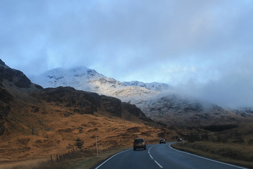
Along the A83
Driving along the A83 between Loch Lomond and Inverary
Winter is an absolutely beautiful time to visit Scotland. Sure, the days are incredibly short, but the snow on the hills makes it unlike anywhere else. Once away from the main cities, the roads get narrow and windy, which makes for getting anywhere quickly quite tricky! It took us a while to get out to Kilmartin Glen, via a coffee stop in Inverary, but a little after noon we pulled into our first stop, Dunadd, which was the first site of the first kings of Scotland, having been in use since the Iron Age. On the little hill above the glen is a rock with some footprints carved into them, possibly where the kings looked out - I imagine much like Mufasa and Simba from Pride Rock :)

A little bit further down the road are a series of standing stones dating back 5,000 years. We missed the winter solstice only by a few days, but it's pretty amazing how these stones would have lined up with the setting sun, even after 5,000 years! I'm often really amazed by how after thousands of years, and with all of our modern technology and knowledge, we still have no real idea what these stones or circles were used for! And while not as grand as the Ring of Brodgar in Orkney or as circular as the Drombeg Stone Circle in southwest Ireland, the stones are just as enigmatic, and there are a lot of them, including one site where five stones make an X figure in a field, apparently a very unusual arrangement. Starving, we stopped in at the Kilmartin Hotel and had a tasty pub supper before exploring the curchyard across the street with brilliant scenery looking down the Glen.

There were still a few things we wanted to see before it got dark and before we got to Oban, and even though it was only 3 o'clock in the afternoon, we were running short on daylight, so we hit the road again, winding around the coast, to the Bridge over the Atlantic. To be fair, this is a very nice looking stone bridge, arching high over a small tidal waterway, technically part of the Atlantic Ocean, separating the Scottish mainland from the small Isle of Seil. Apparently nowhere else (maybe in Scotland) is there a bridge over the Atlantic, so it is only here you can say you've "driven across the Atlantic Ocean." Not really much to see, we kept on to the small town on Seil of Ellenabeich, an old slate mining town that now consists of three rows of whitewash cottages. A beautifully small town that I would have liked to have stayed in a bit longer. Would have been a great place to write up my PhD thesis! While in Ellenabeich, the sun went down and we didn't want to be stuck on unlit country roads for too long, so we headed in to Oban, checked into our hotel, and met up with one of my Uni friends who was home visiting family for the holidays.

Mull Panorama
Snow-capped mountains on the Isle of Mull with Duart Castle in the foreground from the ferry from Oban to Mull.

We got up early the next morning, a brilliantly clear but chilly morning, to catch the ferry from Oban out to the Isle of Mull, a rugged island about an hour offshore from Oban. The views from the ferry back to the mainland of snow capped mountains were amazing, not to mention the snow capped peaks of Ben More, the only Munro on Mull. A little note for visiting Mull in the winter: Don't plan on relying on public transportation, especially on a Sunday! We were lucky to have a Range Rover, so the small single-track roads and ruts of Mull were a piece of cake, but be careful if you have a smaller car not to go off the edge of the road or you will get stuck! We headed immediately out to the westernmost point of Mull, a town called, Fionnphort, where we waited for the quick ferry out to the small Isle of Iona. Again, visiting in the winter and on a Sunday, you run the risk of either the ferry not running, or only making one trip out to Iona, but not back, so it's suggested you call the portmaster on Mull the day before to make sure the ferries are running!

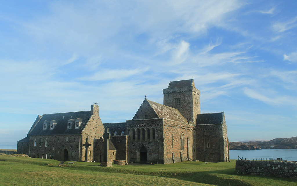
Iona Abbey
Iona Abbey
The sky was crystal clear, and though it wasn't windy, it was really cold! But while waiting for the ferry we did get to see a small fishing boat loading up for the day, and it must be quite a regular occasion because there was a seal who sidled right up to the boat begging for a bit of breakfast! The ferry finally arrived and we walked on, making sure to ensure it would come back from Iona! Now, Iona is a beautiful little island and I wish we had more time to spend there, but with the two hours we did, we made sure to walk over to the famed Iona Abbey, the former Catholic monastery where the Book of Kells was written. The Abbey survived Viking raids as well as the Protestant Reformation, and is now part of the Church of Scotland. So many tourists come out to Iona in the summer, it was nice to experience the island in winter when even the hostels were closed for the season! BUT, if you go on the weekend, you don't have to pay to get in to the grounds! We took a little walk up to the highest point on Iona, Dun I, for some breathtaking views to Mull and so many other Inner Hebridean islands.

Running short on time, we headed back to the ferry and crossed back over to Fionnphort, accompanied by dolphins jumping out of the water and playing in the wake of the ferry! Back in the car, we decided to take the small winding road around the rest of Mull. Now, I thought the road from the Mull ferry to Fionnphort was small, but it was nothing compared to the B8035, which was tucked right along the coast with rocky cliffs on one side, but provided amazing scenery, especially during sunset on such a clear day! The B8035 turns onto the B8073 and the road climbs up some very steep hills that any small car would have some trouble getting up! If you're in a small car, you definitely want to take the B8073 counterclockwise from Tobermory where it will be easier to go down these roads than up. Daylight was nearly gone as we arrived to Calgary Beach in the small locality of Calgary, the same that the Canadian metropolis is named after! But we couldn't stay long since the sun had now set and we still had about 30 minutes to drive to Tobermory for a quick fish dinner (not many places open on a winter Sunday), very quick because we had to get back down to the ferry docks to catch the last ferry back to the mainland.

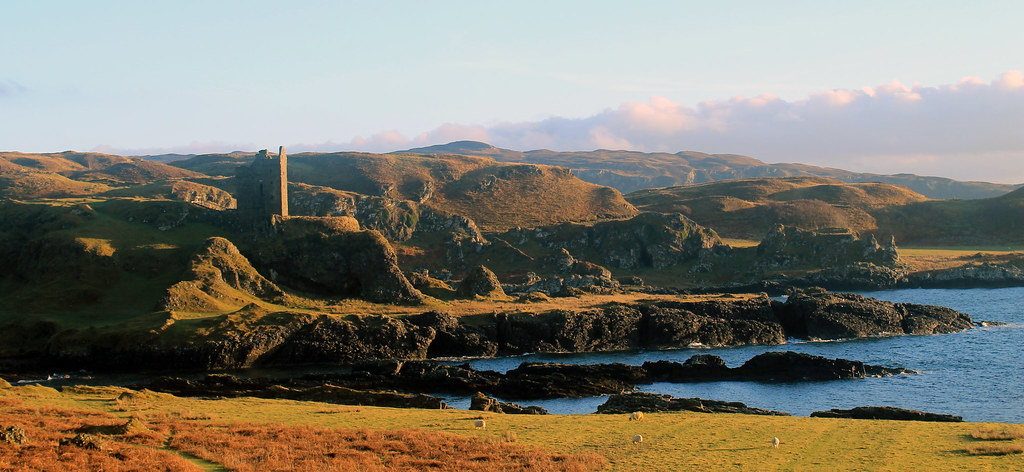
Gylen Castle and Kerrera Coast
Gylen Castle on the southern end of Kerrera
The following morning was yet again a clear day on the western Scottish coast, though much colder! Not wanting to waste time, we grabbed some breakfast and went to the small local ferry from Oban out to the small island, Kerrera. A privately-owned ferry, you signal the owner that you want a ride by sliding a big panel open on the mainland, revealing a big black square, and upon seeing it, the ferryman comes over to pick you up for the 5 minute crossing. We decided to do the 3.5 hour loop down to Gylen Castle at the southern end of the Island and back. Though not a strenuous walk, it felt long because it was so cold, especially in the shade, but the destination was amazing - a square castle with a small footprint exposed on a tall rocky knob over the coast. The castle was besieged and burned in 1647, though recently the Clan MacDougall began restorations. It's surely not much of a castle, but its position in the grassy hills along the coast sure makes it a great place that we had to ourselves! The rest of the circuit along the west side of the island isn't as scenic, and was a bit mushy underfoot, but there were a few brilliant moments in the setting sunlight over to Mull. Back in time for the ferry back to the mainland, we hopped back into the car and headed back up to Oban to pick up my friend who was coming with us back to Glasgow, and with that we were off back home.

Though I think we lucked out, weather-wise, the weekend was a great and most welcome break from city life in Glasgow, and so easy for a few days! Enjoy the photos:

Monday, September 22, 2014

Scotland: Beinn Chabhair (Munro 14)

Travel Date: 21 September 2014

This last weekend around Scotland has been a bit tense, what with the Scottish Independence Referendum being successful for the Better Together campaign. But Glasgow was one of the few councils that voted in a majority to secede from the UK and as such the mood around town has been a bit....glum at best. Huge rainstorms Saturday morning cleared into sunny skies and a new day, and Sunday promised to be the same, so my usual hillwalking partner-in-crime, Hazel, and I decided to do a "short" walk. Beinn Chabhair has been on my list for a while. Not so much because it was promising to be a great walk, but because the walk into the Munro seemed to be long and boggy - not something to do in poor weather.

Meall nan Tarmachan Ridge
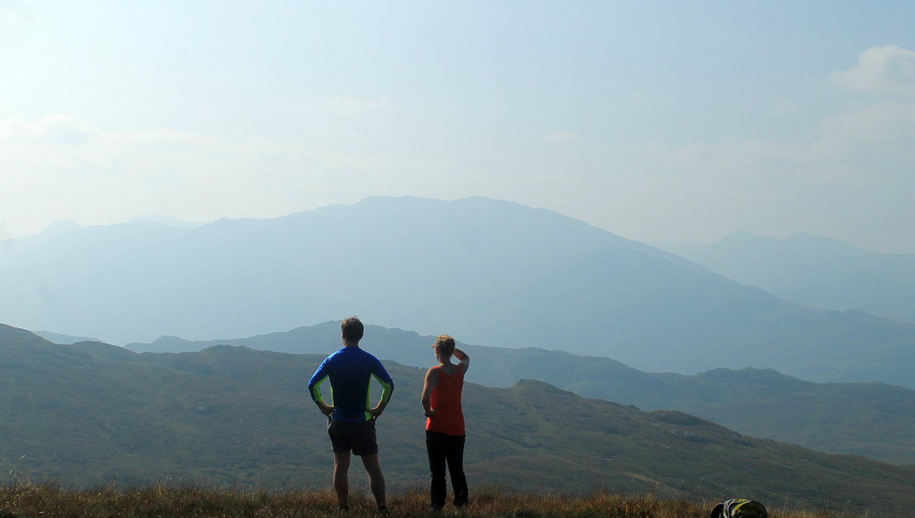
Looking out over the misty mountains of Loch Lomond National Park
from the Meall nan Tarmachan ridge en route to Beinn Chabhair
The walk from Inverarnan up the first steep bit of the walk, through dense ferns in the Loch Lomond valley was definitely not the best part of the walk, though there is a brilliant waterfall where Ben Glas cascades down into the valley. We saw an elderly couple on their way down and had the usual, "Hiya, how's it going?" banter. Usually, the response is a, "Good, and you?" But today, this couple decided to warn us of a tick infestation higher up on the hills, full-on with warnings about how they were jumping all over you, swarming out of the bracken, and you want to get them off before they bury their heads into you with, "THEIR FOUR JAWS!" Coming from anyone, this seems a bit scary, but add in a thick, gravelly Scottish accent, and we were - well, Hazel was - downright terrified! We were warned to put troosers on and cover up. Well, I only had shorts and wasn't planning on turning back so quickly, but Hazel threw on all of her waterproofs, and so covered head to toe - we carried on.

We made it up onto the moorlands, above the supposed tick-zone, and Hazel took off her protective gear and we started the long trudge through the moors. It was a good thing we weren't doing this in the rain, or under poor conditions because navigating the undulating boggy terrain would have been near impossible and certainly not dry. But today, the sun was out, and not a cloud was in the sky, though the atmosphere all around Loch Lomond and the Trossachs National Park was thick with a light-white haze, saturating each mountain with a blue hue that made them seem like paper cutouts, layered one behind another.

Meall nan Tarmachan
Taking a water break while looking west from Meall nan Tarmachan
and it was nice to finally see the summits of
Ben Lui and Beinna'Chleibh from our walk last weekend!
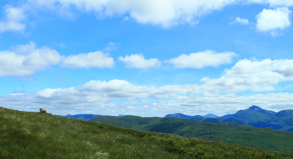
Finally we reached the trail to head up Meall nan Tarmachan and left the bog behind. A few sheep watched us trudge up the hill, and listened to our calls as we tested out the awesome echoing acoustics of the rocks we were climbing through. The trail up to the summit was kind of like a rocky and grassy playground as the trail weaved around large outcrops, up and over some scrambly sections, and finally to the summit of Beinn Chabhair, all the while the misty haze hung draped over the surrounding mountains.

We didn't linger for long at the summit, but enjoyed ourselves, but we could tell that our short walk wasn't going to be too short. We'd left the car at 11:20 am and checked the time at the summit at 3:20 pm. Knowing we had to traverse the moors again, we started off back down the track, but it didn't take nearly as long because we were back at the car by 5:30 pm. Though we just ticked off one Munro, it was about all we wanted to handle for the one day, but it sure was a great day to be out!

Oh, and we never saw a single tick...


Tuesday, September 16, 2014

Scotland: Beinn Eunaich, Beinn a'Chochuill, Stob Dearg, Stob na Broige, Binnein Mor, na Gruacaichean, Ben Lui, and Beinn a'Chleibh (Munros 6-13)

In Scotland, during the summer, you want to spend as much time outside as possible (and as little time updating your blog) because the nice summer weather doesn't last forever! While there were a lot of exciting things going on around Glasgow this summer like the Commonwealth Games and visiting friends from the US, my friend Hazel and I spent a decent amount of time out in the Highlands bagging more Munros - which has now become an obsession of ours.

Beinn Eunaich & Beinn a'Chochuill
20 June 2014

This was was actually one I did myself. Hazel left for Greenland for a few weeks, so I was on my own and really itching to get out into the hills. The problem without a car is that you're reliant on the bus and train. Luckily for me, the train from Glasgow to Oban stops at the beautiful Loch Awe at the foot of four massive munros. I wanted to do all four, but having only gone hillwalking once on my own, I thought I'd at least get two in, so I started off down the road to the footpath up to Beinn Eunaich, which looked easy since it's a farm road heading into a water reservoir stored within the mountains, but it was steep and I was not prepared! I was doing the loop backward and started up the side of Beinn Eunaich which is this relentless grassy hill that ever so slowly arches its way to the summit - you know the kind where you think you're almost there, but then you see the summit still looming in front of you? But the climb was a breath-taking one with incredible views down over Loch Awe and the picturesque Kilchurn Castle on its shores. Well, eventually I made it to the top of this slightly cobbly top (989 m/3,245 ft) and was met with even more views down the other side (which to the north was a vertical dropoff!) over the waters of Loch Etive.

20JUN2014 04
Great day for a hillwalk above Loch Awe. Looking north on the way
up Beinn Eunaich
The wind had started to pick up and bringing clouds in from the ocean. Nothing that really threatened rain, but low enough that the summits of all the mountains around me were shrouded in mist. I carried on down to the saddle between Beinn Eunaich and Beinn a'Chochuill, back into the world of visible distances, but then it was up, up, up to the next Munro. One the way, I passed an elderly man who'd walked in from the nearest town - a much farther distance than I walked from the train station - and was impressed he was still trekking on. I mean, he was old! Back in the clouds, I relied on the path being clear enough for me to see my way to the top of Beinn a'Chochuill (980 m/3,215 ft). It was dry and I had my lunch here, and the summit was high enough that the clouds going over the summit were thin, but it forced the rest of the clouds to flow between it and its neighbouring munros. Not being able to even see the rest of the 4-munro circuit, I decided it was best to head back to the Loch. After all, I had time to check out Kilchurn Castle and have a pint from the hotel at the train station! Overall, it was a nice day out in the crisp air, clouds, and two munros (nearly) all to myself!

(More to read below the slideshow!)


Stob Dearg & Stob na Broige
25 August 2014

Hazel finally returned from Greenland which made getting out to further-flung munros much easier with her car, and though the Matiz is a wee one, it got us where we needed to go. The weather was perfect for late August and we couldn't believe our luck and decided to head up north to the famous Glen Coe - probably Scotland's most recognisable valley (and home to James Bond's Skyfall, in the movie at least). I'd still never been and was pumped to go!

It took a few hours to get there, and another while carefully off-roading Hazel's car into the packed parking lot (did I mention Glen Coe is popular?). We started off to the trail heading up the ridge at the eastern end of Glen Coe - Buachaille Etive Mor. The walk up was brilliant! Right through a very rocky but gently sloping Coire na Tulaich. Having not been hillwalking for a few months, we were a bit nervous about whether we'd be in shape to do it, but the walk to the ridgeline was over before we knew it! We still had another few hundred meters to get to the summit, but we were there, enjoying the absolutely perfect views of the mountains of Glen Coe and over to Ben Nevis, Britain's highest elevation, looming a few ranges away.

25AUG2014 09
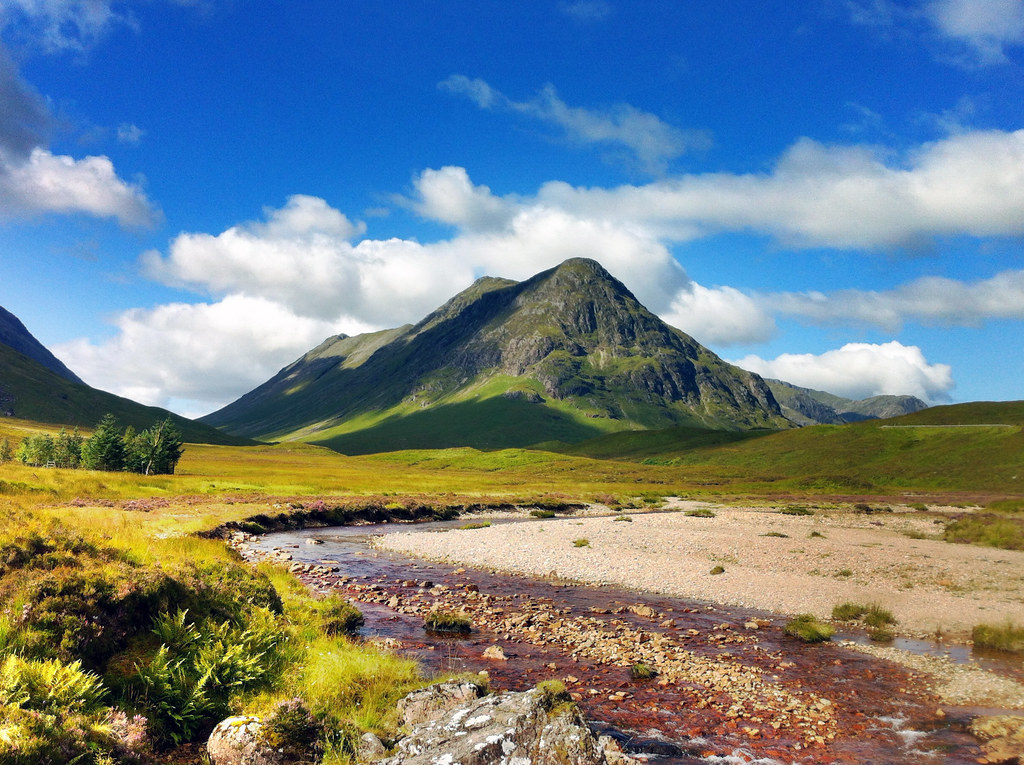
Beautiful peaks of Buachaille Etive Mor, guarding the
entrance to Glen Coe. Who says that middle peak isn't a munro?
C'mon!
It wasn't much more effort to reach the summit of Stob Dearg (1,021 m/3,350 ft), and we were rewarded with one of the most breathtaking views I've ever seen. The summit is perched right at the end of the ridge and it quickly drops off on three sides leaving you with unimpeded views down into Glen Coe to the west and the immensely expansive Rannoch Moor to the east. There was not even a stitch of wind all day and the waters of Rannoch Moor lay perfectly still.

Back down the ridge we went, off to find the next munro, but there was a massive mountain between us and where the map said the next munro was. We were very disheartened to learn that not all mountains in Scotland over 3,000 ft are classified as munros as we trudged up the trail to the summit of Stob na Doire (1,011 m/3,317 ft) - which is boringly classified as a "munro top." Apparently, there is no exact definition of a munro other than that it must be over 3,000 ft (which Stob na Doire clearly meets), but a munro must also be its own mountain, standing prominently from any neighboring ridge or mountain. Stob na Doire was massive, but clearly not "a mountain in its own right" to be classified as a munro. We took a photo at the top anyway, in case the rules change in the near future and it earns classification as a Munro.

After Stob na Doire, it was almost a joke to reach the "summit" of Stob na Broige (956 m/3,136 ft) - almost 200 feet below the summit of Stob na Doire! But it still felt good to reach its top and look out over the road to Loch Etive. The weather couldn't have been better and after a quick bite to eat we started off down the mountains back to the car through a green valley lit up by the golden setting sun. It was a bit tricky getting the car out of the dirt parking lot as the ground was eroded where the pavement from the road ended, but we got her out and started the long drive back to Glasgow.

(More to read below this slideshow, too!)


Binnein Mor & na Gruagaichean
27 August 2014


We just couldn't get enough of the good weather and thought that while it lasted we should get out once more. The weather report called for clear skies, light wind, and no rain, so once again Hazel and I hopped in her "gran-mobile" and drove back up to Glen Coe. We wanted to do the Aonach Eagach ridge on the north side of Glen Coe, but after looking reports of its treachery, we decided against it until we had someone with us who could urge us along Britain's sharpest ridge walk. We decided to try some other ridge walks first before tackling that monster! So we drove through Glen Coe and then tucked east to Kinlochleven where we parked the car and headed off up to the Mamores peaks.

I'm not sure we realised just how long of a walk this was going to be. The first few miles are just a constant slight increase up a long valley (though with nice views over Loch Leven and the town below), until the path dumps you out into a beautiful valley perched up between Binnein Mor (our first destination) and the neighbouring munro Sgurr Eilde Mor. While the day was just as sunny as the previous walk, the air was not nearly as still and we were being buffeted by very stiff and strong gusts of wind! We worked our way up to the ridge overlooking Coire an Lochain where we had spectacular views of Ben Nevis across the valley, and even though our legs were about to give out, we still weren't at the top! Out of 282 munros, Binein Mor is the 28th highest and we still had to get there. We met some nice Dutch tourists and caught up with a single hillwalker who was bagging his 200-and-something munro. He reassured us that Aonach Eagach's bark was worse than its bite, but that with the stiff winds, it was better we weren't on that ridge. We made it to the summit of Binnein Mor (1,130 m/3,707 ft) which is perched on a little point in the sky with very steep and long drop-offs on either side! Vertigo definitely set in a few times, especially with the wind, but once we sat for some water, we got over it pretty quickly.

27AUG2014 36
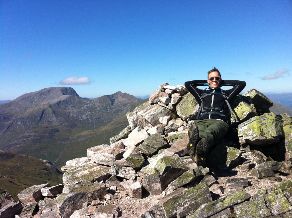
Chilling out on top of Binnein Mor. Munro #10!
We didn't linger at the summit long due to the wind. It was incredibly brisk and chilled us even with all the layers we were wearing! But we did have a little celebration as this was my 10th munro! We found a little spot tucked away from the wind for lunch, but since the walk was so long, we pressed onward along a nice ridge to na Gruagaichean and enjoyed a good scramble up to the summit (1,056 m/3,465 ft) where we celebrated once more as this was Hazel's 10th munro! Ben Nevis just stared us down while we had the rest of our lunch. Time was getting on, and the sun was already setting and we still had to get back to the car and drive back to Glasgow! The walk down the ridge was nice and grassy with stunning views of Loch Leven and we could even see the jagged ridge of Aonach Eagach in the distance. But the nice grassy ridge soon gave way to a massive, steep, pathless, grassy hillside that we essentially bushwacked our way through before reaching the trail that would return us to the car. It was definitely one of the longest walks I've done so far (almost 9 miles), but it was definitely worth it!

(There's one more section to read below this slideshow!)


Ben Lui & Beinn a'Chleibh
14 September 2014


The weather's been changing a lot around Scotland as Fall starts to set in but the weather report suggested we'd have clear skies and cloud-free munros over the weekend, so my intrepid munro-bagging-partner, Hazel, and I went for it. We drove west to Ben Lui, which was described as one of the finest munros in scotland with amazing views, but we had the feeling, as we parked the car, that those views would not be for us today. Clouds were low and the peaks of all the munros were shrouded in mist. But we were here so might as well go for it anyway!

14SEP2014 18
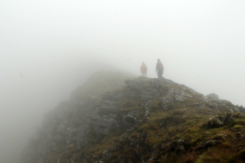
Carefully keeping to the path in the fog along the ridge to Ben Lui
We forded the River Lochy and trudged our way up through the muddy pine timber forest which was nice as there were a few waterfalls and the leaves were already changing colour. But soon we found ourselves in the massive bowl-shaped valley between Ben Lui and Beinn a'Chleibh, both covered in clouds and a brisk wind blowing through the gap between them. We headed up east along a long, steep, grassy slope that just kept going, and going...and going, until we were in the clouds. But the grass stopped and was replaced by broken boulders and alpine-climate plants. We'd reached the ridge that would take us to the summit, being careful not to lose our footing lest we trip and fall down the cliff into the valley on the other side, which incidentally is where a 4-person aircraft tragically crashed a few decades ago. We wanted to see if we could find the wreckage, but the clouds were too thick and we didn't want to go wandering off trail.

After a few fun scrambles and photoshoots, we made it to an open plateau with a cairn that we thought was the summit, only to realise we had a little further to go before reaching Ben Lui's true summit (1,130 m/3,707 - the same height as Binnein Mor, but ranked 29th). It was too cold and damp to linger there much longer so we headed down to the bealach and it was pretty much a hop, skip, and a jump up to the summit of the neighbouring munro, Beinn a'Chleibh (916 m/3,005 ft) which was cloud-free for a while. But there was no reason for it not to be cloud free - after all, Beinn a'Chleibh is the 281st highest munro out of 282! So, not spectacular, but fun to check it off the list nonetheless. Clouds eventually did roll in and we never really got a good clear view of Ben Lui all day. We ran into many people who were doing one or two more munros after Ben Lui and Beinn a'Chleibh, but I'd injured my knee running the day before so we decided to head back to the car, which didn't take long, and it was nice not having a three-hour drive back home. Not sure how many more nice days we'll have, but so far, nothing can stop us!


Saturday, June 7, 2014

Scotland: Beinn Narnain, Beinn Ime, and Ben Vorlich (Munros 3-5)

Beinn Narnain and Beinn Ime

Date: 27 May 2014

I've said it before, but it's worth saying again: when the weather is nice in Scotland, you've got to go take advantage of it! Luckily, as a student, as long as my work gets done on time, it (kind of) doesn't matter when I do it. So when the sun comes out, it's time to go! A few weeks ago, my classmates Hazel and Ruth and I headed off to Arrochar, west of Glasgow near Loch Lomond to hike a few of the Munros in the Arrochar Alps. It was supposed to rain a little bit in the afternoon, but it was clear now and we decided to take the steeper route to the summit of Beinn Narnain and get that over and done with first, figuring if it was rainy later, the steep slope would be too slippery to come down.

It was the right decision. The path up from the Argyle Forest Park parking lot to the summit is a long and tiresome, seemingly never-ending steep trail from sea level right up to 600 meters before it finally levels out for a little while. Once you're up and out of the forest, the views are magnificent and when you get to the part that levels out, stunning views of the craggy peaks of The Cobber loom into view.

The Spearhead
Final ascent up Beinn Narnain through The Spearhead
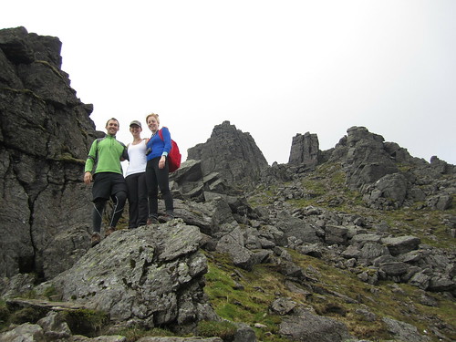
But of course with all hillwalking, there are about three or four "false peaks" that make it seem like you're almost there, but then...nope! One of these false peaks was the Cruach nam Miseag and we really thought we might be to the summit. Instead it was just a vantage point where we could see the trail go down in elevation before winding its way up between huge rock outcrops called The Spearhead! A few hikers were threading their way through The Spearhead and we could hear their voices echoing while we sat and had a wee break. The rest of the trail wasn't terrible, however. It turns out that getting up through The Spearhead didn't take long at all and as a geologist, the blocky and square outcrops that towered overhead were just fascinating!

After one last rocky gully we clambered up through, we found ourselves on the top of the mountain - not the summit yet, mind you, but it was a flat walk from here. We stopped for a few photos looking over Loch Lomond from the top of The Spearhead and eventually made it to the cairn and trig point at Beinn Narnain's summit of 926 metres (3,038 ft). We stayed up there a little while to catch our breath and had a good look around us. It was quite cloudy, but the sun poked through every now and again, and the cloud base was higher than the mountains, so we had good views of all of the other Arrochars and even Ben Lomond across the lake.

Beinn Ime
Over and down from Beinn Narnain to Beinn Ime. Looking
back at it, the trail up Beinn Ime just looks squidgy!
We could see the next mountain over, Beinn Ime, from the top of Beinn Narnain and decided that it didn't look too awfully far off. Besides, the walk down to the "bealach" (which I think is the name for the saddle between two peaks) and up to the top of Beinn Ime was smooth, looked fairly shallow, and quite grassy, so it couldn't have been that bad, right?

While getting down to the bealach from Beinn Narnain wasn't bad, the bealach and the majority of the slope up to Beinn Ime was totally waterlogged from rain we'd had the previous few days. It wasn't all that warm, and soon conditions became worse as our feet sank into soggy, squidgy, grass, and our socks became soaked with cold water. As Hazel put it, it was a long plod. We didn't talk much and instead just kept one foot in front of the other until the path hardened underfoot and became more clear up at the higher elevations. A walker coming down the mountain told us we weren't too far off, and sure enough, the trail quickly leveled off and we walked along the ridge to the cairn at the summit of Beinn Ime, the highest of the Arrochar Alps at 1,011 metres (3,317 ft). Being so high, it was really windy, but luckily previous hikers had created a sort of a fortress around the cairn that blocked some of the wind, so we sat there having our lunch with the best view around!

It was windy and chilly enough, and our feet were still wet, that we didn't stay for too long and started the long plod down the mountain. Fortunately, the trail back to the car looped down the valley between Beinn Narnain and The Cobbler, so we didn't have any more walking upslope. We stopped for some snacks at some large boulders at the foot of The Cobbler but didn't stay too long. The rain came in just as we were getting back to the car, so while we weren't too wet, it did get us in the end. Good thing we hadn't gone down the real steep slope we started on!

(there's more below the slideshow)


Ben Vorlich

06 June 2014


I decided to trade my Friday for my Saturday and since it was sunny on Friday, head off to the one last remaining Munro in the Arrochar Alps I'd yet to tackle - Ben Vorlich. I'd seen Ben Vorlich from my hikes up Ben Vane and the Beinns Narnain and Ime, and the reviews from Walk Highlands said to expect a steep and unrelenting climb to the summit ridge. The reviews were not joking! Luckily, I was hiking on my own yesterday, so I could take my own pace. Once I found the trailhead, as the reviews said, it just goes up. And up. And up. Though the trail is well-defined, it is not just steep, but wet, and mucky. So much so that one misstep could mean face-planting it into the hillslope which would not be good because there were a lot of rocks, too!

Ben Vorlich Summit
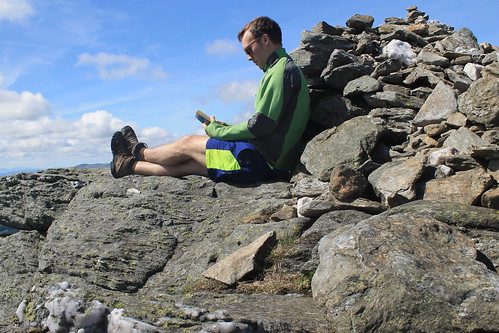
Ben Vorlich - a good place to have a read!
The walk up the slope gets you about 400 metres in elevation over the valley below, and even though the trail started to cut over along the side of the mountain, it sure didn't feel any less steep. The views started to get amazing though as the low clouds all around me started to clear. And near the top of the slope, massive rock outcrops and cliff-forming bedrock created an awesome geologic playground to be walking through! Even the mucky trail was shining with the weathered mica minerals that reflect sunlight so well.

Well, eventually the trail flattens out, kind of, but there is still a ways to go to get to the summit. And even when you get to the trig point, you're still not there because the actual summit is another short walk beyond! But once you're there, you know you're there - 943 metres (3,094 ft) is hard to miss! Not too many people were up at the summit, so it was nice and quiet. And though it was a bit windy, I was able to find a little crevice between some rocks, out of the wind where I could have my lunch and finish reading a book I've been trying to get through. It was so much nicer having time to enjoy the peace and quiet of the summit, rather than being rushed to get to the next one or forced off by inclement weather.

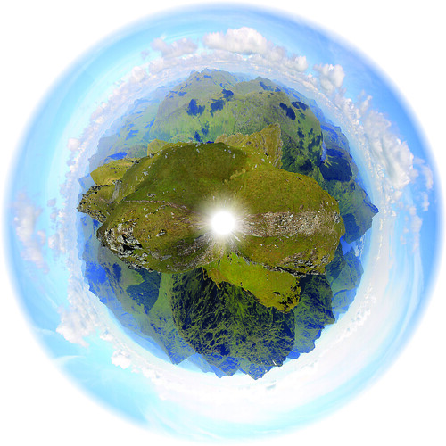
Trig Point Panorama
The panoramic planet I stitched together from the trig point
on Ben Vorlich
But soon enough, I felt it was time to start heading back down to the car park at Inveruglas where I'd been dropped off by the CityLink bus and was getting picked up from them, too. By the time I started walking down the weather was pretty much sunny and warm and I took my time with photography experiments and some of the best Loch Lomond scenery I've seen yet! The trail down the slippery slope I started on wasn't too bad going down, though I did slip a number of times, but before I knew it I was back down heading to the car park with plenty of time to spare. When I got there, the sun was warm on the rocks at the lake's edge, so I found a good comfortable spot, took off my boots and finished my book. Great day away, but tomorrow will have to be a work day. I just hope it actually rains so I don't feel guilty for taking a Friday off!

Sunday, May 25, 2014

Scotland: Ben Lomond and Ben Vane (Munros 1 & 2)

Ben Lomond
 
Date: 15 April 2014

A few weeks back, Glasgow experienced a rare weather phenomenon: we had eight days of beautifully sunny and warm weather! The first of these days, we'd been coming out of rainy doldrums and being Scotland we weren't sure how long the sun would stay, so even though it was a Tuesday, a friend of mine from the University and I decided we'd take advantage of the weather while it was still good, made plans, and drove out to Loch Lomond and the Trossachs National Park, taking a small one-lane windy road around the north shore of the famous lake to the foot of Ben Lomond - the southernmost of the Scottish Munros.

Scotland is famous for its brilliant hillwalking everywhere, but especially in the Highlands. Here, any peak that is over 3,000 feet above sea level is classified as a Munro - anything less is classified as either a Corbett (2,500-3,000 ft above sea level) or a Graham (2,000-2,500 ft asl). There are 282 Munros, and anyone who attempts to climb them all is called a Munro Bagger. Having never done any hillwalking in Scotland before (save maybe the walk to the Old Man of Hoy in the Orkney Islands), I figured what better way to claim my first peak than to hike up to the summit of the southernmost Munro as well as being the peak with the name of the National Park it is in!

The walk took us about six hours, round-trip, and while it was not a challenging hike, per se, it was a beautiful one, nonetheless. Ben Lomond is tall (974 meters, or 3,196 feet above sea level) and since you start very near sea level, the whole elevation is yours to climb. Well...climb is a bit of an overstatement. The walk up Ben Lomond is a pretty easy ramp along a well-marked trail. About three quarters of the way up, the ramp does steepen and the going gets a bit slower, but it's still not challenging if you take your time.

Loch Lomond
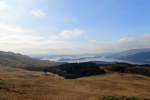
Beautiful views of Loch Lomond all the way up to the summit
My friend and I kept a good pace the entire way up to the top. We had to since even though the sun was out, the wind was a bit chilly, but the views from the walk of both the summit - which would be hidden by clouds for short periods of time - and the beautiful lake beneath us were stunning! There was still snow up at the top on the steep, north-facing slopes, and though we enjoyed it at first, we quickly steered away from it, realising that the possibility that any of the snow packs could collapse and avalanche down the mountain was pretty high!

By the time we got to the summit, the weather had cleared up enough for some good photos and the views of the Arrochar Alps across the lake and the Trossachs to the north were great! We had lunch up there shortly after 1:00 pm, but didn't stay long since we still had to descend. Rather than going down the same way we came up, we headed down a smaller ridge that ran parallel to the lakeshore, bringing us right back to the parking lot. Once down from the top, the wind died down a bit more and the clouds all but vanished. We stopped for a wee snack and watched a Royal Air Force jet fly through the lake valley below us for some sort of training mission. By the time we got to the car, it was nearly 4pm so we had one last little snack on the lakeshore before heading back into Glasgow.

(there's more below the Ben Lomond slideshow!)


Ben Vane

Date: 19 April 2014

Later on in the same week - again, the weather couldn't have been better - a larger group of my friends from the office and I carpooled out to the south side of Loch Lomond to climb Ben Vane, another Munro, 915 metres (3,002 feet) above sea level. While not as high as Ben Lomond, Ben Vane offered up some extra challenges. Mainly, we had to find our own path from the access road up to the path on the trail guide, and higher up the trail got quite steep and we zig-zagged our way up between large rock outcrops, scrambled over boulders and other rocks, and slipped our way over some small snow patches, all the while dodging sheep and trying to keep our feet dry while walking over purely soggy ground!

Sheep and Ben Lomond
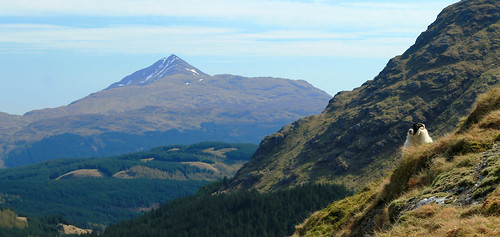
One of the many sheep that dotted the hillslopes on the way up Ben Vane - keeping a keen
eye on us as we summit the Munro. Ben Lomond in the background.

It was great, though. We started off at the Inveruglas parking lot on the shores of Loch Lomond and had to walk up a very long access road past a hydro power station. We couldn't find the trail from the access road up to the ridge we were supposed to follow to the summit so we just marched on up a big long slope, dotted with boulders and massive rock outcrops sticking up from the water-saturated muck beneath our feet. We had perfect views over Ben Lomond and Loch Lomond and with plenty of shaggy sheep running every which way, there were plenty of pure-Scotland moments!

Once we got to the top of the ridge, we followed its gradual path up to the base of the real mountain. Here, the path took steep hairpin turns with large steps up over rocks with a big outcrop every so often that offered a good place to take a break for a moment and steal some fantastic views of the surrounding Arrochar Alps!

The walk was a long and steep one - a bit more strenuous than Ben Lomond. It was one of those mountains that every time you think you reach the summit, there's more to go! The path eventually gives way to some scrambling up and around some rocks, down some rocks, and over some snow banks, but we finally reached the top and were rewarded with stunning views of Ben Lomond, Ben Ime, A'Chrois, the Cobbler, and Beinn Narnain. The schist rock that underlies the Arrochar Alps stuck out in many places at the summit, showing off its beautifully warped and metamorphosed structure, giving the whole summit an incredibly unique geologic feel!

The thing with Munro Bagging (at least from what I've experienced in the two hikes I've done), is that you don't linger at the summits for very long. We stayed up at the top for maybe fifteen minutes before turning right back around and heading down. But the whole walk was well worth it. We had a good group of people, a fantastically nimble dog, and stunning weather! And I can't wait to tick-off the other Munros of the Arrochar Alps off my list soon!

Sunday, July 8, 2012

Scotland: Stirling Castle and William Wallace Memorial

Trip Date: 07 July 2012

This was my last weekend in Scotland until 2014. The time really flies by quickly! My friends and I decided to get out of town on Saturday and do something special and Scottish. Our original plans to go to the Highland Games near Loch Lomond fell through when the event was cancelled due to inclement weather and while Friday kind of rolled on by, we decided that rain or shine we would get out of town no matter what. Saturday arrived and was indeed raining. It wasn't a pouring rain, but it was more than a drizzle and pretty much constant throughout the day. Clearly, any outdoor activity was not going to be pleasant, so we drove an hour northeast of Glasgow to Stirling - the gateway to the highlands.

The Castle is situated on top of a tall ridge sitting high up over the surrounding valley. While most of the castle was built since the 1700s, a fortress or castle occupied the site for hundreds of years before. I am definitely not a historian, and cannot even attempt to get any of the factual details down here, so just understand that the castle switched occupation between the kings of Scotland and the kings of England for centuries. Famous battles within sight of the castle throughout the centuries saw victories for the Scottish heroes, William Wallace and Robert the Bruce, and was home to numerous Kings James and Kings Edwards of Scotland and even Mary Queen of Scots was born here and later lived here with her son. The castle was the home of the Scottish Crown until the early 1600s when King James inherited the English Crown and moved the Royal Court down to London. Since then, additions to the castle were less defensive and more inhabitable and has even been used as recently as the mid 1900s as it was the home base of the Argyll and Sutherland Highlanders Royal Regiment of Scotland. Now the entire castle is operated by Historic Scotland.

07JUL2012 (58)


The castle and its grounds are beautiful. After paying a rather hefty fee (£13) you get all access to the entire castle (where it's open to the public at least) and can explore the many exhibits, renovated rooms, gardens, and any stairways or passageways to hidden rooms you can find. While it obviously would be better for a sunny day, it's a perfect way to spend a day in the drizzle as there are enough places to take cover if it rains a bit. We spent some time in a few exhibits of the history of the Royal Scottish families and the history of the castle, but then joined a guided tour with an awesome tour guide with one of the best Scottish brogues you might hope to hear! I wish I could keep details straight, but again, there was just too much to keep track of, so I'll get on to the photos!

Photos of Stirling Castle:


We left the castle mid-afternoon, and since we were in Stirling, we decided to drive over to the William Wallace National Monument to get a closer look. You can park at the bottom of the hill and either walk up or take a free shuttle. It was raining, so shuttle it was! At the top of the hill is this massive tower of a monument featuring a Scottish coat of arms over the front doors under a towering statue of William Wallace. William Wallace is probably best known to the rest of the world by Mel Brooks' portrayal of him in the movie, Braveheart. Wallace led the victorious Scottish uprising against the English at the Battle of Stirling Bridge. Later in life, he was captured, brought to London, and hanged, drawn, and quartered for crimes of treason. To this day, he is one of the primary Scottish heroes for his unwillingness to allow Scotland to fall back under English rule.


There was a fantastic actor giving a great speech at the top of the hill, recounting the history and fame of William Wallace. When he was done, we got our photos taken with the many weapons he seemed to pull from his costume out of nowhere. He didn't have any left so he joked, saying he'd fight the English off with his teeth. A fun photo shoot with an English girl, the Scottish actor, an Irish girl, and me, the dopey American guy! It was still too cloudy, so we didn't think it was worth paying the £8 to get up to the top, and the shuttle filled before we could get in, so we walked down the hill back to our car and drove back to Glasgow.

07JUL2012 (75)


We were wet, chilly, and starving, so bought some KFC and warmed up back in Glasgow. Sure, it wasn't as entertaining as the Highland Games might have been, but it was so great to finally be able to say that I've been to Stirling Castle and the Wallace Monument, especially after driving past them at least three times by now!

Saturday, June 9, 2012

Goodbye, Orkney Islands! Now, where's my wallet?

Trip Date: 05 June 2012

Today was bittersweet. I was ready to get back to my friends in Glasgow, but I was not ready to leave Orkney. One of the men who shared my room at the Kirkwall Peedie Hostel was a former(/current) reporter for the BBC who had never been and was staying for two weeks! I was very jealous of him.

Well, my bus was supposed to leave at 9am to go back to the South Ronaldsay dock to go back to John O'Groats and then on to Inverness, so I had to get up pretty early. I did one last walkthrough of Kirkwall's City Center and picked up a few snacks from the grocery store for my ride home (Haribo and peanuts) and got on the bus. It was only then that I realized I didn't have my wallet. Immediately stressed, I asked the bus driver how much time I had: 3-4 minutes. I threw my bag out onto the pavement and emptied its contents but couldn't find it. I knew it wasn't at the hostel because I checked everything before I left, and I knew, for once, that I hadn't been pick-pocketed (it's Orkney!), but I couldn't find it. Not wanting to leave the bus, I tried thinking what I had done with it the night before because I knew I must have put it somewhere that I couldn't forget it. Not in my pocket, not in my coat, not in my bag....oh, that's right...I put it in the toe of my hiking boots which were strung onto my backpack. I'm an idiot. So I repacked my bag, with my wallet safely back in my pants pocket, and got back onto the bus where I was met with a round of applause, hahaha!

The bus drove back over the Churchill Barriers where I got some nice parting shots of the blockships at a lower tide with perfectly calm waters. And then, once more, we waited a few moments at the ferry dock and I climbed a peedie bluff and watched the ferry captain navigate the waters and rocky reefs with an outgoing tide like a pro! It was a little bit more gray of a day, but I stood out on top of the ferry the whole ride back to take in all the beautiful scenery of Scapa Flow and the Pentland Firth one last time before I was sitting back down in my seat on a bus.
06052012 (15)
Blockships at low-tide and still water

06052012 (19)
Swift out-going tide creating whitewater on shallow rocky reefs

06052012 (22)
Little purple flowers on the bluffs at the Burwick ferry dock on South Ronaldsay

06052012 (23)
Awesome folded bedding planes along the coast on South Ronaldsay

06052012 (32)
You can see just how shallow the water can be during low-tide in the Pentwater Firth. This is why ship captains have to be so careful when navigating the waters!
Back in Inverness, it was suggested I get lunch at a little American restaurant just around the corner from the train station. It was good, I'll have to say, but I realized as soon as I sat down that I'd left my coat (with my camera lens in the pocket) in the overhead bin on the bus! I asked my server if he'd watch my stuff while I ran back to the bus station. But the bus was no longer there! It quickly dawned on me that it wasn't quite 1:45pm yet and that the bus would have to be back to start it's trip back to John O'Groats at 2:20, so I called the company on my way back to the restaurant to tell them I'd be looking for my coat, and sat down to enjoy my delicious cheeseburger! At 2:10 I was back at the bus station where I luckily was able to retrieve my coat, with camera lens still there, and sat down in the travel center until my bus for Glasgow came around, not wanting to go anywhere in case I forget yet another item somewhere...

But soon enough I was home, walking into my flat in Glasgow. It had been a fantastic 4-day trip to one of the most beautiful and historic places I'd ever been to! Looking back through the photos and writing these blog posts has just reminded me so much why I love to travel. It makes you realize who you are as a person and how you fit in to this tiny little rotating ball in the sky we call home.


The Old Man of Hoy and Maeshowe

Travel Date: 04 June 2012
(Slideshow of photos at the bottom)

Today was much less hassling trying to get around. Buses were back up to their full schedules as were the ferries between islands. I got up early enough to hop a bus back to Stromness from Kirkwall and then had 10 minutes to get onto the little passenger ferry, taking me out to the island of Hoy. It was another sunny day, though still chilly, that provided me with great views of Stromness as we pulled out of the harbor and into the tidally forceful Scapa Flow. There was a little story I read, I think at the Flattie Bar yesterday while in Stromness, that described life on the water: people living there were sailors and fishermen by trade so they were very comfortable being on the water, but the kids who had their own little boats (the Flatties of the pub's name) were warned to not sail past black buoys placed out near the mouth of the harbor because from there on out, the tides and currents were much to strong and would carry them away, out to sea.

06042012 (2)
Leaving Stromness Harbor

Today, though, the ferry easily navigates the tides and we pulled out into the channel between mainland Orkney and Hoy. Again, here was an entrance to the protected harbor where the WWI and WWII British Navy Fleets were stationed, so you can still see the old watch-houses and bunkers along the islands that were used to protect that channel entrance from any German threat. They are abandoned now, but still stand in silent guard.

06042012 (13)
WWI/WWI-era look-outs on the shore of the isle of Graemsay with mountainous Hoy in the background
Hoy is a beautiful island. It has the most topography of any of the Orkney Islands and was visibly sculpted by glaciers during the last Glacial Maximum. One of its more modern features, however, is the Old Man of Hoy, the United Kingdom's tallest seastack (450 feet high)! A seastack is a tower of rock separated from the rest of a cliff-lined coast. They form as wave action strikes a rocky promontory, and as the waves refract around the head of the point, they erode the neck from two sides. Eventually, the neck of the promontory totally erodes through and all that is left is a giant stack of rock out to sea: hence the name seastack.

06042012 (24)
Docking at the isle of Hoy

To get out to the Old Man of Hoy, you have a few options. You can prearrange a cab to pick you up at the ferry dock, you can sign up for a guided tour, you can bike out there, or you can hike the 6.5 miles from the docks, through glacially sculpted valleys, and then up to the site. I bought some new hiking boots when I was in Michigan for my sister's wedding and since I didn't want to pay for a bike rental or a cab, I decided to hike. The first mile and a half are all up a one-lane road leading away from the ferry dock, through sheep pastures, and through some moors. The road eventually turns, but hikers continue the next two and a half miles through the glacial valleys, which are protected as part of the Scottish National Bird Sanctuary. Because of this, though, I was warned by a local Orcadian that you kind of have to keep your eyes open for any divebombing Great Skua birds (called, Bonxies by the locals). They kind of soar around above you and if you get too close to their nests, they will squawk and dive toward you. I won't lie, I had a few stones in my hands just in case, and even shouted at a few that I thought were flying too close to me! There was a little reservoir up in the valley that most of the bonxies stuck to, and once I was past that, they were no longer a problem!

06042012 (35)
The lonely road out to the hiking path to Rackwick on the isle of Hoy

06042012 (40)
Watch out for the dive-bombing bonxies!

Further down the valley, tucked away in little stream valleys, are some of the last remaining wild Orcadian forest, that used to cover much of the islands. Over 5,000 years of constant settlement and agriculture, it's no wonder there is little left of these forests. But then the trail reconnects with the road which ends not much further in the little town (if you can call it that) of Rackwick.

06042012 (115)
Some of the original, most northerly native woodland in the British Isles

Rackwick is literally the end of the road, but it is a beautiful end of the road with a wide, sweeping beach with turquoise water, nestled between huge, enormous, sandstone cliffs. And I'm not talking 100-foot-high Sydney Coastal Walk cliffs, or even 200-foot-high Pictured Rocks cliffs, or even 400-foot-high Cliffs of Moher. These cliffs jut up 500-feet from the ocean far below (and they aren't even the tallest, which rise up over 1,000 feet!). So Rackwick is a beautiful end of the road, but not the end of the journey out to the Old Man of Hoy, which still requires a two and a quarter mile hike along cliffs and over coastal plateaus. But once you are there, it is such a treat! Standing 450-feet up from the ocean, far below, is this behemoth of stacked beds of sandstone, flanked to the south by similarly-high cliffs, and to the north by the massive 1,000 foot cliffs! Now, believe me when I say that the Cliffs of Moher are beautiful and stunning, but the fact that they are so accessible and overrun by tourists makes them a bit less wonderous, compared to these massive cliffs that only those willing enough to hike a few miles will ever get to.

06042012 (57)
Old British Telephone booth at the Rackwick Hostel, looking down at the town and the massive sea cliffs

06042012 (75)
The Old Man of Hoy: 450 feet tall and the tallest sea-stack in the UK

06042012 (78)
Me with the sea cliffs north of the Old Man of Hoy

06042012 (91)
Puffins! This was the best shot I could get, even with my 18x zoom lens... But some birdwatchers there told me of better places closer to Glasgow I can go to get better photos

I stayed out at the cliffs for a little while, enjoying my packed lunch of cheese, jerky, an apple, biscuits, and crisps, watching the sea birds (mostly seagulls, but I did see some puffins, too! - just very, very far below me...) and chatting with a few of the other visitors who were from all over the place: Germany, southern England, California... They all had a few good stories and we each helped the others take photos. It did start to sprinkle, just a thin band of rain, but it was also time to head back to the ferry dock. I wanted to take a more rigorous route up above the massive cliffs to the north, but being alone, without a detailed map, and on a time constraint, I decided it would be better to go back the way I came and leave the high-cliff route for another time. Back toward the ferry dock, a lot of tourists were having an afternoon tea at a little cafe. It was nice, but definitely priced more for the retired clientele who have a little bit more pocket change than your average student day-hiker, but I bought an Irn-Bru and gave my feet a rest in the yard, watching a chicken hobble around.

I had to catch the first afternoon ferry back to Stromness in order to get the right bus out to Maeshowe, which I wasn't able to get in yesterday. We had to wait for the ferry a little bit but it gave me time to explore the exposed rocky shoreline during low tide, which was covered in barnacles, limpets, algae, and seaweed. The ferry came and brought us back to Stromness where I had a little extra time before the bus, so I bought a beer at the Ferry Inn and listened to one final jam session by the remaining musicians in town for the Orkney Folk Festival. But then it was bus time and back to Maeshowe.

06042012 (157)
Limpets stuck to the bedrock at Hoy Harbor during low tide. As water washes over them, it erodes little pockets around each limpet creating a pitted pattern on the rock.

Maeshowe is a fantastic Neolithic site, nearly 5,000 years old. You have to book a tour in advance, and in the summer there are extra "twilight" tours in the evenings, which aren't really twilight since the sun pretty much never sets. To get into Maeshowe, you have to stoop quite low and walk through a ten-meter passageway lined in massive, single blocks of stone. Once inside, you're able to stand up in a square chamber with what was once a corbelled ceiling (but is now a poorly constructed brick dome structure put in place in the early 1900s). Maeshowe is similar to other chambered tombs of the area in that opposite the door and on either side wall are two recessed and L-shaped chambers. In other tombs of this age, human bones have been found stored in these chambers, grouped by bone-type, rather than full skeletons. It is thought that Maeshowe served a similar purpose but very few bones have actually been found there. It may have also served a more ceremonial purpose, archaeologists think, suggested by the fact that the entrance to the tomb directly faces the setting sun on the Winter Solstice. Curiously, on the solstice, the sun sets behind the massive mountains of Hoy, and it is thought that they also served some spiritual purpose. Furthermore, the ceremonial significance of Maeshowe is suggested by its proximity to the Standing Stones of Stenness, the Ring and Ness of Brodgar, and the Barnhouse Village.

In the 12th century, multiple groups of Vikings were vying for control of Orkney and one group started off one morning in Stromness but got caught in a storm and took shelter in Maeshowe, leaving cryptic messages of the runic alphabet carved into some of the stones. They spoke of the treasures of the North and one claimed to be a master writer of runes who and carved his message using a very famous axe, used to slay Gauk - don't ask me the history of that; all I know is that the axe was well-known.

My favorite bit about Maeshowe, though, again were the slabs of rock. The entrance tunnel was lined and covered with ten-meter long single slabs of sandstone, and the lintel above each of the recesses off the main chamber, which were five meters by at least three meters, were each carved of a single slab of rock. How those people 5,000 years ago were able to move such large pieces of rock over large distances still baffles me as well as archaeologists, and as to how it was done is still anyone's guess.

06042012 (197)
In front of the entrance to Maeshowe. No photos are allowed inside, but it's pretty amazing

06042012 (210)
One last look over to the Ring of Brodgar

Upon leaving the tomb, I gave one last look around the landscape, taking a few more photos, before heading back to the visitors center to wait for the last bus into Kirkwall. I bought a few postcards and got some good music suggestions from the woman working the shop, and indulged myself into a wee tub of ice cream from the Orkney Creamery, which was delicious (I suggest the Toffee Swirl and the Orkney Original).

Back in Kirkwall, I ran into some girls who were out at the Old Man of Hoy when I was there that day, and we chatted a while over some coffees and snacks in a little craft shop/coffee house, Judith Glue. The girls were fun to chat with, but they had already eaten dinner and I needed some substantial food before 9pm, so I said goodbye to them and headed out to see my final fish and chips of the trip. I caught the shop just before they closed and took my food out to the harbor to eat. It wasn't quite 10pm yet and I realized that I did want to purchase something to remember Orkney by, and I went back to Judith Glue (which stays open until 10pm!) and purchased a few prints done by a local artist and a bottle of Dark Island, brewed by the Orkney Brewery - as suggested by a man at the pub where I got dinner the night before - and headed back to my hostel where I watched the Queen's Diamond Jubilee concert at Buckingham Palace and wrote my postcards. That night, as part of the Jubilee, beacons, or torches or bonfires, were being lit around the UK and the world in commonwealth countries. Stromness had their own beacon and I was tipped that Kirkwall would be having their own as well on top of a radio-antennae hill visible from the hostel's kitchen window. I kept getting up to see if I could see the fire, but it was either too small or they didn't have one, so I stayed in, repacking my bags, and finally dozing off to sleep.

My legs were sore, feet were covered in blisters, and my brain hurt from trying to piece together all the Orcadian history I had taken in over the past few days. But I fell asleep the moment my head hit the pillow and I would soon be saying goodbye to this beautiful but chilly island paradise of northern Scotland.
Creative Commons License
This work by Eric W. Portenga is licensed under a Creative Commons Attribution-NonCommercial-NoDerivs 3.0 Unported License.