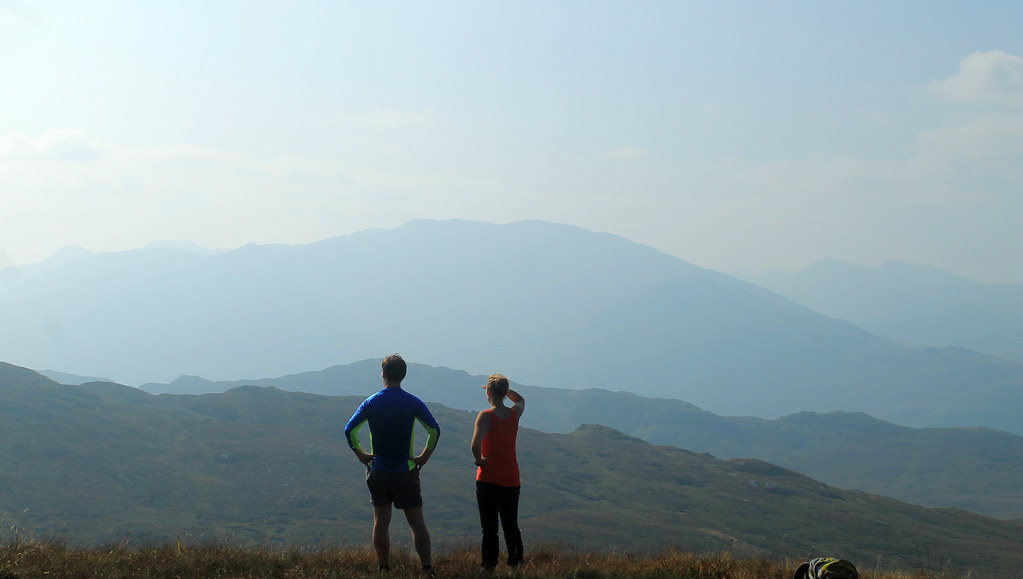
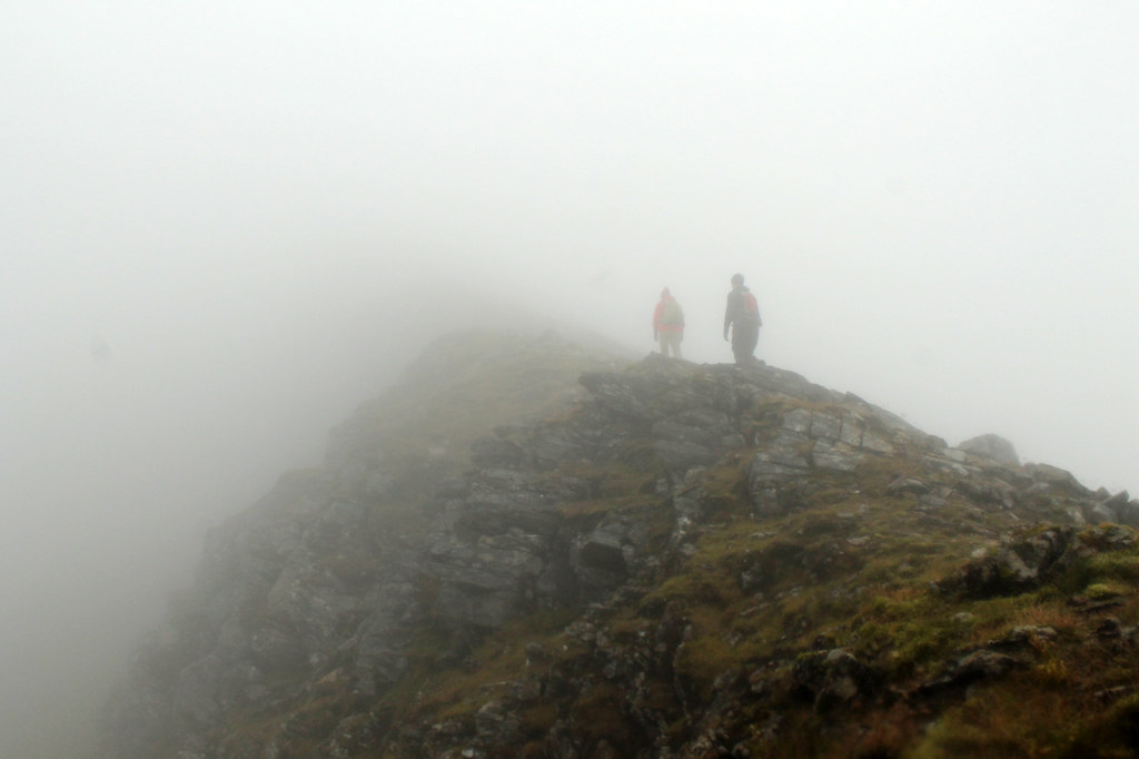
Wow, it's been a while since I've posted any photos from my hillwalks to Scotland's Munros, those peaks over 3,000 feet. My last post, I realise, was about 6 months ago, and it was shortly thereafter that my friend, Hazel, and I did our last hillwalk of the summer (yes, this post is a long-time coming!).
Beinn Chabhair
21 September 2014
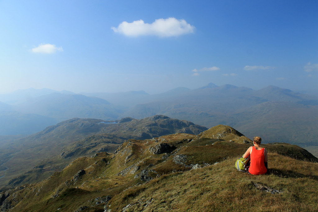
It was a Sunday in September, and we weren't really looking to do anything big, but we wanted to get out into the hills before winter kicked in, and before I headed back to the US for the month of October. We decided that a short walk was in order, and according the Walk Highlands website, Beinn Chabhair should only be 5-6 hours, and that was about right. The walk is pretty much in three stages. The first stage is a walk up a steep, shrubby hill with nice passages of the Ben Glas Burn waterfall. On the way up, an elderly couple was on their way down, and they made a point of stopping to tell us to watch out for ticks, because they were, "jumping out of the bushes," and, "have four sets of jaws!!" Hazel looked a bit ill at that news and wondered if we should stop and go back. I wasn't planning on turning back, even though I only had shorts. Hazel at least had the option of covering up, which she did until we got high enough to feel that we'd gotten through the worst of it without seeing a single damn tick!
A bit more than halfway up the trail from Lochan Beinn Chabhair
to the summit.
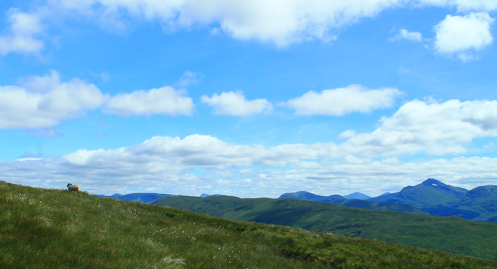
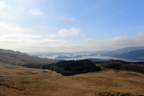
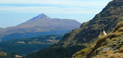
The second stage of the walk is across mostly flat ground, but mucky, marshy ground in a landscape that was really disorienting, even with a map in clear weather. I definitely was happy we weren't doing this walk in the fog, rain, or snow. It was a long traverse up the valley to Lochan Beinn Chabhair where the third stage started up the rocky track to the exposed ridgeline up to the summit. The day was perfect for this type of scenery and we had amazing views back over Loch Lomond to the Arrochar Alps and to the Munros around Crianlarich, and we spent a lot of time taking photos! After chatting to a few sheep along the trail, we eventually made it to the summit of Beinn Chabhair at 933 m (3,061 ft) where we had a bit of lunch before turning around and heading back down. The walk back down didn't take too long, and since it was just going back up the same way we came, there wasn't any new scenery, but the haze had picked up making the sunlight and views a bit more mystical. Overall, a great walk for a quick day out!
This post continues for Ben Chonzie below the Beinn Chabhair slideshow, so keep scrolling!
Ben Chonzie
08 February 2015
It took about five months to get back out into the hills, but just last weekend a small group of friends and I took advantage of a clear, but cold, day to do some hillwalking in the southeast highlands, choosing Ben Chonzie, a gradual and easy walk up to a broad summit. The drive from Glasgow to the parking area for the walk, north of Comrie, took well more than an hour, and along some narrow country roads where you could see the sheen of ice over the road in places, but we eventually all made it and joined a host of other hillwalkers taking advantage of the nice weather.
Up along Ben Chonzie's summit ridge, with the snow-covered
Ben Lawyers range in the distance.
The walk up the hill was only clear of snow for the first little bit, but the trail quickly became snow covered, making for some slick moments and little falls, but luckily the trail followed a car track for most of the way up the Munro, but then the trail deviated up a few hundred metres of snowy patches and bare rock, and I was glad to have bought some slip-on YakTrax for my boots for a bit of extra traction. The last stretch of the walk is along a long flat ridge, totally exposed to the cold and the wind, which was really brisk, but the cold air gave us crisp views over to the Ben Lawyers Range and further on to the foothills of the Cairngorms! We were buffeted by the wind on the final approach to the summit at 931 m (3,054 ft) but got there just to find that the one wind-proof side of the summit cairn was occupied by another group of walkers, so we didn't stay long. The area around Ben Chonzie is known for being a suitable habitat for the Scottish mountain hare, and indeed, at the summit cairn, we spooked one and it took off running and was about halfway down the mountain in a few seconds! Pretty cool to see some of the more rare Scottish wildlife, though!
We definitely did not linger long at the summit, but quickly dropped back down into the valley with the car track to get out of the wind, but being winter, we couldn't leave without doing a bit of sledding (or sledging as they call it here...) on the big snow patches. Hazel had a plastic bag she used as a sled, which worked out pretty well, though I preferred my method of sliding down on my front, like a penguin! We slowly made it back to the cars, but before dispersing in our cars back to Glasgow, we stopped in to the Comrie Royal Hotel for a wee pint (not the drivers, of course), where I tried out the local Earthquake Ale, named so because Comrie lies right on the Highland Boundary Fault and experiences more earthquakes than any other part of the UK! Definitely worth a little stop after a long cold hike.
Christmas was once again spent away from family this year, but this year would at least be exciting. One of my friends and I decided to head west from Glasgow to Oban with some stops along the way. When I moved back to Glasgow from Australia a year ago, a friend of one of my friends was looking at a wall map of the British Isles in my flat, pointed to an area south of Oban, and said, "You must go here, to Kilmartin Glen." He said that Kilmartin Glen is one of the most overlooked destinations for anyone interested in Scottish history and neolithic sites. So, after a day of recovering form boxing day laziness, we headed out from Glasgow.
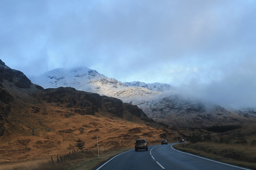
Driving along the A83 between Loch Lomond and Inverary
Winter is an absolutely beautiful time to visit Scotland. Sure, the days are incredibly short, but the snow on the hills makes it unlike anywhere else. Once away from the main cities, the roads get narrow and windy, which makes for getting anywhere quickly quite tricky! It took us a while to get out to Kilmartin Glen, via a coffee stop in Inverary, but a little after noon we pulled into our first stop, Dunadd, which was the first site of the first kings of Scotland, having been in use since the Iron Age. On the little hill above the glen is a rock with some footprints carved into them, possibly where the kings looked out - I imagine much like Mufasa and Simba from Pride Rock :)
A little bit further down the road are a series of standing stones dating back 5,000 years. We missed the winter solstice only by a few days, but it's pretty amazing how these stones would have lined up with the setting sun, even after 5,000 years! I'm often really amazed by how after thousands of years, and with all of our modern technology and knowledge, we still have no real idea what these stones or circles were used for! And while not as grand as the Ring of Brodgar in Orkney or as circular as the Drombeg Stone Circle in southwest Ireland, the stones are just as enigmatic, and there are a lot of them, including one site where five stones make an X figure in a field, apparently a very unusual arrangement. Starving, we stopped in at the Kilmartin Hotel and had a tasty pub supper before exploring the curchyard across the street with brilliant scenery looking down the Glen.
There were still a few things we wanted to see before it got dark and before we got to Oban, and even though it was only 3 o'clock in the afternoon, we were running short on daylight, so we hit the road again, winding around the coast, to the Bridge over the Atlantic. To be fair, this is a very nice looking stone bridge, arching high over a small tidal waterway, technically part of the Atlantic Ocean, separating the Scottish mainland from the small Isle of Seil. Apparently nowhere else (maybe in Scotland) is there a bridge over the Atlantic, so it is only here you can say you've "driven across the Atlantic Ocean." Not really much to see, we kept on to the small town on Seil of Ellenabeich, an old slate mining town that now consists of three rows of whitewash cottages. A beautifully small town that I would have liked to have stayed in a bit longer. Would have been a great place to write up my PhD thesis! While in Ellenabeich, the sun went down and we didn't want to be stuck on unlit country roads for too long, so we headed in to Oban, checked into our hotel, and met up with one of my Uni friends who was home visiting family for the holidays.
Snow-capped mountains on the Isle of Mull with Duart Castle in the foreground from the ferry from Oban to Mull.
We got up early the next morning, a brilliantly clear but chilly morning, to catch the ferry from Oban out to the Isle of Mull, a rugged island about an hour offshore from Oban. The views from the ferry back to the mainland of snow capped mountains were amazing, not to mention the snow capped peaks of Ben More, the only Munro on Mull. A little note for visiting Mull in the winter: Don't plan on relying on public transportation, especially on a Sunday! We were lucky to have a Range Rover, so the small single-track roads and ruts of Mull were a piece of cake, but be careful if you have a smaller car not to go off the edge of the road or you will get stuck! We headed immediately out to the westernmost point of Mull, a town called, Fionnphort, where we waited for the quick ferry out to the small Isle of Iona. Again, visiting in the winter and on a Sunday, you run the risk of either the ferry not running, or only making one trip out to Iona, but not back, so it's suggested you call the portmaster on Mull the day before to make sure the ferries are running!
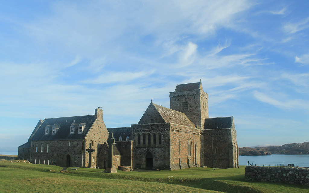
Iona Abbey
The sky was crystal clear, and though it wasn't windy, it was really cold! But while waiting for the ferry we did get to see a small fishing boat loading up for the day, and it must be quite a regular occasion because there was a seal who sidled right up to the boat begging for a bit of breakfast! The ferry finally arrived and we walked on, making sure to ensure it would come back from Iona! Now, Iona is a beautiful little island and I wish we had more time to spend there, but with the two hours we did, we made sure to walk over to the famed Iona Abbey, the former Catholic monastery where the Book of Kells was written. The Abbey survived Viking raids as well as the Protestant Reformation, and is now part of the Church of Scotland. So many tourists come out to Iona in the summer, it was nice to experience the island in winter when even the hostels were closed for the season! BUT, if you go on the weekend, you don't have to pay to get in to the grounds! We took a little walk up to the highest point on Iona, Dun I, for some breathtaking views to Mull and so many other Inner Hebridean islands.
Running short on time, we headed back to the ferry and crossed back over to Fionnphort, accompanied by dolphins jumping out of the water and playing in the wake of the ferry! Back in the car, we decided to take the small winding road around the rest of Mull. Now, I thought the road from the Mull ferry to Fionnphort was small, but it was nothing compared to the B8035, which was tucked right along the coast with rocky cliffs on one side, but provided amazing scenery, especially during sunset on such a clear day! The B8035 turns onto the B8073 and the road climbs up some very steep hills that any small car would have some trouble getting up! If you're in a small car, you definitely want to take the B8073 counterclockwise from Tobermory where it will be easier to go down these roads than up. Daylight was nearly gone as we arrived to Calgary Beach in the small locality of Calgary, the same that the Canadian metropolis is named after! But we couldn't stay long since the sun had now set and we still had about 30 minutes to drive to Tobermory for a quick fish dinner (not many places open on a winter Sunday), very quick because we had to get back down to the ferry docks to catch the last ferry back to the mainland.
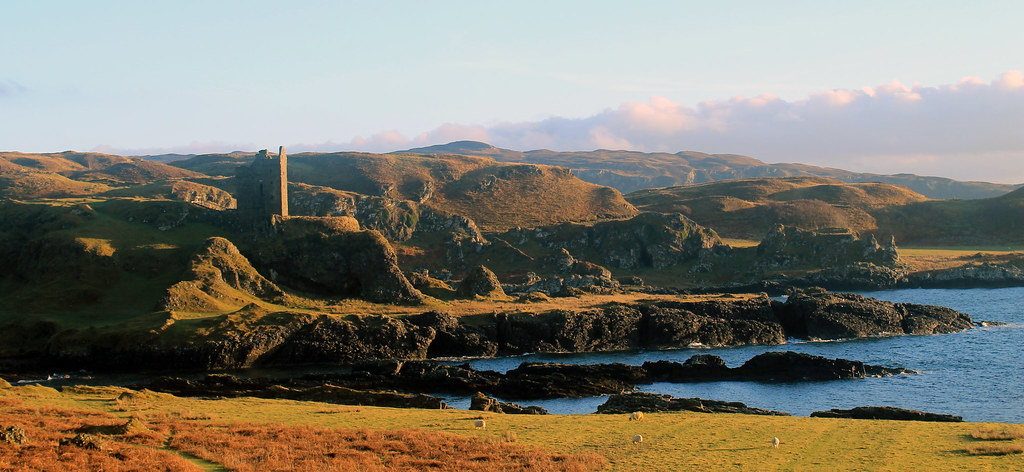
Gylen Castle on the southern end of Kerrera
The following morning was yet again a clear day on the western Scottish coast, though much colder! Not wanting to waste time, we grabbed some breakfast and went to the small local ferry from Oban out to the small island, Kerrera. A privately-owned ferry, you signal the owner that you want a ride by sliding a big panel open on the mainland, revealing a big black square, and upon seeing it, the ferryman comes over to pick you up for the 5 minute crossing. We decided to do the 3.5 hour loop down to Gylen Castle at the southern end of the Island and back. Though not a strenuous walk, it felt long because it was so cold, especially in the shade, but the destination was amazing - a square castle with a small footprint exposed on a tall rocky knob over the coast. The castle was besieged and burned in 1647, though recently the Clan MacDougall began restorations. It's surely not much of a castle, but its position in the grassy hills along the coast sure makes it a great place that we had to ourselves! The rest of the circuit along the west side of the island isn't as scenic, and was a bit mushy underfoot, but there were a few brilliant moments in the setting sunlight over to Mull. Back in time for the ferry back to the mainland, we hopped back into the car and headed back up to Oban to pick up my friend who was coming with us back to Glasgow, and with that we were off back home.
Though I think we lucked out, weather-wise, the weekend was a great and most welcome break from city life in Glasgow, and so easy for a few days! Enjoy the photos:
This last weekend around Scotland has been a bit tense, what with the Scottish Independence Referendum being successful for the Better Together campaign. But Glasgow was one of the few councils that voted in a majority to secede from the UK and as such the mood around town has been a bit....glum at best. Huge rainstorms Saturday morning cleared into sunny skies and a new day, and Sunday promised to be the same, so my usual hillwalking partner-in-crime, Hazel, and I decided to do a "short" walk. Beinn Chabhair has been on my list for a while. Not so much because it was promising to be a great walk, but because the walk into the Munro seemed to be long and boggy - not something to do in poor weather.
Looking out over the misty mountains of Loch Lomond National Park
from the Meall nan Tarmachan ridge en route to Beinn Chabhair
The walk from Inverarnan up the first steep bit of the walk, through dense ferns in the Loch Lomond valley was definitely not the best part of the walk, though there is a brilliant waterfall where Ben Glas cascades down into the valley. We saw an elderly couple on their way down and had the usual, "Hiya, how's it going?" banter. Usually, the response is a, "Good, and you?" But today, this couple decided to warn us of a tick infestation higher up on the hills, full-on with warnings about how they were jumping all over you, swarming out of the bracken, and you want to get them off before they bury their heads into you with, "THEIR FOUR JAWS!" Coming from anyone, this seems a bit scary, but add in a thick, gravelly Scottish accent, and we were - well, Hazel was - downright terrified! We were warned to put troosers on and cover up. Well, I only had shorts and wasn't planning on turning back so quickly, but Hazel threw on all of her waterproofs, and so covered head to toe - we carried on.
We made it up onto the moorlands, above the supposed tick-zone, and Hazel took off her protective gear and we started the long trudge through the moors. It was a good thing we weren't doing this in the rain, or under poor conditions because navigating the undulating boggy terrain would have been near impossible and certainly not dry. But today, the sun was out, and not a cloud was in the sky, though the atmosphere all around Loch Lomond and the Trossachs National Park was thick with a light-white haze, saturating each mountain with a blue hue that made them seem like paper cutouts, layered one behind another.
Finally we reached the trail to head up Meall nan Tarmachan and left the bog behind. A few sheep watched us trudge up the hill, and listened to our calls as we tested out the awesome echoing acoustics of the rocks we were climbing through. The trail up to the summit was kind of like a rocky and grassy playground as the trail weaved around large outcrops, up and over some scrambly sections, and finally to the summit of Beinn Chabhair, all the while the misty haze hung draped over the surrounding mountains.
We didn't linger for long at the summit, but enjoyed ourselves, but we could tell that our short walk wasn't going to be too short. We'd left the car at 11:20 am and checked the time at the summit at 3:20 pm. Knowing we had to traverse the moors again, we started off back down the track, but it didn't take nearly as long because we were back at the car by 5:30 pm. Though we just ticked off one Munro, it was about all we wanted to handle for the one day, but it sure was a great day to be out!
In Scotland, during the summer, you want to spend as much time outside as possible (and as little time updating your blog) because the nice summer weather doesn't last forever! While there were a lot of exciting things going on around Glasgow this summer like the Commonwealth Games and visiting friends from the US, my friend Hazel and I spent a decent amount of time out in the Highlands bagging more Munros - which has now become an obsession of ours.
Beinn Eunaich & Beinn a'Chochuill
20 June 2014
This was was actually one I did myself. Hazel left for Greenland for a few weeks, so I was on my own and really itching to get out into the hills. The problem without a car is that you're reliant on the bus and train. Luckily for me, the train from Glasgow to Oban stops at the beautiful Loch Awe at the foot of four massive munros. I wanted to do all four, but having only gone hillwalking once on my own, I thought I'd at least get two in, so I started off down the road to the footpath up to Beinn Eunaich, which looked easy since it's a farm road heading into a water reservoir stored within the mountains, but it was steep and I was not prepared! I was doing the loop backward and started up the side of Beinn Eunaich which is this relentless grassy hill that ever so slowly arches its way to the summit - you know the kind where you think you're almost there, but then you see the summit still looming in front of you? But the climb was a breath-taking one with incredible views down over Loch Awe and the picturesque Kilchurn Castle on its shores. Well, eventually I made it to the top of this slightly cobbly top (989 m/3,245 ft) and was met with even more views down the other side (which to the north was a vertical dropoff!) over the waters of Loch Etive.
Great day for a hillwalk above Loch Awe. Looking north on the way
up Beinn Eunaich
The wind had started to pick up and bringing clouds in from the ocean. Nothing that really threatened rain, but low enough that the summits of all the mountains around me were shrouded in mist. I carried on down to the saddle between Beinn Eunaich and Beinn a'Chochuill, back into the world of visible distances, but then it was up, up, up to the next Munro. One the way, I passed an elderly man who'd walked in from the nearest town - a much farther distance than I walked from the train station - and was impressed he was still trekking on. I mean, he was old! Back in the clouds, I relied on the path being clear enough for me to see my way to the top of Beinn a'Chochuill (980 m/3,215 ft). It was dry and I had my lunch here, and the summit was high enough that the clouds going over the summit were thin, but it forced the rest of the clouds to flow between it and its neighbouring munros. Not being able to even see the rest of the 4-munro circuit, I decided it was best to head back to the Loch. After all, I had time to check out Kilchurn Castle and have a pint from the hotel at the train station! Overall, it was a nice day out in the crisp air, clouds, and two munros (nearly) all to myself!
(More to read below the slideshow!)
Stob Dearg & Stob na Broige
25 August 2014
Hazel finally returned from Greenland which made getting out to further-flung munros much easier with her car, and though the Matiz is a wee one, it got us where we needed to go. The weather was perfect for late August and we couldn't believe our luck and decided to head up north to the famous Glen Coe - probably Scotland's most recognisable valley (and home to James Bond's Skyfall, in the movie at least). I'd still never been and was pumped to go!
It took a few hours to get there, and another while carefully off-roading Hazel's car into the packed parking lot (did I mention Glen Coe is popular?). We started off to the trail heading up the ridge at the eastern end of Glen Coe - Buachaille Etive Mor. The walk up was brilliant! Right through a very rocky but gently sloping Coire na Tulaich. Having not been hillwalking for a few months, we were a bit nervous about whether we'd be in shape to do it, but the walk to the ridgeline was over before we knew it! We still had another few hundred meters to get to the summit, but we were there, enjoying the absolutely perfect views of the mountains of Glen Coe and over to Ben Nevis, Britain's highest elevation, looming a few ranges away.
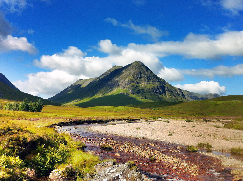
Beautiful peaks of Buachaille Etive Mor, guarding the
entrance to Glen Coe. Who says that middle peak isn't a munro?
C'mon!
It wasn't much more effort to reach the summit of Stob Dearg (1,021 m/3,350 ft), and we were rewarded with one of the most breathtaking views I've ever seen. The summit is perched right at the end of the ridge and it quickly drops off on three sides leaving you with unimpeded views down into Glen Coe to the west and the immensely expansive Rannoch Moor to the east. There was not even a stitch of wind all day and the waters of Rannoch Moor lay perfectly still.
Back down the ridge we went, off to find the next munro, but there was a massive mountain between us and where the map said the next munro was. We were very disheartened to learn that not all mountains in Scotland over 3,000 ft are classified as munros as we trudged up the trail to the summit of Stob na Doire (1,011 m/3,317 ft) - which is boringly classified as a "munro top." Apparently, there is no exact definition of a munro other than that it must be over 3,000 ft (which Stob na Doire clearly meets), but a munro must also be its own mountain, standing prominently from any neighboring ridge or mountain. Stob na Doire was massive, but clearly not "a mountain in its own right" to be classified as a munro. We took a photo at the top anyway, in case the rules change in the near future and it earns classification as a Munro.
After Stob na Doire, it was almost a joke to reach the "summit" of Stob na Broige (956 m/3,136 ft) - almost 200 feet below the summit of Stob na Doire! But it still felt good to reach its top and look out over the road to Loch Etive. The weather couldn't have been better and after a quick bite to eat we started off down the mountains back to the car through a green valley lit up by the golden setting sun. It was a bit tricky getting the car out of the dirt parking lot as the ground was eroded where the pavement from the road ended, but we got her out and started the long drive back to Glasgow.
(More to read below this slideshow, too!)
Binnein Mor &na Gruagaichean
27 August 2014
We just couldn't get enough of the good weather and thought that while it lasted we should get out once more. The weather report called for clear skies, light wind, and no rain, so once again Hazel and I hopped in her "gran-mobile" and drove back up to Glen Coe. We wanted to do the Aonach Eagach ridge on the north side of Glen Coe, but after looking reports of its treachery, we decided against it until we had someone with us who could urge us along Britain's sharpest ridge walk. We decided to try some other ridge walks first before tackling that monster! So we drove through Glen Coe and then tucked east to Kinlochleven where we parked the car and headed off up to the Mamores peaks.
I'm not sure we realised just how long of a walk this was going to be. The first few miles are just a constant slight increase up a long valley (though with nice views over Loch Leven and the town below), until the path dumps you out into a beautiful valley perched up between Binnein Mor (our first destination) and the neighbouring munro Sgurr Eilde Mor. While the day was just as sunny as the previous walk, the air was not nearly as still and we were being buffeted by very stiff and strong gusts of wind! We worked our way up to the ridge overlooking Coire an Lochain where we had spectacular views of Ben Nevis across the valley, and even though our legs were about to give out, we still weren't at the top! Out of 282 munros, Binein Mor is the 28th highest and we still had to get there. We met some nice Dutch tourists and caught up with a single hillwalker who was bagging his 200-and-something munro. He reassured us that Aonach Eagach's bark was worse than its bite, but that with the stiff winds, it was better we weren't on that ridge. We made it to the summit of Binnein Mor (1,130 m/3,707 ft) which is perched on a little point in the sky with very steep and long drop-offs on either side! Vertigo definitely set in a few times, especially with the wind, but once we sat for some water, we got over it pretty quickly.
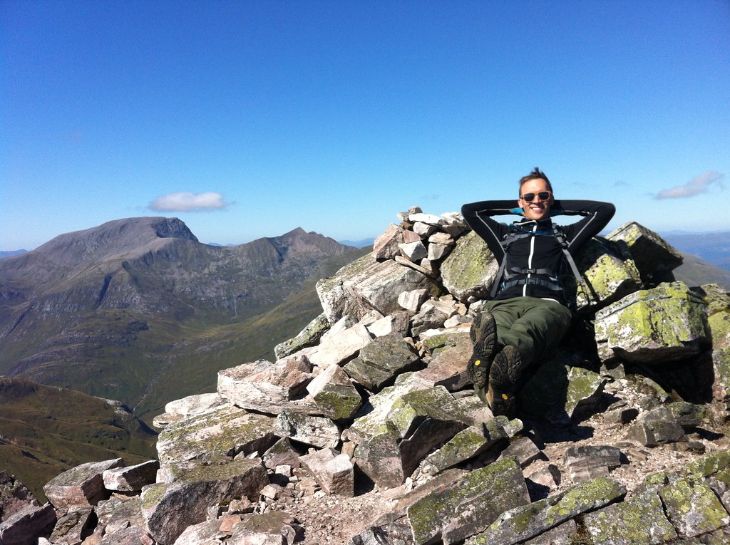
Chilling out on top of Binnein Mor. Munro #10!
We didn't linger at the summit long due to the wind. It was incredibly brisk and chilled us even with all the layers we were wearing! But we did have a little celebration as this was my 10th munro! We found a little spot tucked away from the wind for lunch, but since the walk was so long, we pressed onward along a nice ridge to na Gruagaichean and enjoyed a good scramble up to the summit (1,056 m/3,465 ft) where we celebrated once more as this was Hazel's 10th munro! Ben Nevis just stared us down while we had the rest of our lunch. Time was getting on, and the sun was already setting and we still had to get back to the car and drive back to Glasgow! The walk down the ridge was nice and grassy with stunning views of Loch Leven and we could even see the jagged ridge of Aonach Eagach in the distance. But the nice grassy ridge soon gave way to a massive, steep, pathless, grassy hillside that we essentially bushwacked our way through before reaching the trail that would return us to the car. It was definitely one of the longest walks I've done so far (almost 9 miles), but it was definitely worth it!
(There's one more section to read below this slideshow!)
Ben Lui & Beinn a'Chleibh
14 September 2014
The weather's been changing a lot around Scotland as Fall starts to set in but the weather report suggested we'd have clear skies and cloud-free munros over the weekend, so my intrepid munro-bagging-partner, Hazel, and I went for it. We drove west to Ben Lui, which was described as one of the finest munros in scotland with amazing views, but we had the feeling, as we parked the car, that those views would not be for us today. Clouds were low and the peaks of all the munros were shrouded in mist. But we were here so might as well go for it anyway!
Carefully keeping to the path in the fog along the ridge to Ben Lui
We forded the River Lochy and trudged our way up through the muddy pine timber forest which was nice as there were a few waterfalls and the leaves were already changing colour. But soon we found ourselves in the massive bowl-shaped valley between Ben Lui and Beinn a'Chleibh, both covered in clouds and a brisk wind blowing through the gap between them. We headed up east along a long, steep, grassy slope that just kept going, and going...and going, until we were in the clouds. But the grass stopped and was replaced by broken boulders and alpine-climate plants. We'd reached the ridge that would take us to the summit, being careful not to lose our footing lest we trip and fall down the cliff into the valley on the other side, which incidentally is where a 4-person aircraft tragically crashed a few decades ago. We wanted to see if we could find the wreckage, but the clouds were too thick and we didn't want to go wandering off trail.
After a few fun scrambles and photoshoots, we made it to an open plateau with a cairn that we thought was the summit, only to realise we had a little further to go before reaching Ben Lui's true summit (1,130 m/3,707 - the same height as Binnein Mor, but ranked 29th). It was too cold and damp to linger there much longer so we headed down to the bealach and it was pretty much a hop, skip, and a jump up to the summit of the neighbouring munro, Beinn a'Chleibh (916 m/3,005 ft) which was cloud-free for a while. But there was no reason for it not to be cloud free - after all, Beinn a'Chleibh is the 281st highest munro out of 282! So, not spectacular, but fun to check it off the list nonetheless. Clouds eventually did roll in and we never really got a good clear view of Ben Lui all day. We ran into many people who were doing one or two more munros after Ben Lui and Beinn a'Chleibh, but I'd injured my knee running the day before so we decided to head back to the car, which didn't take long, and it was nice not having a three-hour drive back home. Not sure how many more nice days we'll have, but so far, nothing can stop us!
Right, so continuing on this trend of finally writing backed-up blog posts, this one's a monster simply because of the photos I had to reorganise to get here! Last December, though, I had the great pleasure of being able to tag along and help teach a glacial geology and geomorphology field trip to the central region of New Zealand's South Island. Having been to the North Island and having experienced the northern- and western-most points of the North Island and explored the watery wonderland of the Bay of Islands, I was totally pumped to get to some of the more staggering New Zealand scenery we all know from Lord of the Rings!
After three hours of one of the most turbulent flights I'd been on in a while (and I'd just return to Sydney from a trip to Denver and Vermont), we landed in Queenstown, the adventure capital of New Zealand. The flight in over the Southern Alps was beautiful. Being early December, New Zealand was just emerging from winter and all of the mountains still had substantial snow on them! We wasted no time in picking up our three passenger buses and trailer, and with 24 student in tow, set right off out of Queenstown to the Kawarau Bridge, famous for being the original bungee jump in New Zealand. Of course, we were there to learn about New Zealand's past glacial geology, climate, and geomorphology - or how the landscapes develop and change through time. Along the first few days the students would be presenting small mini-reports on different aspects of these topics and we weren't letting any second go to waste!
After learning about New Zealand's loess deposits, accumulations of wind-blown dust that were deposited under colder dryer conditions during the last glacial period, we headed off the main highway, taking the Crown Range Road to Wanaka where we'd spend the first night. We stayed at a small hostel/motor park near the shores of Lake Wanaka, which fills one of the many glacially-sculpted valleys east of the Southern Alps, including Lakes Wakatipu, Ohau, Pukaki, and Tekapo. Early the next morning, I got up early for a short walk along the lake, looking out across to the beautiful Mt. Alta rising across the shores. Our destination by the end of the day was Mt. Cook Village in Aoraki/Mt. Cook National Park, but we had plenty of stops to make before calling it a day.
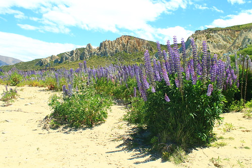
Purple lupin growing at the Clay Cliffs near Omarama
We took Lindi's Pass toward Omarama before doubling back across the Ahuriri River to the Clay Cliffs, a geological formation of very soft rocks exposed along the active Osler Fault. The cliffs are a deeply dissected feature that is the site of an ongoing battle between the uplifting tectonic fault and erosion. We stayed here for a short while and had lunch along the Ahuriri River, a beautiful place to dip your feet in the refreshing water and have a bite to eat. We made one more stop to the former river outlet of Lake Pukaki before it was dammed and diverted but also had time to stop at the southern end of Lake Pukaki to get a sense of what we were in for for the next few days.
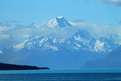
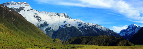
Aoraki/Mt. Cook (3,724 m/12,218 ft) looming over Lake Pukaki
The weather was bright and sunny and fairly few clouds against a blue sky, and from here, far off in the distance, was the brilliantly majestic peak of Aoraki (or Mt. Cook), the highest point in New Zealand at 3,724 meters (12,218 ft) above sea level! We had to stop here because the view was simply breathtaking, and because Aoraki is apparently often shrouded in clouds, we thought this might be our only chance to see its entire height! And I should mention Lake Pukaki because it was amazing in its own way. There is so much powdered rock, crushed by glacial erosion that gets washed into the lake that it takes on a very milky appearance which reflects the sky on a sunny day, turning it a turquoise colour that is really only best matched by a Crayola crayon of the same colour!
It was windy, so we got back into the vans and started the fairly long drive down the Mt. Cook Road toward Mt. Cook Village, the views along which were absolutely stunning. I'm jealous of the students in my van because they got to stare out the windows the entire time, while I had to keep my eyes on the road. But if you want a fun road to drive along, this is one of them. It just rolls and wraps its way long the lake and the ever-impressive Southern Alps just keep looming in the distance! Well, if the drive wasn't thrilling enough, once you're past the head of the lake, you begin driving through the wide and flat river valley that drains the Mueller, Tasman, and Hooker Lakes which are all fed by glaciers. And while you can't see the glaciers, as they are hidden by huge glacial moraines and tucked away around the mountains, you do see the incredible wall of ICE that is known as the Huddleston Glacier, which frankly, I thought was one of the most impressive things I've ever seen! It's just this massive, steep wall of ice that you just couldn't stop looking at!
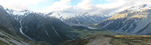
Looking down to the Mt. Cook Village from the Red Tarns. The Huddleston Glacier is the big wall of ice plastered
on the side of the Southern Alps in the distance. Mueller Lake and its end moraine seen in the bottom of the valley.
Aoraki (the Maori name for Mt. Cook) features prominently in Maori history. The Maori people believed the South Island to be a canoe that Aoraki and his brothers were using to voyage the world. It tipped and the brothers climbed onto the top of the overturned canoe and turned to stone. Geologically, Mt. Cook is positioned in the Southern Alps which are the result of convergence along the Alpine Fault which is the boundary between the Indo-Australian tectonic plate and the Pacific plate. The fault is mostly a dexteral strike-slip fault, but there is oblique convergence which has uplifted the mountains on the South Island. It is the Alpine Fault that causes most of the earthquakes in New Zealand, and also as it cuts across the north part of the South Island it goes offshore east of the North Island where subduction of the Pacific plate under the Indo-Australian plate results in the volcanism the North Island is famed for!
Well, while all of the students were excited to get out of the vans and start eating and drinking for the night, I had picked up a wee trail map and having heard that weather is rarely clear in the park, I thought I'd take advantage of it by doing a short hike up to the Red Tarns, some small ponds perched high up the mountains above Mt. Cook Village. Luckily summer in the Southern Hemisphere means plenty of light late into the evening, so I didn't have much to worry about - other than breaking my ankle with no one around! Well, the hike up was unrelentlessly steep, but I eventually made it to the tarns, which in and of themselves aren't that impressive, but you don't make that kind of hike to look at a pond, but for the view of the rest of the valley. Up here, you're so high up above the valley that you can see up and over Mt. Wakefield to Mt. Cook as well as up the Tasman River valley to The Armchair and Malcher Peak. The weather was holding up, so I decided to climb even higher to the shoulder of Sebastopol, the lowest peak in the National Park. Catching my breath, I decided my hunger would win over my want to reach the summit, so I raced down a big scree slope and headed back to dinner at the Mt. Cook Village.
The Huddleston Glacier and Mt. Sefton (left), Aoraki/Mt. Cook (right), and the Mueller
Glacier's end massive end-moraine (centre-bottom)
Weather was clear the next morning again, blue skies and few clouds, so I walked up toward The Hermitage - the famously fancy resort hotel in the National Park that looks directly over to Mt. Cook - for a few morning photos before joining back up with the students. We drove up to the Mueller Glacier overlook for a few more student talks. During one of the talks, we all of a sudden heard this huge crack that sounded like thunder, followed by a cascade of booms and crashes. It was so startling that everyone turned their heads to the glaciers behind us. Though we couldn't see anything, it was pretty obvious we'd just heard a massive block of ice break off the Huddleston Glacier, falling down onto the Mueller Glacier below. Coincidentally, the student giving his report was just talking about ice falls. Talk about timing!
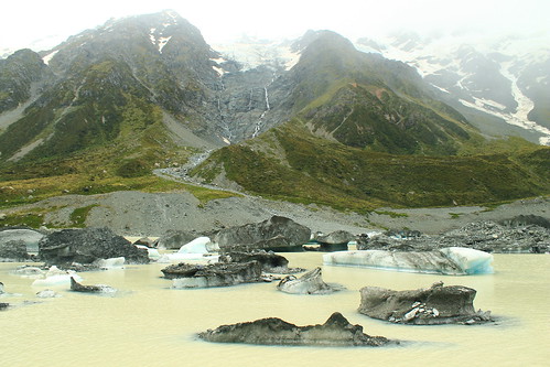
Icebergs from the Hooker Glacier floating in Hooker Lake
Once the student talks were done, we started the long hike up to Hooker Lake and the Hooker Glacier that sits right at the base of Mt. Cook. We continued to hear booms of breaking ice behind us during the hour-long walk up to Hooker Lake, which was cool, but the weather turned, which was not. We could see the clouds rising up from the west and flowing over the mountain tops to our left as the wind picked up and threatened to rain us in. But, being geologists, we go out in anything and this certainly didn't stop us and the last few students presented their mini-reports. You couldn't really see the mountain peaks by this point, but you could still get great views over Hooker Lake which was just chockers full of icebergs in various stages of melting, all shapes and sizes! By the time we left Hooker Lake, the weather had cleared up once again, permitting us to drive around to the next valley over to the Tasman Glacier and Lake.
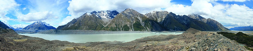
Lake Tasman is a recent feature to the landscape, having only formed in the last 40 years after the Tasman Glacier (left)
retreated to its current position!
Lake Tasman is impressive, if not for its size (7 kilometres long!), for the fact that 40 years ago, it was not there! Forty years ago the Tasman Glacier's terminus was at the lookout most visitors take the short walk up to from the car park. Now, however, Tasman Glacier ends in the lake and icebergs calve off its front. Though the retreat is impressive and offers the opportunity to take speed boat tours around the lake, it just means our changing climate is killing off these magnificent glaciers!
We headed back out of Aoraki/Mt. Cook National Park toward the town of Twizel where we'd be based for the remainder of the trip. Over the next 5-6 days, the students would be working on small group projects in the area, and we, the trip leaders, would drive them wherever they needed to go. But first, we had another stop to get to up beyond Lake Ohau on the other side of Twizel. By the time we got beyond the shores of Lake Ohau, the weather came back with a vengeance.
The next day was fairly uneventful. The rough weather had cleared up and the students used the day to plan their projects. Twizel itself is a pretty dull town. It was founded as a working camp during the construction of the dams that were built on Lake Ohau, but remained a popular stopover point for travelers going to Mt. Cook (not to mention cheaper than staying in Aoraki/Mt. Cook National Park. While there are some nice coffee shops and cafes in the main shopping area, there isn't much to speak of - especially of the locals. While eating dinner at the Power Station Bistro I noticed one man down his beer outside and promptly walk to a short brick wall and urinate on it! Welcome to Twizel, indeed!
I played chauffer for students heading up back into Aoraki/Mt. Cook National Park over the next three days to collect data for their projects. Depending on which group was where, and when they needed to get to their next stops, I often had anywhere from an hour to a few hours by myself before I had to meet any of the students and move them. This was nice because it gave me time to do a few shorter walks and explore the park a bit more. One of the days I walked up the Mueller Glacier trail to see the head of the glacier which had retreated around the corner of its valley, out of sight from the main view point. Right at the bottom of the Huddleston Glacier. No one else was up this far and I enjoy sitting in the sun in the middle of this amazing landscape. I felt so fortunate to be able to experience it in all its sun-shiny glory!
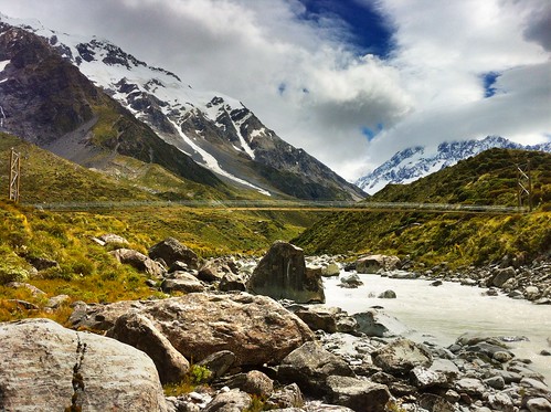
Suspension footbridge over the Hooker River. Aoraki/Mt. Cook shrouded in clouds
I also joined a few student groups on their quests to collect field data. This varied from walking up along the crest of the lateral moraine along the edge of Tasman Lake looking for students who had gotten well-ahead of me, helping students measure boulder dimensions in streams coming down from creeks draining the steep valleys to the west of Mt. Cook Village, and taking one more walk up to the iceberg choked Hooker Lake.
I had no plans to see any more of the South Island on this trip, and though I was a bit let down about not being able to do that before arriving, I don't think I could have asked for a more amazing experience that just being able to wander and explore the Hooker and Tasman Valleys in Aoraki/Mt. Cook National Park. It really must be one of the most spectacular landscapes I've been to. It's drastic, but accessible; staggeringly expansive, but easy to get around; busy with tourists, but big enough that you don't have to go far to get away from them!
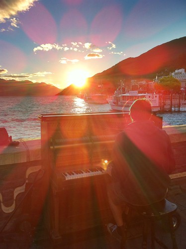
Pianist playing his own music during a beautiful Queenstown sunset
over Lake Wakatipu
The students had a final day in Twizel to write up and hand in their reports, so the last day near the mountains wasn't all that exciting. Finally, we were ready to leave Twizel and made the long drive back to Queenstown for our last night in New Zealand. We arrived early afternoon and many of us had previously signed up to go whitewater rafting to celebrate the end of a long week. We dropped our things off at the hostel and met down in the town at Queenstown Rafting where we were fitted up with wetsuits and packed into large vans with a trailer packed with rafts in tow behind us. This is no big deal, except to get to the launch site, we had to drive down Skippers Road, a long, very tightly-winding road that is cut into the side of mountains with very steep slopes! To put it in perspective, if you sat next to the window, you couldn't see the edge of the road and it looked like there was nothing beneath the van! In fact in one or two places, there almost wasn't anything beneath the van... One tight turn has been so abused that the edge of the road has eroded to the point that side of the van on the inside of the road gets scratched by the rocks sticking out of the slope! At another point on Skippers Road, the road appears to be intact, but when you look back up at it from the river, you see that a big chunk of rock, that would otherwise support the road, has simply fallen away! If you're afraid of this kind of driving, there's no hope for you because no matter which side of the van you sit on, you're going to be exposed to one of these hazards!!!
But the rafting itself was awesome! I've only been whitewater rafting once before on the New River in West Virginia where the water levels that year were low enough that the big rapids had diminished many of the rapids, so I wasn't sure what to expect. Well, the Shotover River is pretty much a narrow, narrow canyon with rocky cliffs on either side and in most places the river is as wide as the raft! I've got to give it to the raft guides because they have some of the hardest jobs in the world in keeping us all safe! While we didn't flip, like we did on the New River, there were so many times I thought we were goners! Two girls did fall out at one point, but we safely got them back on the raft just before they were pinned between the rocks and raft! The trip culminates a tunnel that was blasted into the mountianside to funnel water for gold mining in the mid-1800s, the final rapid is shooting down the mill run right where every raft in front of us was waiting and watching, hoping someone would flip. We didn't, but had a great time and it was an awesomely adventurous way to end a week in New Zealand!
That night was spent out in Queenstown watching a beautiful sunset over Lake Wakatipu and eventually some mechanical bull-riding in one of the town's innumerable options of Western/Cowboy-themed bars. Flights back to Sydney the next afternoon gave me a little bit of time to walk around the local Saturday markets along the lakeshore in what ended up being a very nice sunny relaxing way to end my last visit to New Zealand in a long time! Definitely not the last, but a long time at least!
I've said it before, but it's worth saying again: when the weather is nice in Scotland, you've got to go take advantage of it! Luckily, as a student, as long as my work gets done on time, it (kind of) doesn't matter when I do it. So when the sun comes out, it's time to go! A few weeks ago, my classmates Hazel and Ruth and I headed off to Arrochar, west of Glasgow near Loch Lomond to hike a few of the Munros in the Arrochar Alps. It was supposed to rain a little bit in the afternoon, but it was clear now and we decided to take the steeper route to the summit of Beinn Narnain and get that over and done with first, figuring if it was rainy later, the steep slope would be too slippery to come down.
It was the right decision. The path up from the Argyle Forest Park parking lot to the summit is a long and tiresome, seemingly never-ending steep trail from sea level right up to 600 meters before it finally levels out for a little while. Once you're up and out of the forest, the views are magnificent and when you get to the part that levels out, stunning views of the craggy peaks of The Cobber loom into view.
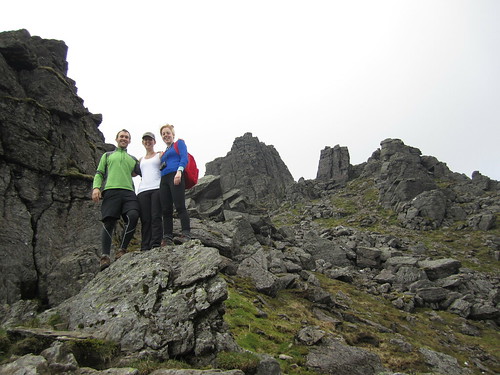
Final ascent up Beinn Narnain through The Spearhead
But of course with all hillwalking, there are about three or four "false peaks" that make it seem like you're almost there, but then...nope! One of these false peaks was the Cruach nam Miseag and we really thought we might be to the summit. Instead it was just a vantage point where we could see the trail go down in elevation before winding its way up between huge rock outcrops called The Spearhead! A few hikers were threading their way through The Spearhead and we could hear their voices echoing while we sat and had a wee break. The rest of the trail wasn't terrible, however. It turns out that getting up through The Spearhead didn't take long at all and as a geologist, the blocky and square outcrops that towered overhead were just fascinating!
After one last rocky gully we clambered up through, we found ourselves on the top of the mountain - not the summit yet, mind you, but it was a flat walk from here. We stopped for a few photos looking over Loch Lomond from the top of The Spearhead and eventually made it to the cairn and trig point at Beinn Narnain's summit of 926 metres (3,038 ft). We stayed up there a little while to catch our breath and had a good look around us. It was quite cloudy, but the sun poked through every now and again, and the cloud base was higher than the mountains, so we had good views of all of the other Arrochars and even Ben Lomond across the lake.
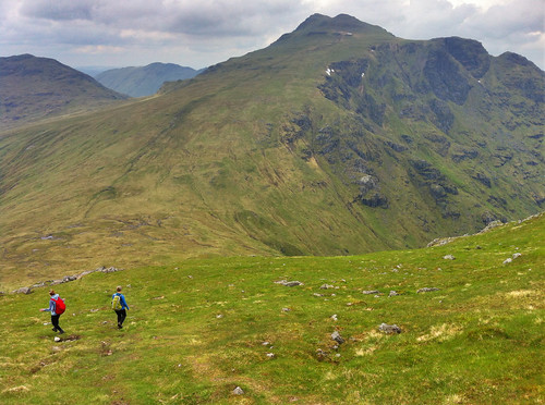
Over and down from Beinn Narnain to Beinn Ime. Looking
back at it, the trail up Beinn Ime just looks squidgy!
We could see the next mountain over, Beinn Ime, from the top of Beinn Narnain and decided that it didn't look too awfully far off. Besides, the walk down to the "bealach" (which I think is the name for the saddle between two peaks) and up to the top of Beinn Ime was smooth, looked fairly shallow, and quite grassy, so it couldn't have been that bad, right?
While getting down to the bealach from Beinn Narnain wasn't bad, the bealach and the majority of the slope up to Beinn Ime was totally waterlogged from rain we'd had the previous few days. It wasn't all that warm, and soon conditions became worse as our feet sank into soggy, squidgy, grass, and our socks became soaked with cold water. As Hazel put it, it was a long plod. We didn't talk much and instead just kept one foot in front of the other until the path hardened underfoot and became more clear up at the higher elevations. A walker coming down the mountain told us we weren't too far off, and sure enough, the trail quickly leveled off and we walked along the ridge to the cairn at the summit of Beinn Ime, the highest of the Arrochar Alps at 1,011 metres (3,317 ft). Being so high, it was really windy, but luckily previous hikers had created a sort of a fortress around the cairn that blocked some of the wind, so we sat there having our lunch with the best view around!
It was windy and chilly enough, and our feet were still wet, that we didn't stay for too long and started the long plod down the mountain. Fortunately, the trail back to the car looped down the valley between Beinn Narnain and The Cobbler, so we didn't have any more walking upslope. We stopped for some snacks at some large boulders at the foot of The Cobbler but didn't stay too long. The rain came in just as we were getting back to the car, so while we weren't too wet, it did get us in the end. Good thing we hadn't gone down the real steep slope we started on!
(there's more below the slideshow)
Ben Vorlich
06 June 2014
I decided to trade my Friday for my Saturday and since it was sunny on Friday, head off to the one last remaining Munro in the Arrochar Alps I'd yet to tackle - Ben Vorlich. I'd seen Ben Vorlich from my hikes up Ben Vane and the Beinns Narnain and Ime, and the reviews from Walk Highlands said to expect a steep and unrelenting climb to the summit ridge. The reviews were not joking! Luckily, I was hiking on my own yesterday, so I could take my own pace. Once I found the trailhead, as the reviews said, it just goes up. And up. And up. Though the trail is well-defined, it is not just steep, but wet, and mucky. So much so that one misstep could mean face-planting it into the hillslope which would not be good because there were a lot of rocks, too!
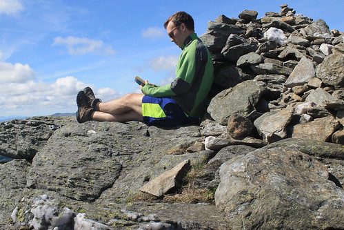
Ben Vorlich - a good place to have a read!
The walk up the slope gets you about 400 metres in elevation over the valley below, and even though the trail started to cut over along the side of the mountain, it sure didn't feel any less steep. The views started to get amazing though as the low clouds all around me started to clear. And near the top of the slope, massive rock outcrops and cliff-forming bedrock created an awesome geologic playground to be walking through! Even the mucky trail was shining with the weathered mica minerals that reflect sunlight so well.
Well, eventually the trail flattens out, kind of, but there is still a ways to go to get to the summit. And even when you get to the trig point, you're still not there because the actual summit is another short walk beyond! But once you're there, you know you're there - 943 metres (3,094 ft) is hard to miss! Not too many people were up at the summit, so it was nice and quiet. And though it was a bit windy, I was able to find a little crevice between some rocks, out of the wind where I could have my lunch and finish reading a book I've been trying to get through. It was so much nicer having time to enjoy the peace and quiet of the summit, rather than being rushed to get to the next one or forced off by inclement weather.
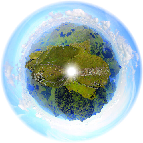
The panoramic planet I stitched together from the trig point
on Ben Vorlich
But soon enough, I felt it was time to start heading back down to the car park at Inveruglas where I'd been dropped off by the CityLink bus and was getting picked up from them, too. By the time I started walking down the weather was pretty much sunny and warm and I took my time with photography experiments and some of the best Loch Lomond scenery I've seen yet! The trail down the slippery slope I started on wasn't too bad going down, though I did slip a number of times, but before I knew it I was back down heading to the car park with plenty of time to spare. When I got there, the sun was warm on the rocks at the lake's edge, so I found a good comfortable spot, took off my boots and finished my book. Great day away, but tomorrow will have to be a work day. I just hope it actually rains so I don't feel guilty for taking a Friday off!
A few weeks back, Glasgow experienced a rare weather phenomenon: we had eight days of beautifully sunny and warm weather! The first of these days, we'd been coming out of rainy doldrums and being Scotland we weren't sure how long the sun would stay, so even though it was a Tuesday, a friend of mine from the University and I decided we'd take advantage of the weather while it was still good, made plans, and drove out to Loch Lomond and the Trossachs National Park, taking a small one-lane windy road around the north shore of the famous lake to the foot of Ben Lomond - the southernmost of the Scottish Munros.
Scotland is famous for its brilliant hillwalking everywhere, but especially in the Highlands. Here, any peak that is over 3,000 feet above sea level is classified as a Munro - anything less is classified as either a Corbett (2,500-3,000 ft above sea level) or a Graham (2,000-2,500 ft asl). There are 282 Munros, and anyone who attempts to climb them all is called a Munro Bagger. Having never done any hillwalking in Scotland before (save maybe the walk to the Old Man of Hoy in the Orkney Islands), I figured what better way to claim my first peak than to hike up to the summit of the southernmost Munro as well as being the peak with the name of the National Park it is in!
The walk took us about six hours, round-trip, and while it was not a challenging hike, per se, it was a beautiful one, nonetheless. Ben Lomond is tall (974 meters, or 3,196 feet above sea level) and since you start very near sea level, the whole elevation is yours to climb. Well...climb is a bit of an overstatement. The walk up Ben Lomond is a pretty easy ramp along a well-marked trail. About three quarters of the way up, the ramp does steepen and the going gets a bit slower, but it's still not challenging if you take your time.
Beautiful views of Loch Lomond all the way up to the summit
My friend and I kept a good pace the entire way up to the top. We had to since even though the sun was out, the wind was a bit chilly, but the views from the walk of both the summit - which would be hidden by clouds for short periods of time - and the beautiful lake beneath us were stunning! There was still snow up at the top on the steep, north-facing slopes, and though we enjoyed it at first, we quickly steered away from it, realising that the possibility that any of the snow packs could collapse and avalanche down the mountain was pretty high!
By the time we got to the summit, the weather had cleared up enough for some good photos and the views of the Arrochar Alps across the lake and the Trossachs to the north were great! We had lunch up there shortly after 1:00 pm, but didn't stay long since we still had to descend. Rather than going down the same way we came up, we headed down a smaller ridge that ran parallel to the lakeshore, bringing us right back to the parking lot. Once down from the top, the wind died down a bit more and the clouds all but vanished. We stopped for a wee snack and watched a Royal Air Force jet fly through the lake valley below us for some sort of training mission. By the time we got to the car, it was nearly 4pm so we had one last little snack on the lakeshore before heading back into Glasgow.
(there's more below the Ben Lomond slideshow!)
Ben Vane
Date: 19 April 2014
Later on in the same week - again, the weather couldn't have been better - a larger group of my friends from the office and I carpooled out to the south side of Loch Lomond to climb Ben Vane, another Munro, 915 metres (3,002 feet) above sea level. While not as high as Ben Lomond, Ben Vane offered up some extra challenges. Mainly, we had to find our own path from the access road up to the path on the trail guide, and higher up the trail got quite steep and we zig-zagged our way up between large rock outcrops, scrambled over boulders and other rocks, and slipped our way over some small snow patches, all the while dodging sheep and trying to keep our feet dry while walking over purely soggy ground!
One of the many sheep that dotted the hillslopes on the way up Ben Vane - keeping a keen
eye on us as we summit the Munro. Ben Lomond in the background.
It was great, though. We started off at the Inveruglas parking lot on the shores of Loch Lomond and had to walk up a very long access road past a hydro power station. We couldn't find the trail from the access road up to the ridge we were supposed to follow to the summit so we just marched on up a big long slope, dotted with boulders and massive rock outcrops sticking up from the water-saturated muck beneath our feet. We had perfect views over Ben Lomond and Loch Lomond and with plenty of shaggy sheep running every which way, there were plenty of pure-Scotland moments!
Once we got to the top of the ridge, we followed its gradual path up to the base of the real mountain. Here, the path took steep hairpin turns with large steps up over rocks with a big outcrop every so often that offered a good place to take a break for a moment and steal some fantastic views of the surrounding Arrochar Alps!
The walk was a long and steep one - a bit more strenuous than Ben Lomond. It was one of those mountains that every time you think you reach the summit, there's more to go! The path eventually gives way to some scrambling up and around some rocks, down some rocks, and over some snow banks, but we finally reached the top and were rewarded with stunning views of Ben Lomond, Ben Ime, A'Chrois, the Cobbler, and Beinn Narnain. The schist rock that underlies the Arrochar Alps stuck out in many places at the summit, showing off its beautifully warped and metamorphosed structure, giving the whole summit an incredibly unique geologic feel!
The thing with Munro Bagging (at least from what I've experienced in the two hikes I've done), is that you don't linger at the summits for very long. We stayed up at the top for maybe fifteen minutes before turning right back around and heading down. But the whole walk was well worth it. We had a good group of people, a fantastically nimble dog, and stunning weather! And I can't wait to tick-off the other Munros of the Arrochar Alps off my list soon!
We didn’t have to wake up as early this morning as we did the previous morning, but after an early rise, and a quick pack up of our swags and gear back into the bus, we made the short drive to Kings Canyon in Watarrkah National Park. Kings Canyon lays claim to being the world’s largest canyon, surpassing all others including Arizona’s Grand Canyon, because “technically the Grand Canyon is a chasm.” I had even read that Kings Canyon was even more impressive than Uluru, so needless to say, my expectations were very high!
From the parking lot, Adam pointed out the canyon which cuts its way through the sandstone ridge to the north, and to the trail that we were taking which follows the rim of the canyon. Looking at it from the parking lot, it was clear that my expectations of grandeur were going to be dashed. Semantics aside, the canyon is definitely not bigger than the Grand Canyon (not by a long shot!) and in my opinion, not more spectacular than Uluru.
Panorama of Kings Canyon in Watarrka National Park
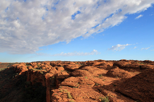
With that said, Kings Canyon is marvelous! The trail heads up Heart Attack Hill to the top of the rim and winds in and out and between impressive sandstone formations that have weathered over time into these dome-like features. Erosion along joints – natural fractures in the rock – wore down the rock in grid-like patterns and some of these more deeply-eroded joints are what separate one dome from the next. And in the extreme case of Kings Canyon, stream erosion cut down hundreds of metres into the sandstone carving out a spectacularly beautiful canyon filled with eucalypts and other green trees. You might even recognise the landscape of Kings Canyon if you’ve ever seen the seminal Australian film, The Adventures of Priscilla Queen of the Desert as this is where the shot of the three drag queens stand on the Canyon’s edge in their fabulous dresses and feathery headwear!
Dome structures created by erosion along joints in the sandstone dot the
landscape of Kings Canyon in Watarrka National Park
The trail eventually takes you to the narrowest part of Kings Canyon where you descend a few flights of stairs to The Garden of Eden, an aptly named oasis where water collects in large permanent water holes spanning the narrow canyon width with towering rock cliffs rising above your head. Palms and more tropical gum trees fill the lush Garden in stark contrast to the scrubby and white ghost gums growing up on top of the canyon. The ponds were a great place for a small lunch and break from the sun, but soon enough we headed up another flight of stairs and continued to an amazing canyon lookout where we could belly up to the edge of the canyon and look straight down the cliff faces!
The trail finishes by coming down the mouth of the canyon opposite Heart Attack Hill and those of us at the front of the group lamented as we waited for the stragglers who were taking photos of every single flower, rock, small lizard, spider, or whatever they could find. Adam was about at his wit’s end trying to keep us on schedule, but we eventually mustered back at the bus and we began the 6-hour drive back to Alice Springs.
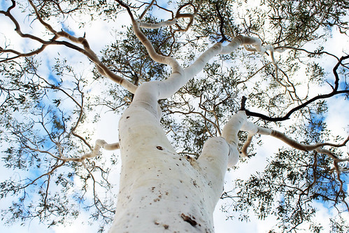
Looking up the trunk of a ghost gum in Watarrka National Park
We had yet to use the bus’s 4WD capabilities, but instead of taking the paved road back to the Stuart Highway via the Lasseter Highway, we bounded off the pavement making a bee-line straight back to the Stuart via a series of dusty, dirty, bouncy, bumpy dirt roads that no normal vehicle would survive! It was great fun and the vibrating floor provided for a nice foot massage after three days of intense walking! Everyone seemed to be enjoying it except, of course, for the Canadian fashionista who clearly had no concept of what four-wheel-driving was all about. At one point, the bus came to a stop as Adam had to get a clear look as to how best to navigate through an area of soft sand. The fashionista opened her eyes as we stopped, looked out the window and in a moment that defies all logic turned to me and asked, “Is this Alice Springs?” There were no buildings to be seen anywhere around us and we’d only been on the road for a few hours, and in disbelief at her question just stared at her and shook my head. “We’ve still got at least three hours,” I said. She just scoffed and started getting all worked up again at how annoying it was that we weren’t there yet, and what was this bumpy road? She couldn’t even get a good nap! While she was a very nice person, surely with good intentions, I could not wait to get away from her negative attitude. It just astounded me that someone could be so unprepared and not have even the slightest idea of what she was signing up for when she booked her trip. She was a trooper and did everything the rest of us did with a smile, and a joke, and funny stories, but I was glad that in a few hours time, I was not going to have to listen to her complaints ever again!
The rest of the drive back to Alice Springs was pretty uneventful. We didn’t make any more stops, and we didn’t see any more wildlife, but that was alright. Once we were back on the paved road everyone started to nod off. Being on a trip for a few days, with the same people day-in and day-out can be tiring when you know who you’re with, but when personalities don’t match, 3 days can sometimes feel much longer!
Back in Alice Springs, everyone was dropped off at their hotels and hostels and I’m sure no one wanted anything more but to take a much-needed shower and just a bit of quiet alone time for a short while! I know I enjoyed mine! That night, though, we all reconvened at a pub for tour-discounted dinner and beers. It was sort of the last-hurrah as we all talked about our amazing three days in the Outback and talked about what our next planned adventures would be.
It was overall, a great three days of good company, amazing scenery, rich culture, and fun. It made me realise that organised tours and playing backpacker can be really fun, and sure, you might not see those people again, you all shared an experience, and that is really what traveling is all about, and this was no exception. An amazing three days were now over and I had one more night in Alice Springs before my flight left the next morning.
The morning of my flight, I had a few ours left to explore bits of Alice Springs and I walked to the café at the Olive Pink Botanic Garden across the River Todd. It is a much longer walk than it looks on the map, but the café was really good, and the botanic gardens were nice for a quiet morning before flying back to Sydney, re-entering the busy city life. A quick walk up the hill in the Botanic Gardens gave me one final glimpse of the dry, but brilliant landscape that is the Northern Territories and I’m already looking forward to the day that I return there.
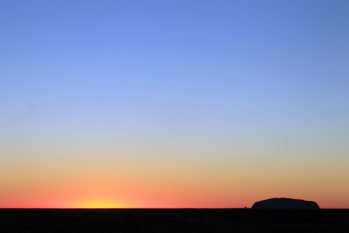
Just like watching the swirling colours of the sunset on
Uluru the night before, watching the sunrise behind Uluru, illuminating its
neighbouring rock formation, Kata Tjuta (better known as The Olgas) is not to
be missed! Our tour was woken up nice and early in the pitch black and chilly
cold. We quickly collected our belongings and rolled up our swags, and
clambered into the tour bus for a 40-minute drive west to a viewing platform
bang in the middle of the two amazing rock formations.
The sunrise in the east behind Uluru
The Olgas are in some ways more impressive than Uluru,
albeit being much less known (though they feature prominently in the opening
sequence to the Disney film The Rescuers
Down Under). Whereas Uluru is one massive rock, Kata Tjuta is a cluster of
towering rock stacks with rounded tops, and they are even taller than Uluru!
Geologically, the rocks at Kata Tjuta and Uluru date back over 500 million
years! An ancient mountain range to the west that was created during the
Petermann Orogengy was the source for all of the sand and boulders that were
eroded from the mountains and deposited in a large basin to the east of the
mountains. Over time, these sediments built up and compressed earlier
depositional strata into the sandstone and conglomerates that make up these
rock formations. Over time, further compression and faulting tilted the rocks
such that previously horizontal strata are now almost vertical! While Uluru is
mostly sandstone, large boulders stick out of the steep conglomerate rock walls
of Kata Tjuta.
We stopped at a designated viewing platform for the sunrise
and along with at least one hundred other people waited as the sky started to
lighten up behind Uluru to the east and eventually the sun peaked up over the
horizon, silhouetting Uluru in the distance while illuminating the massive
domes of The Olgas, turning them from shades of gray to pink to orange and
yellow and red. It was a beautiful setting to be sure; however, the sheer
number of people and cameras continuously clicking and the Canadian
fashionista’s complaining about the cold made it much less peaceful as it could
be, though if you could block those sounds out in your head, you could just
imagine what it would have been like to see this every morning without the
nearby roads or viewing platforms, and the whole experience takes you to a
whole new place.
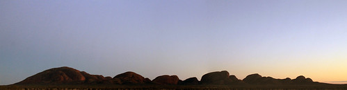
The breaking sunlight on Kata Tjuta (The Olgas)
Again, we had a lot of ground to cover today, and Adam, our
guide, wasted no time in getting us back onto the bus and brought us to the
parking lot at the locality of Petermann. The sun was already high in the sky.
Considering the throng of people at the sunrise viewing platform, there were
amazingly few people here at Kata Tjuta. As much as I loved how quiet it was
here, it’s really too bad that so many thousands of people come all the way out
here, to the middle of this huge country to get on a bus, drive to a viewing
platform, take a few photos, and hop back on their plane. I can’t lie, I also
took a lot of photos, but that is
never enough for me. I couldn’t come all the way out here and not have an experience, to walk through
the landscape, or listen to the wind and birds, or feel the sun’s radiating
heat. I wish more people desired experiences in nature. Maybe we’d all have a
better appreciation for our planet and our environments and become better, more
humble people.
We got off the bus and prepared for a hike through the
Valley of the Winds which takes you from the parking area between some of the
massive rocks that are The Olgas and into the valley protected between them.
Even in August, Australia’s winter, the sun can become too intense to be
outside this far in the Outback, so any hikes should start promptly in the
morning. The Olgas are also incredibly sacred to the local Aboriginal
communities, but curiously, outside of those communities, no one knows why. At
Uluru, there are places where you cannot take photos because of spiritual
significance, but there are signs explaining why the site is sacred. At Kata
Tjuta, nothing is off-limits, but the whole area holds such a deep spiritual
importance that only those in the Aboriginal communities can know what it is!
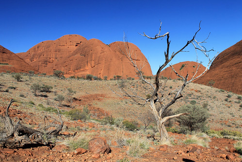
Down in the Valley of the Winds at Kata Tjuta
The Valley of the Winds is aptly named as air from the
heating rocks rises and pulls in air from the surrounding area that gets
funneled and focused in the valleys between the rocks. It’s not a difficult
walk into the valley, but it is a stunning walk as you work your way between
amazingly steep rock walls with massive boulders sticking out. The valley
itself is made up of gently rolling rocky hills with scrubby vegetation and a
few gum trees dotting it. The walk takes about three hours, provides
spectacular scenery dotted with intricate flowers, and is incredibly peaceful
as anyone you walk past just smiles and nods their hellos, not wanting to ruin
the quiet atmosphere. Because no one knows the real significance of Kata Tjuta,
there almost isn’t much else to say because there is nothing to interpret.
We finished our walk in the late morning and set up our
lunch back at the bus before we packed up at set off for another long drive. We
left Kata Tjuta, passed Uluru once more, and drove the hour or so back to the
Curtin Springs Roadhouse for a quick break before turning off the Lasseter
Highway onto Luritja Road toward Watarrka National Park, home of Kings Canyon.
We stopped once more to collect firewood for that night’s dinner that was a
fun, if not frustrating pit stop. The Canadian fashionista hadn’t been with us
the previous day when we collected firewood and was trying to write postcards
to send back home as our bus drove down the bumpy, dusty dirt road. Trying to
write while driving over washboard road conditions is no easy task, and one
more than one occasion, she would slam down her pen and shout something along
the lines of, “I’m trying to write a postcard! Can’t the bus just stop so I can finish? This is so hard!”
Complaints that received nothing but an annoyed look from me as I asked her
what she expected! My postcards were barely legible because of all of the
bumping around, but I thought it was part of the fun! Not only was I describing
to my family what I was doing, but they could actually see it in the squiggles
in my lettering! She didn’t seem to understand and got even more flustered as
the bus swerved to the left and right. Once we stopped, she finally finished
her postcards (though she took her time, probably not wanting to get her
clothes too dirty with all the red dust) while the rest of us ventured back out
into snake country to collect firewood.
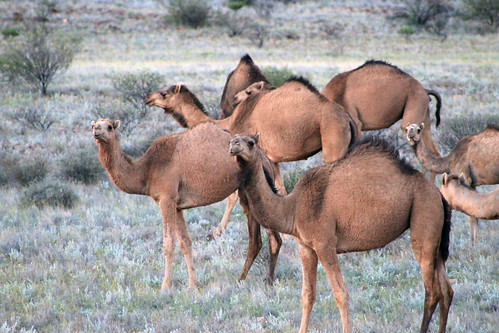
A herd of feral camels in Australia
And we were in store for a treat before we left. As we
loaded back onto the bus, someone spotted a little brownish-gold body bouncing
between the trees and a single solitary dingo sauntered up to the bus! Frankly,
I expected to see more dingoes than we did, but the curious little creature was
the only one we saw and after figuring out we had nothing to offer it, he
quickly sauntered away just as quickly as he came.
Further down the road, we were in for another treat as a
massive herd of wild camels was socialising on the side of the road. Adam
stopped our bus and we all got out, quietly stepping as close as we could to
these amazing creatures without spooking them! There were dozens of them –
mostly adults, but a few young ones, too and they just moved together, minding
their own business. We stayed there, watching them for a while as another
brilliant sunset lowered down toward the horizon. It was just such an odd
sight, seeing the camels, not only because they are just funny looking animals,
but because you just know they aren’t supposed to be there! The wild camel
herds have naturalised so easily to the Australian Outback, their numbers can’t
be culled. They’ve repopulated so well, and from such a small original stock,
that people in the Middle East actually buy their camels back from Australia
because the Australian camel genetics are so pure, they fetch quite a high
price back in the Middle East!
The setting sun was blinding as we drove west to Kings Canyon Resort but we eventually
pulled in to our campsite for the night, got our fire up and blazing, made
dinner, and set up our swags for another chilly night under brilliantly clear
skies in the middle of the Outback.