Monday, August 15, 2011

Ireland: Mizen Head Peninsula, Skibbereen, and Baltimore

Trip Date: August 2, 2011

I woke up early the next morning - my first in Ireland - and while everyone was still sleeping, I put my shoes on and took a little walk along the road which went up the hill behind our cottage. It wasn't cold, but it wasn't yet hot, either, even though the sun was already high in the sky. I'm not entirely sure about the rest of the Irish year, but it sure seemed like we picked the right time to go because the flowers were all in bloom and just amazing!
Foxglove
Spear Thistle
Fuchsia
A little bit of everything
I walked only for about half an hour before returning to Agma, our cottage, and began making noise to get everyone else up. Once everyone was up, washed, and breakfasted, we packed into our two cars for our first day-trip. That's what my family does on vacation: we find somewhere to make our base camp and then we take day-trips to all sorts of locations rather than constantly being on the road. Well, Britta had been to this region of Ireland before and one of the things they did was drive out to the end of the most southwestern of all the Irish peninsulas jutting out into the Atlantic Ocean.

It was a little bit grey as we made the drive to the end of the Mizen Peninsula, but we stopped a few times for some photo ops, but by the time we got to our destination, the light station at the end of the peninsula, Mizen Head, the sun was back out. The Mizen Head station has a neat museum in the visitor center (which you do not need tickets to see, even though they sell tickets before the museum entrance) and explains some of the shipping, geology, and ecological histories of the Irish coast. I was mostly interested in the geology, since we saw so many rocks alongside the roads.

Roughly 400 million years ago, a mountainous region in what is now northwestern Ireland was slowly eroding and rivers were depositing numerous sedimentary sequences into a warm shallow sea. Then, about 100 million years later, Europe and Africa collided, causing a shortening of 50% of the Earth's crust. All that material had to go somewhere, and typically when two continents collide, material ends up moving upward, so the Irish landscape suddenly became extremely mountainous once again as the older sedimentary sequences deformed. Over time, this very large mountain belt wore down until there was more sediment than river systems could carry. Then, about 150 million years ago, the land was flooded by rising seas again, and shells from dead organisms created a new layer of limestone. Glaciations began to inundate Ireland about 120,000 years ago from the north and a smaller ice cap over the southwest corner of Ireland. A rigorously eroded landscape emerged from under the ice nearly 10,000 years ago and since then has become soaked with rain, allowing for the wet, green landscape Ireland is famous for today.

A brief walk from the museum takes you out to the end of the peninsula where there is a walking bridge that carries you over a deep cove to a large rocky island where the light station is located. Only once you get to that light station do you actually need to show anyone a ticket, and for the few exhibits out in the buildings there, it's not really worth it. The views along the walkways and to different viewing points on the way out to the light station are the real draw! But the little exhibits about all the different ships that became victim to the ocean's ravaging waves and submerged shoals, and how ships communicated to each other using flags, and the various whales in the area, and how Marconi set up his famous wireless telegraph system were mildly educational. Again, though, it's the scenery you want to see out here!
My brother Ryan, my Dad, my sister Lizzie, and me on the Mizen Peninsula
At Mizen Head this was a demonstration of how the foundations for the Fastnet Rock Lighthouse were constructed. Each granite block is individually carved and notched such that every single block is interconnected with every other block around it. Once everything is loaded into place, it is impossible to move the block foundation in any direction other than up. This makes the foundation design ideal for lighthouses that are constantly being bombarded horizontally by brutal ocean waves!
Walking bridge out to the Mizen Head light station
Looking back on the Mizen Peninsula
View of the rocky cove walls at Mizen Head
Me at the Mizen Head light. This isn't really a lighthouse, per se, but it does help ships figure out where they are!
THIS is the lighthouse on Fastnet Rock where the keepers would stay for months on end during all sorts of weather
Mizen Bridge from above.
Looking north along the rocky shoreline from Mizen Head.
Sea arch carved into the rocks at Mizen head.
Bell heather
From Mizen Head, we drove back inland and stopped in the town of Skibbereen where Irish Independence leader, Michael Collins, had his last pint before being ambushed and assassinated near Bandon in County Cork. It is also famous for being hardest hit by the infamous Irish Potato Famine (1845-1850). We ate dinner at a great Irish restaurant/pub/cafe called Annie May's before continuing through to the coastal town of Baltimore. Britta suggested Baltimore because you could watch the sunset while sipping down a pint at the harbor, and though we did not have enough time, you can also take a quick ferry ride out to Sherkin Island and explore a monastery in ruins. With a pint down, and the sun beginning its descent, we left Baltimore and headed back to Bantry while there was still light to drive by (you don't want to be on Irish country roads at night! They are poorly lit, narrow, and windy!). Going back through Skibbereen, though, we stopped at a cemetery just to the west of town and visited a mass burial site for victims of the Potato Famine.
Small church in Crookhaven
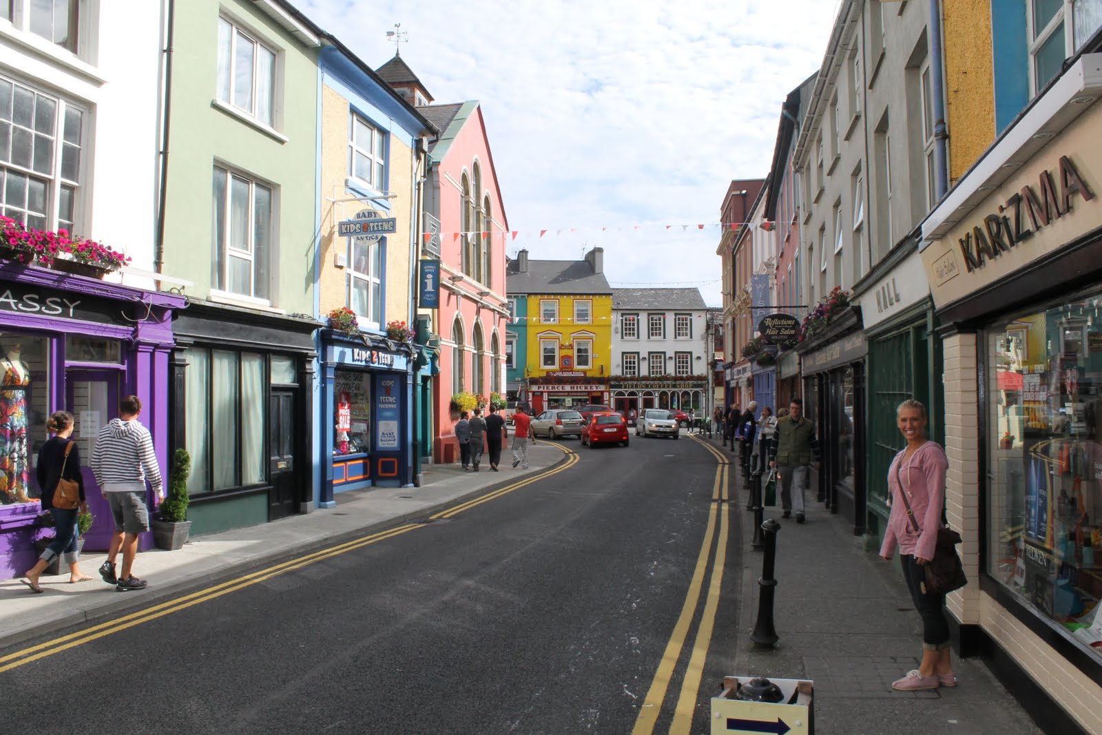
Lizzie on the streets of Skibbereen
Great place for dinner!
Pubs, restaurants, and lodgings right at Baltimore Harbor
Plaque at Abbeystrewery, a cemetery where there is a mass-grave site where 9,000 victims of the Great Potato Famine are buried.


Friday, August 12, 2011

Ireland: Cliffs of Moher, The Burren, Limerick

Trip Date: July 30

After a day in Atlanta, I was ready to get to Ireland. We were just about to start boarding in ATL, headed for JFK, when the flight crew made the announcement that we needed to board as quickly as possible to get up in the air as quickly as possible. Why? JFK flight control had issued a ground stop earlier in the day at the New York airport, meaning that no flights were coming in or leaving, unless they were already in the air. Moments before we starting boarding, JFK lifted the ground stop, but it was possible they would issue another one, so we needed to at least get up in the air, in which case JFK could not stop us from landing. Surprisingly, boarding the plane went really well! Everyone was quick and people realized that they could create more space in the overhead bins if they put their roll-on suitcases in with the short end first instead of the wide end! But then the captain told us that we were 15th in line to taxi out to the runway and we would be delayed half an hour.

I didn't think I was going to make it to Ireland on time, which was crucial because my brother and his girlfriend, Sarah, were going to pick me up from the Shannon Airport at 9:25am Ireland time. We didn't really have a back-up plan. Nevertheless, once we got to JFK I had to switch airplanes, praying that my luggage would make the switch as well, and immediately boarded my next plane. Everything seemed to be going okay there, too, but then the auxiliary power cut out and we were left without air conditioning for about 15 minutes and the plane started to heat up, along with peoples' patiences. But after a while we were up in the air and I was officially Ireland-bound!

I landed at Shannon Airport early and with perfect timing too! My brother, Ryan, and Sarah just pulled up to the airport as I was coming out of customs. We jumped in their little Renault four-seater and started our day off with some good old-fashioned sightseeing. A few hours north of Shannon is one of Ireland's most spectacular natural attractions: the Cliffs of Moher. These cliffs, rising nearly 400 feet up out of the ocean are a staggering sight! Sandstone and shale make up these rocks and provide a nesting ground for various sea birds including gulls and puffins (but I didn't see any of those). Access to the Cliffs has been built up excessively since the last time I was here in 2001. Then, you just drove up to a small cabin that was the Visitor Center and you walk up a narrow, but paved, path to an observation platform next to a small castle-tower. But now, you pay €4-6 for parking and access to a behemoth Visitor Center, resembling a gigantic hobbit-house, built into the side of a hill. A series of wide stairs and safety railings keep you from getting too close to the edge. But, if you want, you can follow other tourists and hop the fence to the private property next door and walk along the edge to get stunning views of the cliffs and if you're really daring, go out to rock outcrops jutting over the edge. We learned that Ryan has a significant fear of heights and it took some goading on our part, but we finally got him out near the edge. While now over-touristy and expensive, the Cliffs are not to be missed!
Cliffs of Moher
 
 
The Aryn Islands seen from the Cliffs
 
Ryan and Sarah on a rock ledge 400 feet up from the ocean!
Me, looking 400 feet down to the ocean
After the Cliffs, we drove along the coast a little ways toward Doolin and down a narrow country road to the town of Ballyvaughn, where we then turned south and drove through the Burren. The Burren is a totally desolate landscape with minimal amounts of vegetation and nearly entirely exposed sequences of limestone. In fact, as far as we could see, there was nearly nothing but limestone. Again, windy roads seemed to be the norm for Ireland and we eventually came to the site of the Poulnabrone Dolmen.


The Poulnabrone Dolmen is one of Ireland's best preserved Portal Tombs of the Neolithic Age, some 6,000 years ago. According to on-site documentation, at that time, the glaciers Europe carved the landscape down to the limestone we saw all around us and open pine forests and grasslands were fully intact. The Portal Tomb is about 10 feet tall with thin slabs of stone providing the wall support for a 12-foot long, 1.5 ton limestone slab. It was used as a burial site for upwards of 30 individuals who were placed there about 5,000 years ago, as well as ceremonies and rituals. Because of its proximity to the Cliffs of Moher, the Poulnabrone Dolmen is heavily frequented by tour buses and it's best to visit the site earlier in the day and later in the afternoon. Luckily, there is no fee for this site!
Poulnabrone Dolmen
Deep, narrow limestone troughs are normal for this landscape. Rain, which is slightly acidic, slowly dissolves the 320 million year old limestone in typical karst landscape fashion. The rock platforms you see are called "clints" and the troughs are called "grikes".
 
Beautiful vegetation seen at the Poulnabrone Dolmen. Nearly 70% of all Ireland's native vegetation can be found in the Burren.
Once back in the car, we needed to finish off our day by driving all the way down to the little southwestern town of Bantry, which is no easy task as most of the roads going that way are narrow, windy, and lined with stone walls and hedges, leaving you very little wiggle room if you come across a car (or God forbid, a tour bus) going the opposite direction! Along the way, though, we stopped in the city of Limerick, Ireland's third largest city (190,000 people). This is the city brought to life in the memoirs of Frank McCourt in his book, Angela's Ashes. While less grimy of a city nowadays, row houses and narrow alleyways are still common, as they are in every Irish town. A deeper history of Engligh invasion and rule is also present here, but we didn't have enough time to see much as time was short and we still had a few hours to get to Bantry.
Part of the city of Limerick viewed across the River Shannon.
View of St. Munchins Church and a bridge over the river
The day I arrived was a Bank Holiday, similar to any of our national holidays, where everything is shut down in some way or other. For us, we were getting hungry but none of the pubs were serving anything but some sandwiches, so we at least stopped for a quick pint at a pub and I had my first Irish Pint: a Beamish Irish Stout. But with no food, we drove on and tried the next town which had some pubs, but again, no one was serving food. Thankfully a helpful pub owner directed us to a place for dinner where we got some simple, but decidedly Irish food.

I don't recall much of the rest of the drive because I definitely fell asleep in the back of the car, still trying to adjust to the new time zone. But I woke up to Sarah trying to decipher the directions we were given to get to "Agma," the cottage we were renting. My dad's wife, Britta, had been there before, so they knew where they were going, but for us, it was like solving a puzzle:
As you come into Bantry you will pass the Opel dealership and an anchor and the Westlodge Hotel will be on your right, but take the first road going west, south of the hotel. You will pass a church that is now an art studio and continue until you see what appears to be a factory of sorts and then pass a house with green trim. Take the next road to the left, even though it looks like a driveway. Go up a hill and down a hill and up another hill. Go straight where it looks as if you would turn left to find Agma.
Well, we took the right road, but were unsure how far down it we had to go until we would find what looks like a factory. What appeared to be a factory was in fact a small industrial farm and the house with green trim was really nothing more than a house with a small shed that had a green roof... It was around 9:30pm and the sun was setting when we found what we thought was the road that went up, down, and up again, but we stopped for a few photos of a beautiful sunset setting over the Beara Peninsula to our north and finally pulled into the driveway. The rest of the family was already there and were very happy to see us. They weren't sure if we were lost somewhere or if we could make any sense of the directions. They even positioned themselves in town for a few hours, hoping that maybe we would see them if we got that far. But all was well and we all took an evening walk around the countryside and returned to some pizza while Carl, Britta's son got a peat fire going in the fireplace.


Thursday, August 11, 2011

Martin Luther King, Jr. National Historic Site and Olympic Centennial Park

Trip Date: July 30, 2011

The other night I was counting the number of times I've left the country this year. The count was four (if you include the trip I took through Canada on my way home from Burlington - something I don't normally include, but I did stay there for three nights this time!) and as I wrote this post, I was sitting in the Atlanta airport getting ready to raise my Europe count to five!

I've become a bit neurotic with how I've been traveling recently. I joined the ranks of Silver Medallion with Delta Airlines and I've been trying to desperately reach Gold Medallion status by the end of the year (and retain it forever, as far as I understand). What this means is that I've been booking flights with as many layovers as possible. With no job at the moment there is no real rush to get from Point A to Point B and it's more fun traveling with out the stress of having to make a deadline!

Things do get frustrating from time to time, however. Take this trip for instance: My family and I left for our trip to Ireland on Saturday July 30 - the first family trip since 2001 (which was coincidentally, also to Ireland). They all booked their tickets with Aer Lingus, Ireland's National Airline; I however, booked mine with Delta to get the miles. Things started off great. We dropped my car off at the Michigan City train station so I could get to it upon my arrival back in the states. Then, my family dropped me off at Chicago's Midway Airport, which I found out is named after the famous World War II battle of Midway Atoll in the Pacific Arena. The Chicago area was used to train pilots in taking off and landing on aircraft carriers on Lake Michigan. Two Lake Michigan vessels were refitted with runways for this training and designated the USS Sable and the USS Wolverine (Go Blue!). There was a great exhibit in the airport with a reconstructed war plan that was pulled up from the bottom of Lake Michigan.

The flight from MDW to ATL was great. My Silver Medallion status got me upgraded to first class where our flight attendant was wonderful but made wicked strong drinks! There's really nothing special about first class on short flights in the US, but it was nice to get free drinks and room to stretch my legs. It wasn't until landing at ATL that I realized my plans had to change. I had a 16-hour layover in Atlanta so I was planning on just sleeping on the floor in the airport and then take the METRA into the city the next morning and come back in the afternoon before my flight left. BUT I learned that I was required to pick up my checked luggage instead of leaving it checked overnight, something I wasn't planning on doing. So what can you do but roll with the punches? I got my suitcase and then faced the challenge of finding a place so sleep. I could have stayed at the airport, but I didn't feel comfortable going to sleep with so many of my belongings free for the taking. So I called up the Super 8 and they said they would send a Hotel Bus to pick me up... But as always it wasn't that easy.

In my haste, I waited and waited in the "Drop-off" area outside the airport, so of course never saw the Hotel Bus that was sent for me. But I didn't realize that I was in the wrong place, so, very irritated at this time, I called up the Econo Lodge and did the same thing. After about an hour of waiting (it's now ten minutes after midnight), I realized that I was in the wrong place, so I corrected myself and went to where about two dozen hotel buses were waiting, and I finally got my ride to the Econo Lodge, which was a bit utilitarian, but it was clean, cool, and cheap ($40/night!). So really my mishap only became a minor detour and all was well because I even got to sleep in a bed, take a shower, and have a free breakfast!

The next morning I hopped in the shuttle back to the airport and while I was nearly 12 hours early for my flight, checked my suitcase (which I thought for sure would be lost). I put my personal belongings in my camera bag, clipped on a water bottle, and put my backpack in storage for the day. And so with nothing but my camera, I bought my ticket to the MARTA, Atlanta's light-rail system, and rode it into town.

Atlanta is home to the headquarters of Delta Airlines, CNN, the Weather Channel, the American Cancer Society, and of course, Coca Cola. While everyone recommended I check these places out, my past experience traveling this year and seeing the effects of poor news service and dishonest corporate greed, I decided to make my visit a bit more cultured.

Getting off the MARTA at the King Memorial station, I walked about a half-mile through a neightborhood that had maybe seen better days but appeared to pose no threats. Only for about one block did I pick up my pace to get somewhere that looked a little more friendly. Apparently, I later learned, I was a block or two over from the more ideal street for walking from the King Memorial station (Jackson St., by the way) to my destination: The Martin Luther King, Jr. National Historic Site.

The MLKJNHS occupies three city blocks of Atlanta preserved from the 1930s. There are a few modern buildings that now house the National Park's Visitor Center, the King Center, and the new Ebenezer Baptist Church. Also included in the park are various houses from the Queen Anne era and some shot-gun houses (narrow homes one room wide and four rooms deep), and just around the corner from the Historic Fire Station No. 6 (the first integrated station in Atlanta) is the house that Martin Luther King, Jr. was born and raised. Free tours are available for the house, but they fill up fast, and I didn't have time to wait, so I didn't get to go inside.
Martin Luther King, Jr.'s childhood home in Atlanta, GA
Fire Station No. 6 - the first in Atlanta to become integrated
I did check out the Visitor Center which has some fantastic interpretive displays, a half-hour long, very well-done video, and the simple mule-drawn cart which carried his casket after his assassination. And just across the street is the original Ebenezer Baptist Church where MLK Jr., his fater, and his grandfather all preached.

I knew that MLK was an amazing orator and had many famous speeches, sermons, and letters, but it wasn't really until her, where they are all around me, did his passion for equality and civil rights really become tangibly evident. I realized just how incredible and humble of a person he really was. It also, however, made me realize how sorely we are need of an inspirational voice of justice, outside of any type of politician, in our society today. And it was in the Ebenezer Church that I realized this. The sanctuary has been restored to how it would have appeared when MLK Jr. was a preacher there and recordings of his sermons were playing over loudspeakers. It was almost as if you could feel the inspiration filling the air and see the room packed full of people struggling to receive the basic rights that everyone is entitled.
The carriage that carried MLK Jr.'s casket and the cross that was laid on top of it.
Outside of Ebenezer Baptist Church
Restored sanctuary of Ebenezer Baptist Church
Just outside the church is a long reflecting pool in the middle of which sits a dais with a beautiful marble tomb - the final resting place for both Martin Luther King, Jr. and his wife Coretta Scott King. Both of their legacies are succinctly summed up in an epitaph on each. Opposite the pool is an eternal flame forever burning with the fire of hope and life for a more equal and just world. This National Historic Site is not one to just breeze through and it's nearly impossible to stand in front of the tomb without shedding a few tears.
Reflecting Pool at MLKJNHS
Burial tomb of Martin Luther King, Jr. and Coretta Scott King
Eternal Flame at Martin Luther King, Jr. National Historic Site
It got instructions on how to walk back to downtown Atlanta and I decided  to get lunch in or around the Olympic Centennial Park. Atlanta was the last US city to host the Summer Olympics and it won the opportunity to host the 100th Anniversary games of the modern Olympic movement. The downtown park was built as an International Meeting Place of sorts for all who attended. Right in the center of the park is a fountain coming up out of inlaid stones in the shape of the Olympic Rings. On hot summer days, kids run through the fountain to keep cool and every hour the fountain puts on a show to music like "The 1812 Overture," "Sir Duke," and "Under the Sea." It's an entertaining park with many statues, sculptures, and landscaping appropriately fitting with the Olympic Mission. I tried finding the site where the bomb that ripped through the park during the games went off, but the lady at the Tourism Desk said they don't like to advertise that event but that there was some of the shrapnel from the blast on display somewhere in the park, but she didn't know where that was either. I would have stayed to look for it, but I was getting hungry and wanted to make sure to get to the airport on time. So I grabbed a quick lunch at Googie Burger, where they call your order by saying over a loudspeaker, "Number 82, shake it on over!!!" Lunch there was great and my salad and alcoholic "twinkie" shake were refreshing on such a hot day!
 
 
Kids taking a break from playing in the fountain while they watch the musical show
Statue of Pierre de Coubertin, the father of the Modern Olympcs
I didn't want to be late to my flight and so I started working my way back to the airport where I sat down to write this blog post, waiting for boarding to start anytime. Goodbye, Atlanta, for now! It was a great day, but now I'm ready to cool off in the Emerald Isle!
Creative Commons License
This work by Eric W. Portenga is licensed under a Creative Commons Attribution-NonCommercial-NoDerivs 3.0 Unported License.